Visit lesser-known Cotswold villages and beautiful countryside on this this 7-mile Moreton-in-Marsh to Longborough and Bourton-on-the-Hill walk. The route also takes in some of the North Cotswolds’ most gorgeous gardens and two cosy pubs so you can easily make a whole day of it.
The trail follows the Monarch’s Way long-distance walking route southwest of Moreton-in-Marsh to the village of Longborough, which is best known for its summer opera festival. From there it heads north past the quirky Indian-inspired Sezincote House and Garden towards Bourton-on-the-Hill. And finally you walk along the edge of Batsford Arboretum on the way back into Moreton.

There are a couple of good Donnington Brewery pubs along the way – the Coach and Horses in Longborough and the Horse and Groom in Bourton-on-the-Hill. You can also add on visits to the gardens at Sezincote House, Bourton House Garden or Batsford Arboretum.
The Moreton-in-Marsh to Longborough and Bourton-on-the-Hill walk is fairly easy, though as it’s mainly on grass and dirt paths it can get muddy in winter. It takes around three hours to walk – and as Moreton-in-Marsh is on a mainline train station you can easily do it without a car.

Moreton-in-Marsh to Longborough and Bourton-on-the-Hill walk details and map
- Distance: 7 miles/11.2km.
- Time: 3 hours.
- Elevation: 330 feet elevation gain.
- Difficulty: Easy.
- Paths: Mainly grass and dirt paths through fields, and pavements in the villages.
- Accessibility: Several stiles and bridge stiles. Can get very muddy and wet in parts.
- Map: OL45 The Cotswolds*
- Toilets: Public toilets in Moreton-in-Marsh next to Redesdale Hall on the High Street (cost 40p – cash or card) and free toilets behind Longborough church.
- Facilities: In Longborough there’s the Coach and Horses pub and a village shop and café. And in Bourton-on-the-Hill there’s the Horse and Groom pub. There’s also a café at Batsford Arboretum, just off the route, as well as lots of places to eat and drink in Moreton.
Disclaimer: While we try to keep information up-to-date and accurate, Explore the Cotswolds cannot accept responsibility for errors or omissions. Walks are undertaken at your own risk, and we are not liable for any personal injury, loss or damage that may occur.

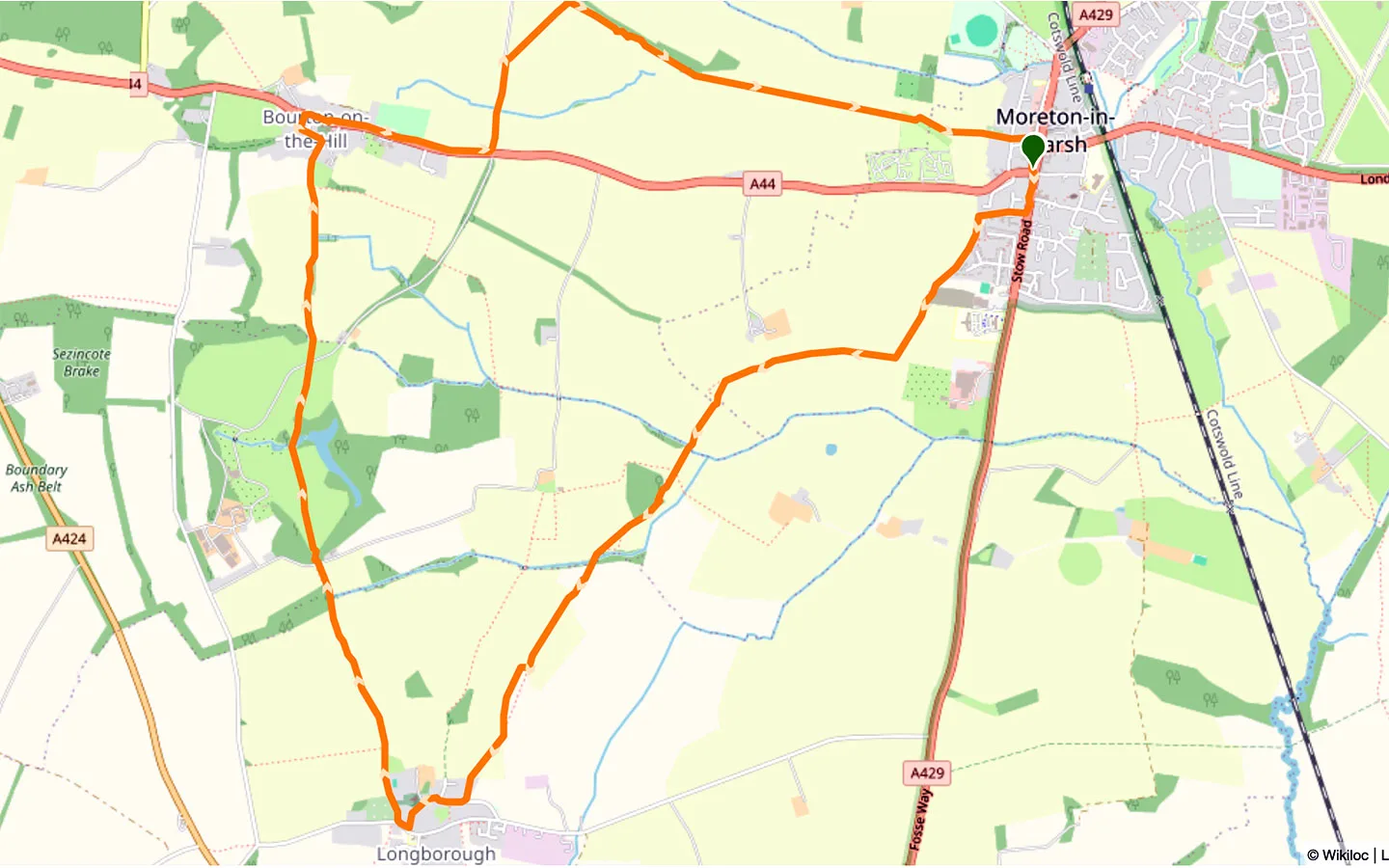
Click on the map above to be taken to Wikiloc, a free app where you can download a map and GPS directions for the Moreton-in-Marsh to Longborough and Bourton-on-the-Hill walk.
Start/finish point
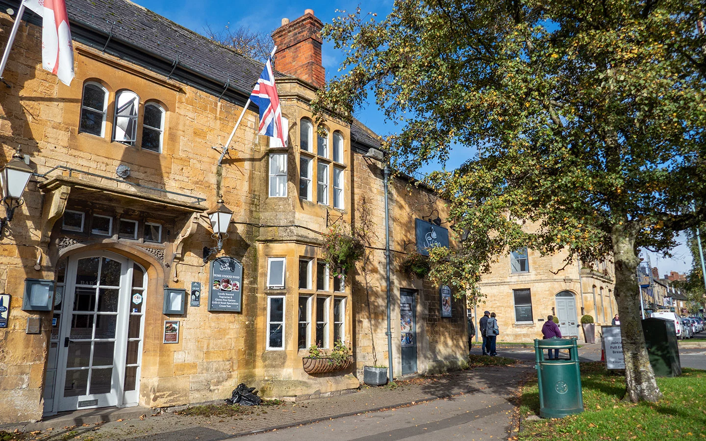
The starting point for the walk is outside The Swan Inn pub (GL56 0LL), on the corner of the High Street and Bourton Road in the centre of Moreton-in-Marsh.
If you’re travelling by car, there’s paid parking at the Old Market Way Car Park (GL56 0JY) and the train station (GL56 0AA), plus limited free parking on the High Street (except on Tuesdays).
If you’re travelling by public transport, Moreton-in-Marsh has a train station with direct trains to London and Oxford. The station is a five-minute walk from the start of the walk. You can also get to Moreton from Cheltenham, Bourton-on-the-Water and Stow-on-the-Wold on the Pulhams 801 bus (daily) or from Stratford-upon-Avon on the Stagecoach 51 or 1/2 buses (Monday–Saturday).

Moreton-in-Marsh to Longborough and Bourton-on-the-Hill walk route
Stage 1: Moreton-in-Marsh to Longborough
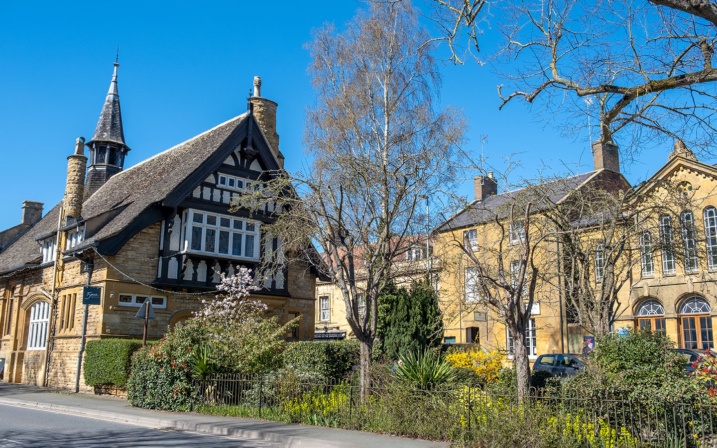
Start your walk outside The Swan Inn and head south along Moreton-in-Marsh High Street for around 200 metres. Then turn right down Parkers Lane, which is marked with a Monarch’s Way sign. At the end of the lane (just before a sign for Fosseway Fields dog walking), turn left.
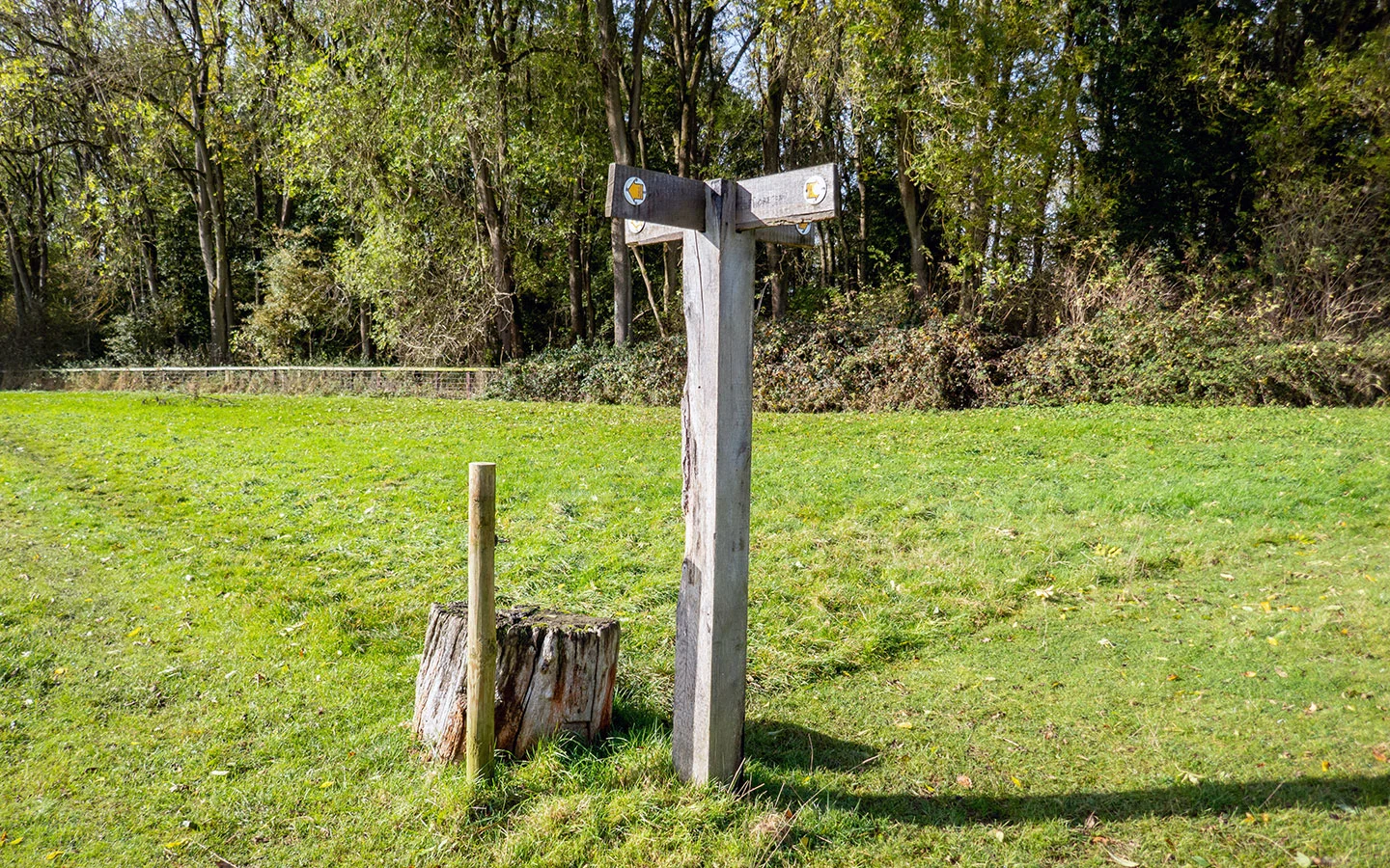
Follow the path behind a row of houses and along the edge of a field. At the end of the field you’ll see a wooden signpost with a public footpath sign pointing to the right. Follow this footpath through the next few fields, passing a fingerpost which points straight on towards Longborough.

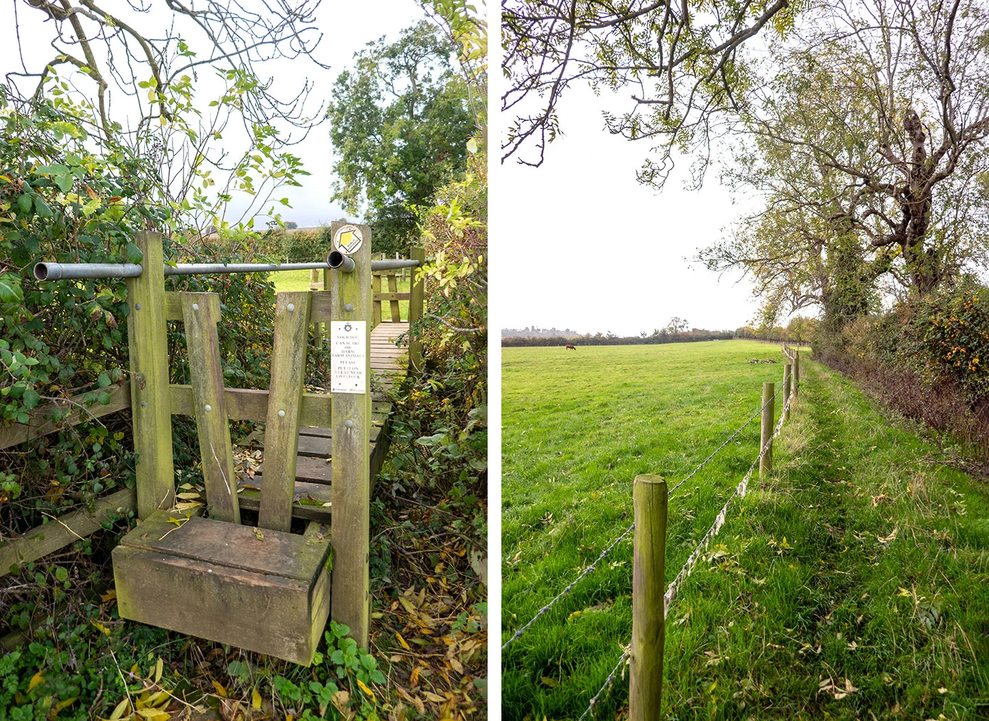
Continue along this path, which is marked with yellow public footpath signs. After crossing a stile you turn right and go over a bridge stile. You have two options here, depending on whether there are cows in the field. If not, go over the stile on your left and walk diagonally across the field.
If there are cows there, you can avoid them by going over a different stile straight ahead, then over a second stile just in front into a fenced-off area which runs along the edge of the field.

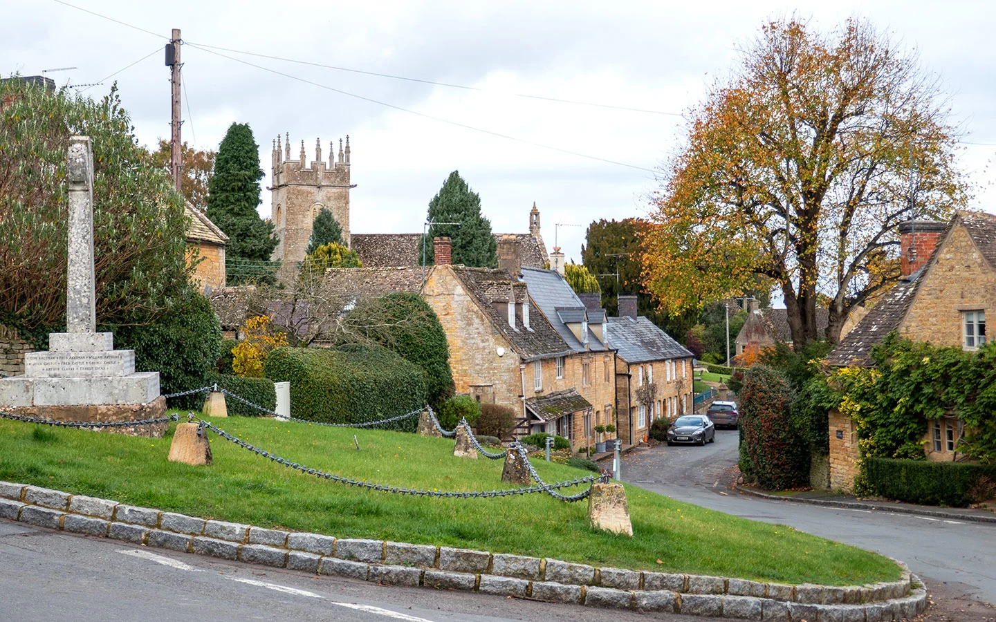
In the corner of the field, go through a kissing gate on the right and follow the path across the field towards Longborough. Another kissing gate takes you onto a path which joins onto a cul-de-sac called Bean Lane. Then at the end of the lane, go right into Longborough village.
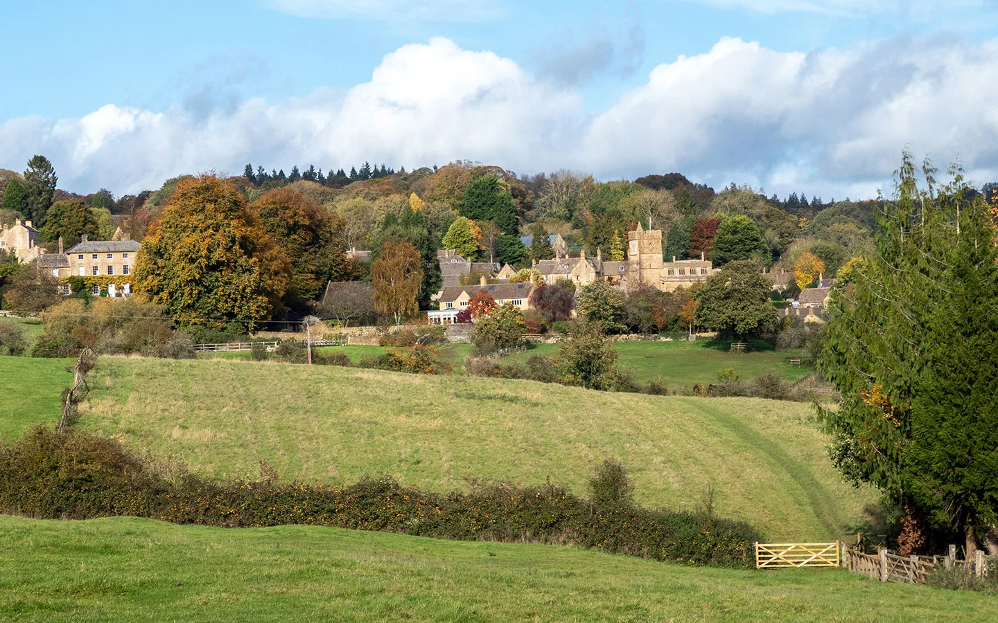
The road leads uphill – when you reach the junction in front of the church take the road on the left. You can take a look around St James’ Church, which dates back to the 12th century and has ornate tombs and stained-glass windows. There’s also a free public toilet behind the church.
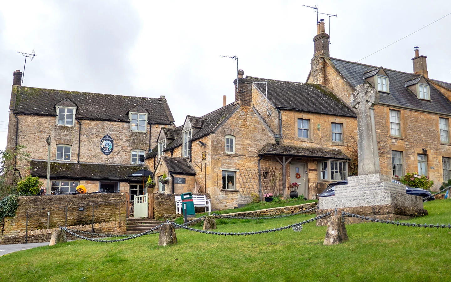
From the church, carry on up the main road towards the war memorial. In front of you is the Coach and Horses, a Donnington Brewery pub serving sandwiches and traditional pub grub, with a nice beer garden. You can also turn left here to visit the community-run village shop and café.

Stage 2: Longborough to Bourton-on-the-Hill
Follow the road past the pub, then turn down the road on the right which has a sign saying ‘Goldborough House, private road, public footpath’. The path passes the end of the churchyard then goes through a gate and along the edge of fields (with another diversion for cattle if needed).
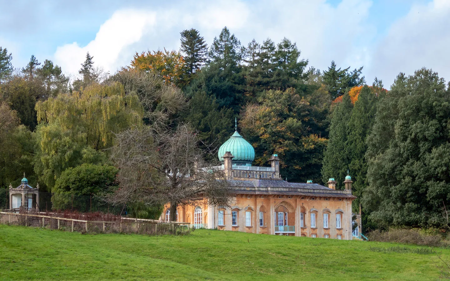
After crossing a driveway, you’ll see two metal gates in front of you which lead onto the Sezincote estate. One or the other will be open, depending on where the cattle are. Go through it and follow the path along the fence line – you’ll get great views of Sezincote House to your left.
Sezincote was built in 1805 by Samuel Pepys Cockerell for his brother Charles. It was inspired by the architecture of the Mogul palaces of Rajasthan, with its copper onion dome, minarets and Hindu temple. And it’s thought to have influenced the design of the Royal Pavillion in Brighton.

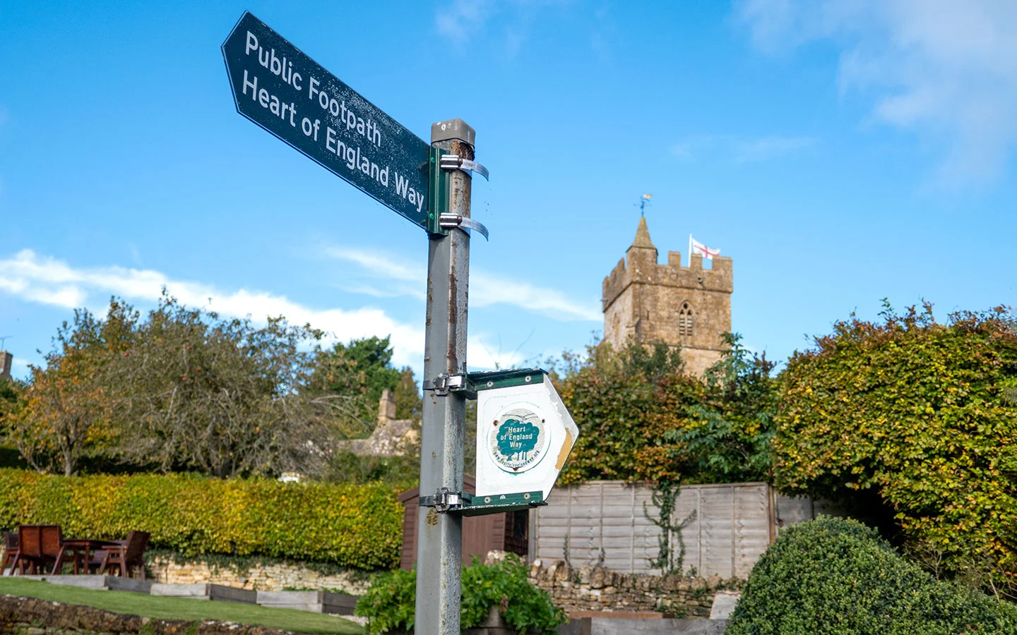
Go through a wooden gate at the end of the field and cross a bridge with a pretty water garden on your left. When you come to another wooden gate, take the path to the right of it marked with a Heart of England Way sign. Go straight on along this path, passing through several gates.
You’ll see the village of Bourton-on-the-Hill in front of you. When you get there, go through a wooden gate with a tall stone wall to the left, then through another gate onto the road. Turn left here for the village, or if you want to go straight on take the road on the right onto the main road.

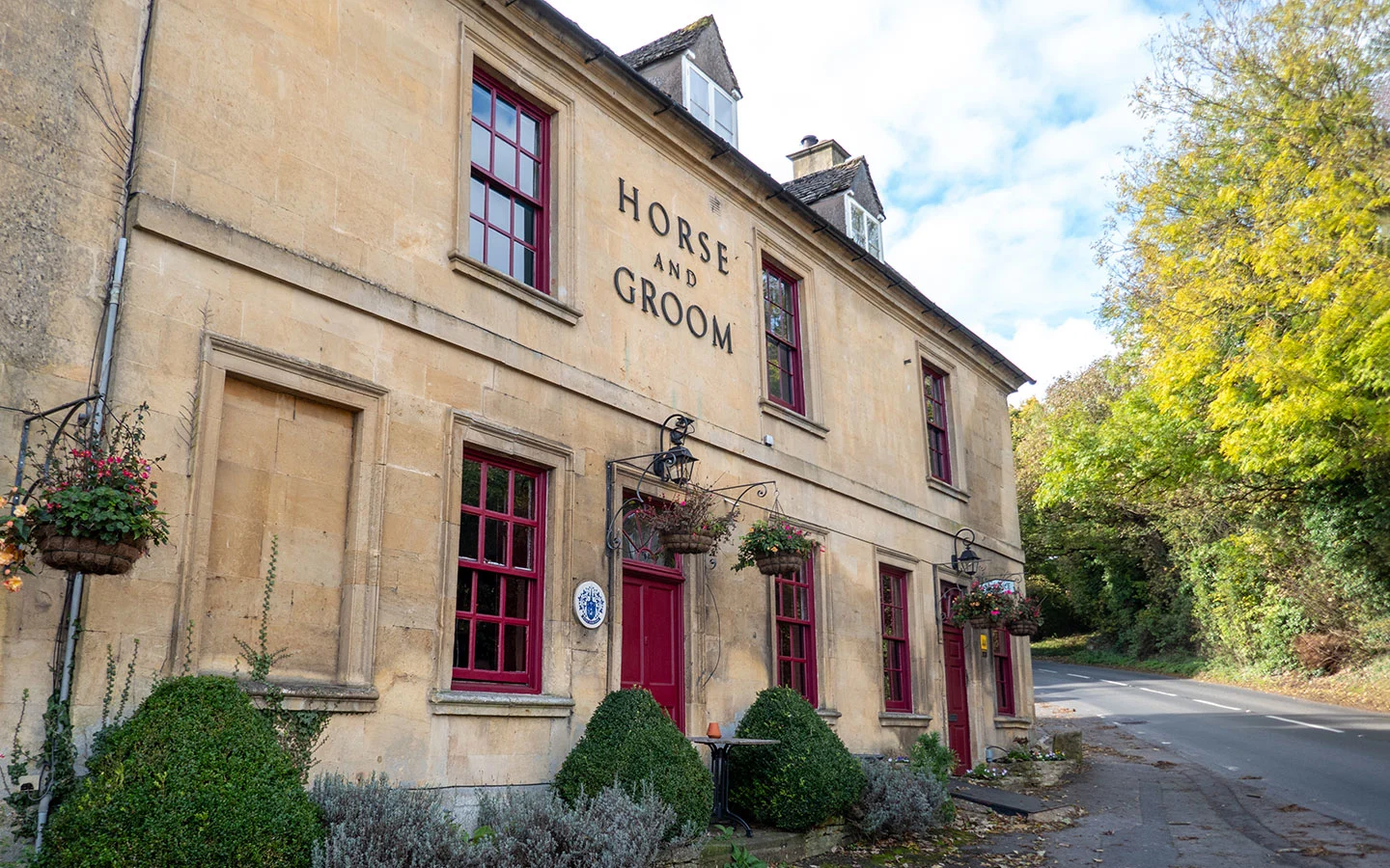
If you’re visiting the village, turn right at the ‘No entry’ sign at the top of the hill which leads onto the main road. You can turn left here to visit the Horse and Groom pub, another Donnington Brewery inn which does great food, with lots of local meat, game and produce on the menu.
Otherwise head right past the Church of St Lawrence. This Grade I-listed building dates from 1157 AD, when it was originally known as St Mary’s, but has been added to and adapted since.

Stage 3: Bourton-on-the-Hill to Moreton-in-Marsh
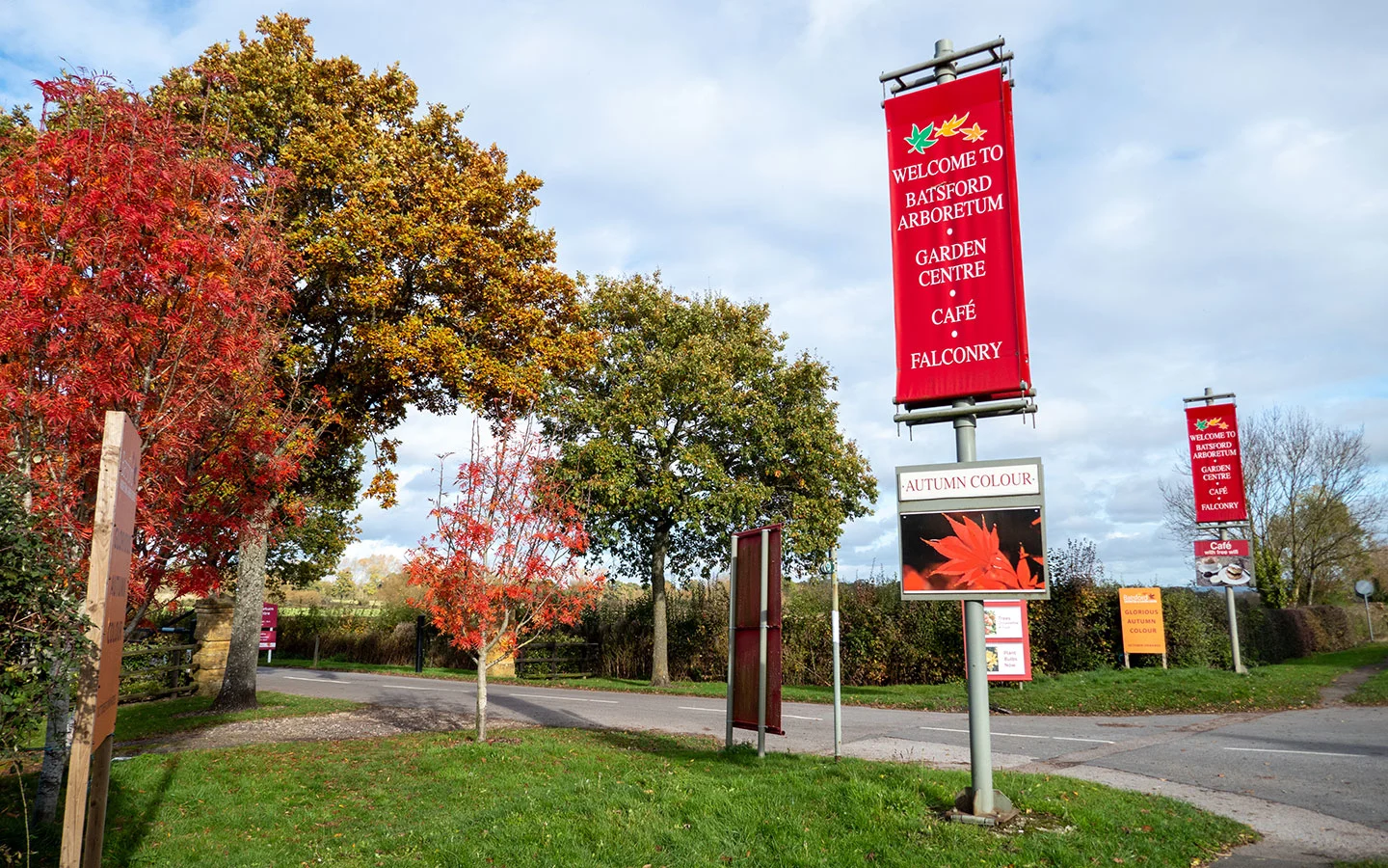
From Bourton-on-the-Hill, head downhill along the road as far as the entrance to Batsford Arboretum. Along the way you pass Bourton House Garden on the right, an award-winning English country garden that’s open to the public on Tuesdays to Fridays from April to October.
Turn left off the main road and walk down the arboretum driveway until you reach a wooden gate on the right, which has a Heart of England Way sign showing a path running diagonally across the field (or you can go straight on to visit the arboretum or their café and garden centre).

When you get towards the end of the field you’ll see a wooden gate in front of you. Don’t go through this, but instead turn right and head towards a smaller gate signposted Monarch’s Way.
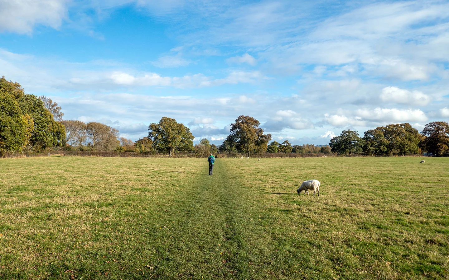
Go straight on through the next few fields, with several gates and bridges. When you get near to Moreton, go through a metal kissing gate on the left (this was marked with a red arrow when we walked the route) – if you pass cabins on your right you’ve gone too far and will reach a dead end.

Follow the path along the right-hand side of the field, then go through a kissing gate and along a pathway which runs along the side of allotments. When the path emerges onto Hospital Road, go straight ahead down Corders Lane and you’ll come out onto Moreton’s High Street.
Turn right to return to the starting point of the walk. Or there are lots of places to eat and drink nearby, including the Black Bear Inn and the White Hart Royal across the road, the Victoria Coffee House on your left and the Redesdale Arms and Rixy’s Cotswold Tearoom to your right.


* This site contains affiliate links, where I get a small commission from purchases at no extra cost to you.
Save for later


You might also like