
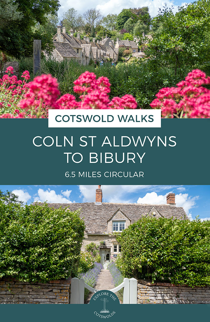
Combine a visit to one of the Cotswolds’ lesser-known villages with one of its most popular on this 6.7-mile/10.8km Coln St Aldwyns to Bibury walk. The route takes you through peaceful countryside and along the banks of the River Coln, passing mills, churches and Cotswold stone cottages.
It’s also a great way to visit Bibury, with its famous Arlington Row weavers’ cottages, water meadows, riverside Swan Hotel and Trout Farm, as walking there means you don’t have to hunt for a parking space, especially in summer and at weekends when the village gets hugely busy.

The trail starts in the small village of Coln St Aldwyns and passes its historic church before running across fields along part of the Palladian Way long-distance walking route. It then heads into Bibury, taking you past Arlington Row, the village church and grand Bibury Court, before following the River Coln as it meanders its way back through the valley towards Coln St Aldwyns.
The Coln St Aldwyns to Bibury walk takes around 3 hours and is a fairly easy walk, with just a couple of short climbs and a mix of dirt paths and country lanes. It’s a popular route for dog walkers and has several good pubs and cafés along the way where you can stop off for lunch or a drink.

Coln St Aldwyns to Bibury walk details and map
- Distance: 6.7 miles/10.8km.
- Time: 3 hours.
- Elevation: 374 feet elevation gain.
- Difficulty: Easy.
- Paths: Mainly flat dirt and grass paths, with a couple of short climbs. Some pavements and quiet country lanes and a short section along a busier road without a verge.
- Accessibility: One stone stile (which you can avoid and use a gate instead).
- Map: OL45 The Cotswolds*
- Toilets: Public toilets in Bibury on the Street (GL7 5NP) which charge 40p.
- Facilities: There are places to eat and drink in both Coln St Aldwyns and Bibury. In Coln there’s The New Inn pub and the Community Stores shop and café. And in Bibury there’s The Catherine Wheel pub and The Swan hotel and restaurant plus the café at Bibury Trout Farm.
Disclaimer: While we try to keep information up-to-date and accurate, Explore the Cotswolds cannot accept responsibility for errors or omissions. Walks are undertaken at your own risk, and we are not liable for any personal injury, loss or damage that may occur.

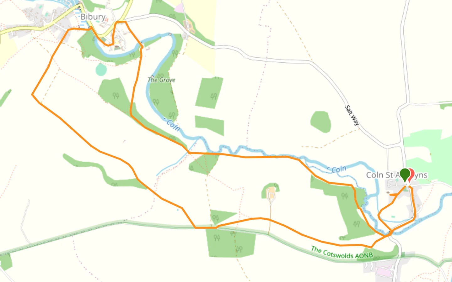
Click on the map above to be taken to Wikiloc, a free app where you can download a map and GPS directions for the Coln St Aldwyns to Bibury walk.
Start/finish point
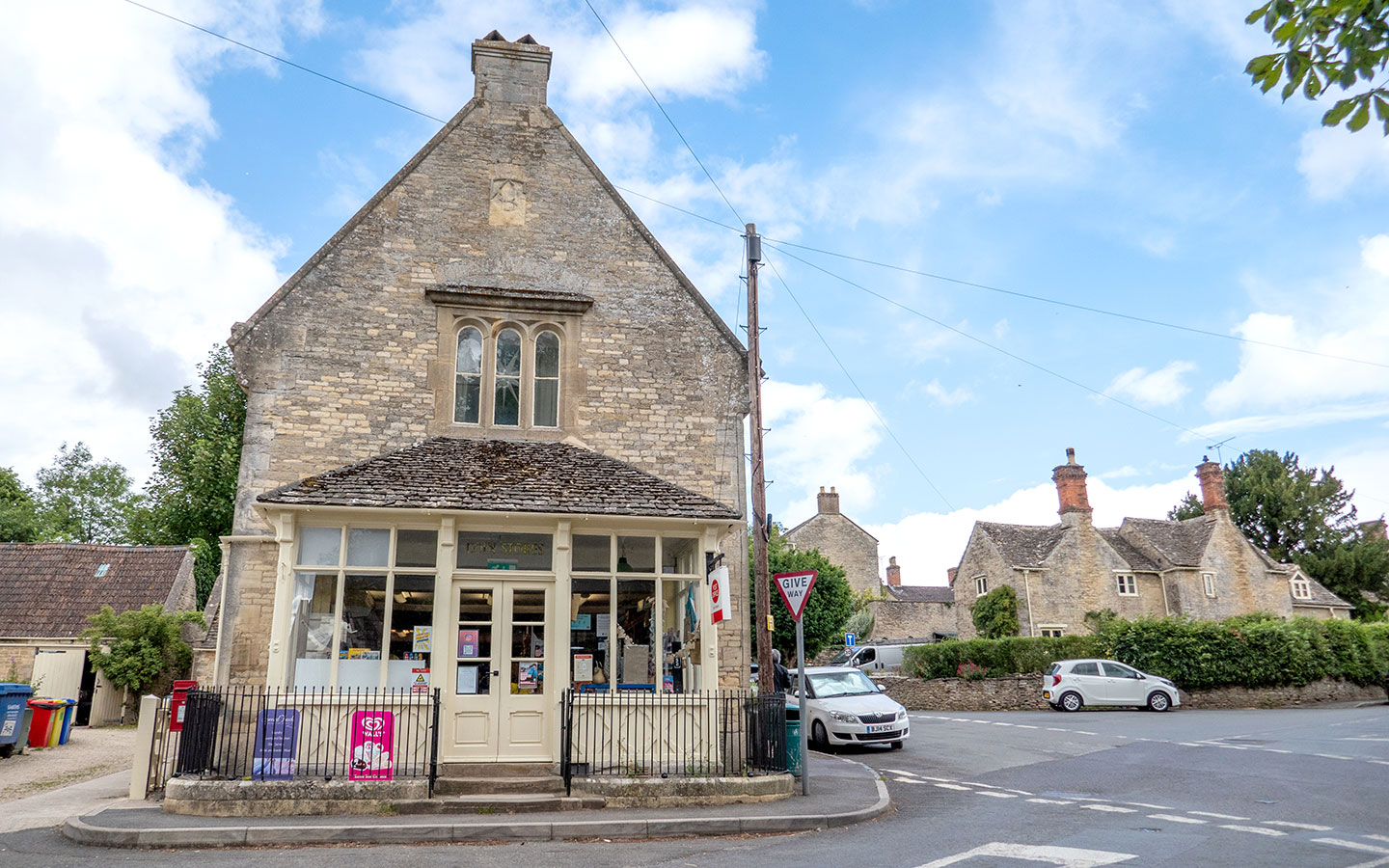
The starting point for the walk is outside the Community Stores in Coln St Aldwyns (GL7 5AN). If you’re travelling by car, there’s on-street parking around the crossroads outside the stores.
If you’re travelling by public transport, the Pulhams 855 bus connects Coln St Aldwyns with Cirencester and Bourton-on-the-Water – but it only stops in Coln once a day (excluding Sundays). It does stop in Bibury hourly though so you could start the walk there and do stage 2 first.
The Robin, the Cotswolds’ bookable bus service, also covers Coln St Aldwyns. Its South Cotswolds service allows you to pre-book minibus journeys around the area, including to or from Cirencester or Kemble train station. Rides can be requested and booked via their website and cost £3.

Coln St Aldwyns to Bibury walk route
Stage 1: Coln St Aldwyns to Bibury
Start your walk outside the Coln St Aldwyns Community Stores and follow the road uphill with the stores to your left. After around 50 metres you’ll reach a junction, where you take the road to the left which is marked with a metal signpost pointing ‘To the Church’.
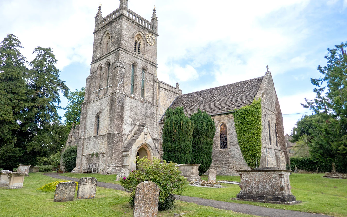
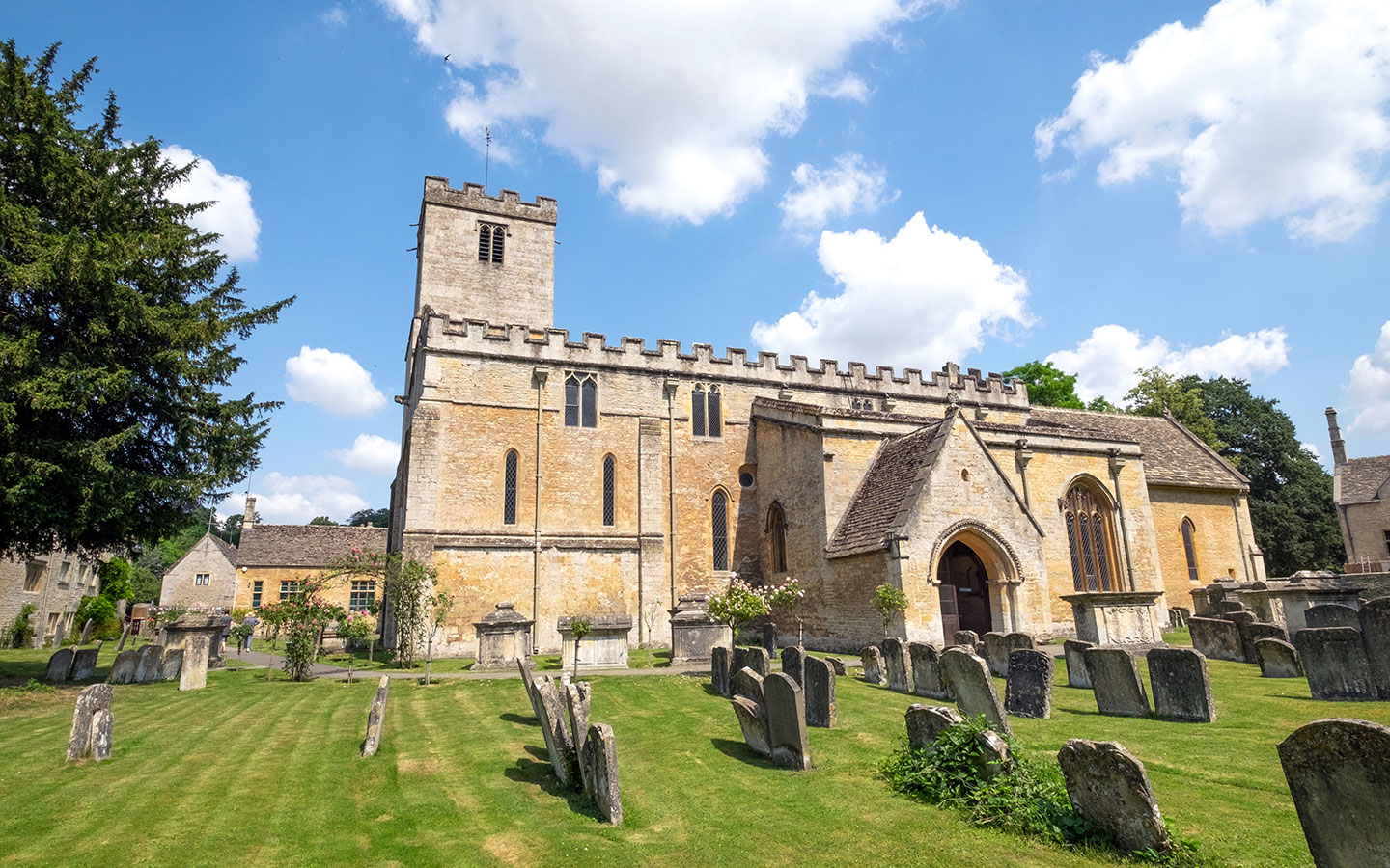
When you reach a sign saying ‘Dead end no turning’ you can take a short diversion to the right to visit St John the Baptist church, set through an archway. The church is unusual in that it’s one of only two in England which are dedicated to the beheading of John the Baptist. The oldest sections date back to the 13th century, but it was later added to and restored by the Victorians.

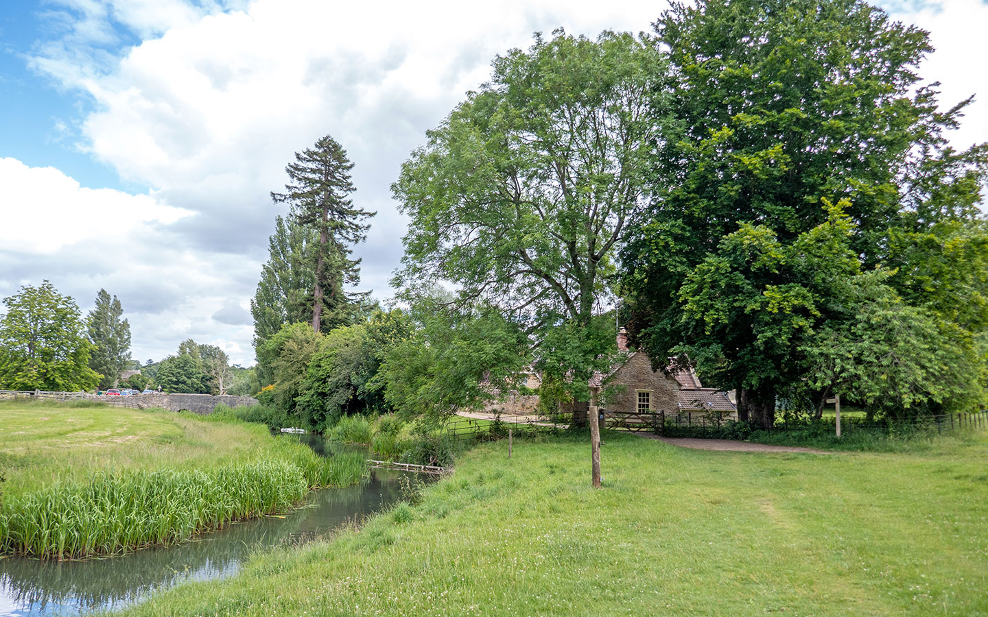
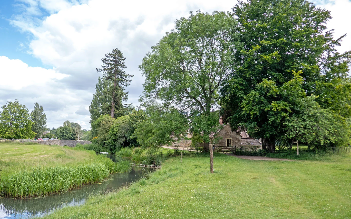
Back on the path, continue straight on along the road, which narrows into a track marked with a public footpath signpost. You’ll cross a small bridge before reaching a road, where you turn left. At the end of the road there’s a bridge over the River Coln to your right.
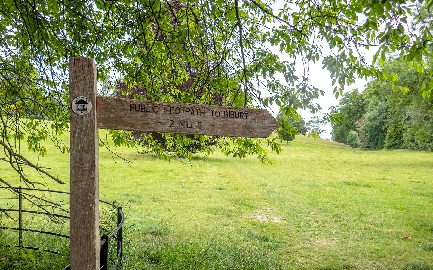
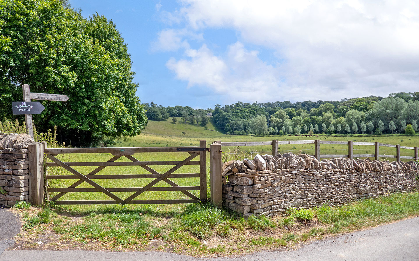
Cross the bridge, then turn right almost immediately through the gate of Yew Tree Lodge. After passing through another gate, you’ll see a sign pointing right saying ‘Public footpath to Bibury 2 miles’. Ignore this and walk straight across the field ahead, following the Palladian Way marker.

Continue along the path, which runs through fields and crosses a small unmade farm track next to a stone cottage. At the end of the path you’ll come to a gate which leads onto the main road. Turn right and follow the road for around 200 metres past Conygar Cottages.
Beware this stretch of road is quite narrow and doesn’t have a verge so be prepared to duck out the way of any passing cars. After 200 metres, take the footpath off the road on your right which is marked with a green public footpath signpost and follows the line of trees.

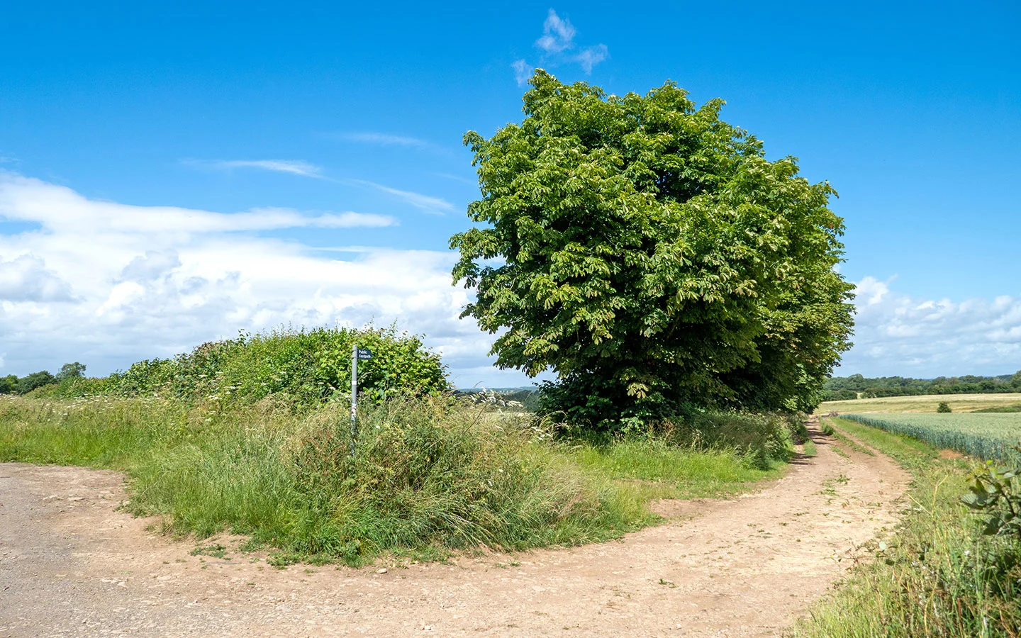
Follow this path, which passes through a wooden gate marked with a restricted byway sign and climbs up a short but fairly steep hill. At the top of the hill, continue straight on along a narrow path which runs between two fields (and can get quite overgrown in the spring and summer).
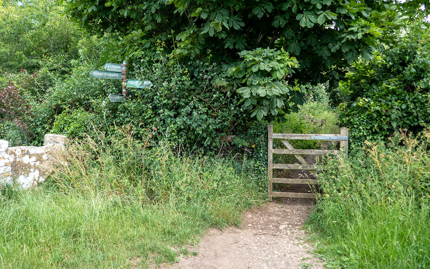
When you come to a crossroads of paths, with a metal gate to your left, take the path to the right. The track meets a small unmade road which goes around to the right. Then you’ll see a small wooden gate next to a metal signpost with public footpath signs pointing in five directions.

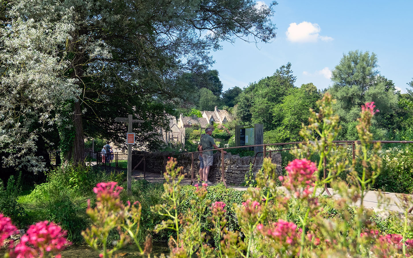
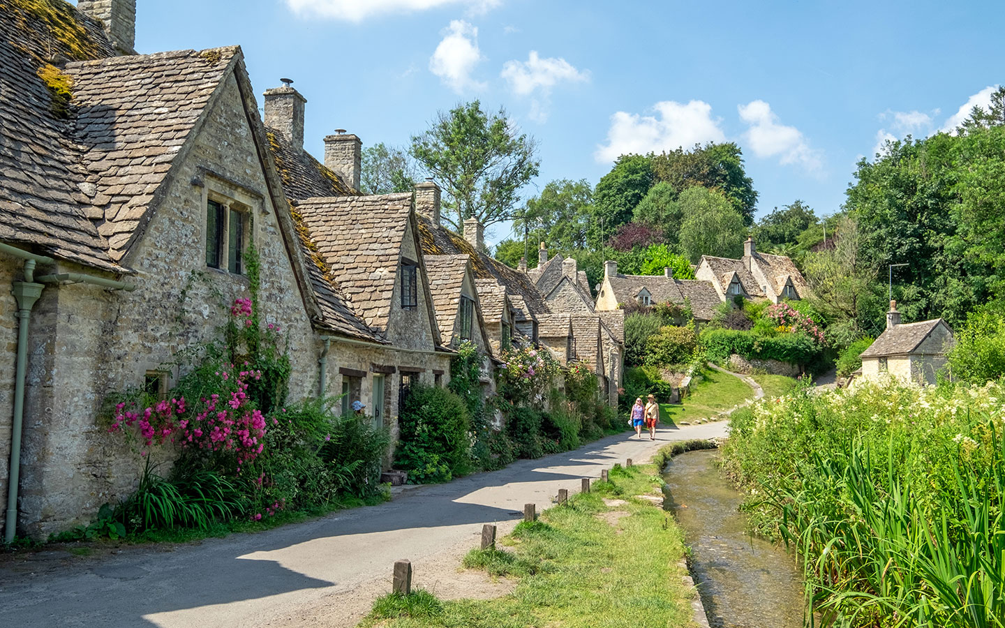
Go through the gate and another metal gate and you come out next to some barn conversions. Walk past them and follow the road downhill to the right and you’ll reach Arlington Row.
This picturesque row of cottages alongside the Rack Isle water meadows was built as a monastic wool store in 1380 before being converted into weavers’ cottages in the 17th century. Now they’re one of the Cotswolds’ most photographed spots – and if you want to get a closer look, the cottages at number 1 and number 9 Arlington Row are available to rent through the National Trust.

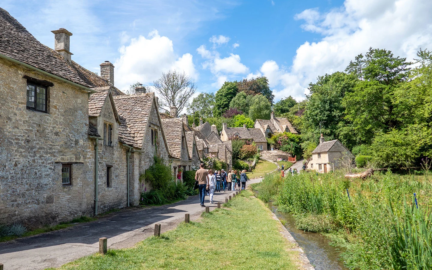
Walk past Arlington Row and cross over the small bridge to join the main road in front of the post office (a good place to pick up an ice cream on a hot day). If you want to explore Bibury, turn left and follow the road into the village, where you’ll find The Swan and The Catherine Wheel as well as the Trout Farm, where you can catch your own fish or grab something to eat in their café.
Otherwise turn right after crossing the bridge. Then when the main road curves to the left, carry straight on along the smaller road with Bibury Village Hall to your left past St Mary’s Church, which has a Saxon graveyard, medieval stained glass and an unusual 13th-century square font.

Stage 2: Bibury to Coln St Aldwyns
Carry on along the road marked ‘Dead end no access’ past the church, which rejoins the main road at the top of the hill next to a red telephone box. Follow the main road to the right, and after 50 metres turn right down the road signposted Coln St Aldywns, Quenington and Hatherop.
After around another 50 metres, take the road on the right which leads downhill and is marked with a wooden sign saying ‘Public bridleway, Coln St Aldywns 2 miles’ (the sign looks a bit like it’s pointing through the field but stay on the road, heading towards the old mill buildings).
Look to your right just before you reach the mill and you can get a glimpse of the grand Jacobean Bibury Court, which was once a hotel but is now a private house. Continue along the road past the mill buildings until you reach a wooden gate which takes you into Bibury Court Estate.
Go straight ahead following the bridleway sign, with the path passing through a wooden gate then climbing uphill into Oxhills Woods. At the top of the hill the path splits in two – take the left fork signposted public bridleway and follow the narrow pathway along the edge of the woods.
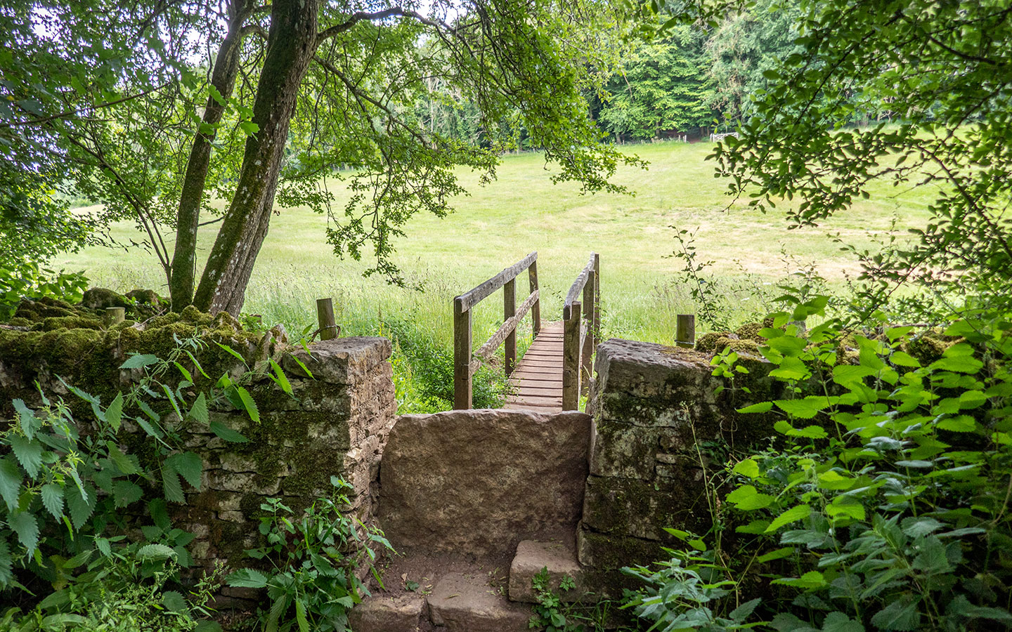

Go through a wooden gate and down a short, fairly steep hill, then cross over a stone stile and small wooden bridge (there’s also a gate to the right if you want to avoid the stile). Follow the path to the left which runs diagonally across the meadow and passes through two metal gates.
Keep on along this path which runs though the valley with the River Coln to your left until you end up back at Yew Tree Lodge and the signpost to Bibury. Go back through the gates and left over the bridge, but this time carry on along the main road into Coln St Aldwyns rather than turning off.
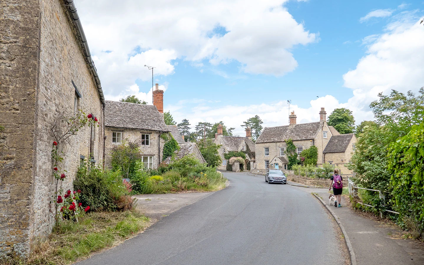
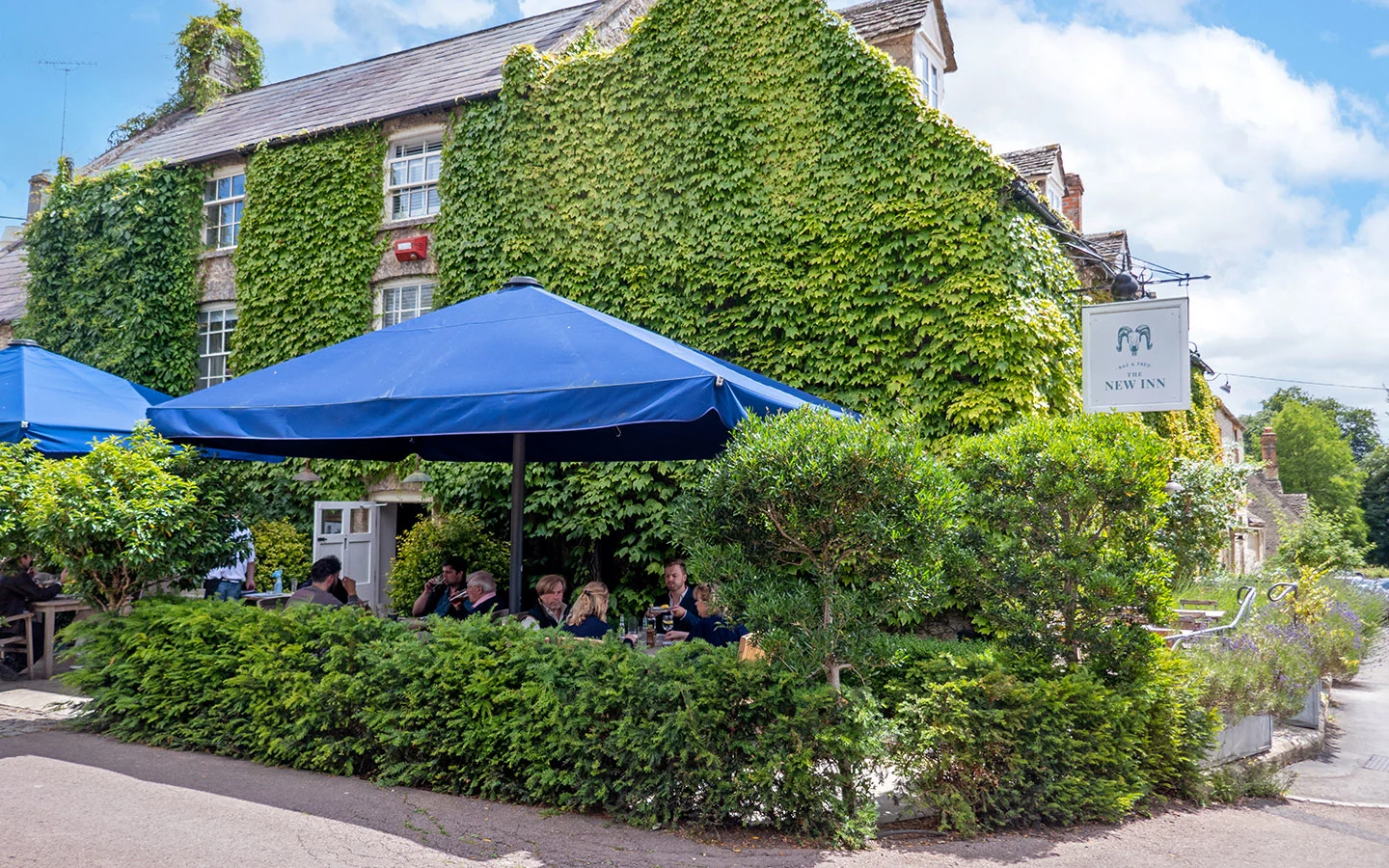
The road runs through the village and passes The New Inn, a 16th-century coaching inn which has a beer garden for summer and a cosy fire in winter, and does good burgers. Carry on past the pub and you’ll find yourself back at the crossroads outside the Community Stores where you started.

* This site contains affiliate links, where I get a small commission from purchases at no extra cost to you.
Save for later

You might also like


Nanci
Tuesday 17th of March 2026
We did this walk back in 2007 when the river had caused flooding so we had some detours. We did it from Bibury and back before mobile phones and used a Garmin GPS and map. Lovely walk!!
Lucy Dodsworth
Friday 27th of March 2026
Such a lovely area! (Though it can get a bit wet in winter).