Explore a medieval castle and historic pilgrimage site on this 3.7-mile/5.9km Winchcombe and Sudeley Castle walk in the Cotswolds. The walk starts in the centre of Winchcombe and passes through the grounds of 15th-century Sudeley Castle – where you can stop for a visit.
It then follows part of the Warden’s Way walking route, climbing up through farmland with views back down over Winchcombe and the castle, and passing the site of St Kenelm’s Well.

St Kenelm’s Well marks the spot where the body of Kenelm, the Mercian king and martyr who was murdered by his sister, rested on its way to Winchcombe Abbey for burial. According to legend, a spring burst into life where his body stood and became a place of pilgrimage in the Middle Ages.
The route then follows the Winchcombe Way back down towards the town, where there are plenty of pubs and cafés to end your walk in. The Winchcombe and Sudeley Castle walk takes around 1 hour 45 minutes, but is moderately challenging with some fairly steep climbs.

Winchcombe and Sudeley Castle walk details and map
- Distance: 3.7 miles/5.9km.
- Time: 1 hour 45 minutes.
- Elevation: 505 feet elevation gain.
- Difficulty: Moderate.
- Paths: Mainly grass and dirt paths and a few short sections along quiet country roads.
- Accessibility: One bridge stile, lots of kissing gates and some steep uphill sections.
- Map: OL45 The Cotswolds*
- Toilets: There are public toilets in the Back Lane car park next to the library in Winchcombe (20p), but none along the route other than for visitors to Sudeley Castle.
- Facilities: There are lots of places to eat and drink in Winchcombe, including The Old Bakery Coffee & Wine Bar and the White Hart and Plaisterers Arms pubs, which are all along the walk route. There’s also a café at Sudeley Castle Visitors’ Centre when it’s open.
Disclaimer: While we try to keep information up-to-date and accurate, Explore the Cotswolds cannot accept responsibility for errors or omissions. Walks are undertaken at your own risk, and we are not liable for any personal injury, loss or damage that may occur.
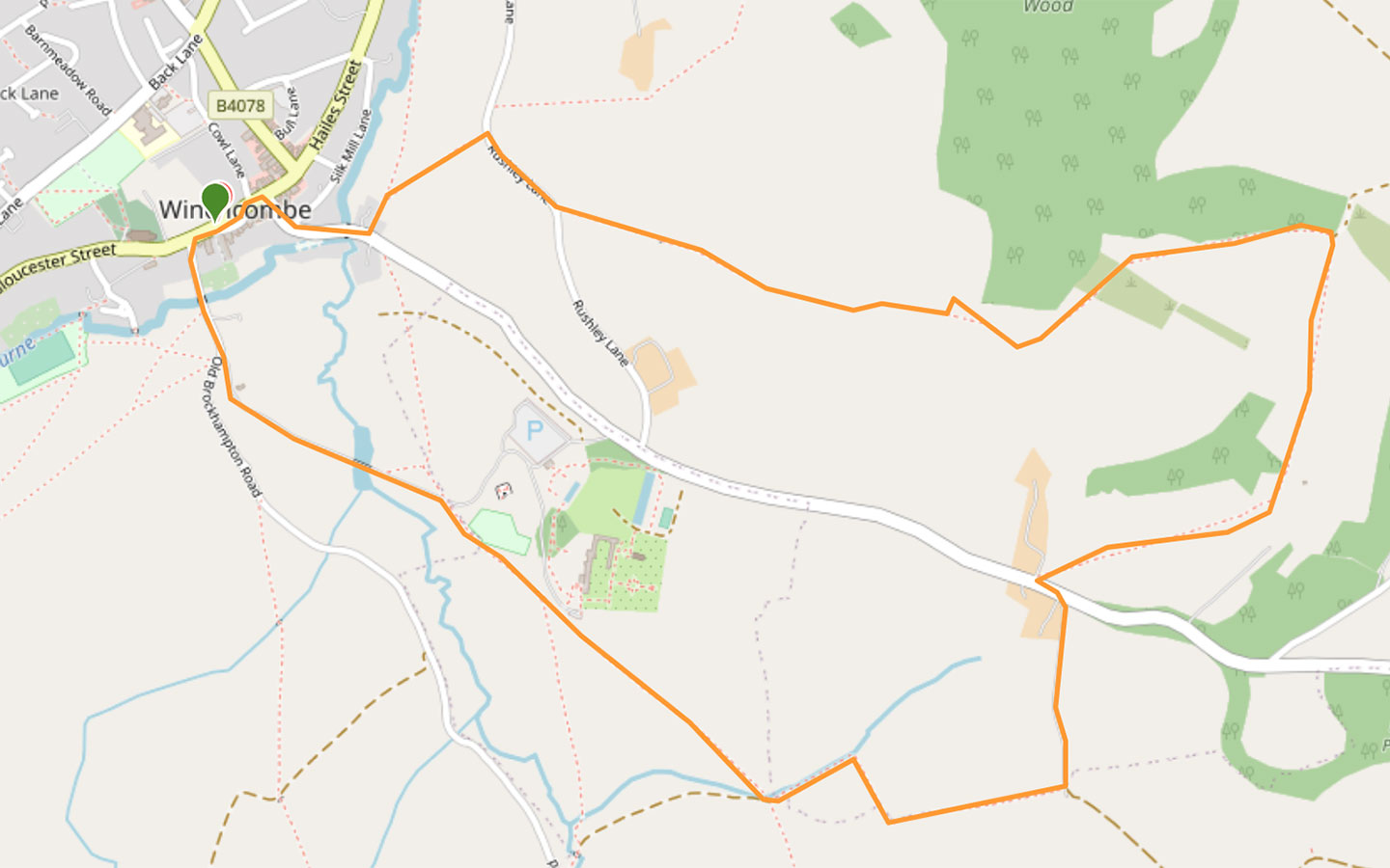

Click on the map above to be taken to Wikiloc, a free app where you can download a map and GPS directions for the Winchcombe and Sudeley Castle walk.
Start/finish point
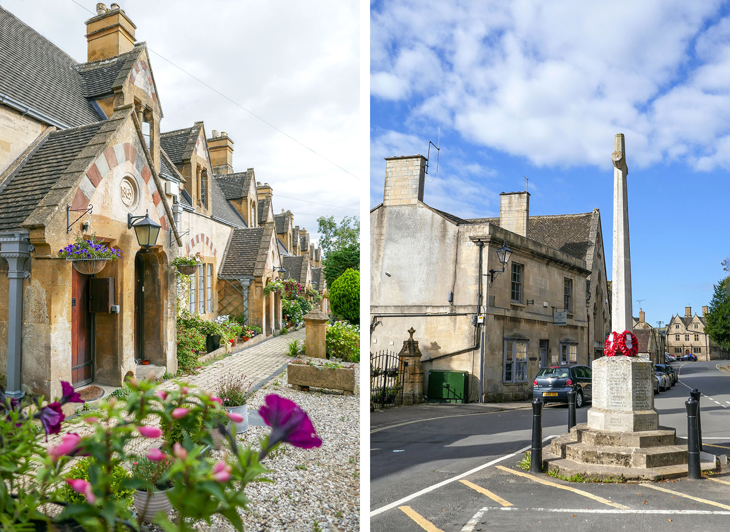
The starting point for the walk is Winchcombe’s war memorial on Gloucester Street (GL54 5LW). If you’re travelling by car, there’s paid parking at the Back Lane car park (GL54 5PZ), which costs £1 all day and is a couple of minutes’ walk via Cowl Lane to the starting point of the walk.
If you’re travelling by public transport, the nearest train station is in Cheltenham, and the Stagecoach W and Pulhams 606 buses both run from Pittville Street in Cheltenham to Winchcombe. The W takes 25 minutes and the 606 50 minutes (though neither run on Sundays).
You could also travel to Winchcombe in style on a Gloucestershire–Warwickshire Steam Railway train from Cheltenham Racecourse – though the service only runs on certain dates. The train arrives into Greet, which is a 25-minute walk from the walk’s start point in Winchcombe.
Winchcombe and Sudeley Castle walk route
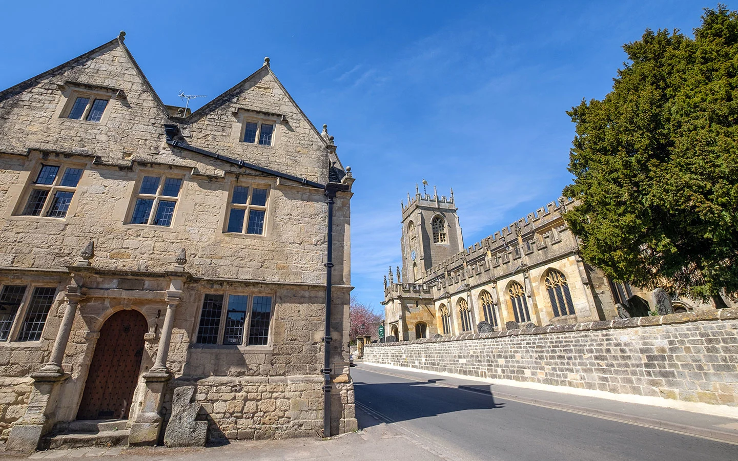
Start your walk next to the Winchcombe war memorial. Next to it you’ll see the entrance to the Dent’s Terrace almshouses, a row of pretty cottages which were built by the architect Sir George Gilbert Scott in 1865. They’re named after the Dent family – owners of nearby Sudeley Castle – and were founded by Emma Dent to provide housing for local people in need, which they still do.
Walk down Gloucester Street towards the church, taking the first left down Vineyard Street, where you’ll see a signpost for Sudeley Castle. Walk down Vineyard Street across the bridge over the River Isbourne and uphill towards the Sudeley Castle Gatehouse* (which is available to rent).
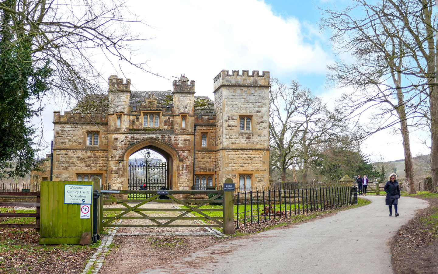
Follow the path which runs to the right of the gatehouse, passing through a wooden gate and continuing on through the castle grounds. Then when you reach a metal gateway just before the castle, marked with a 10mph speed limit sign, take the path to the right marked Warden’s Way.
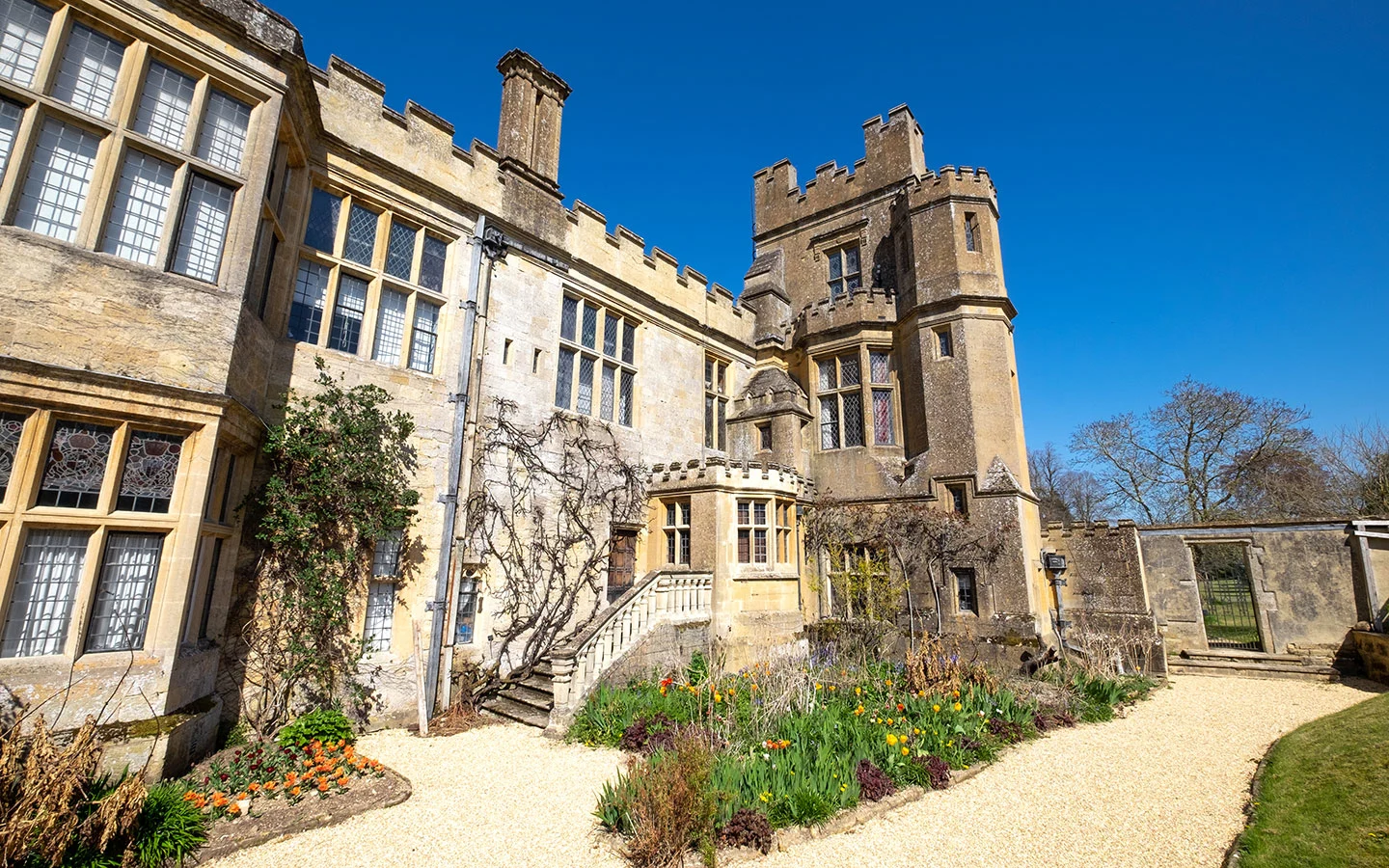
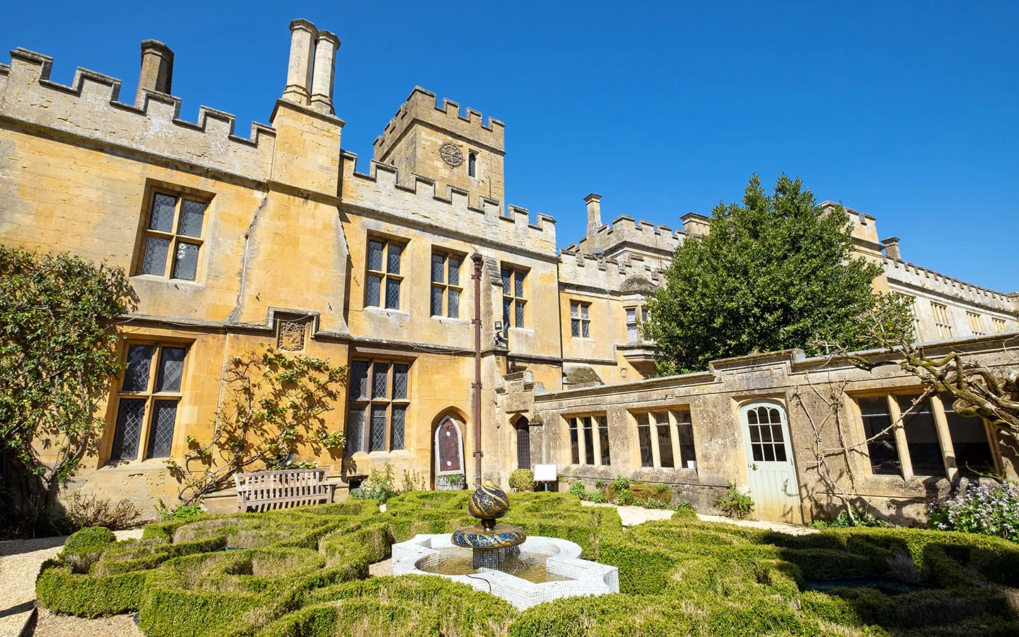
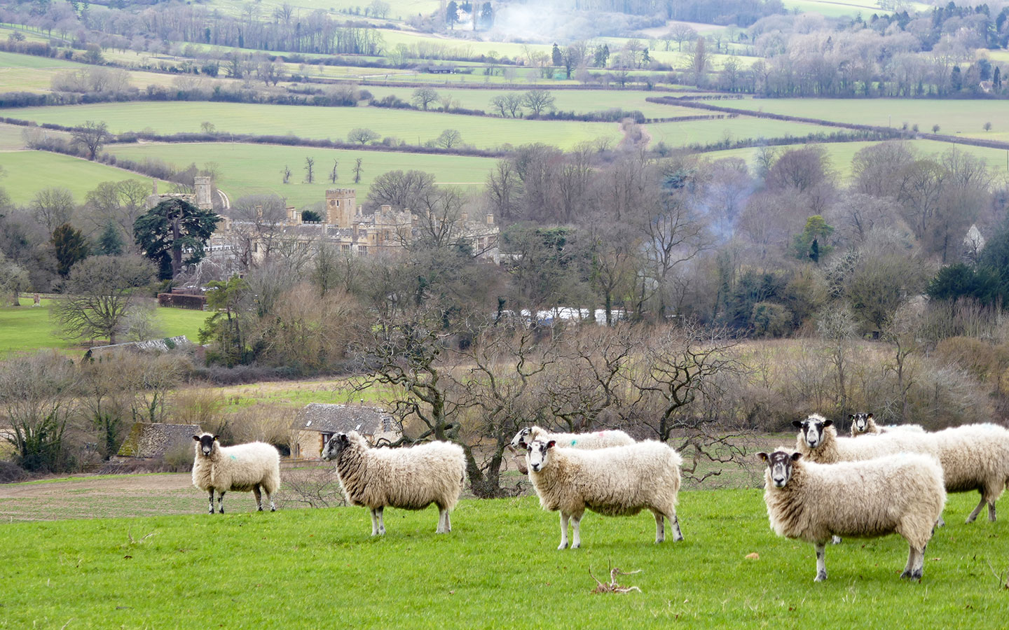
If you want to visit Sudeley Castle (normally open mid-March to November), take the road to the left at this point instead which leads to the entrance. Sudeley Castle was built in 1442 and is where Henry VIII’s last wife Katherine Parr lived and died. The castle is surrounded by 10 different gardens and has a museum with historic artefacts.


Walk across the field, with the castle and its children’s playground on your left – the path is marked with wooden Warden’s Way signposts. At the end of the field, go across a small bridge and through a kissing gate, then turn left and go through another kissing gate with a Warden’s Way sign.
The path runs around the edge of the field, and then crosses over another small bridge and through a gate, climbing upwards along the left-hand side of the next field.

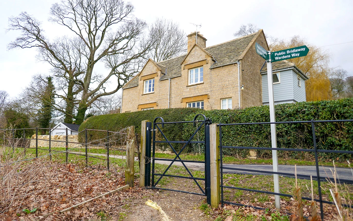
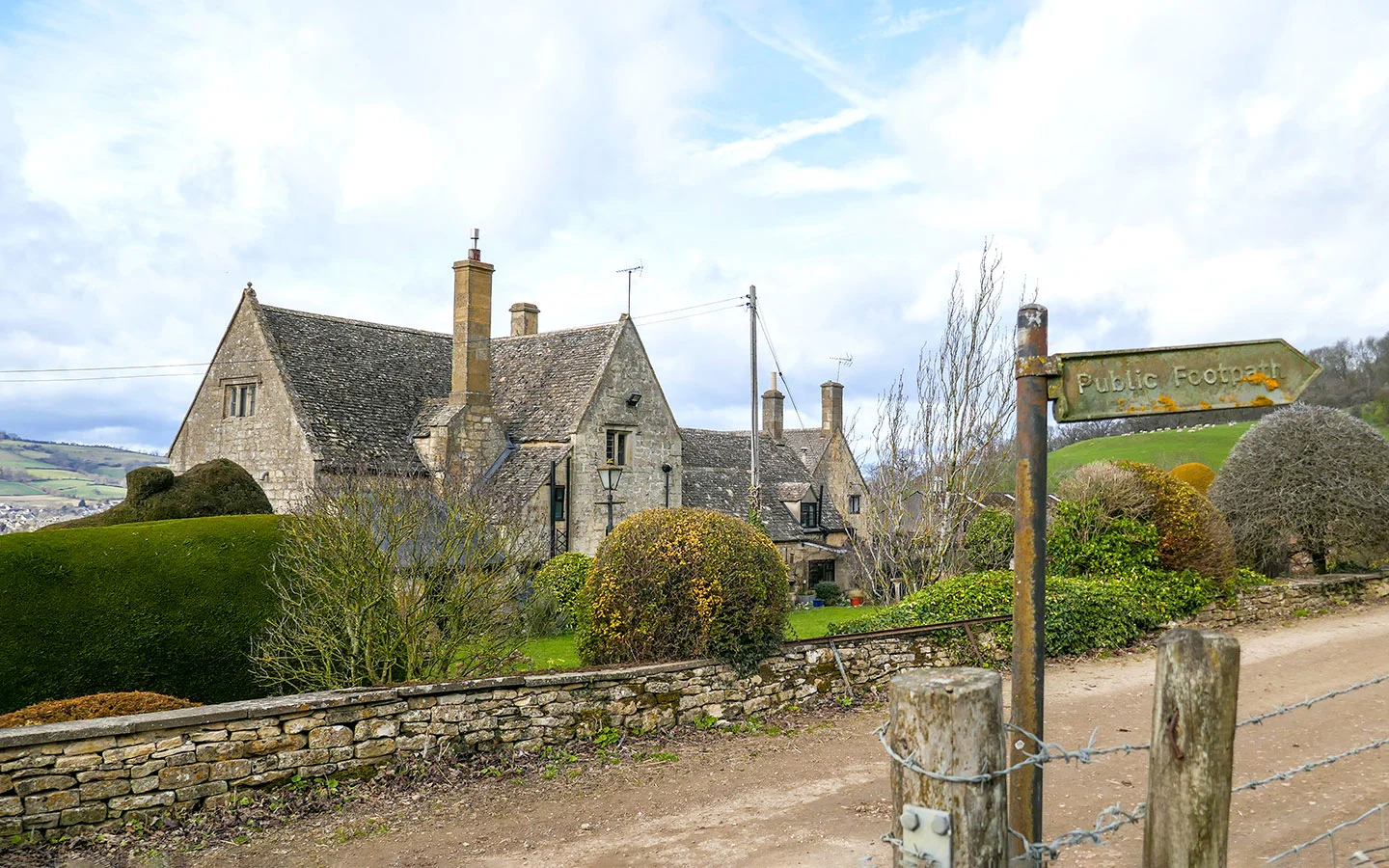
When you reach the top of the hill, go through a metal gate just in front of a stone house which leads onto a small road. Ignore the signpost pointing to the right which says ‘Public Bridleway Warden’s Way’ and instead turn left and walk along the road towards some farm buildings.
After passing the farm, the road joins onto a larger road. Turn left and walk downhill for around 50 metres, then turn right down a stony track marked with a sign for ‘Sudeley Hill Farm’. Before you reach the farmhouse, go through the gate on your right with a metal ‘Public footpath’ sign.
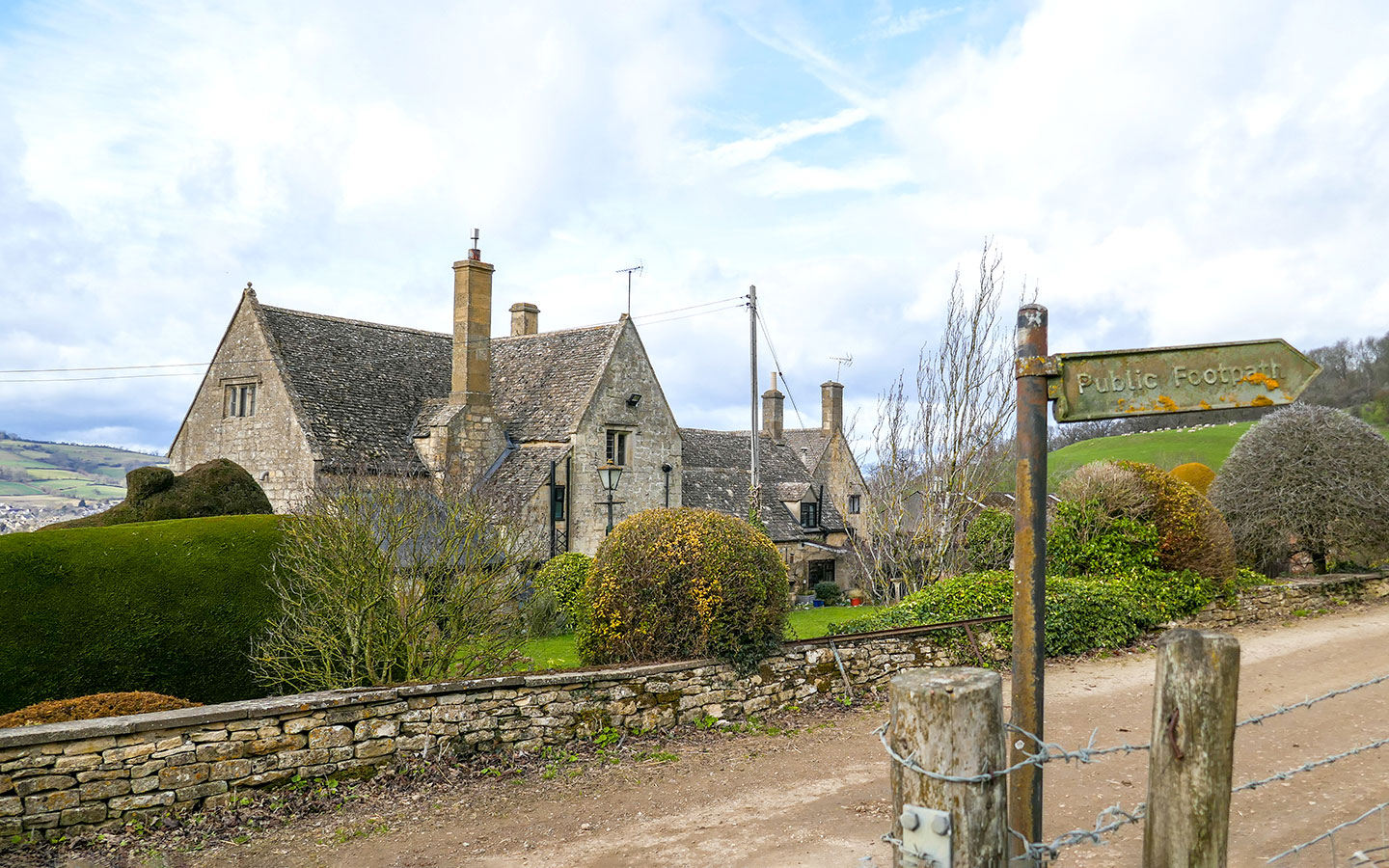
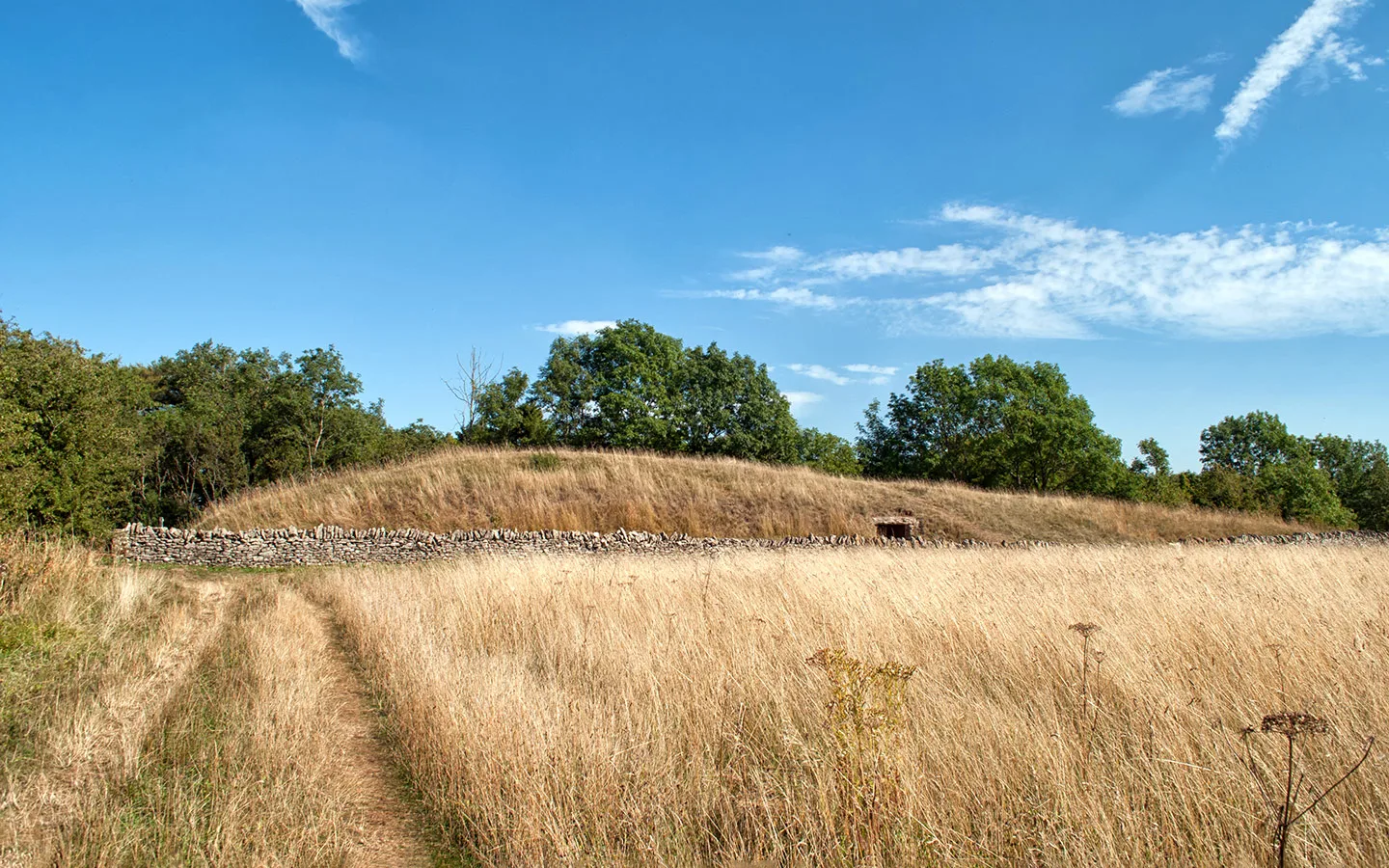
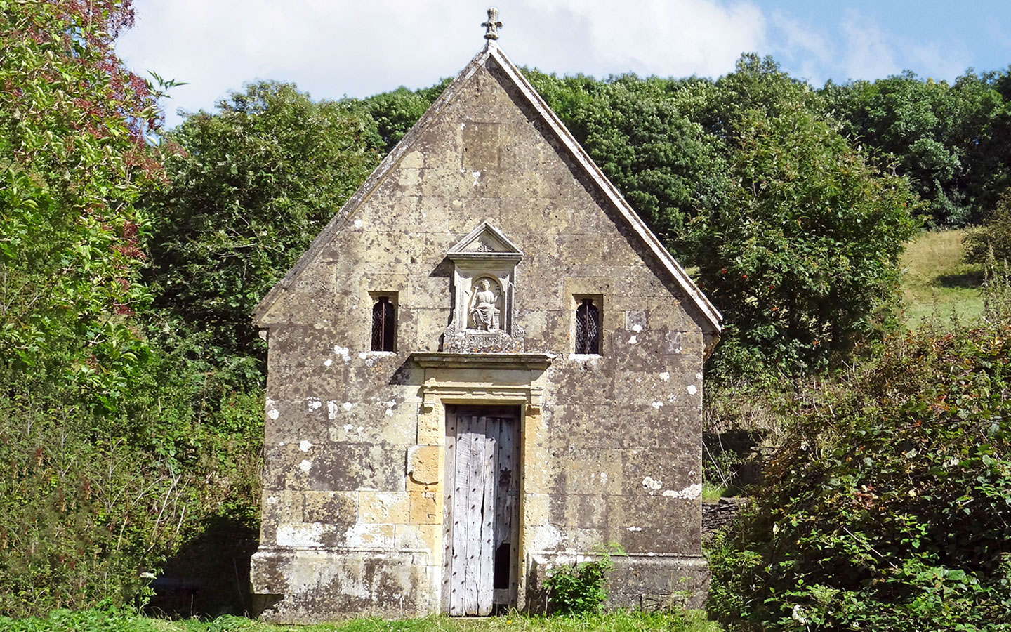
Walk uphill across the field, passing through a kissing gate at the top of the field and carrying straight on across the next field, bearing left onto a track and going through another gate. Continuing upwards, on your right you’ll see the stone building of St Kenelm’s Well. The well house was built in 1887 on the site of an older chapel in honour of Queen Victoria’s Golden Jubilee.
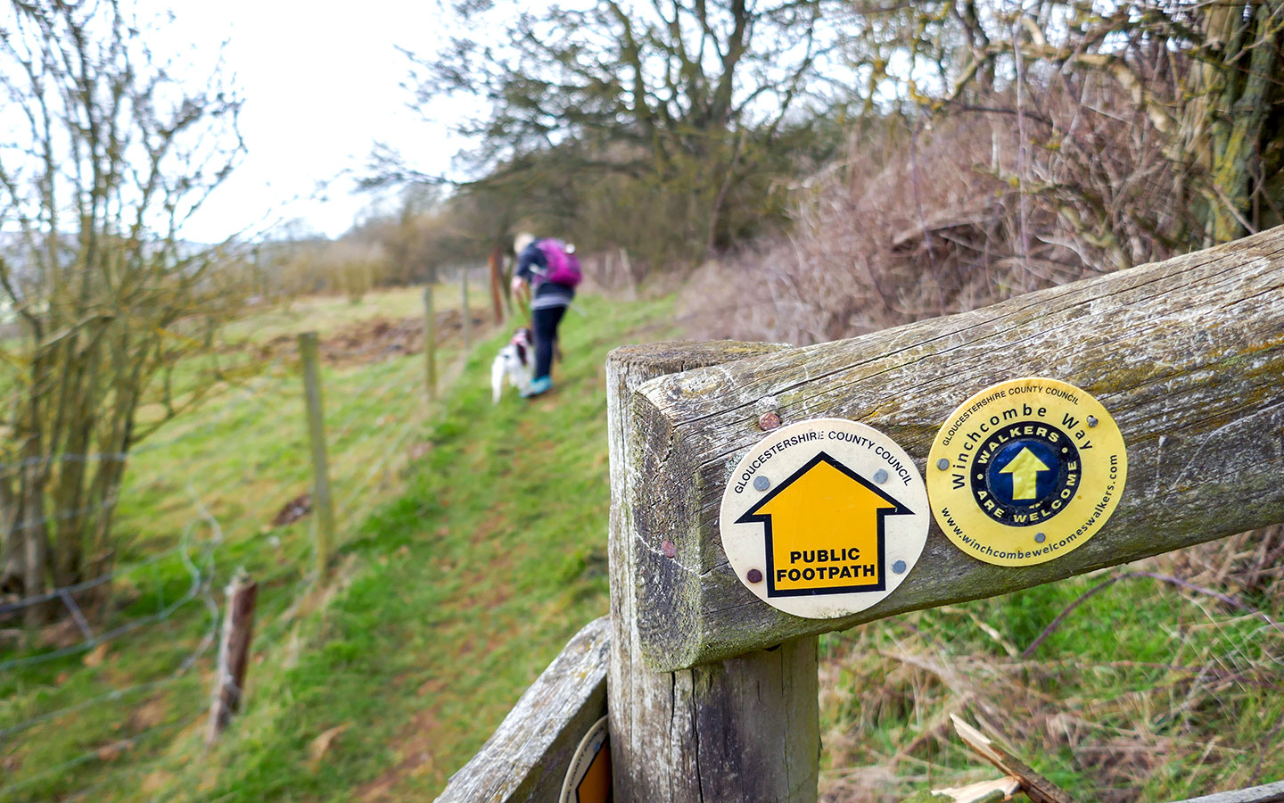
Just before you get to the top of the hill, you’ll see a metal gate with a Winchcombe Way sign on your left. Go through the gate and follow the path, which runs along the edge of a pig pen then through another gate. Follow the left-hand edge of the field and pass through a kissing gate into a narrow path through a small tree plantation, with another kissing gate at the end.

Walk through the next field, staying to the right along the tree line. And when you reach the gate in the bottom right-hand corner of the field you’ll see great views out over Sudeley Castle.
Go through the gate and keep to the right of the field as you walk down Dunn’s Hill. Go through another gate into the next field and again keep to the right, following the boundary until you see a gap in the hedge marked with a wooden signpost with a Winchcombe Way sign.
Go through the gap and walk diagonally across the field, through a gate and then across a stile bridge. At the end of the next field, the path goes through a metal gate and joins onto a small road – Rushley Lane – with a pretty stone cottage and a long stone wall in front of you.
Turn right and walk down the road for around 200 metres until it curves to the right. At this point go through the gate on the left onto a path signposted Gloucestershire Way. Cross the field towards the church, and once you reach edge of the field the path merges onto the riverside walkway.
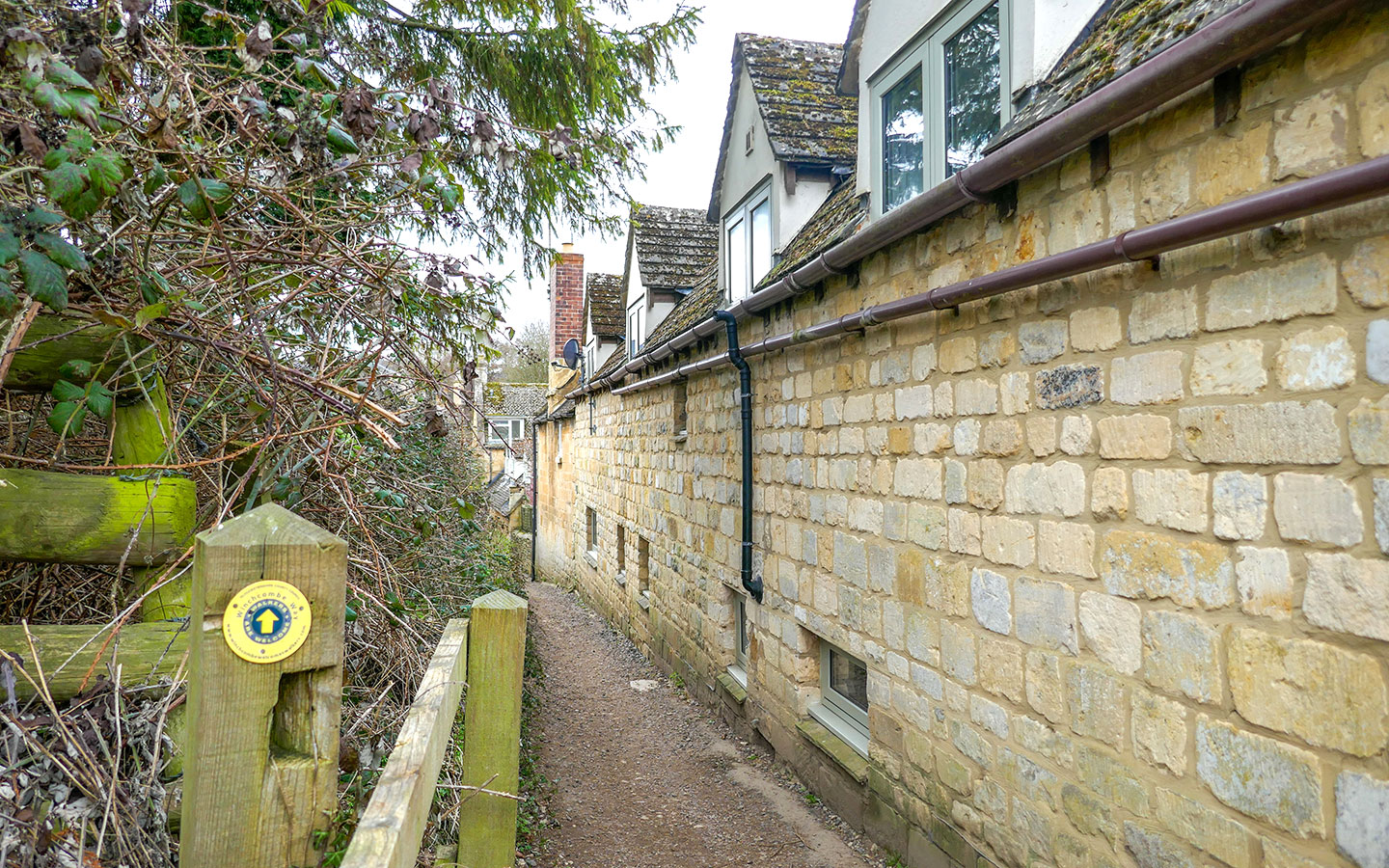

Ahead of you a narrow footpath – marked with Winchcombe Way and Isbourne way signs – runs between houses and a hedge. Walk down this path, which joins onto Castle Street at the end, where you’ll see more of the Sudeley Castle holiday cottages in front of you.
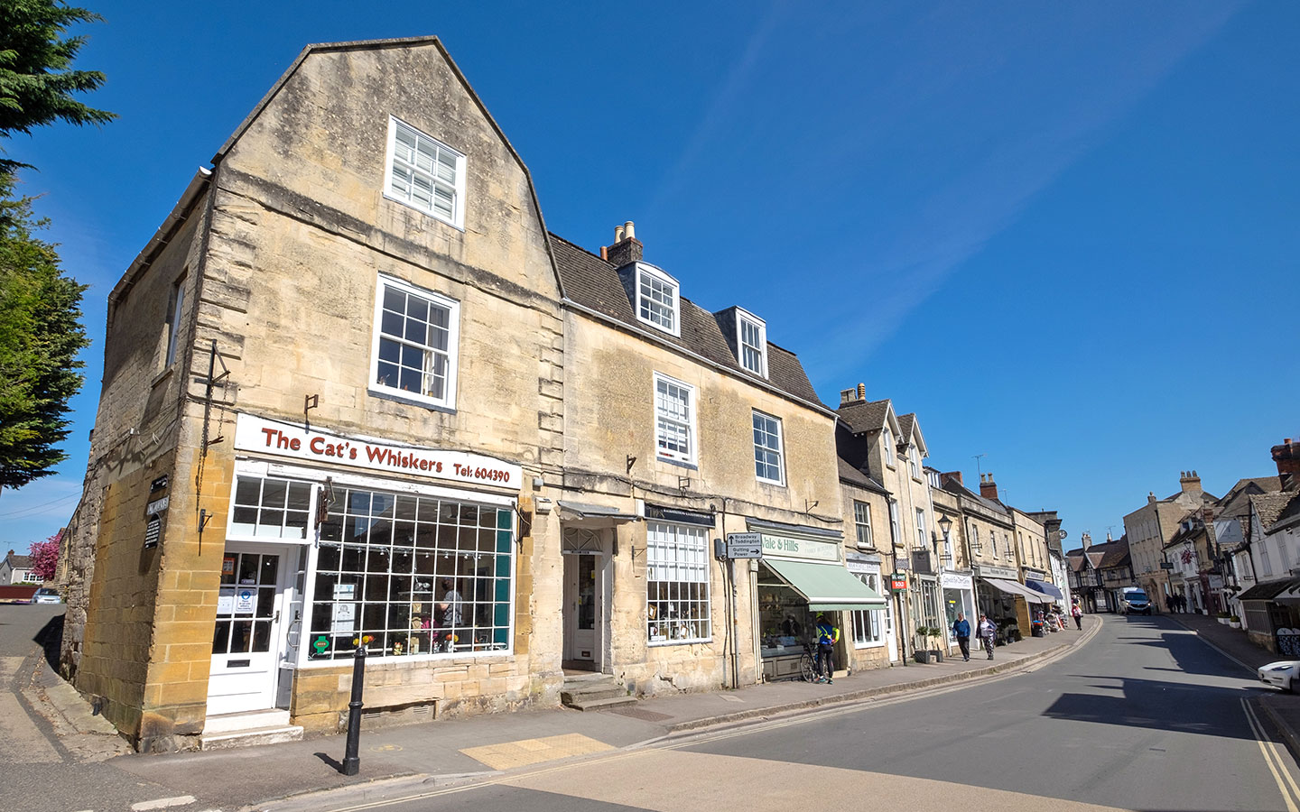
Turn right and walk uphill along Castle Street. At the top of the hill it joins onto the High Street and you’re back in the centre of Winchcombe. If you want to stop for a drink, the White Hart pub is just to your right and has a beer garden in summer, or turn left to get back to the start point.

* This site contains affiliate links, where I get a small commission from purchases at no extra cost to you.
Save for later


You might also like