
Visit a 3000-year old Neolithic burial site and enjoy fantastic views of Winchcombe and Sudeley Castle on this 5.1 mile/8.2km circular Winchcombe to Belas Knap walk in the Cotswolds. Belas Knap is one of four long barrows in Gloucestershire which are managed by English Heritage.
The route is part of a series of Cotswold Way circular walks, which incorporate sections of the 102-mile-long Cotswold Way National Trail between Chipping Campden and Bath. It also includes part of the Winchcombe Way, a 42-mile circular trail forming a figure of eight around the town.

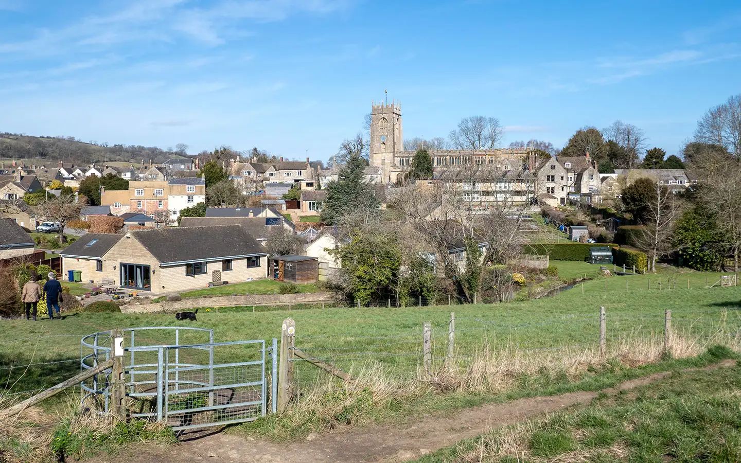
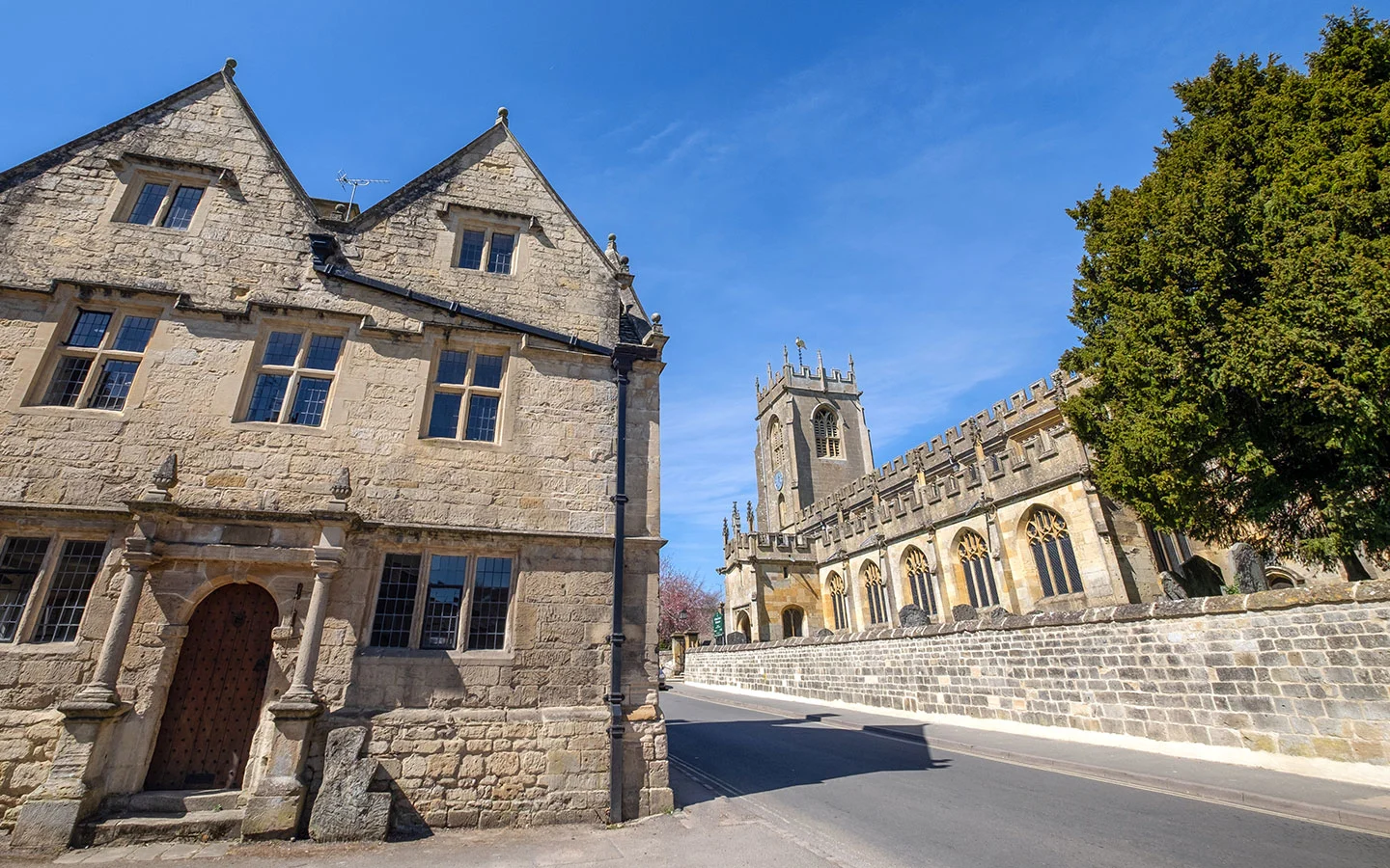
The walk starts in the centre of Winchcombe, climbing uphill along the Cotswold Way with views back down to the town and St Peter’s Church. After turning off the Cotswold Way and climbing up along quiet country roads, it rejoins the route near the Belas Knap burial mound.
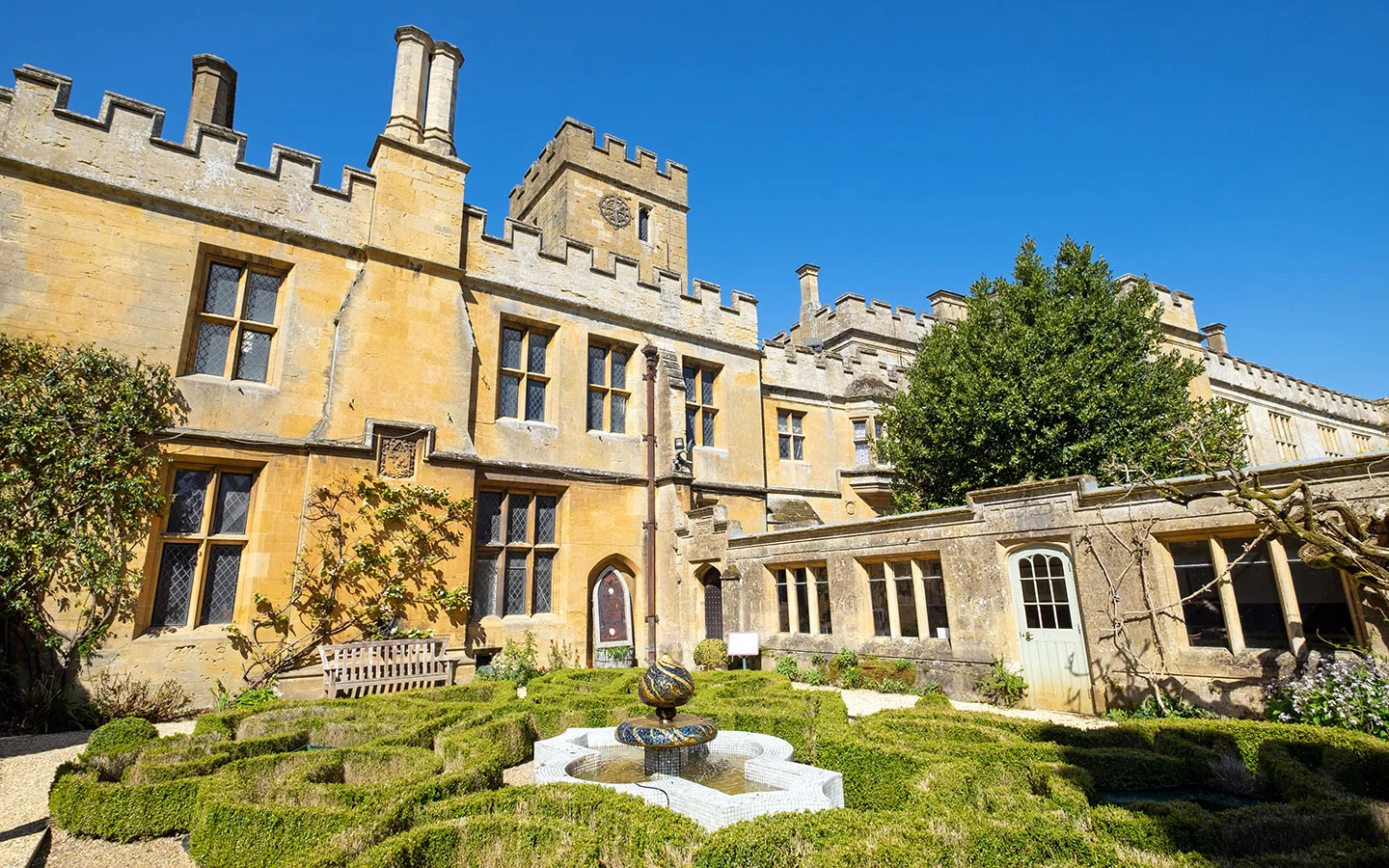
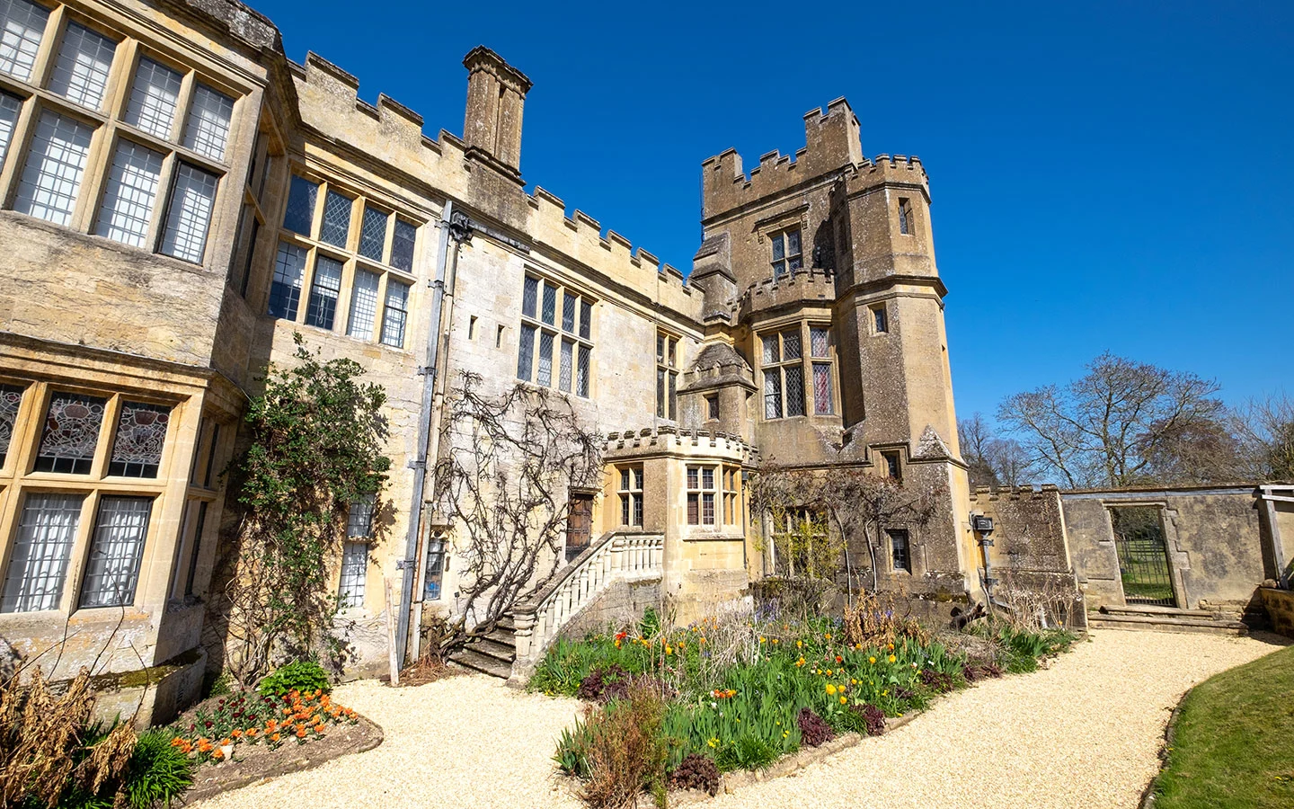
From Belas Knap you follow the Winchcombe Way downhill into Winchcombe, passing alongside historic Sudeley Castle, which was once the home of Henry VIII’s wife Katherine Parr. The castle is just a short diversion off the walk route so you could easily combine them on the same day.


The Winchcombe to Belas Knap walk takes 2–2.5 hours to complete, and is moderately challenging with some steep climbs. It ends in the centre of Winchcombe, which has plenty of pubs and cafés where you can stop off afterwards, and is easy to reach by public transport from Cheltenham.


Winchcombe to Belas Knap walk details and map
- Distance: 5.1 miles/8.2km.
- Time: 2–2.5 hours.
- Elevation: 686 feet elevation gain.
- Difficulty: Moderate.
- Paths: Mainly grass and dirt paths, some sections along fairly quiet country roads.
- Accessibility: Several stiles and kissing gates and some steep climbs.
- Map: OL45 The Cotswolds*
- Toilets: There are public toilets in the Back Lane car park next to the library in Winchcombe (20p), but none along the walk route.
- Facilities: There are lots of places to eat and drink in Winchcombe, including The Old Bakery Coffee & Wine Bar, which does a great homemade cake and has a sunny garden, and the White Hart and Plaisterers Arms pubs, all of which are close to the start/finish point.
Disclaimer: While we try to keep information up-to-date and accurate, Explore the Cotswolds cannot accept responsibility for errors or omissions. Walks are undertaken at your own risk, and we are not liable for any personal injury, loss or damage that may occur.


Click on the map above to be taken to Wikiloc, a free app where you can download a map and GPS directions for the Winchcombe to Belas Knap walk.
Start/finish point
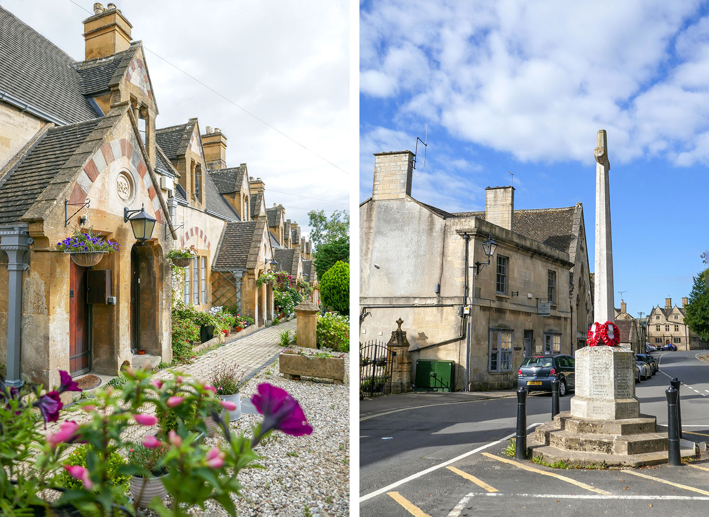
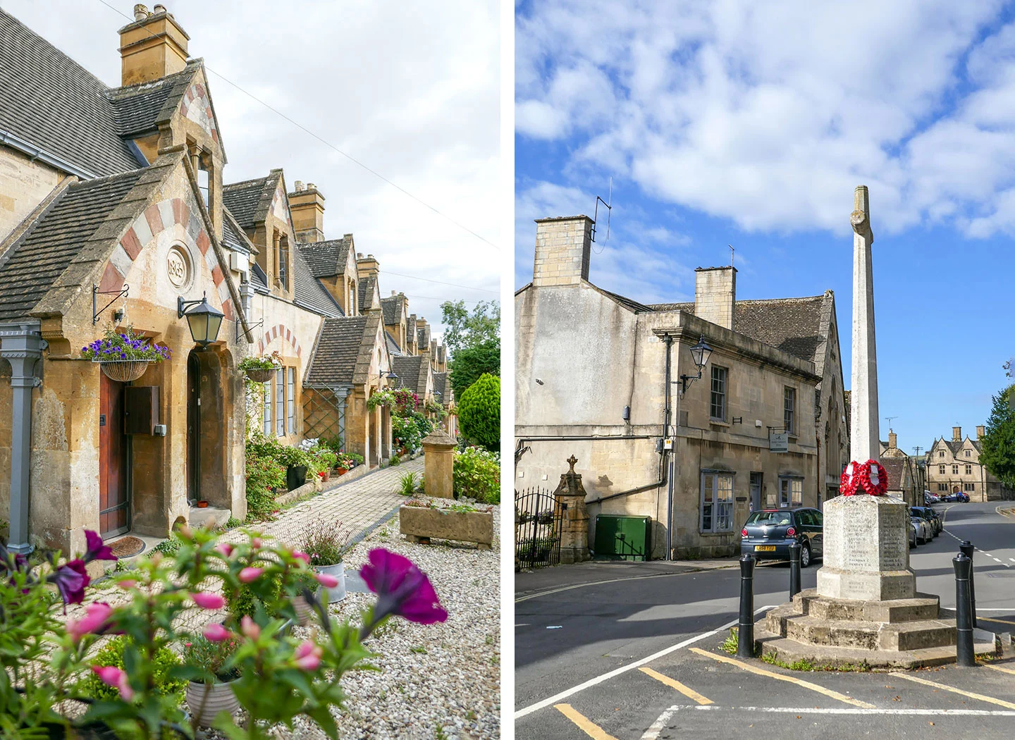
The starting point for the walk is Winchcombe’s war memorial on Gloucester Street (GL54 5LW). If you’re travelling by car, there’s paid parking at the Back Lane car park (GL54 5PZ), which costs £1 all day and is a couple of minutes’ walk via Cowl Lane to the starting point of the walk.
If you’re travelling by public transport, the nearest train station is in Cheltenham, and the Stagecoach W and Pulhams 606 buses both run from Pittville Street in Cheltenham to Winchcombe. The W takes 25 minutes and the 606 50 minutes (though neither run on Sundays).
You could also travel to Winchcombe in style on a Gloucestershire–Warwickshire Steam Railway train from Cheltenham Racecourse – though the service only runs on certain dates. The train arrives into Greet, which is a 25-minute walk from the walk’s start point in Winchcombe.
Winchcombe to Belas Knap walk route
Stage 1: Winchcombe to Belas Knap via The Cotswold Way
Start your walk next to the Winchcombe war memorial. Next to it you’ll see the entrance to the Dent’s Terrace almshouses, a row of pretty cottages which were built by the architect Sir George Gilbert Scott in 1865. They’re named after the Dent family – owners of nearby Sudeley Castle – and were founded by Emma Dent to provide housing for local people in need, which they still do.
Walk down Gloucester Street towards the church, taking the first left down Vineyard Street, where you’ll see a signpost for Sudeley Castle. Walk down Vineyard Street across the bridge over the River Isbourne, then take the path on the right marked with a wooden Cotswold Way sign.

Follow the path across the field – with views of St Peter’s Church on your right – until you come to a road. Then turn left and walk down Corndean Lane. When you reach the entrance for Corndean Hall on your right, turn down the driveway following the sign saying ‘Belas Knap 1½ miles’.
Partway along the drive, go through a kissing gate on the left marked with a Cotswold Way fingerpost. Follow the path uphill – make sure to look back for great views of Winchcombe.


At the top of the hill, the path goes through a gate and comes out at a road junction. Don’t follow the signs for the Cotswold Way and Belas Knap, instead turn right and follow the road. When you reach a junction after 350 metres, take the left fork marked ‘Farm access only’.
The road climbs uphill, turning into a stony track and passing the farm. When you come to the next junction, take the path on the left, following the Cotswold Way sign saying ‘Belas Knap 1½ mile, Winchcombe 1 mile’. You’re now also on the Winchcombe Way and Gustav Holst Way.


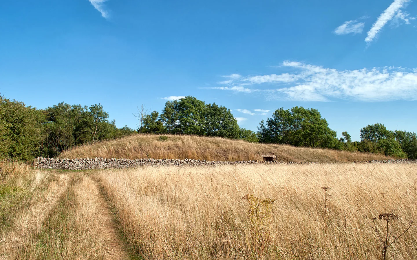
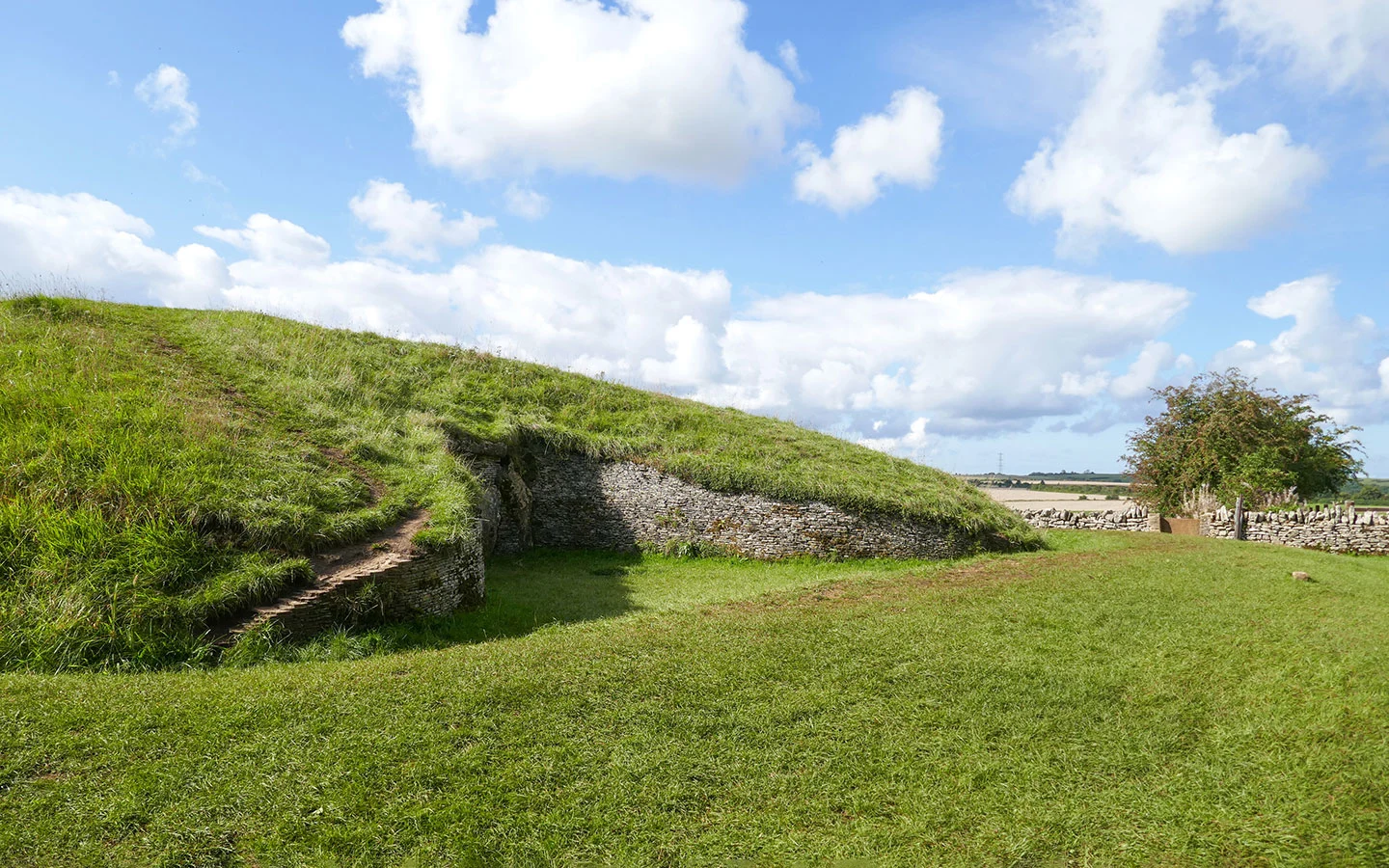
The path runs along the left-hand side of a field, with the mound of Belas Knap soon visible ahead. When you get there, climb over the stone stile and take a look around.
Belas Knap was built around 3000 BC as a burial chamber. It’s around 55 metres long, 20 metres wide and four metres tall, with four chambers inside. The skeletons of 31 people were discovered when it was excavated in the 19th century, and Roman pottery has also been found here.
Belas Knap is unusual in that it has a false entrance at the front, which was built to deter grave robbers, with the real entrance on the side which would’ve been blocked up with earth.

Stage 2: Belas Knap to Winchcombe via The Winchcombe Way
When you’re ready to carry on, go over another stone stile in front of the one you crossed earlier, and follow the path to the left which runs alongside a stone wall. The path goes through a kissing gate then curves to the right, before cutting diagonally downhill across the next field.
When you reach the trees, go though a metal kissing gate. Follow the path through another gate onto the road, then turn right following the ‘Winchcombe Way’ sign. After 500 metres, turn off to the left through an elaborate wooden gate, just before another Winchcombe Way sign.


Follow the gravel driveway past a group of cottages on the right. Then when the drive curves right, take the path on the left instead, marked with a wooden signpost saying ‘Winchcombe Way/Cotswold Way circular walks’. [There’s a patch here which can be muddy if it’s rained.]
The path runs across the next field (with a stern sign telling walkers to say on the path) towards Wadfield Farm. When you get there, it continues along the right-hand side of the farm.


Follow the path downhill through an area of newly planted trees. Ahead you can see Sudeley Castle in the distance. Go over a stile at the bottom and follow the path along the right of the field. It crosses over a stile and a bridge (marked with a public footpath sign) then curves left.
At the end of the field, cross over a bridge stile on your left (this is a bit hidden by the hedge so can be hard to see from a distance). Follow the path straight on towards the church tower. Cross over another bridge stile and a small road and stay on the path, which curves to the right.


After another bridge and a kissing gate, the path runs diagonally to the right over the next field (head towards the telegraph pole on the right). Then go through another gate onto the road.
Turn left and follow Old Brockhampton Road back to the driveway of Sudeley Castle – on your right you’ll see the mini castle-style building of the Sudeley Castle Gatehouse* (which is available to rent). Go back up Vineyard Street and turn right to return to the start point.
If you fancy a drink, the Plaisterers Arms pub is right by the war memorial. Or it’s a few minutes to the White Hart and The Old Bakery Coffee & Wine Bar, which both have outside seating.


* This site contains affiliate links, where I get a small commission from purchases at no extra cost to you.
Save for later


You might also like


Jon M Bird
Tuesday 26th of May 2026
Hi, Love your site. Some time would you be able to do a feature on bike trails in the Cotswolds (for recreational bikes / ebikes), or maybe you have already. Thanks Jon
Lucy Dodsworth
Monday 1st of June 2026
Thanks Jon, and that's a great idea! I'll look at putting something together over the summer.