
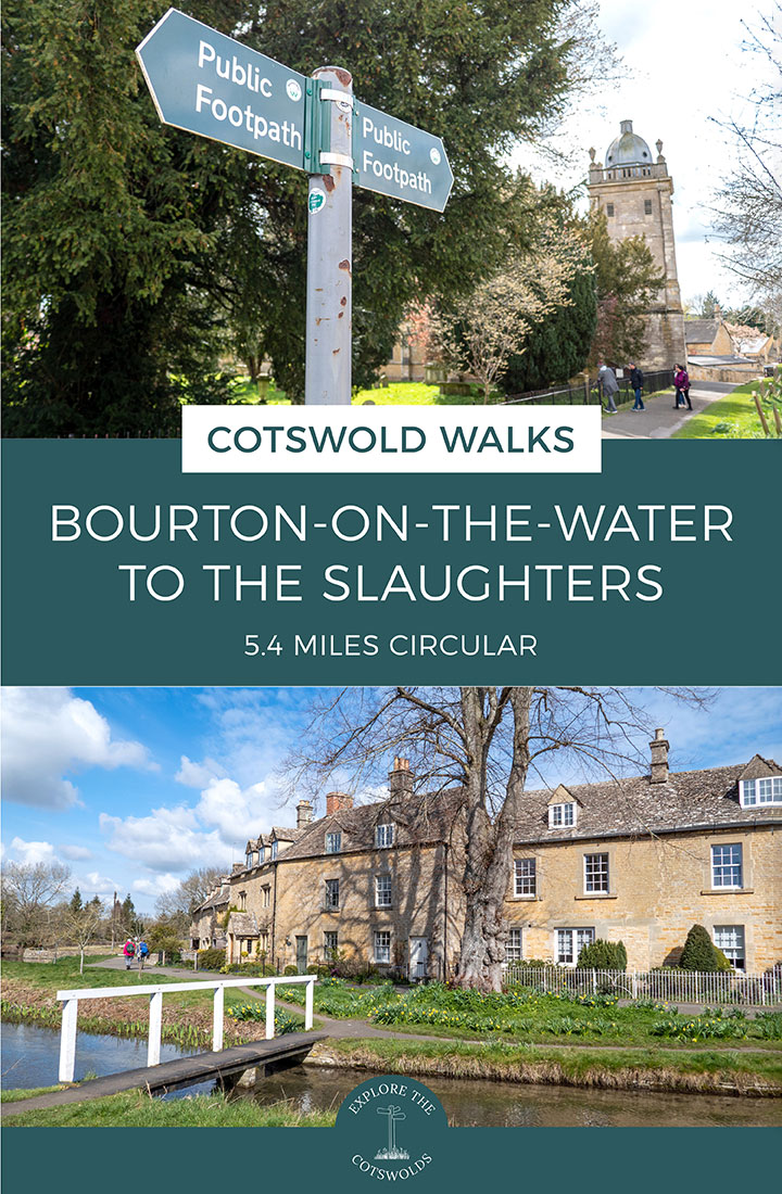
Discover some of the prettiest villages in the Cotswolds on this 5.4-mile/8.6km Bourton-on-the-Water to the Slaughters walk, a circular route which takes you along the banks of the Rivers Windrush and Eye, past historic churches, stone cottages, mills and manor houses.
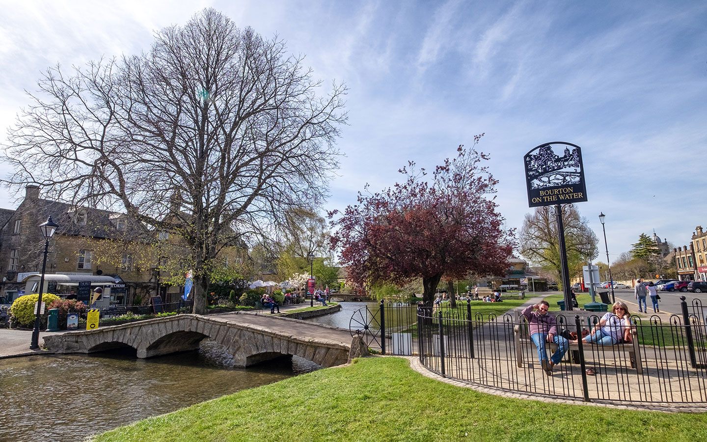
The route starts in the village of Bourton-on-the-Water, nicknamed the ‘Venice of the Cotswolds’ for its lovely setting alongside the River Windrush. It’s one of the Cotswolds’ most popular spots, and home to attractions like the Model Village, Cotswold Motoring Museum and Birdland.

Leaving the busy streets of Bourton behind, this Cotswold walk heads west along the River Windrush before cutting across peaceful countryside to Upper Slaughter. From there you follow the River Eye to neighbouring Lower Slaughter and then walk on across fields back towards Bourton.
The Bourton-on-the-Water to the Slaughters walk takes around two–three hours to complete. It includes sections of the Wardens’ Way and Windrush Way long-distance walks, following pathways and quiet county roads, with a couple of good places to eat and drink along the way.

Bourton-on-the-Water to the Slaughters walk details and map
- Distance: 5.4 miles/8.6km.
- Time: 2.5 hours.
- Elevation: 384 feet elevation gain.
- Difficulty: Easy.
- Paths: Mainly dirt and grass paths, some quiet country roads and a short section along a busier road where you need to walk along the verge.
- Accessibility: One stile and a short uphill climb.
- Map: OL45 The Cotswolds*
- Toilets: There are public toilets in Bourton-on-the-Water at the Church Rooms (on the corner of the High Street and Rectory Lane, GL54 2AX) and on Rissington Road (GL54 2DR), both of which charge 40p. There are no public toilets along the route.
- Facilities: There are a few places to stop for a drink or lunch along the way – the Lords of the Manor Hotel in Upper Slaughter or the Slaughters Country Inn and Slaughters Manor House in Lower Slaughter – as well as plenty of shops, cafés and pubs in Bourton.
Disclaimer: While we try to keep information up-to-date and accurate, Explore the Cotswolds cannot accept responsibility for errors or omissions. Walks are undertaken at your own risk, and we are not liable for any personal injury, loss or damage that may occur.
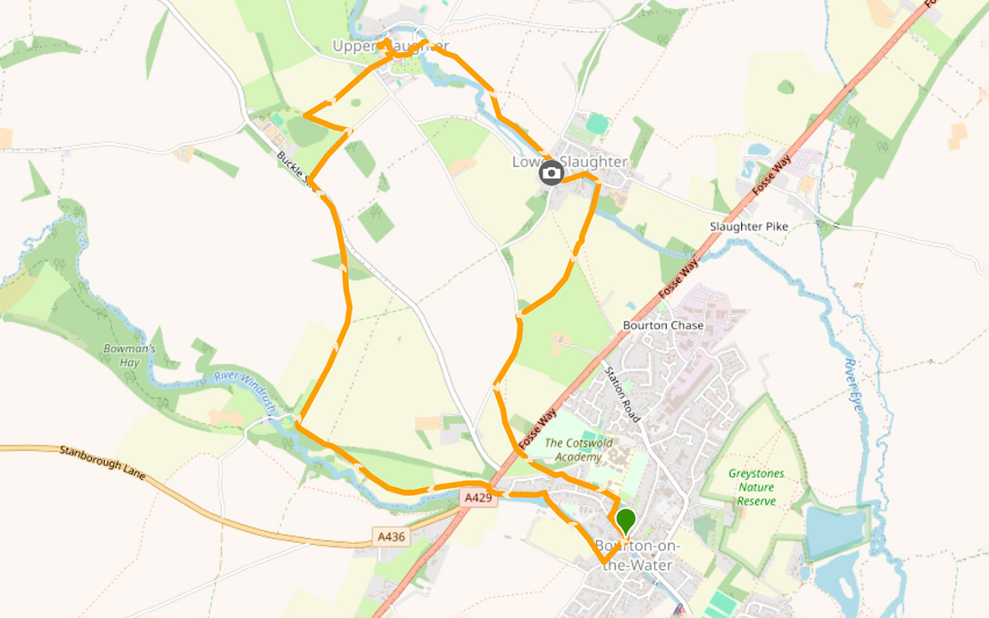

Click on the map above to be taken to Wikiloc, a free app where you can download a map and GPS directions for the Bourton-on-the-Water to the Slaughters walk.
Start/finish point
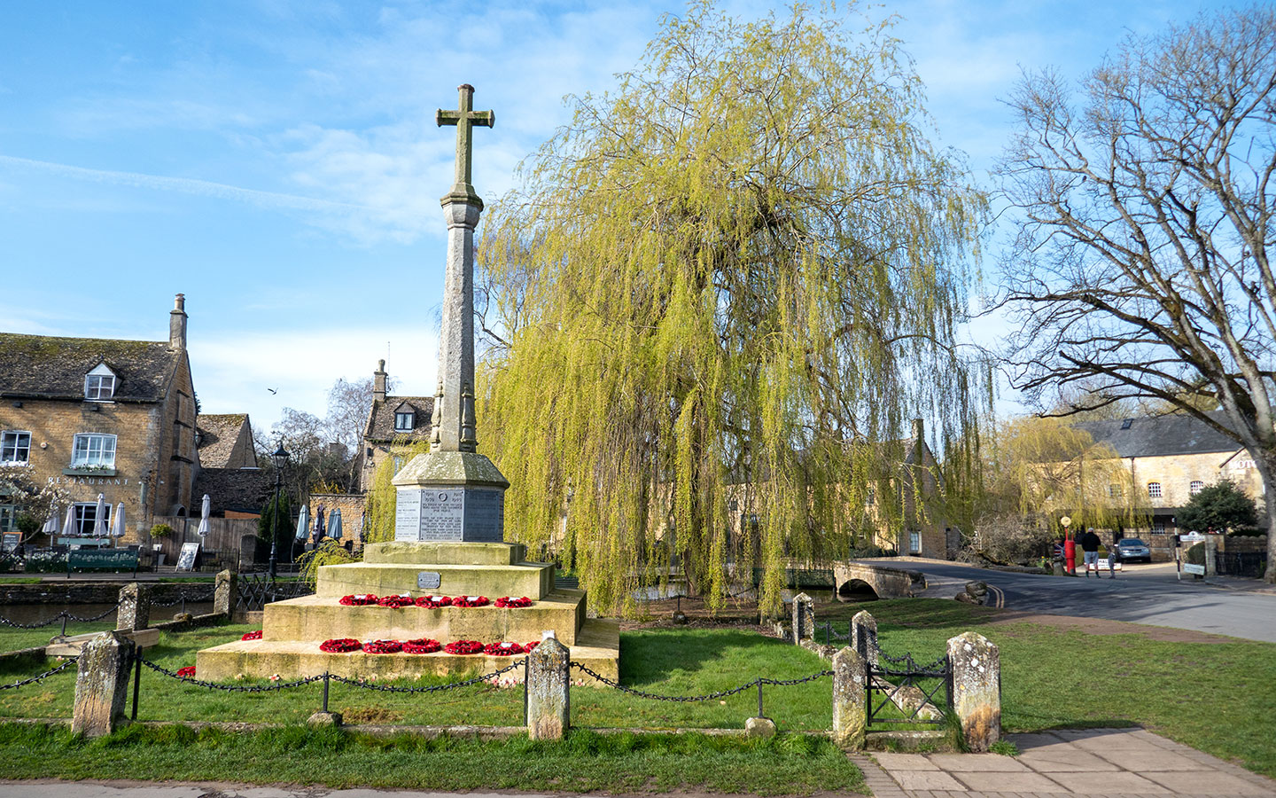
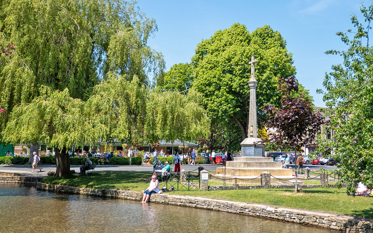
The starting point is Bourton-on-the-Water’s war memorial, on the corner of the High Street and Sherbourne Street near the motor museum. If you’re travelling by car, there’s paid parking at Bourton Vale Car Park (GL54 2LU), a couple of minutes away – £5 for three hours. Beware that Bourton gets hugely busy in summer though so it’s a good idea to get there early.
If you’re travelling by public transport, the nearest train station is in Moreton-in-Marsh. From there the Pulhams 801 bus (daily) runs to Bourton around once an hour, taking 30 minutes. The nearest bus stop to the start of the walk is Bourton Newsagent. The Pulhams 801 also connects Bourton to Cheltenham and Stow-on-the-Wold.

Bourton-on-the-Water to the Slaughters walk route
Stage 1: Bourton-on-the-Water to Upper Slaughter
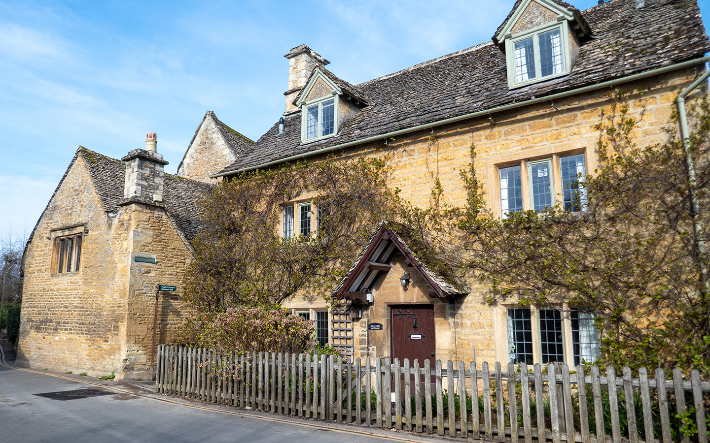
Start your walk at the Bourton-on-the-Water war memorial and follow Sherbourne Street to the south, crossing over the river and passing the Bakery on the Water (which is a good spot to stop and pick up supplies if you’re planning a picnic) and the Duke of Wellington pub.
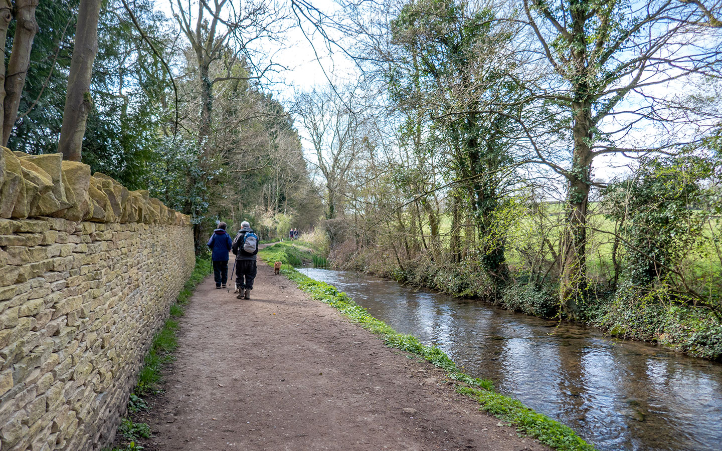
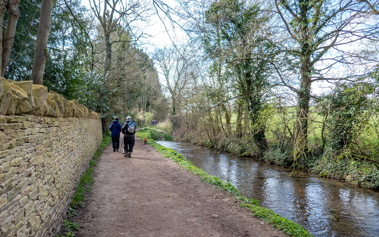
Just after you pass Hill View Cottage, follow the signs for the Windrush Way on your right, which leads down a narrow passageway before running along the banks of the River Windrush. You then cross over the river on a little stone bridge in front of a beautiful old mill house.

When the path meets Lansdown Road, follow the Windrush Way sign to your left. At the end of the road, cross over the A429 – this is a really busy road so be careful. This was originally part of the Fosse Way, the Roman Road which connected Exeter with Lincoln.
Once you’ve crossed the road, follow the path straight ahead (signposted Windrush Way) with the river on one side and fields on the other. After around 900 metres, the path splits in two – take the right path marked Gloucestershire Way (you’ll see a shed painted with safari animals to your left).

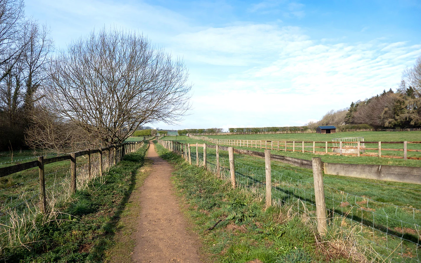
Follow the path as it runs through the trees then across fields – ignore the footpath which goes off to the right and carry on along the main path until it meets the road. Turn left and follow the road for 300 metres (there’s no pavement so you’ll need to walk on the verge but it’s not too busy).
When you approach a stone farmhouse, turn off to the right onto the small road which is signposted Upper Slaughter/Lower Slaughter. Follow this road for 400 metres – you’ll see Upper Slaughter village in front of you, but instead take the unpaved track off to the left.
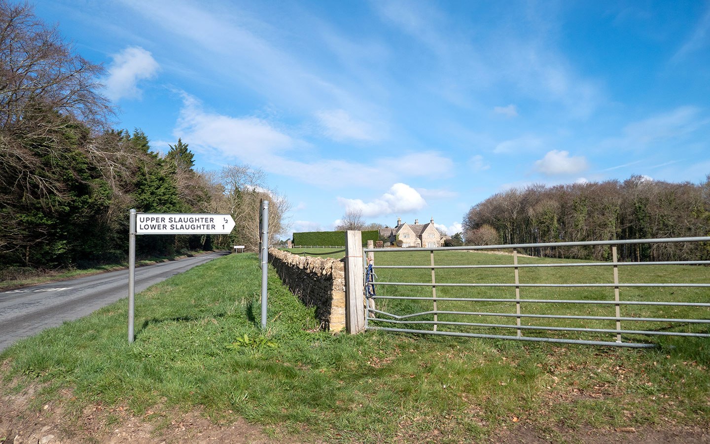

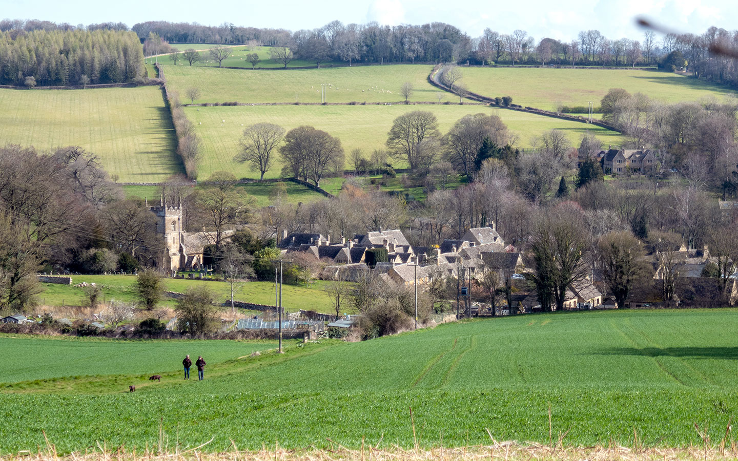
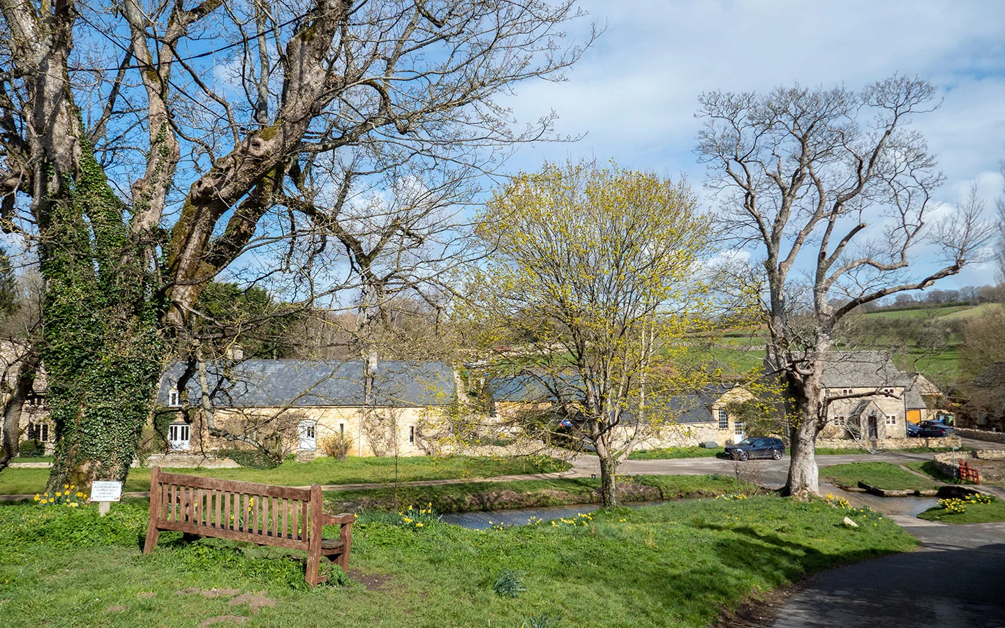
After going through the wooden gate at the end of the path, go through the metal gate immediately to your right which takes you downhill towards Upper Slaughter (the village gets its name from an Old English word for muddy place rather than anything sinister!). When you reach the road, follow it to the right into the village square, which is signposted Upper Slaughter/Lower Swell.
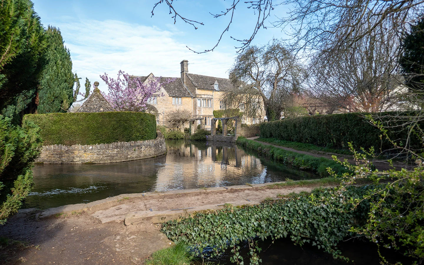
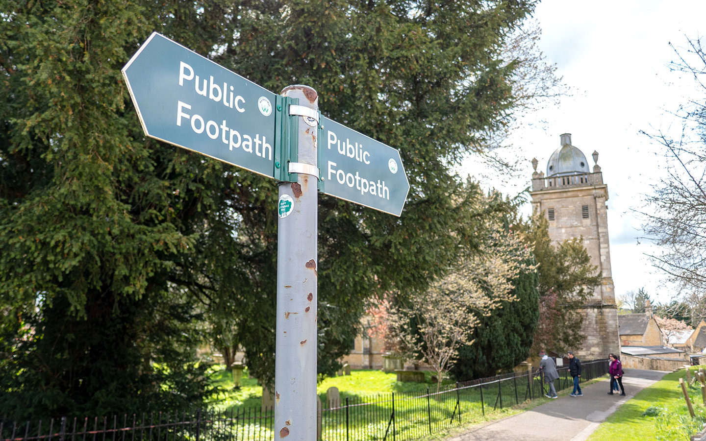
Look out for the Cotswold stone buildings in the square, which were reconstructed by architect Sir Edwin Lutyens in 1906 – this was the last time any new buildings was built in Upper Slaughter. Follow the path on the left into St Peter’s churchyard and you can take a look inside this 12th-century church with its medieval stonework, brass plaques and stained-glass windows.

Then carry on along the side of the church and you’ll come out on a hillside above the ford, where cars can drive through the River Eye. There’s a bench overlooking the river which is a good spot for a picnic. And if it’s a hot day you can dip your feet in the river to cool them off.
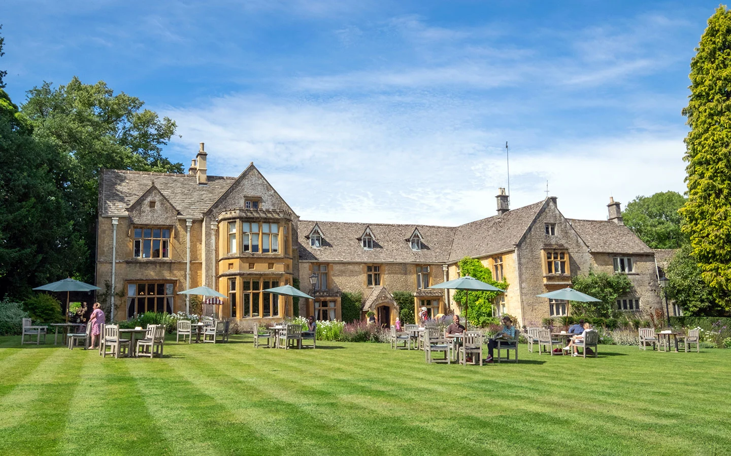
Retrace your steps back to the square, where you’ll also find the Lords of the Manor Hotel. This 17th-century building is now a luxurious hotel and restaurant, with a fine-dining restaurant and less formal dining room. You can also get drinks and bar snacks on their garden terrace.

Stage 2: Upper Slaughter to Lower Slaughter
Carry on along the road past the Lords of the Manor and you’ll see a footpath to your right signposted the Wardens’ Way. Follow this path which runs along the edge of the hotel grounds, across a bridge and over fields towards Lower Slaughter. The mile-long walk between the Slaughters is very popular so you’ll see a lot more people walking here than along the rest of the route.
If you look to your right you get a good view of Upper Slaughter’s Elizabethan Manor House (which is a private residence) and into the gardens of the Lords of the Manor Hotel.

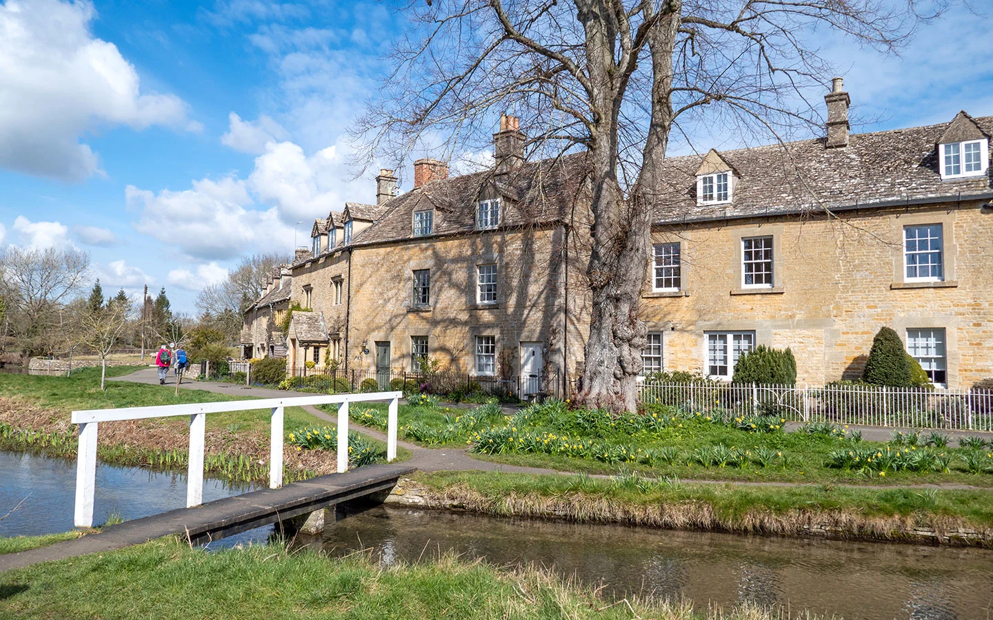
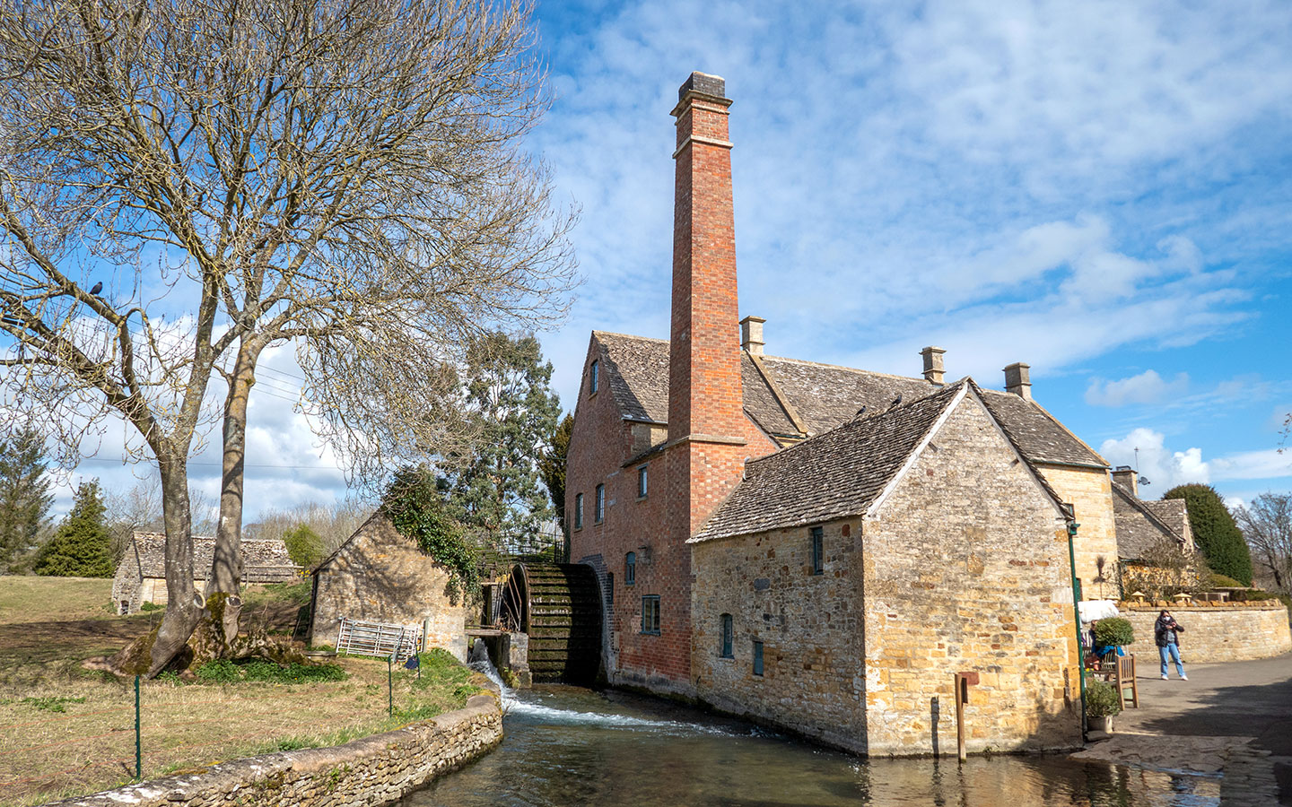
After around 600 metres the path goes through a gate and then runs along the edge of the River Eye. At the end of the path you’ll arrive in Lower Slaughter. Turn right, following the signpost for the Wardens’ Way, and you’ll see the 18th-century Old Mill, which was used to grind flour until 1958.
Follow the river through the village, past stone cottages and along Copsehill Road, which was once voted the most romantic street in Britain. You can also visit St Mary’s Church or stop off at the Slaughters Country Inn, a cosy traditional pub with a big riverside beer garden.

Stage 3: Lower Slaughter to Bourton-on-the-Water
Follow the river out of Lower Slaughter, taking the path which curves to the right and is signposted Bourton-on-the-Water. Continue along the same path after the river turns off to the left until you reach a gate. Then take the right-hand path which is signposted the Monarch’s Way (rather than taking the path which goes straight on and is signposted towards Bourton).
The path runs along the edge of a field and up a hill where it meets a small road. Turn to the left and walk along the road for around 200 metres, then follow the sign for the Monarch’s Way, which takes you through one field and over a stile and a little bridge into the next field.
When you reach the A429, cross over it again then stay on the Monarch’s Way, which carries on straight ahead of you. The Monarch’s Way runs across edge of the Cotswold School playing fields and then crosses over an embankment and carries on past secondary and primary schools.
Once you reach Old Library Mews, turn right following a public footpath sign which leads along the side of St Lawrence’s Church to the High Street. Then turn left and walk along the High Street back to the war memorial – or if you fancy a drink, The Willow pub is just opposite.

* This site contains affiliate links, where I get a small commission from purchases at no extra cost to you.
Save for later

You might also like


Ashley
Monday 17th of November 2025
My mother and I used your directions this summer, in August. We are from Canada and I printed off your instructions before getting to England. We thoroughly enjoyed our walk!!! This was one of the greatest highlights of our trip!!! Your instructions were VERY easy to follow. We did not get lost once (although, I'm not a great judge of how far 600 meters is, so we had to trust that we just hadn't gone far enough yet before we reached where we needed to go ... but we were fine with that! We just enjoyed the adventure of it!). We loved this walk a lot! Thank you SO much for sharing your knowledge of this area! We cannot wait to come back and try more of your walks!
Lucy Dodsworth
Tuesday 18th of November 2025
Thanks Ashley, so pleased that you enjoyed the walk and your visit!
Rich
Thursday 4th of September 2025
Great walk and very clear instructions, highly recommend. Would suggest stopping for a drink in lower slaughter rather than the hotel.
Lucy Dodsworth
Monday 8th of September 2025
Thanks Rich, glad you enjoyed it.
Jasmijn
Tuesday 19th of August 2025
What a wonderful walk with very clear instructions! Did the walk today with my dog and was impressed! Would recommend!
Lucy Dodsworth
Wednesday 20th of August 2025
Thanks Jasmijn, great to hear that you enjoyed it!
Dianne
Wednesday 4th of June 2025
Hello If I just walked from Bourton to Lower Slaughter and back is that doable. I am 75 and have a dodgy knee but I walk daily
Lucy Dodsworth
Saturday 14th of June 2025
Hi Dianne, that should be fine – it's a fairly flat route and 1.5 miles each way. You can see a map and directions at https://www.wikiloc.com/hiking-trails/bourton-on-the-water-to-lower-slaughter-walk-in-the-cotswolds-164671928
Sue
Sunday 1st of June 2025
Hi Lucy This sounds like a lovely walk. We will be there next week. Can you please tell me if you need to go through any fields, with cows, as my friend refuses to go through one! We will have our dog with us, so the river will be excellent for him to jump in to cool off.
Kam Cheung
Monday 8th of September 2025
@Lucy Dodsworth, we came across some cows but they were fenced off.
Lucy Dodsworth
Monday 2nd of June 2025
Hi Sue, I've never seen any cows along this route – part of the footpath is fenced off and although there are some stretches across fields it's only ever been crops when I've done it. There's also various other paths and small roads so you could easily divert if you had to.