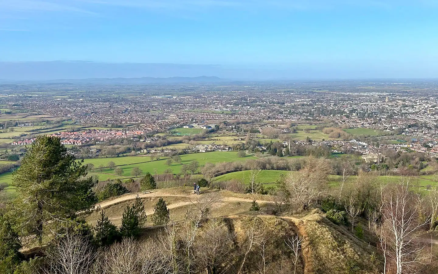
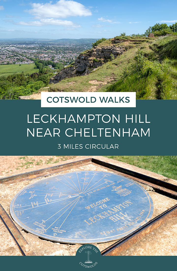
Looking for a great walk which is within easy reach of Cheltenham? This Leckhampton Hill walk is one of our favourite local walks for its panoramic views, which stretch out across Cheltenham, over the Severn Valley and Malvern Hills – and even out as far as Wales on a clear day.
The route takes you to the top of Leckhampton Hill and across Charlton Kings Common, past historic remnants dating from the hill’s days as a limestone quarry. The rare limestone grassland found in this area has made it a Site of Special Scientific Interest, with wildflowers including several species of orchids, butterflies, insects, birds and small mammals making it their home.

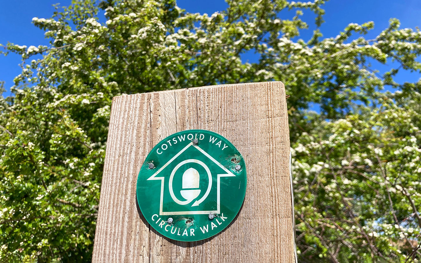
The 3-mile/4.8km circular Leckhampton Hill walk takes around an hour to complete and includes a stretch of the Cotswold Way long-distance walking route. It’s a fairly short walk but moderately difficult with some steep and rocky sections, mainly following stone and dirt paths.

Leckhampton Hill walk details and map
- Distance: 3 miles/4.8km.
- Time: Around 1 hour.
- Elevation: 463 feet elevation gain.
- Difficulty: Moderate.
- Paths: A mix of well-made paths and dirt tracks, with some rougher, rocky stretches.
- Accessibility: No stiles but some fairly steep up- and downhill sections.
- Map: 179 Gloucester, Cheltenham & Stroud*
- Toilets: There are no public toilets along the route.
- Facilities: There’s nowhere to get food or drink on the route so bring your own supplies. The nearest pub is the Wheatsheaf on Old Bath Road, 15 minutes’ walk from the start/finish point. There’s a corner shop opposite the Wheatsheaf and a Coop on Leckhampton Road.
Disclaimer: While we try to keep information up-to-date and accurate, Explore the Cotswolds cannot accept responsibility for errors or omissions. Walks are undertaken at your own risk, and we are not liable for any personal injury, loss or damage that may occur.
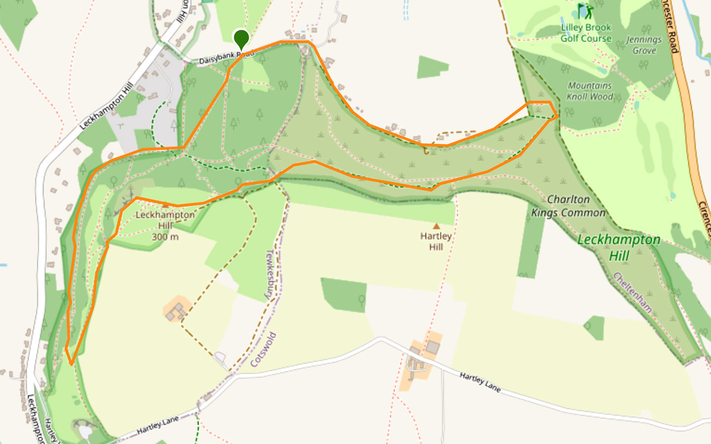
Click on the map above to be taken to Wikiloc, a free app where you can download a map and GPS directions for the Leckhampton Hill walk.
Start/finish point
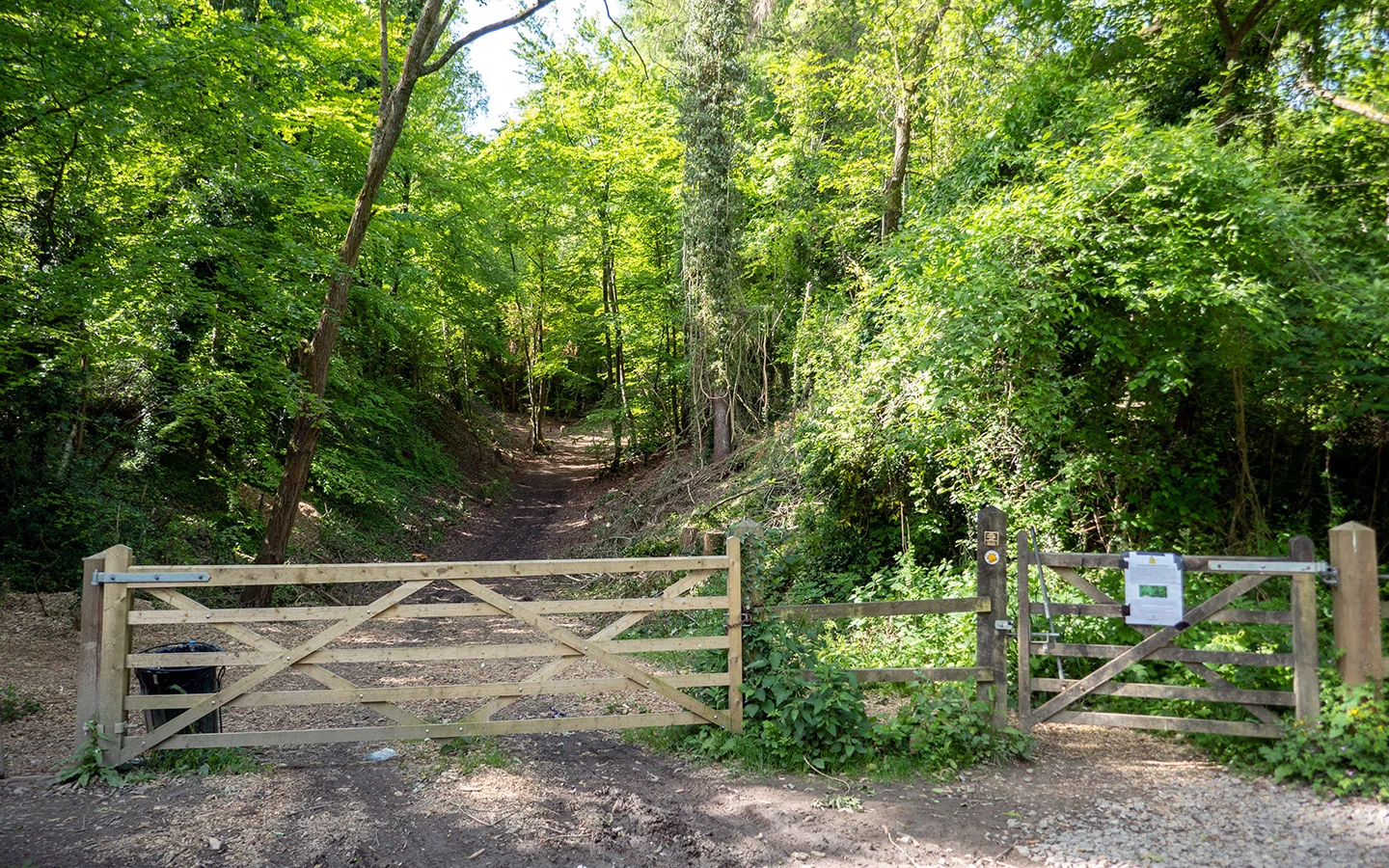
The starting point for the walk is by the two wooden entrance gates to Leckhampton Hill on Daisybank Road, which is just off the main road running up Leckhampton Hill.
If you’re travelling by car, there are two small car parking areas on Daisybank Road (GL53 9QQ) – the second is marked on maps as the Bridge Car Park and is closest to the start of the walk.
If you’re travelling by public transport, you can take the Pulhams L bus (daily) from North Street in the centre of Cheltenham (near Primark) to the Leckhampton Hill Foot stop, where Leckhampton Road meets Old Bath Road. Then Daisybank Road is a five-minute walk up the hill.

Leckhampton Hill walk route
Stage 1: Daisybank Road to Leckhampton Hill viewpoint
Start your walk by going though the wooden gate on Daisybank Road and heading uphill along the straight path ahead of you. This pathway was once the route of a railway line in the 1920s, which ran from the top of the hill, under Daisybank Road and on down to Charlton Kings.
It was built to transport materials from the limestone quarries on Leckhampton Hill. And when you get to the top of the hill you can see the remains of some old lime kilns. Both these kilns and the railway only lasted a couple of years and the rails and machinery were removed years ago, but you can still spot a few remnants of the hill’s old industrial past if you look carefully.

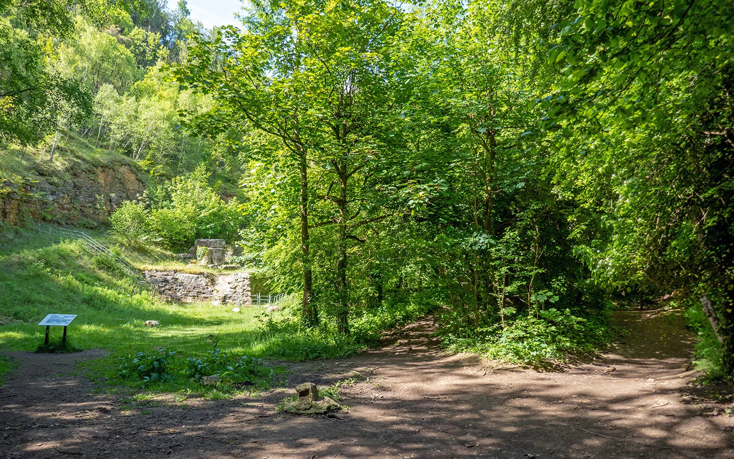
At the top of the hill the path splits into three, with the old lime kilns on your left and two paths to your right. Take the path on the far right which almost immediately splits in two. Stay to the left and follow the flat path through the trees rather than the one heading downhill.
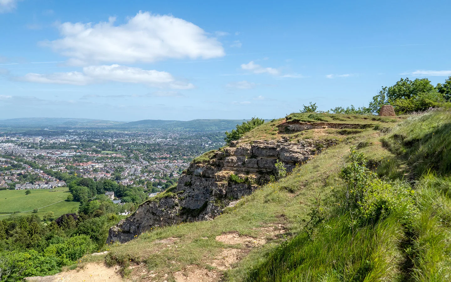
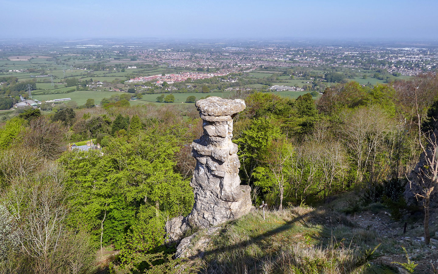
The path runs through woodland next to a stone wall – you’ll see some impressive houses to your right which have hilltop views over Cheltenham and Gloucester. When the path opens out into a clearing without any trees, look up to your left and you will see the Devil’s Chimney.
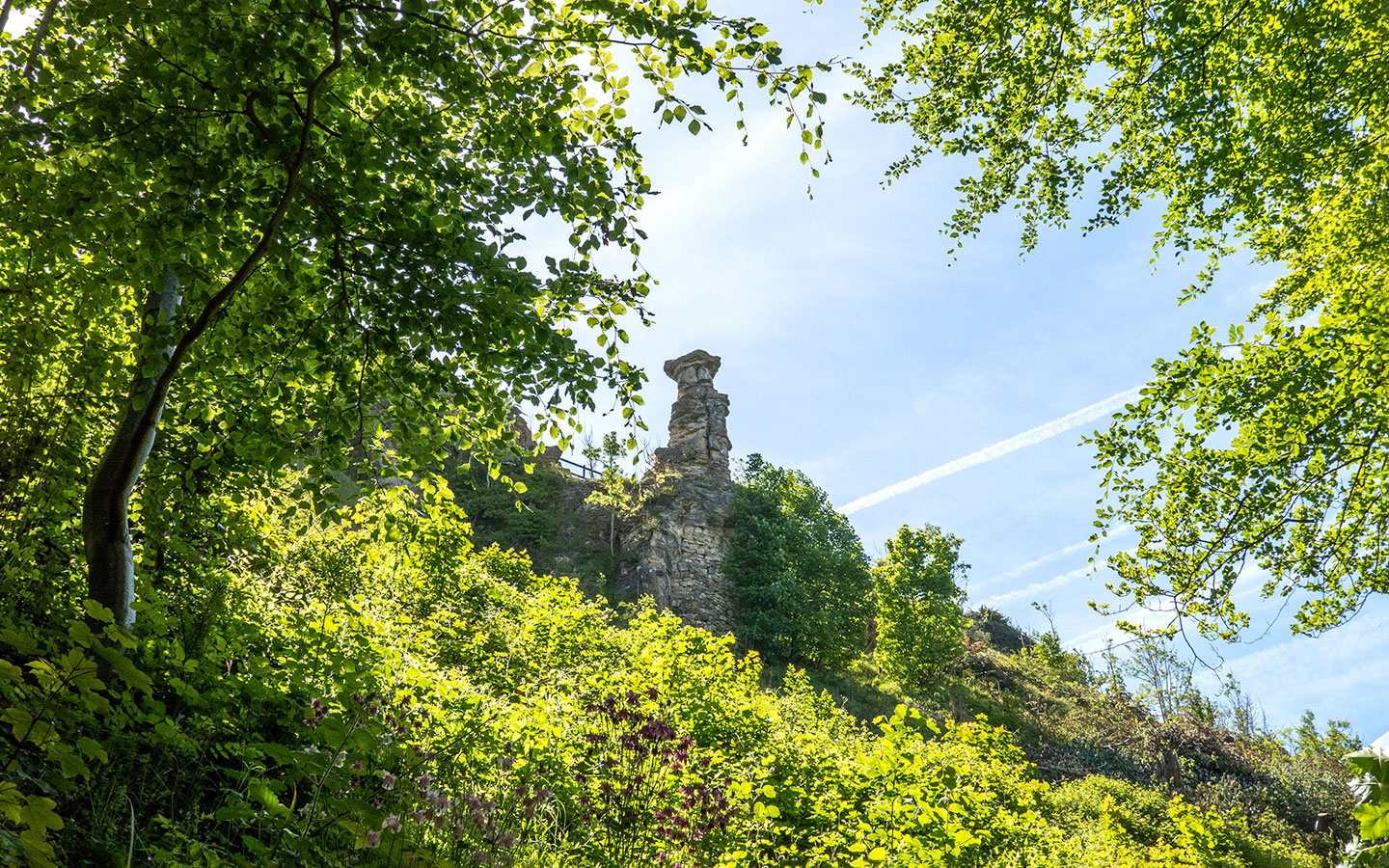

This precarious looking limestone rock stack juts out of the side of the hill. It was created when stone was removed from the hill to create a slope to the top for quarry trucks to transport materials. Or if you prefer, legend has it the Devil would throw stones at pilgrims on their way to prayer from the hill, but the stones came raining back at him and buried him in a crooked pile.
Carry on walking along the path, which briefly narrows as you pass a large rock on the left. The path then splits in two – take the main path on the left which has steps going uphill. Keep climbing, with a steeper stretch at the end, until you reach the top, emerging next to a wooden signpost.

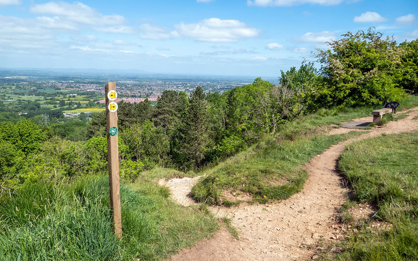
At the signpost – which shows you’ve now joined the route of the Cotswold Way – take a sharp left turn. There’s a bench where you can stop and soak up the views over the west of Cheltenham. Look out for the distinctive circular GCHQ building which is visible in the distance.
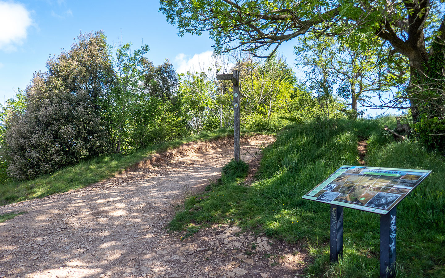
Follow the path until you reach a Cotswold Way signpost and an information board. Then if you want to get a better look at the Devil’s Chimney from above, you can take a short diversion. Follow the path to the left for about 100 metres and there’s an overlook looking down onto it. Then retrace your steps back to the signpost and and carry on along the Cotswold Way route.

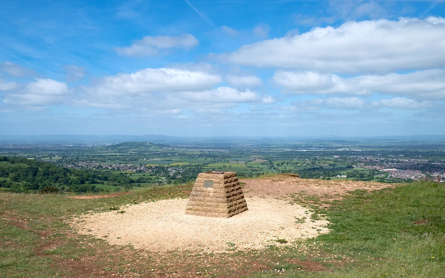
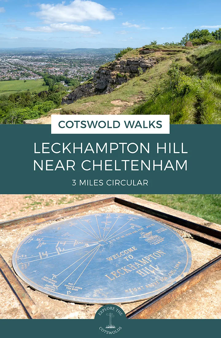
Keep to the left edge of the field rather than walking diagonally across it. You’ll see great views across Cheltenham and down to Leckhampton village and its church. Carry on until you reach the viewpoint on the corner, which is marked with a stone pillar. There’s a topograph on top of it too so you can see what you’re looking out at and a couple of nearby benches you can stop off at.

Stage 2: Leckhampton Hill viewpoint to Daisybank Road
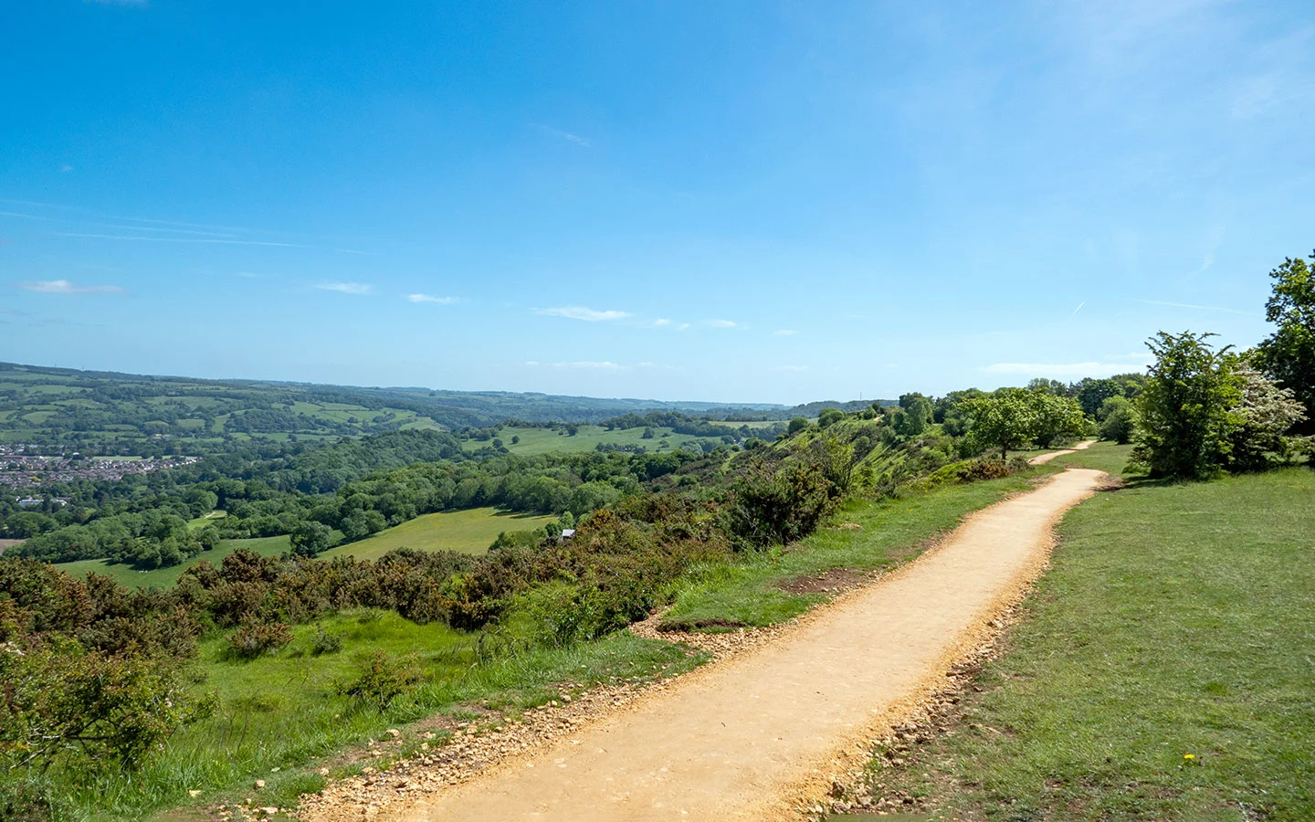
Continue on along the edge of the hill, past a stone trig point marker on your right, and follow the Cotswold Way signs (which are pretty frequent). The path runs down steps cut into the rock and through woodland before reaching a wooden gate onto Charlton Kings Common.
Follow the stone path along the edge of the common with more panoramic views, this time across the east of Cheltenham. Look out for the paragliders who sometimes launch from here – and the fairly docile British White and English Longhorn cows who graze on the common.

Towards the end of the common, the path splits in two and the Cotswold Way goes off to the right. Take the path to the left instead which is marked with a public footpath sign and heads downhill. It’s quite stony and steep in places so it’s a good idea to take it slowly.
At the bottom of hill, just after you’ve passed the Charlton Kings Common information board, the path splits into three – one going right, one left and one straight ahead. Take the (unsignposted) path off to the left which heads into the trees and along the edge of a fenced field.

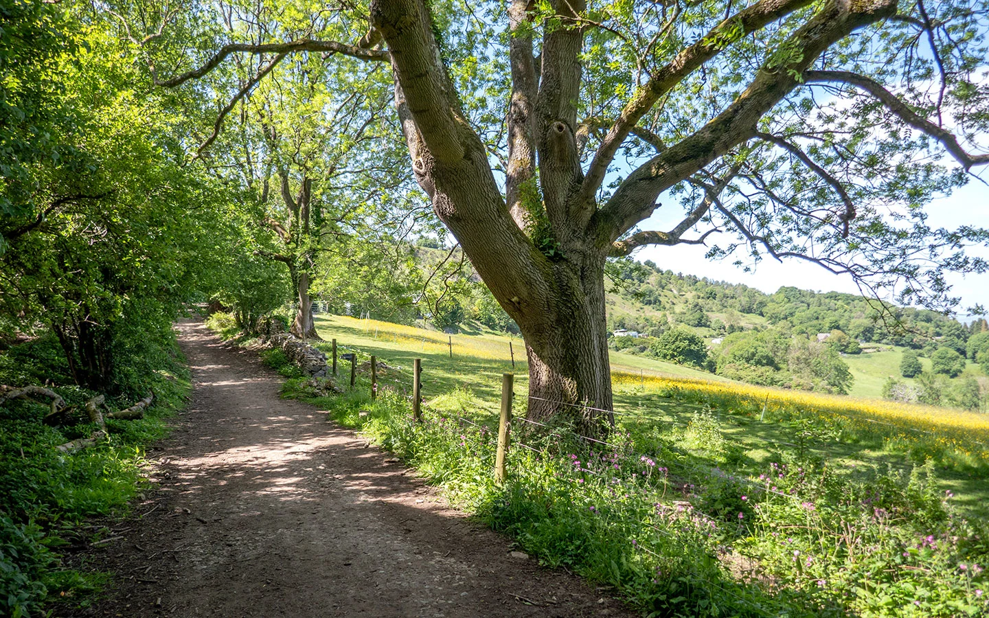
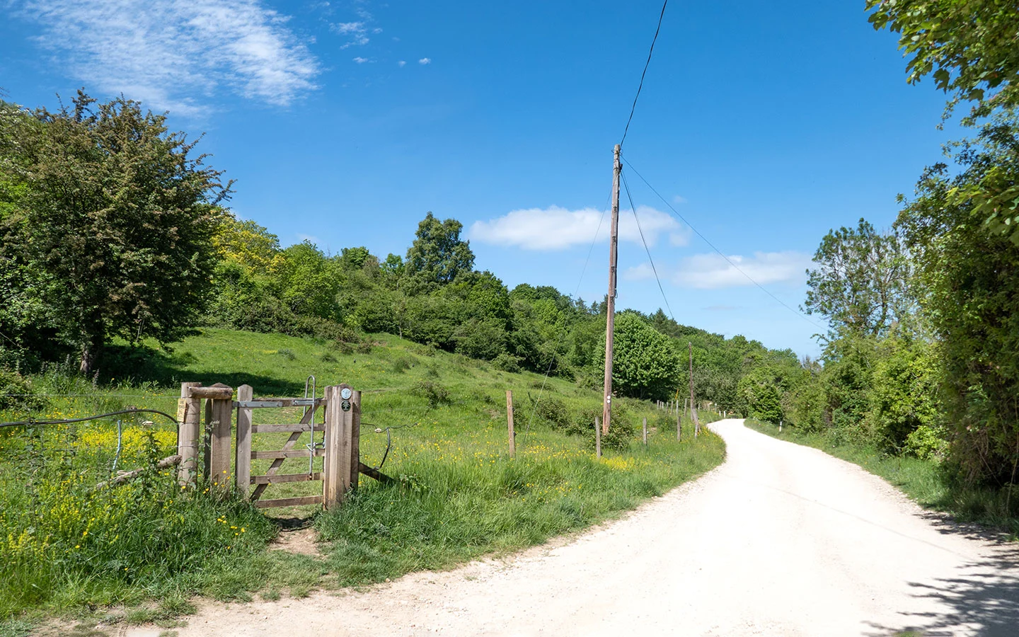
Continue on through a wooden gate, which is marked with public footpath and public bridleway signs, and stay on the same path. It turns into a more well-made stone path before widening out into an unmade road, which later joins on to the end of Daisybank Road.
You’ll see some more fancy houses as you walk along the road, including a couple of modern, glass-fronted properties (one of which was recently on the market for £1.7 million!). And not long after passing them you’ll find yourself back at the starting point of this Leckhampton Hill walk.

* This site contains affiliate links, where I get a small commission from purchases at no extra cost to you.
Save for later
You might also like