
With its scenic views, picturesque towns and villages and historic sites, the Cotswold Way is one of the UK’s most beautiful long-distance walks, running for 102 miles between Chipping Campden and Bath. It’s a route we know well, and we’re sharing our tips in this Cotswold Way guide.
Whether you’re walking straight through or as day walks, up for a challenge or taking it easy, here’s everything you need to know about walking the Cotswold Way – from how long it takes and which is the best direction to walk it in, to transport, accommodation, food and what to pack.
What is the Cotswold Way?
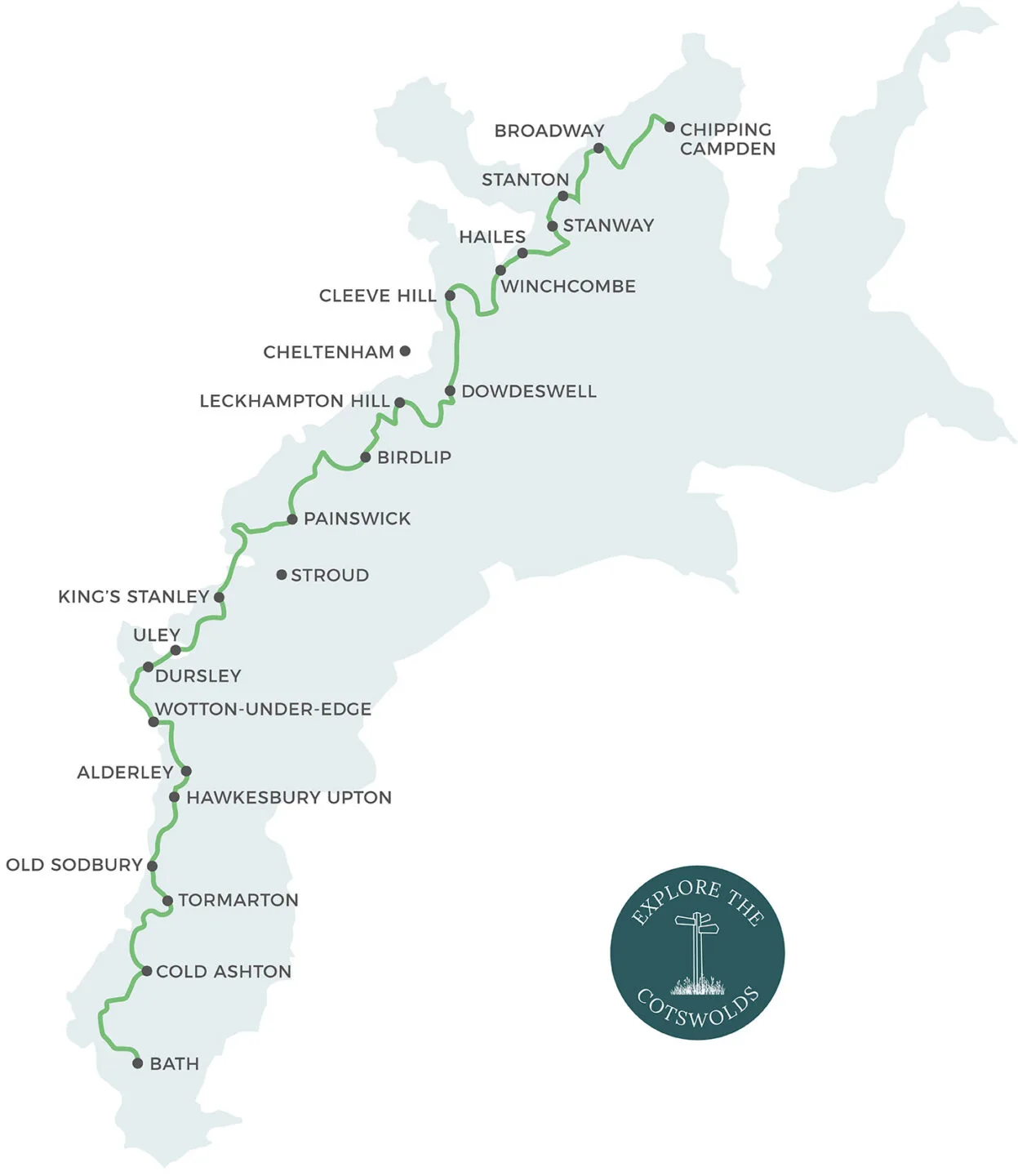
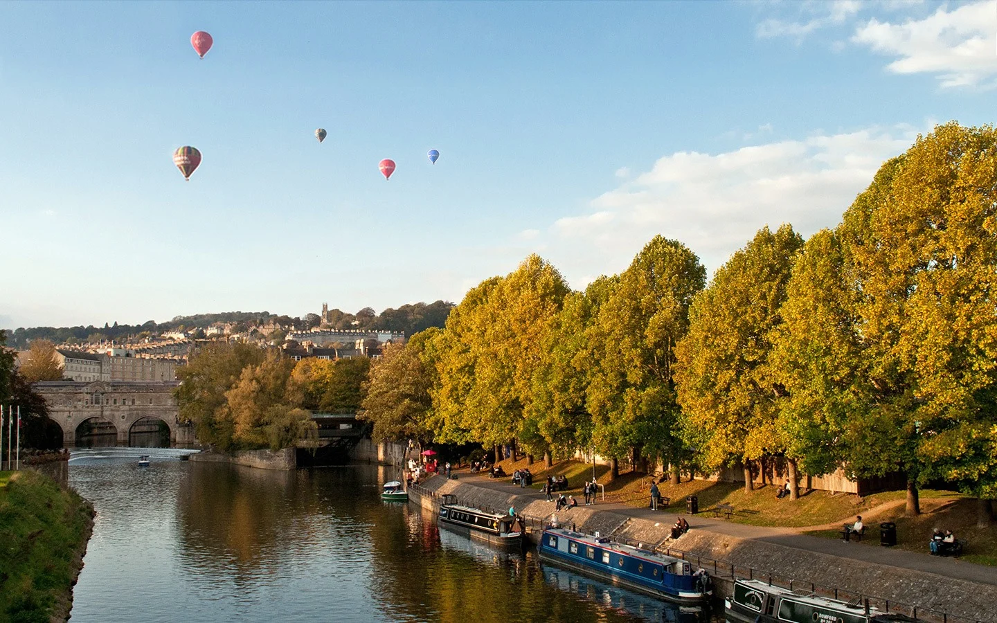
The Cotswold Way is a 102-mile (164km) long-distance walking route through the Cotswolds Area of Outstanding Natural Beauty, connecting Chipping Campden in the north and Bath in the south.
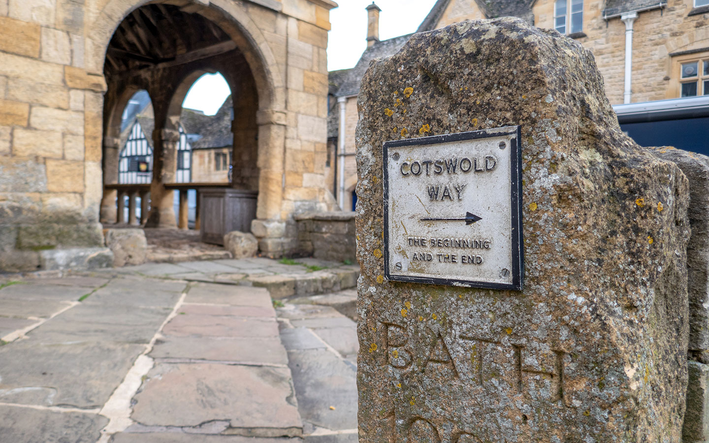
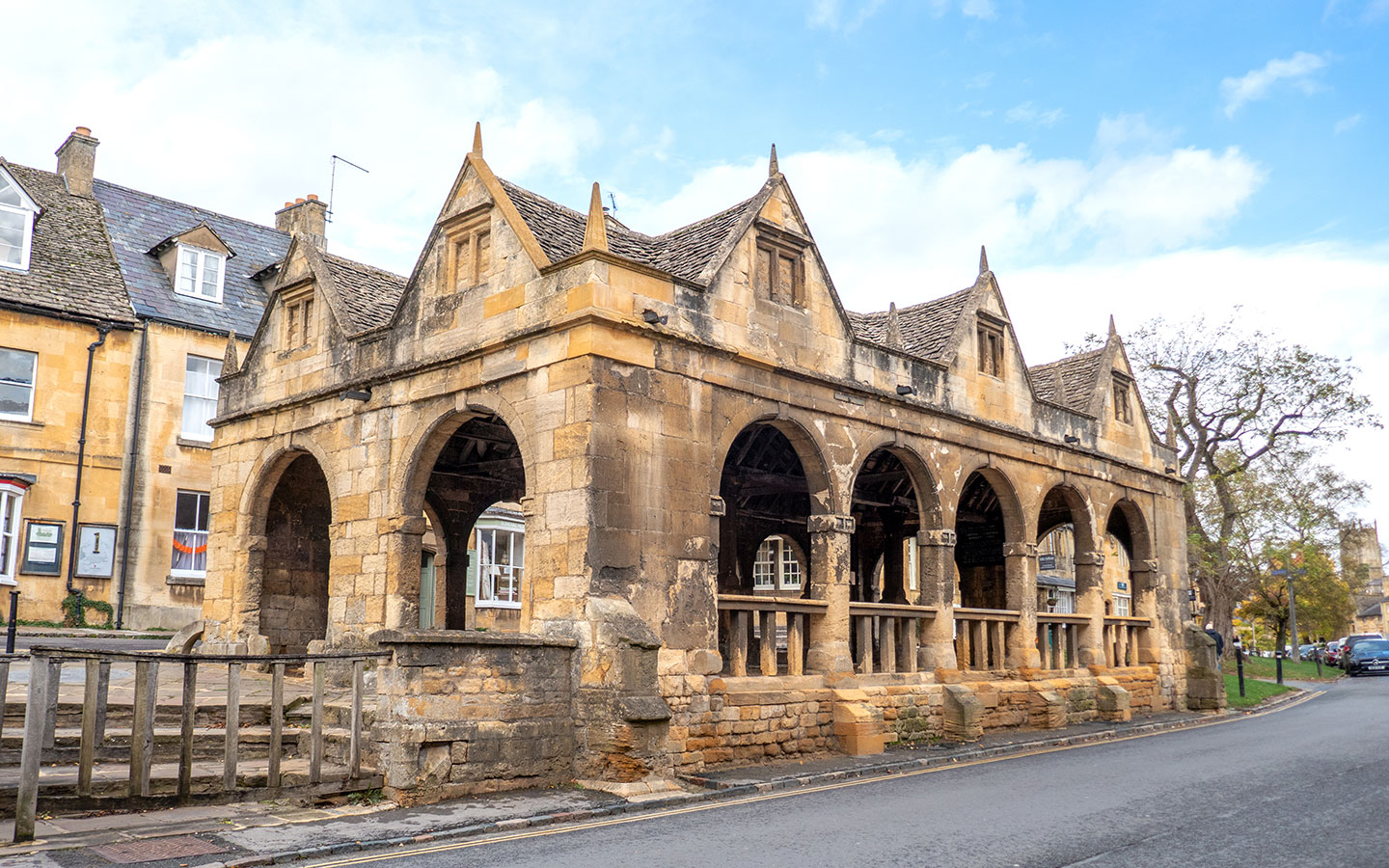
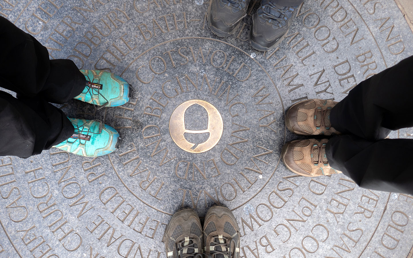
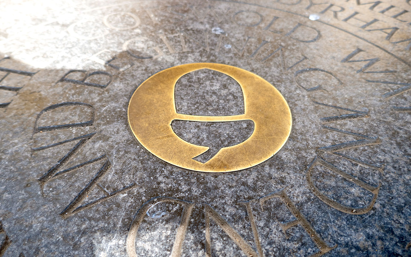
Each end of the route has a circular carved stone marker on the ground, which is next to Chipping Campden Market Hall at one end and outside Bath Abbey at the other. And between them you follow the western edge of the Cotswold Hills on a path through woodland and meadows, to hilltop viewpoints, past honey-stone towns and villages, stately homes, churches and battle sites.
The Cotswold Way is one of 16 National Trails across England and Wales which cover over 2500 miles (4000km). Although it was first suggested over 50 years ago, the Cotswold Way was only inaugurated as a National Trail in 2007, but it quickly became one of the most popular.
Where does the Cotswold Way start and finish?
The map below shows the route of the Cotswold Way marked in green, with the main towns and villages along the route (and a couple of larger ones just off it) highlighted.

How long does it take to walk the Cotswold Way?
The biggest decision you need to make when planning your Cotswold Way walk is how many days you want to spread it over – the right timing will depend on your fitness, how much exploring you want to do along the way, and how much time you have available to complete the route.
The route isn’t particularly tough, but it does have a lot of hills. And beware that the distances for each section are the minimum, and you’ll probably end up walking more (we ended up doing 107 miles in total) and may need to add on diversions to reach your accommodation.
A very fit, experienced hiker who wants to push themselves could complete the Cotswold Way walk in 5–6 days. Though that would mean early starts and long days, with around 18–20 miles of walking each day, going straight through without making any stops along the way.

Most people walking the Cotswold Way straight through do it in 7–8 days. This gives you around 13–14 miles to walk each day, which is still a challenge for someone with average fitness but means that you don’t have such long walking days and gives you a bit more time to play with.
Or if you want to explore some of the destinations along the route, spreading the Cotswold Way over 9–10 days means you only have around 10 miles to walk each day so can take it easy and stop off for a pub lunch, visit a National Trust property or add in a rest day to break it up.

Our advice would be not to overcommit yourself to a super-tight schedule and add in a bit more time than you think you need, rather than having to rush through and end up exhausted and not appreciating the route. The Cotswold Way is all about the beautiful landscapes and historic towns and villages, and there’s a lot to see along the way so it’s worth taking it slowly.
Note that availability of accommodation will also affect the number of days you need – you might find that if places are booked up you’ll need to add in an extra day or take one away and rejig your itinerary, so book accommodation well in advance if you’re tied to specific dates.
Which direction should I walk the Cotswold Way in?
The other big decision you need to make when walking the Cotswold Way is which direction to do it in – from north to south or from south to north? Most guidebooks are based around walking the route from north to south, starting in Chipping Campden and finishing in Bath, which seems to be the most common direction. But each direction has its benefits and drawbacks.
Starting in Bath means you’ll finish the walk with some of the prettiest Cotswold scenery and the best-known villages like Winchcombe and Broadway, which can help keep you motivated as you get towards the end. You’ll also avoid having the sun in your eyes for a lot of the route.

But there’s arguably not so much of a sense of achievement in arriving into sleepy Chipping Campden as in walking into the historic centre of Bath. There are a lot more pubs and restaurants to toast your achievement in Bath – or you could soak aching muscles in the Thermae Bath Spa.
Public transport is also less frequent in Chipping Campden, so it’s easier to start there and finish in Bath, which has frequent train and bus services. That way you have more flexibility in your timings and don’t run the risk of having to rush to catch the last bus of the day if you’re delayed.
We chose to walk north to south, partly as Chipping Campden was closest to us and partly so we could celebrate in Bath at the end. But it’s very much a personal choice. Or if you’re really keen, some people walk the Cotswold Way in both directions to compare the experience!


How do I get to the start and finish points?
To avoid having to park your car for a week or more if you’re walking straight through, it’s best to get to the start and finish points of the Cotswold Way by public transport if you can.
Getting to Bath by public transport is easy. Bath Spa train station is 1 hour 20 minutes by train* from London, and there are frequent rail services from around the UK to Bristol Temple Meads, where you can take a connecting train to Bath in just 12 minutes. There are also local buses to Bath from Bristol and National Express coaches from London and other UK destinations.

Getting to Chipping Campden is a bit more fiddly by public transport. The nearest train stations are in Moreton-in-Marsh and Stratford-upon-Avon, both of which are connected to Chipping Campden by the Stagecoach 1/2 bus, which takes 30–40 minutes. Buses run every day, but there are only six–eight services a day in each direction so you’ll need to plan your train times.
The Robin, the Cotswolds’ bookable bus service, also covers Chipping Campden. Its North Cotswolds service allows you to pre-book journeys around the area, including to or from Moreton-in-Marsh train station. Rides can be requested and booked via their website and cost £3.

When is the best time of year to walk the Cotswold Way?
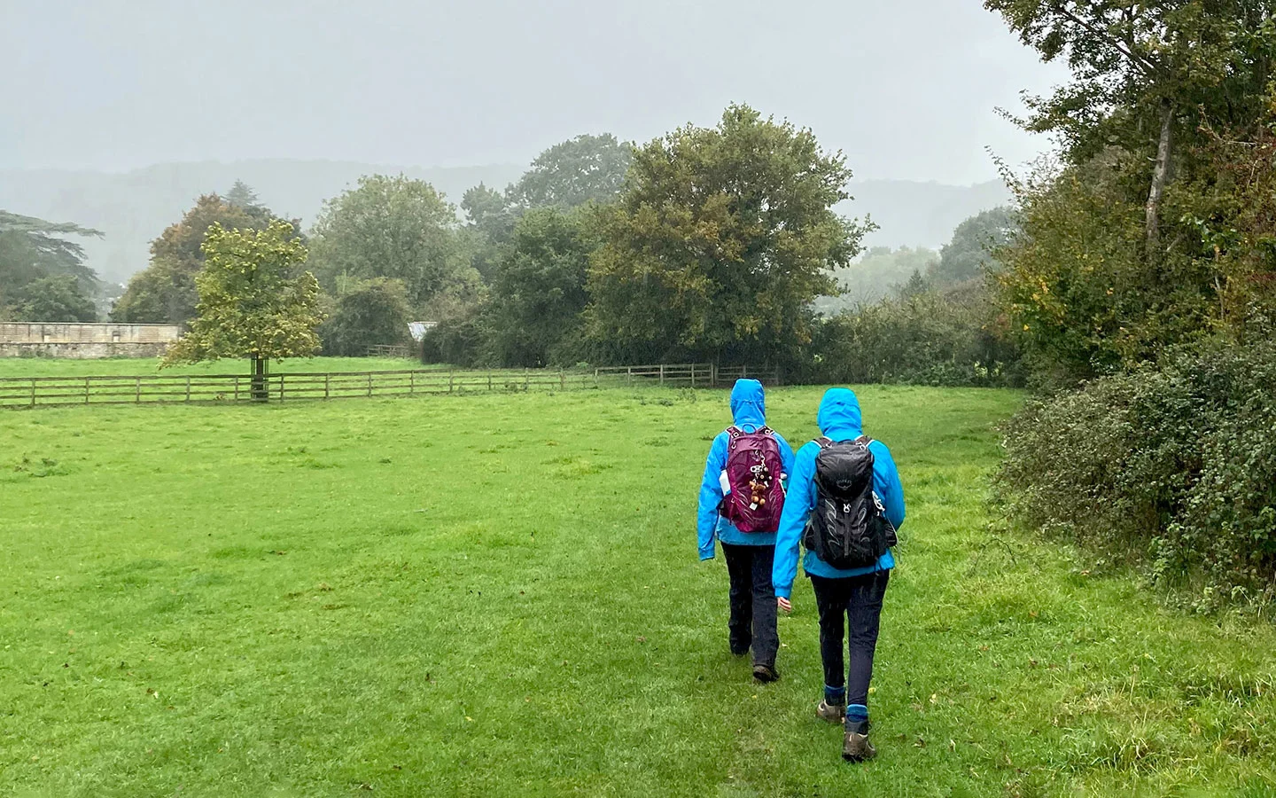
You can walk the Cotswold Way at any time of year, but this being England, make sure that whichever time you choose, you’re prepared for every possible type of weather!
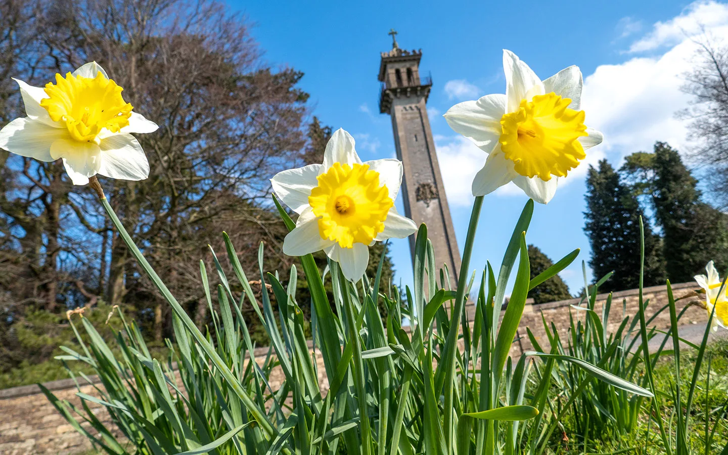
Spring is a great time to see the Cotswolds in full bloom, with bluebells and wild garlic in the woods. Average high temperatures range from 11–15ºC (52–59ºF) in the Cotswolds in spring, but there are often rain showers and the paths can get muddy, which slows down progress.


Summer is peak season in the Cotswolds, so book accommodation well in advance and expect big crowds in popular towns and villages. The long summer days mean you can cover more ground, but average highs of 18–20ºC (64–68ºC) and not a lot of shade on some sections mean it can get uncomfortable walking in the middle of the day during July and August.
Autumn sees similar temperatures to spring, but tends to be wetter. It’s a beautiful time to walk though with all the autumn colours. And winter is a bit more of a challenge, with short days, temperatures under 7ºC (45ºF), cold winds and plenty of rain – or maybe even some snow. The pros are that you’ll probably have the trail to yourself and accommodation will be cheaper.


How difficult is the Cotswold Way? Do I need to do much training?
The Cotswold Way is considered one of the easiest of the National Trails and makes a good first long-distance walk. Though that doesn’t mean it’s not still a challenge. Although the hills on the route aren’t hugely steep, there are a lot of them, and walking continuously one day after the next gets a lot more tiring than just doing a single one-off long walk if you’re not used to it.
Anyone with average fitness should be able to walk the Cotswold Way, particularly if you’re doing it over 9–10 days. But if you’re not an experienced hiker, it’s a good idea to do some training in advance, walking regularly and doing a few walks of similar distances to what you’ll be doing.
It’s also helpful to do some simple stretching exercises before and after each day’s walk and whenever you stop to avoid stiffness. And a lot of walkers swear by an evening bath to relax the muscles, so look out for accommodation which comes with a bath rather than a shower.

Do I have to do it all in one go?
Although there’s a great sense of achievement in completing a long-distance walk like the Cotswold Way in one go, you can also break it down into smaller chunks. You could walk it as day walks if you live close enough, or choose a short section of the route to walk over a few days.
You could also do one of the Cotswold Way circular walks, which include some of the most scenic sections of the route and range from 2.5 to 6 miles. Or the Cotswold Way Voluntary Wardens run guided day walks of various lengths on different parts of the route, which are free of charge.

If you’re walking the Cotswold Way in sections as day walks, one important consideration is how you’re going to get to and from the route. Leaving one car at the start point and another at the end point is the easiest option if there are two or more of you walking together.
Otherwise you’ll need to use public transport (which is patchy in some areas so does involve some planning – you can find transport details in our town and village guides), book a ride on The Robin or take a taxi. Taxi availability is limited so book ahead if possible to guarantee a ride.

What are the paths like?
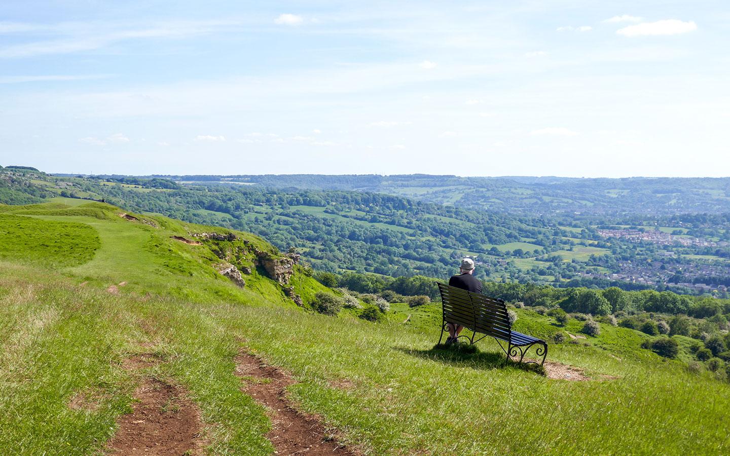
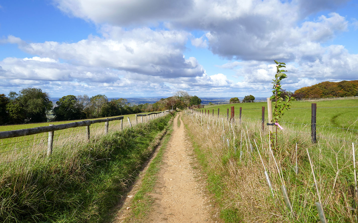
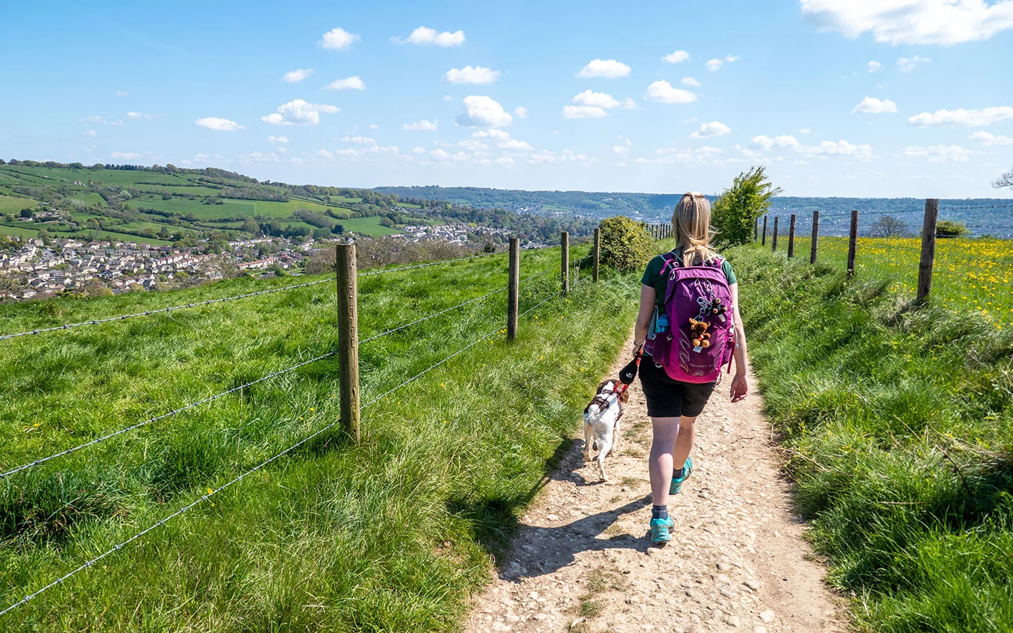
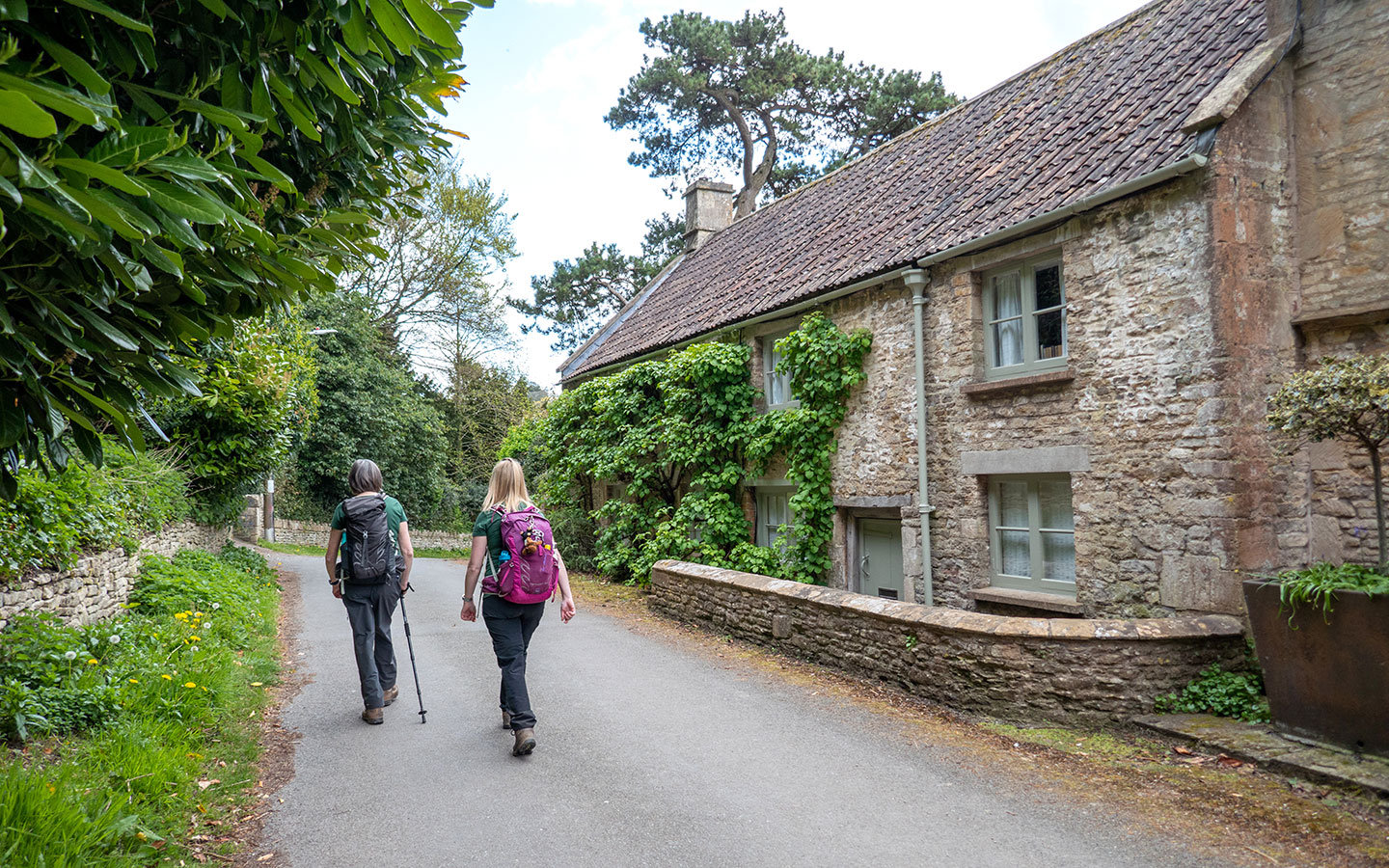
The Cotswold Way route includes a mix of different terrains, with mainly dirt and grass paths through woodlands, rolling hills and farmland, and a few stretches along country roads. It mostly steers clear of main roads, but there are a few you need to cross over near to Bath.
There are plenty of hills along the way (with fantastic views from the top) but the climbs aren’t generally too steep, and a few short, stony downhill paths where a stick or walking poles might be useful. Some sections run through farmland where you might see cattle – keep to the edge of the field, walk slowly and give them a wide berth, especially if they have calves.

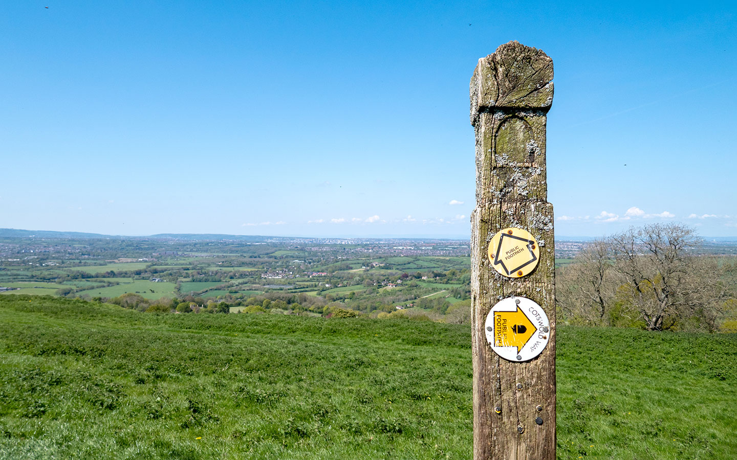
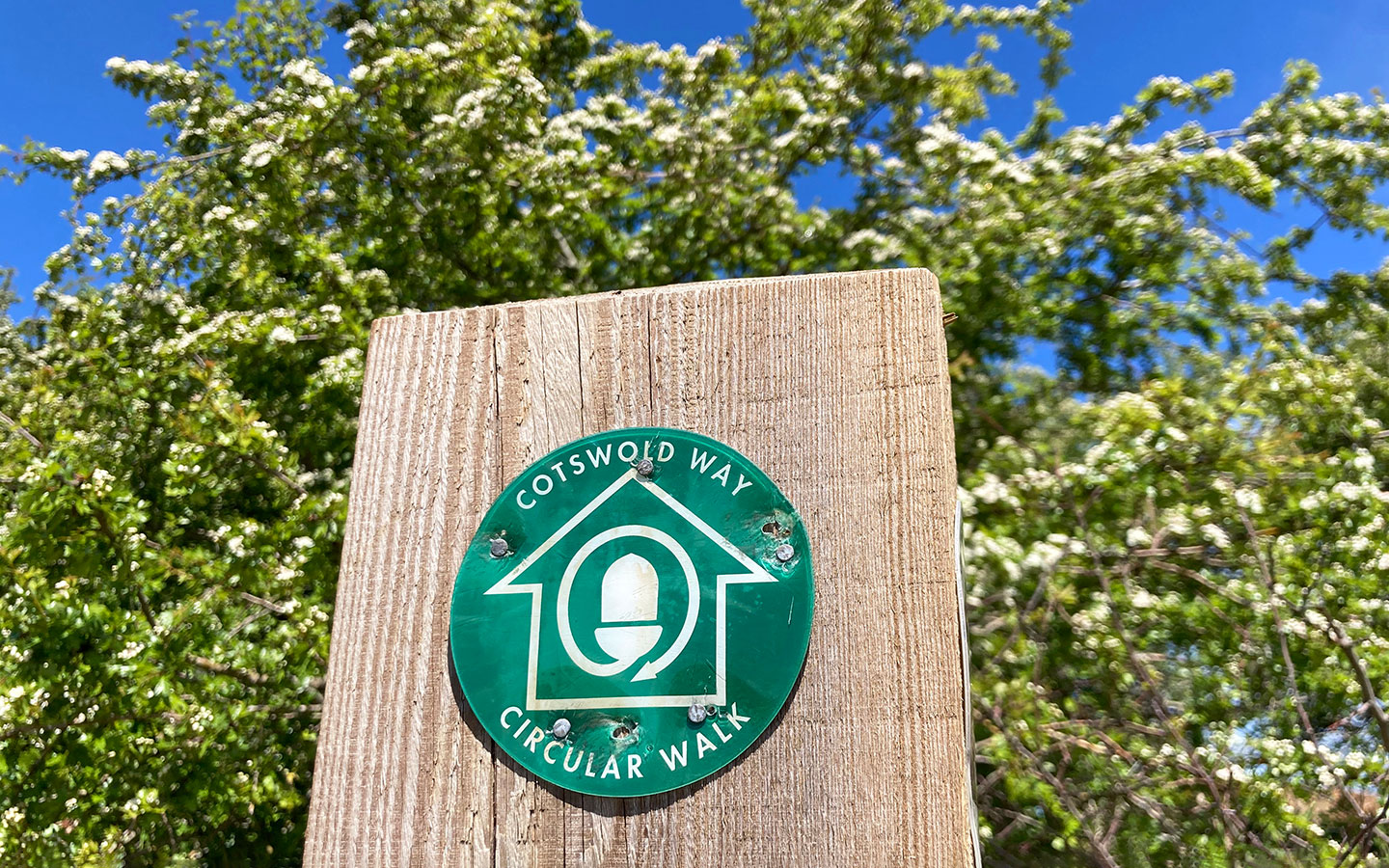
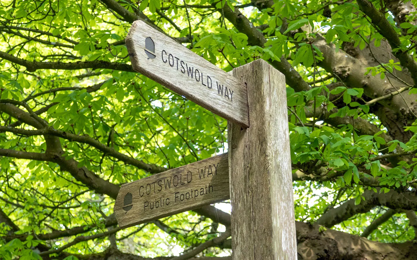
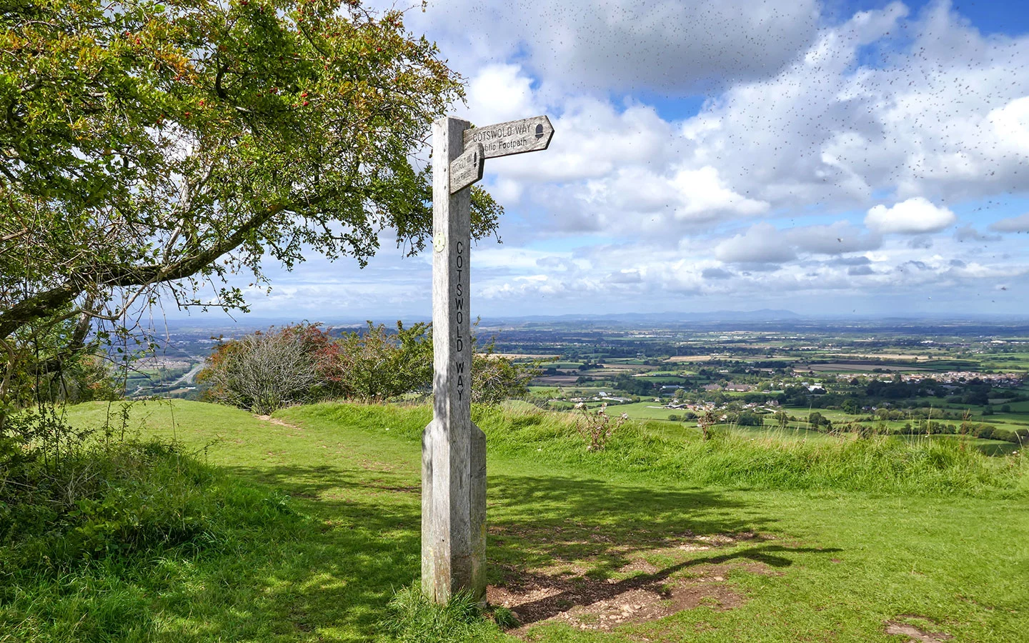
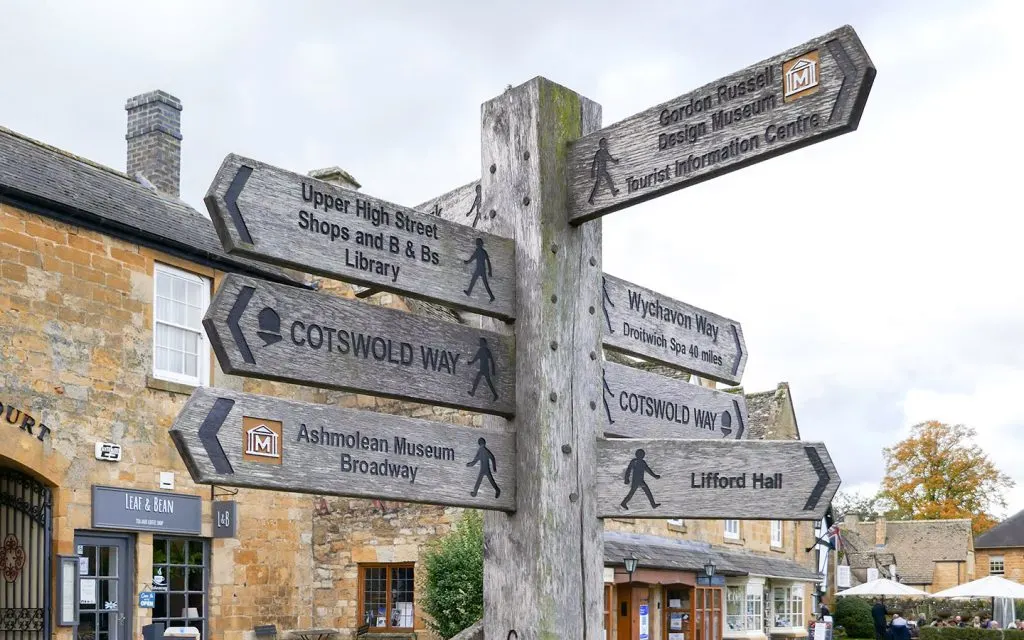
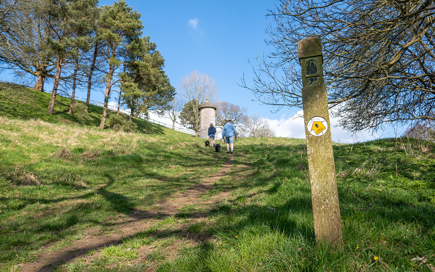
Is the Cotswold Way trail easy to follow?
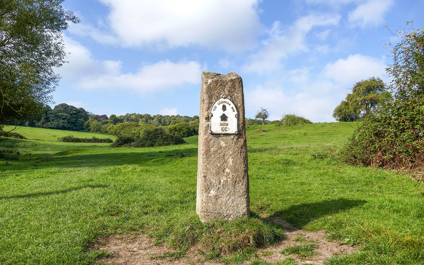
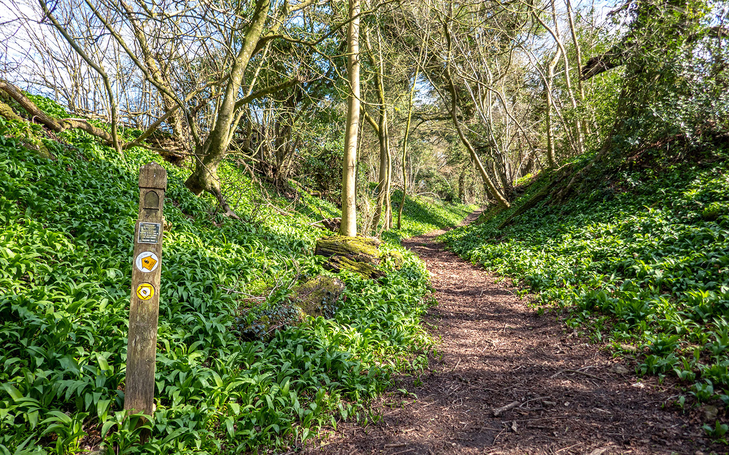
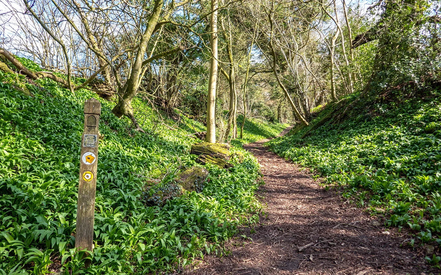
The Cotswold Way is one of the newest National Trails so it’s very well marked. And any major diversions are flagged up in on a map on the National Trails website.
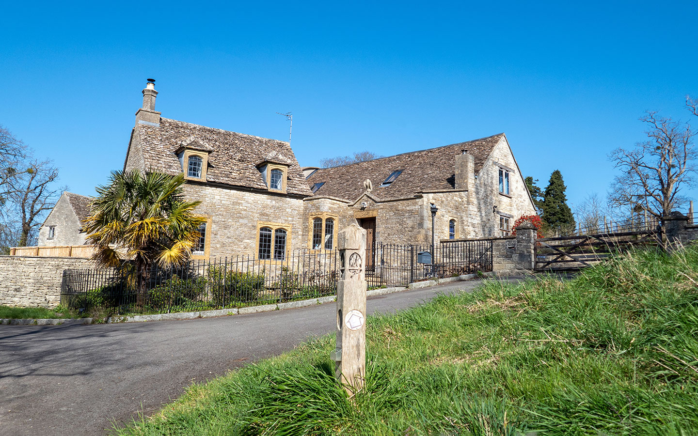
Each National Trail is marked with circular waymarkers which have an acorn symbol on them and the name of the route, which you’ll see on stiles and posts along the Cotswold Way (though in spring and summer they can sometimes get hidden away amongst the greenery).
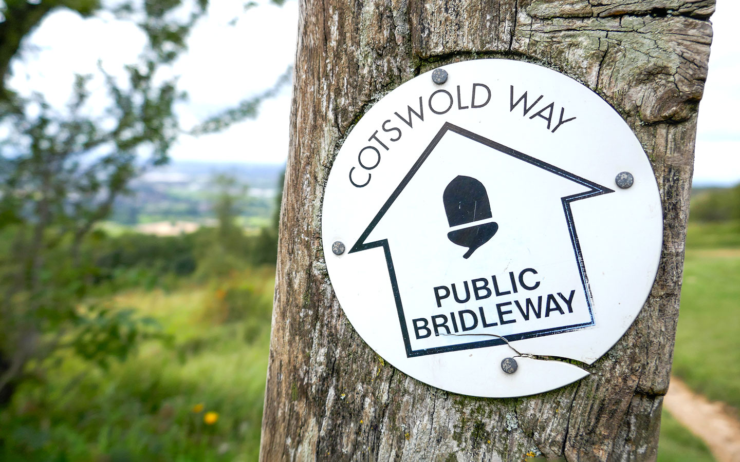

There are also wooden finger posts at most junctions which show you which way to go and sometimes have the distance to the next town marked on them. Signs are fairly frequent so if you haven’t seen one for a while it’s worth checking you’re still on the right track.
Although the Cotswold Way is well-marked, it’s good to have a backup. Maps and guidebooks covering the trail are listed below. We planned our route on the OS Maps app* but you can also download a GPX file from the National Trails website or use the free Cotswold Way app.

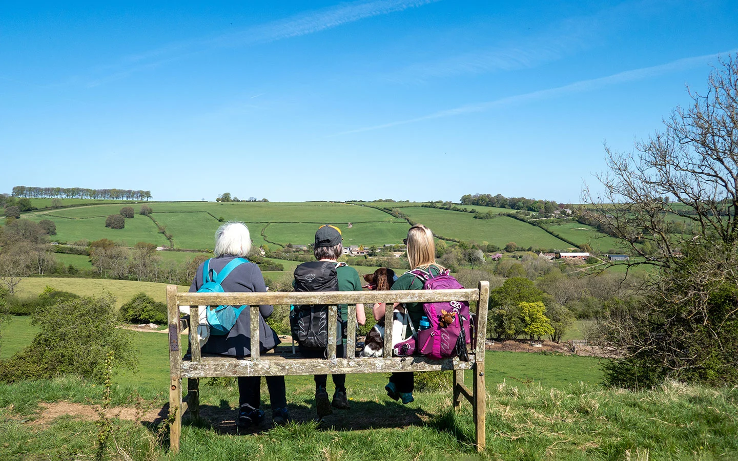
Can I take my dog on the Cotswold Way?
You’re welcome to take your dog with you when you’re walking the Cotswold Way, though the usual advice applies when it comes to walking with dogs in the countryside.
Always clean up after your dog and dispose of any waste safely. Keep dogs under control at all times so they don’t disturb farm animals or wildlife, especially in spring around lambs or ground-nesting birds. And stay on the designated paths. Also make sure to take plenty of water for your dog and break the route up into distances which are small enough for them to manage.

Where can I stay along the Cotswold Way?
There’s a good selection of places to stay along the Cotswold Way, most commonly B&Bs, guesthouses and pubs, but also some hotels, campsites and glamping pods and cabins.
The Cotswolds is a popular place though and accommodation can get very busy, so book as far in advance as you can, particularly at peak times (during the July/August school holidays, over Easter and at weekends) or in areas where there are limited accommodation options.

You might struggle to find accommodation right on the route in some areas and may have to walk a bit further to reach your bed for the night. Alternatively some B&Bs and guesthouses can organise lifts to and from the trail for you, or you could take a taxi to and from the trail.
The Cotswold Way isn’t the easiest route to do if you’re trying to stick to a very low budget. There aren’t many campsites along the route and wild camping is illegal in England, so if you’re planning on camping you might need to combine it with a couple of nights in B&Bs or guesthouses. There also aren’t any budget bunkhouses or hostels like you find along some long-distance trails.
Find a list of places to stay in our Cotswold Way accommodation guide

What about food and drink along the Cotswold Way?
Most B&Bs and guesthouses provide breakfast, either included in the room rate or for an extra cost, so you can fill up at the start of each day. There’s normally a Full English breakfast on the menu, with bacon, eggs, sausages, beans, mushrooms and toast. But if walking after that sounds a bit like hard work, you can usually get lighter options like scrambled eggs on toast or cereal too.
Although the Cotswolds has no shortage of pubs, they’re not always conveniently positioned on the Cotswold Way trail to make good lunch stops. It’s worth checking each day’s walking route to see if you’ll be passing a pub around the right time (our itinerary details the options) – and double check opening times as they’re not always open every day, especially during low season.
It’s often easier to take a packed lunch and snacks with you each day. Many B&Bs and guesthouses can make a packed lunch for you, or you can find small grocery shops in most towns and villages, though you might not have a huge selection of options. Our snack favourites include bananas, cheese, nuts, granola bars – and a few packets of Jelly Babies to get us up the hills.
When it comes to evening meals, the local pub is the usual option, unless you’re overnighting somewhere like Cheltenham where there’s a selection of restaurants. Cotswold pubs range from traditional pie and a pint spots to gourmet gastropubs. In more remote areas you may need to get a lift or taxi from your accommodation to the nearest pub (unless you fancy an extra walk!).

Are there toilets along the route?
When nature calls, there aren’t many public toilets along the Cotswold Way – any that there are are listed in our 10-day itinerary – so often your best bet is to stop off at a pub or café in one of the towns or villages along the route and make use of their bathrooms when you can.
Otherwise it’s a case of finding the nearest convenient bush or tree (luckily there are plenty of both along the trail) and making sure it’s off the path and away from any water sources. And if you need a ‘number two’, dig a hole with a stick (or seasoned walkers often bring a small shovel), bury it afterwards and bag up any toilet paper up and take it away with you to dispose of later.

What do I need to take with me?
What you need to take with you when walking the Cotswold Way will depend on whether you’re planning on carrying all your luggage with you day-to-day, or getting your main bags transported for you each day (see below for luggage transport options) and just carrying a day pack.
Either way, the most important part of your walking kit is what you’ll be wearing, particularly on your feet. Although the Cotswold Way isn’t a really difficult route it’s advisable to wear comfortable walking shoes or boots, which are waterproof but breathable, and have decent ankle support. Some walkers also like to have walking sticks or poles to help on uneven ground.

Pack plasters or blister pads too, as even well-worn boots can start to rub after a few days of continuous walking. Regular hikers advise wearing two pairs of socks to prevent blisters, and merino wool socks are particularly good as they’re lightweight, warm and quick-drying.
The weather in the Cotswolds is changeable year-round, so always make sure you’re carrying waterproofs – at least a lightweight waterproof jacket and preferably waterproof over trousers for any really wet days. A fold-up poncho which also covers your rucksack is useful too in case the rain sets in. And if it’s cold the wind can be harsh, so gloves and a scarf or buff are useful.
And at the other weather extreme, on sunny days you’ll need sunscreen, sunglasses and a sun hat as there’s not a lot of shade along some sections of the route, plus plenty of water.

If you’re carrying all your kit, a 40–50-litre rucksack should be big enough for a couple of changes of clothes, waterproofs, toiletries, a water bottle (which can be refilled at pubs and cafés along the way), lunch and snacks. If you’re getting your bags transported you can add more comforts like a change of shoes to rest your feet in the evenings as you’ll only need to carry a day pack with you.
Mobile phone reception can be patchy on the Cotswold Way. If you’re relying on a phone app for navigation it’s useful to have a power bank to top up your phone battery if you need it, as well as a paper map, compass and torch in case of emergencies. And don’t forget a camera (or a camera phone) to capture all the gorgeous Cotswold views you’ll see along the way.

Can I get my luggage transported for me?
If you don’t want to carry everything with you, there are a few different companies which offer bag transportation services along the Cotswold Way. They collect your luggage from your accommodation each morning and drop it off at your destination so it’s waiting for you when you arrive later on, so you only have to carry a day bag with the essentials out with you.
Sherpa Van, Carry a Bag and Cotswold Luggage Transfers all offer luggage transfers on the Cotswold Way. Prices are £10–£15 per bag per transfer and are cheaper for multiple bags. Many of these companies also offer passenger transport and accommodation booking too.
What Cotswold Way maps and guidebooks are there?
If you like to have a paper map, there are a few different maps which cover the Cotswold Way. The Ordnance Survey Explorer Maps (1:25,000 scale) – the ones with the orange covers – are ideal for walkers, with lots of details on footpaths and points of interest along the way.
The following OS Explorer Maps include different sections of the Cotswold Way:
- OL45 The Cotswolds* (covers Chipping Campden to Winchcombe)
- 179 Gloucester, Cheltenham & Stroud* (covers Cleeve Hill to Stroud)
- 168 Stroud, Tetbury & Malmesbury* (covers Stroud to Uley)
- 167 Thornbury, Dursley & Yate* (covers Uley to Chipping Sodbury)
- 155 Bristol & Bath* (covers Old Sodbury to Bath).
As you can see, the route crosses onto quite a few maps. If you don’t want to buy them all, there are a couple of Cotswold Way maps which only cover the areas you need for the route: The Cotswold Way A–Z Adventure Atlas* and Cotswold Way Map Booklet* both use OS 1:25,000 maps.
If you’d rather go digital and use GPS to see where you are, a subscription to the OS Maps app* (£34.99 a year) gives you offline access to their maps. Or the Cotswold Way app is a free all-in-one app which works offline and shows points of interest, places to eat and stay on the route.

There are also several Cotswold Way guidebooks available, which have maps and directions, route-planning tips and details of accommodation and places of interest along the way.
- Cotswold Way by Anthony Burton (2017): The official National Trails guidebook splits the trail into 15 sections, going from north to south, with OS 1:25,000 maps and detailed directions.
- Cotswold Way (Trailblazer Guides)* by Tricia & Bob Hayne (2024): Covers the trail from north to south, with 44 hand-drawn 1:20,000-scale maps, plus details of transport, places to stay and eat, and background on local history, flora and fauna.
- Walking the Cotswold Way (Cicerone)* by Kev Reynolds (2024): Covers the trail from north to south over 14 stages, with a summary of route in reverse. Also includes information on where to stay and eat, and a separate booklet of 1:25,000 OS maps.
- Trekking the Cotswold Way (The Great Treks of England)* by Andrew McCluggage (2022): This covers the route in full in both directions, so might be most useful for people walking south to north. It uses 1:25,000 OS maps with suggested itineraries covering 4–12 days.

The Cotswold Way Association also publish The Cotswold Way Companion, which is an insider’s guide to the trail written by its voluntary wardens. It’s not a step-by-step route guide, but more an insight into the Cotswold Way and the places along it, with some interesting stories and custom maps. Plus the profits go to help support the Association maintain the trail.


What if I don’t want to organise it myself? Is there someone who can plan it for me?
If you’re short on time or don’t want to have to sort out planning all the details of your Cotswold Way walk yourself, there are several companies who offer self-guided Cotswold Way holiday packages. These usually include accommodation, luggage transfers, guidebooks and an emergency contact, and you can choose how many days you want to spread the walk over.
These are a few of the companies offering Cotswold Way holidays:
- Compass Holidays: 8 or 12 days walking or northern and southern sections
- Macs Adventures: 8–12 days walking, northern and southern sections or short breaks
- Mickledore: 6–11 days walking or northern and southern sections
- Cotswold Walks: 6–11 days walking plus a luxury hotel option.

I’ve finished walking the Cotswold Way! What next?
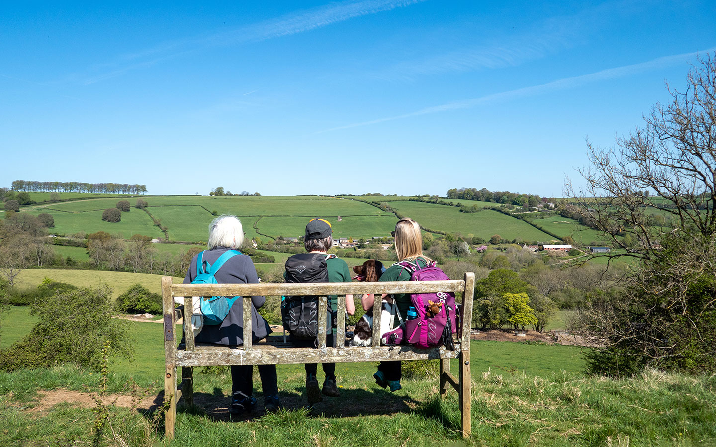
Congratulations! There’s an amazing sense of achievement in finishing the Cotswold Way, especially when you look back at the Cotswold hills stretching off into the distance behind you.
If you want to mark your achievement, you can submit your details to the Cotswold Way Hall of Fame on the Cotswolds AONB website. You can also get souvenir pin and cloth badges, waymarkers, t-shirts and bags from the Cotswold Way Association shop. Or National Trails also have an online shop selling Cotswold Way badges, mugs, posters and completion certificates.
And if you’ve got a taste for long-distance hiking there are 15 more National Trails around England and Wales as well as coastal paths and Scottish walking routes.
Or if you want to see more of the Cotswolds, there are several other long-distance walks in or passing through the area, including the Heart of England Way (101 miles), Cotswold Ring (61 miles), Wysis Way (55 miles) and Winchcombe Way (42 miles), as well as our next challenge – the Cotswold section of the Monarch’s Way, 107 miles from Stratford-upon-Avon to Bristol.
* This site contains affiliate links, where I get a small commission from purchases at no extra cost to you.
Save for later

You might also like

DJ Wilson
Wednesday 11th of October 2023
Three of us finished the walk on October 1! Your guide was very helpful. A couple notes: 1) I wish some governmental agency put out a booklet to all the restaurants/pubs/hotels/airbnbs near the Way to give them some guidance. We had places to stay that knew little or nothing about it, had no idea that there were luggage transfer companies and didn't even know where the bus stops/routes were. 2) We used the one luggage transfer company that did pick up/deliver to non-hotels. A warning that you really do need to let the owner know that luggage is coming, they should have a space to drop it off/store it/pick it up so the walker can convey that info to the luggage transfer company. 3) We were surprised that taxis and Ubers were so unavailable. Probably our bad having come from population-dense Massachusetts! 4) It should be noted that while Cold Ashton is on the route, it has NOTHING in it. We did find a cafe not far away but there are no places to stay. 5) Showing our "city folk", the route has yellow signage for walking paths and blue signage if the path is a bridle path. Took us awhile to figure out what a bridle path was.
Thanks for the great guide!
Lucy Dodsworth
Monday 16th of October 2023
Thanks so much! Great to hear it was useful and you enjoyed the walk. Thanks for the extra tips too, will add them into the guide.