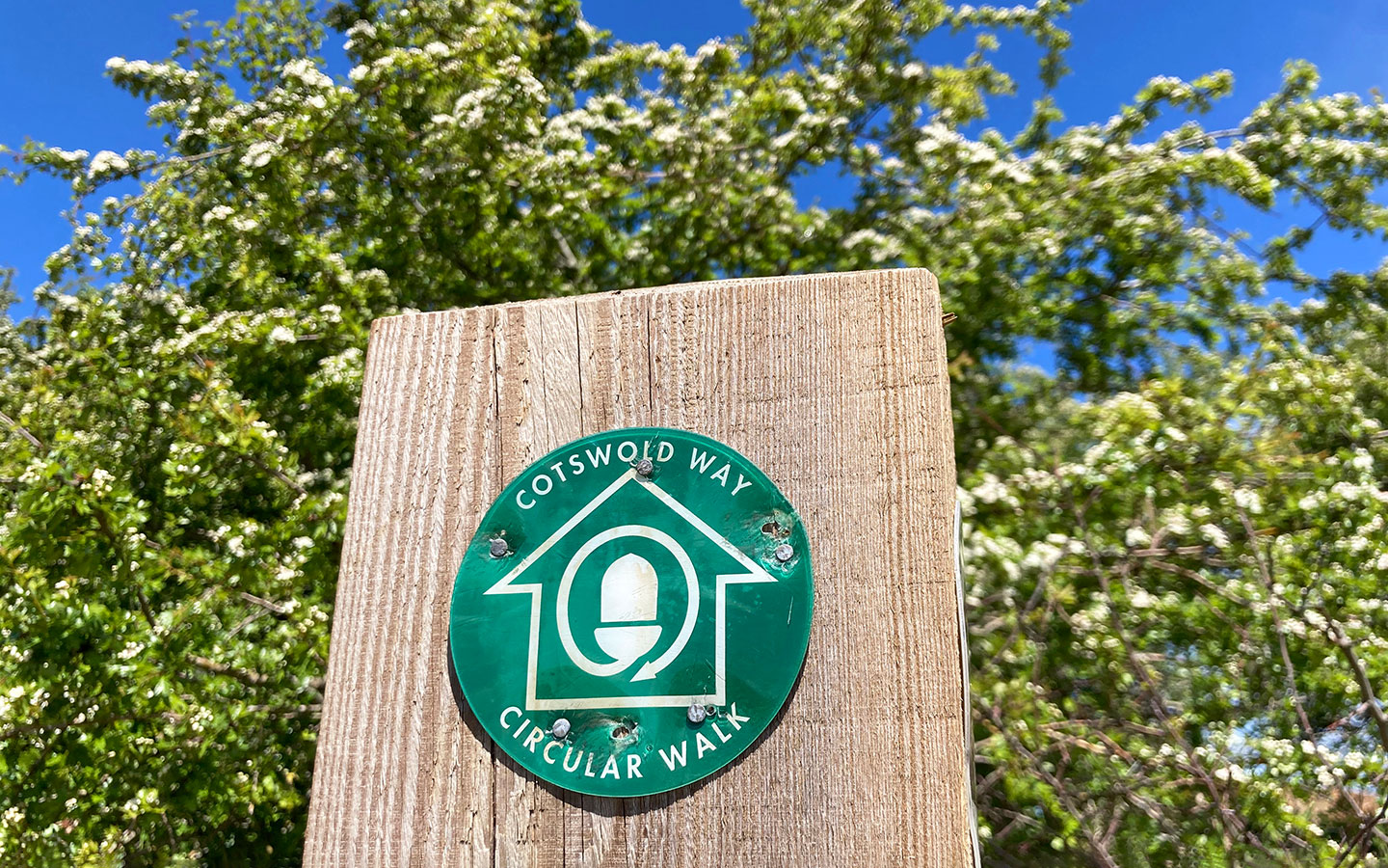
Running for 102 miles between Chipping Campden and Bath, the Cotswold Way is one of Britain’s great long-distance walks, and was made a National Trail in 2007. But if you don’t have time to do the full walk, you can still get a taste of the route with a Cotswold Way circular walk.
The Cotswolds AONB have developed a series of different routes which take in some of the villages, landscapes, viewpoints and historic sites which make the Cotswold Way so special.

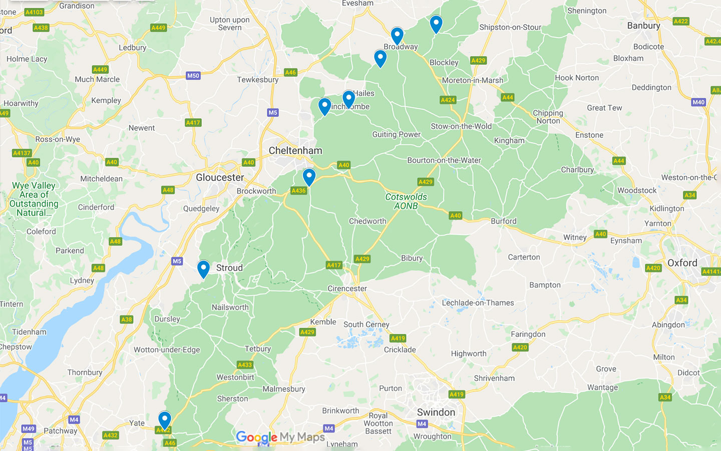
After walking our way around the region, we’ve chosen eight of our favourite Cotswold Way circular walks, which vary in distance from 2.5 to 6 miles. Circular walks mean you don’t have to worry about transport back to your car at the end of the route, and the start point for each of the walks is also accessible by public transport (though bus frequencies vary, so check times in advance).
Discover lots more Cotswold walk ideas, including maps and directions.
Eight Cotswold Way circular walks

1. Chipping Campden to Dover’s Hill
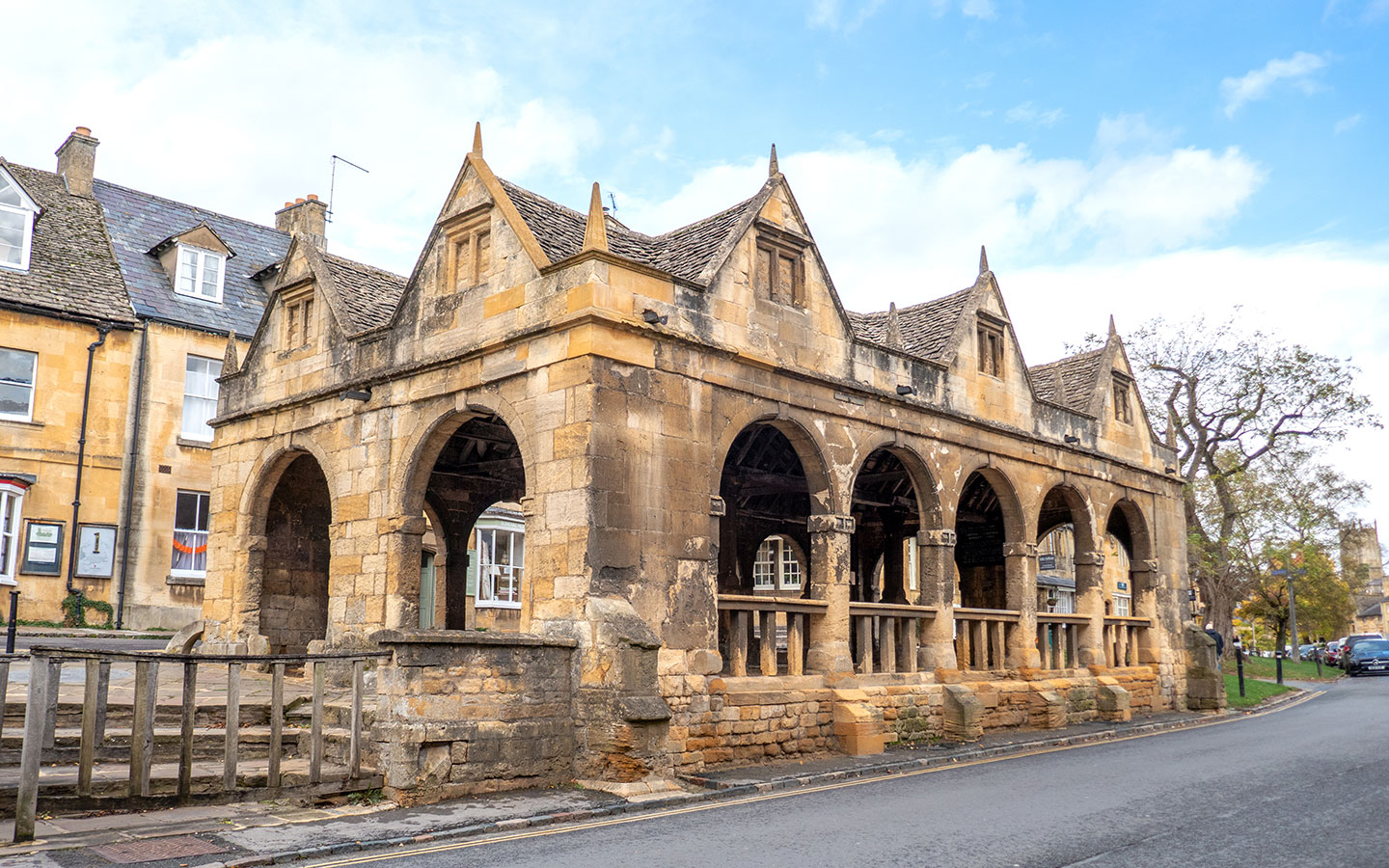
This walk takes you along the very first stretch of the Cotswold Way (or the last if you’re walking from south to north) from the Market Hall in Chipping Campden – look out for the Cotswold Way marker stone on the ground at the starting point. Walk through Chipping Campden to St Catharine’s Church where you turn off onto Hoo Lane and join a stony track which climbs uphill.
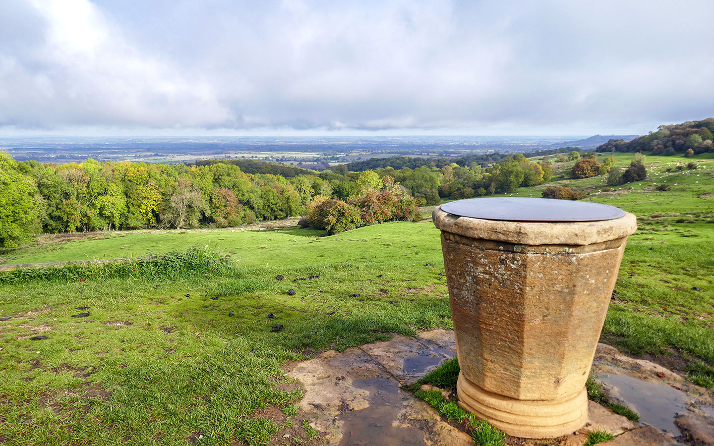
After crossing a road, the footpath carries on to Dover’s Hill. Owned and managed by the National Trust, Dover’s Hill is a natural amphitheatre with great views over the Vale of Evesham. It was also the site of the original English Olympic Games, which were started by Robert Dover in 1612, and now hosts the Cotswold Olimpick Games in May/June, with quirky events like shin-kicking.

The route leaves the Cotswold Way behind to head off on a circuit through leafy Lynches Wood, which has beautiful bluebells in spring, before reaching a stone topograph. From there you rejoin the Cotswold Way before heading back down the hill to Chipping Campden, where you can call in to the Bantam Tea Rooms for a cream tea – or the Eight Bells Inn for something stronger.
- Distance/time: 4.1 miles/2 hours.
- Difficulty: Moderate, some steep sections.
- Start/finish point: Chipping Campden Market Hall (GL55 6AJ).
- Parking: Limited parking in the Market Square and on-street parking on the Back Ends.
- Public transport: Stagecoach 1/2 bus (every day) from Moreton-in-Marsh and Stratford-upon-Avon; Pulhams 606 bus (Mon–Sat) from Cheltenham, Winchcombe and Broadway.
- Map and directions

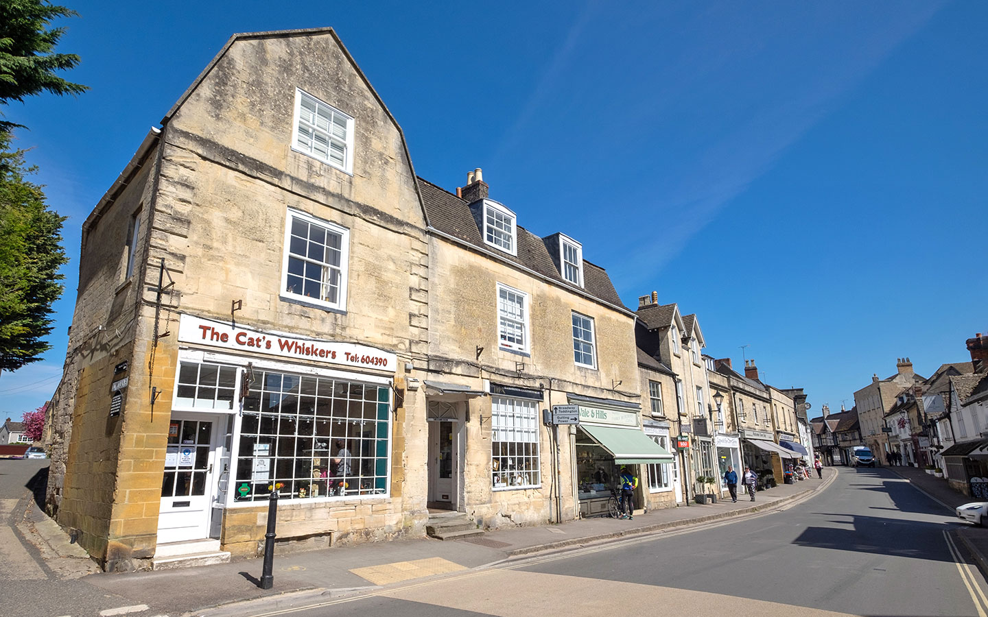
2. Broadway to the Broadway Tower
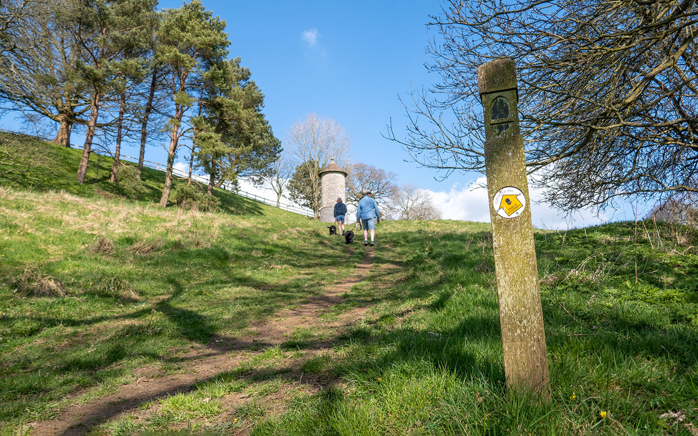
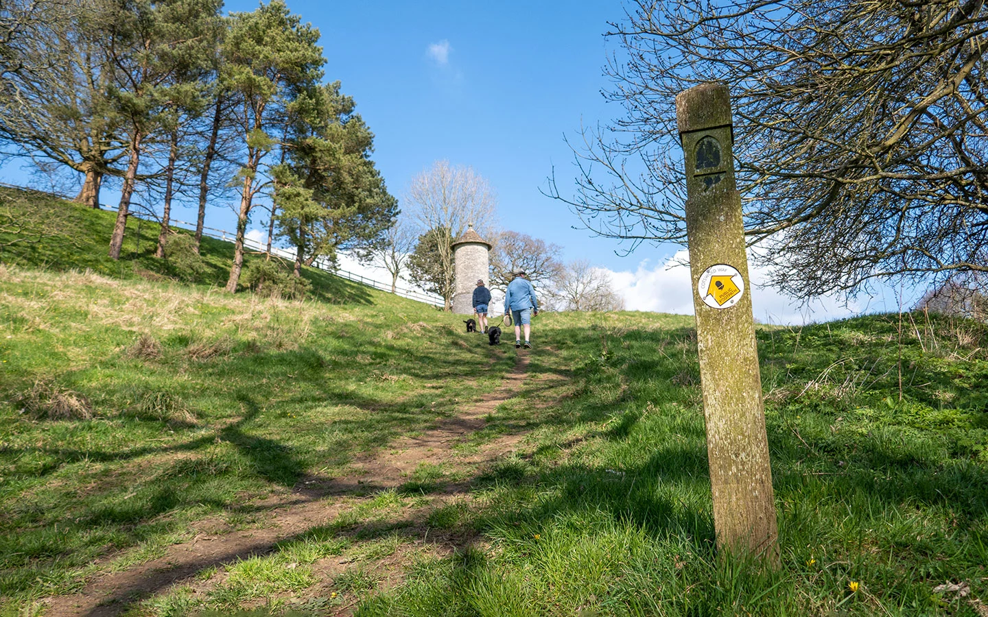
One of the most popular Cotswold Way circular walks is the route from the village of Broadway to the fairytale hilltop Broadway Tower. The route starts and finishes on Broadway’s High Street with its boutique shops, galleries, restaurants and bars. It quickly turns off the High Street and follows tracks across fields, passing 12th-century St Eadburgha’s, Broadway’s old parish church.
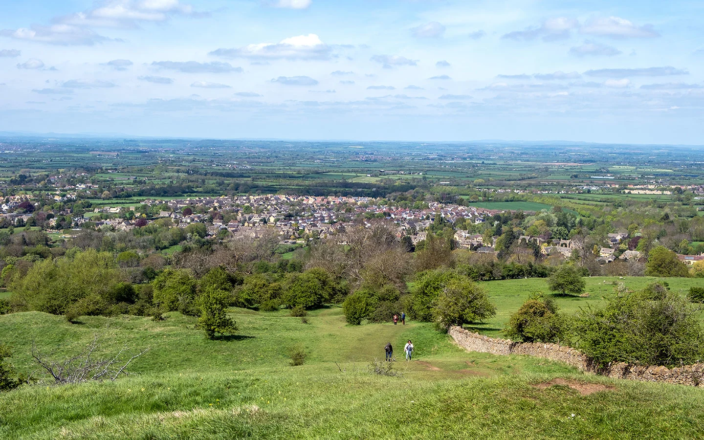
After climbing up past Rookery Farm you’ll see the Broadway Tower rising up. The tower was built in 1794 and has been used as an artist’s retreat as well as being the site of a nuclear bunker. It’s the second-highest point in the Cotswolds and on a clear day you can see across 16 counties. The tower is open to the public if you want to climb to the top, and there’s also a café on site.

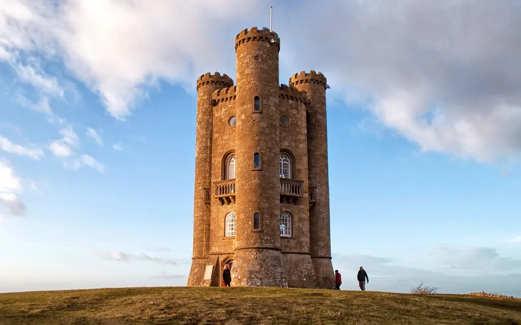
From the tower the route joins the Cotswold Way as it heads downhill to Broadway. Look out for the herd of red deer and the restored dry stone walls along the way. But the view is the star, stretching out for miles in front of you. Back in Broadway the route rejoins the High Street where you can stop off for a drink in the historic Lygon Arms or for tasty fish and chips at Russell’s.
- Distance/time: 4.4 miles/2 hours.
- Difficulty: Moderate, some steep sections and steps.
- Start/finish point: War memorial on Broadway High Street (WR12 7DP).
- Parking: Car parks on Church Close or Leamington Road.
- Public transport: Stagecoach 1/2 bus (every day) from Moreton-in-Marsh and Stratford; NN Cresswell Rural 4 bus (Mon–Fri) from Evesham; Pulhams 606 bus (Mon–Sat) from Cheltenham, Winchcombe and Chipping Campden. Or GWSR steam train from Cheltenham and Winchcombe.
- Map and directions

3. Stanton to Snowshill
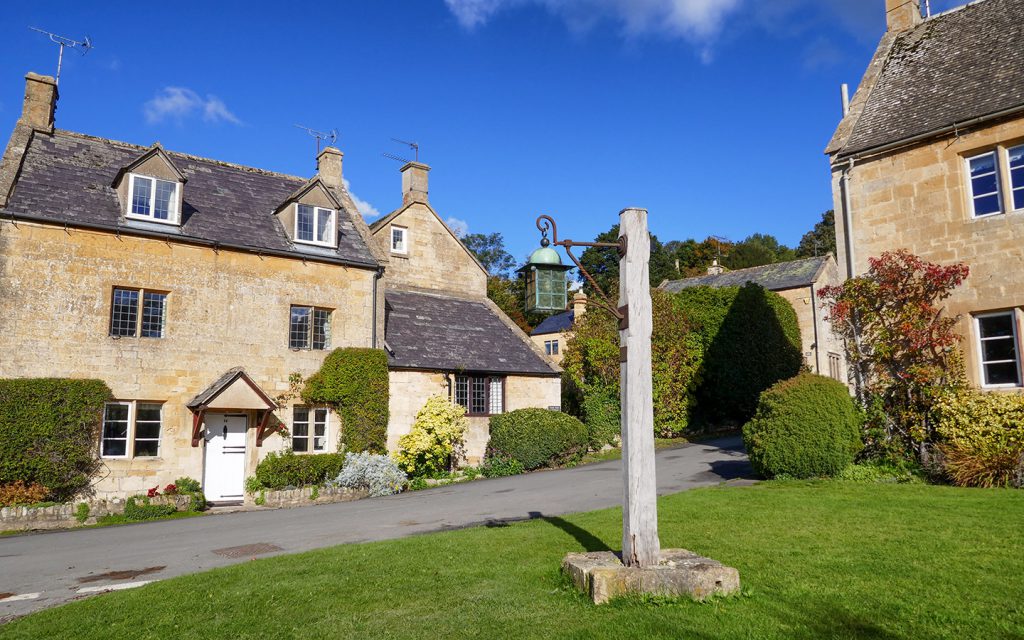
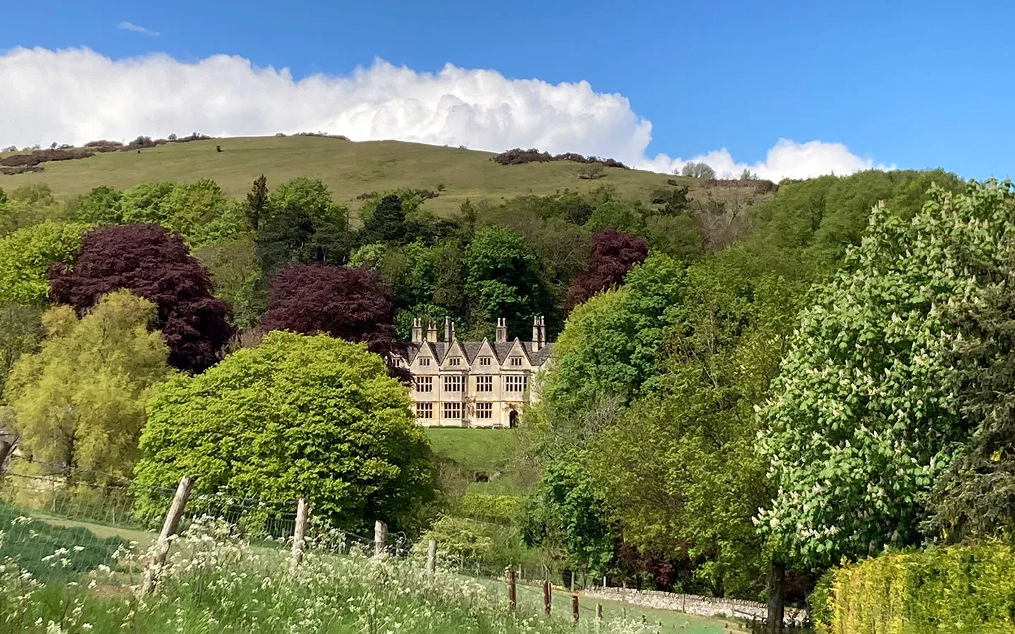
This route takes in some of the area’s prettiest villages, starting with Stanton with its mix of Cotswold stone and half-timbered buildings. Much of the village was bought and restored by architect Sir Philip Sidney Stott in the 1900s, who lived in Stanton Court. Start by following the Cotswold Way east out of the village, climbing steeply up onto Shenberrow Hill.
Then you leave the Cotswold Way behind and turn off through peaceful Littleworth Woods as you head down to Snowshill. The village is home to Snowshill Manor and Garden, a 16th-century house owned by eccentric architect and poet Charles Paget Wade, with some of the 22,000 objects he collected on display. There’s also the Snowshill Arms pub if you fancy stopping off.

Walk on through woodland until you rejoin to Cotswold Way for another stretch, running past old quarries until it reaches the waymarker post where you left the route earlier. Finally turn off down a steep track where you’ll get views of Stanton and across the Severn Vale before emerging back in Stanton close to the Mount Inn, which has a beer garden perfect for sunny days.
- Distance/time: 6 miles/3–3.5 hours.
- Difficulty: Moderate, some steep sections.
- Start/finish point: East end of the High Street (WR12 7NF).
- Parking: Car park at the Stanton Village Club.
- Public transport: Pulhams 606 bus (Mon–Sat) from Cheltenham and Winchcombe to the south and Broadway and Chipping Campden to the north.
- Map and directions

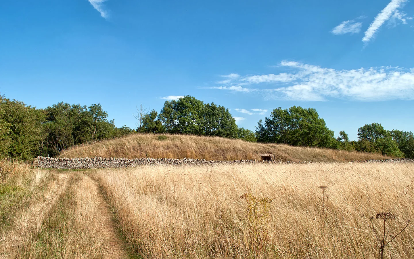
4. Winchcombe to Belas Knap
This Cotswold Way circular walk takes you from the village of Winchcombe to one of the area’s oldest historic monuments – Belas Knap Long Barrow. It starts by heading down Vineyard Street with its row of picturesque stone cottages, before joining the footpath to Corndean Lane, which takes you up a driveway past the cricket club before turning off into a hillside field.
As you climb uphill, don’t forget to look back behind you where you’ll see Winchcombe stretching out below. The route leaves the Cotswold Way on its way to Hill Barn Farm before later rejoining it and carrying on to Belas Knap. This Neolithic burial mound was built around 3000 BC, and 31 Bronze Age skeletons were discovered inside when it was excavated in the 19th century.

Carry on along the Cotswold Way to the bottom of the hill, then take the Winchcombe Way walking route back to the town past a series of farms, with views down to Sudeley Castle, Winchcombe and out over the Cotswold Hills. Finally you’ll end up back on Vineyard Street where it’s only a short walk to many of Winchcombe’s pubs, including The Lion Inn and White Hart.
- Distance/time: 5.1 miles/2–2.5 hours.
- Difficulty: Moderate, some steep sections.
- Start/finish point: War memorial on Abbey Street (GL52 3PW).
- Parking: Back Lane car park.
- Public transport: Stagecoach W bus from Cheltenham (Mon–Sat); Pulhams 606 bus (Mon–Sat) from Cheltenham, Broadway and Chipping Campden.
- Map and directions

5. The Cleeve Hill Common Ring
Cleeve Hill Common is the highest point in the Cotswolds at 330 metres, and this walk takes advantage of its fantastic views. The common is also a conservation area and a Site of Special Scientific Interest due to its rare limestone grassland, which is home to an array of wildflowers as well as birds, butterflies and small mammals – so keep an eye out as you walk.
The route starts from the clubhouse of the Cleeve Hill Golf Club and follows the Cotswold Way out of the common and on towards the small hamlet of Postlip, running through a farm and past 17th-century Postlip Hall. The path carries on through quiet woodlands before turning off the Cotswold Way towards some abandoned farm buildings and then a group of radio masts.


Just past the radio masts you rejoin the Cotswold Way and follow it along the escarpment with panoramic views out over the surrounding countryside. Follow the edge of the golf course (though watch out for flying golf balls) and you’ll end up back at the clubhouse, where there’s a café/restaurant. Or the nearby Rising Sun pub is a good spot for a drink with a view.
- Distance/time: 6 miles/3.5 hours.
- Difficulty: Moderate, some steep sections.
- Start/finish point: Cleeve Hill Golf Club (GL52 3PW).
- Parking: Old quarry car park next to the Golf Club.
- Public transport: Stagecoach W or Pulhams 606 buses (Mon–Sat) from Cheltenham and Winchcombe – alight at the Malvern View care home stop.
- Map and directions

6. The Leckhampton Loop
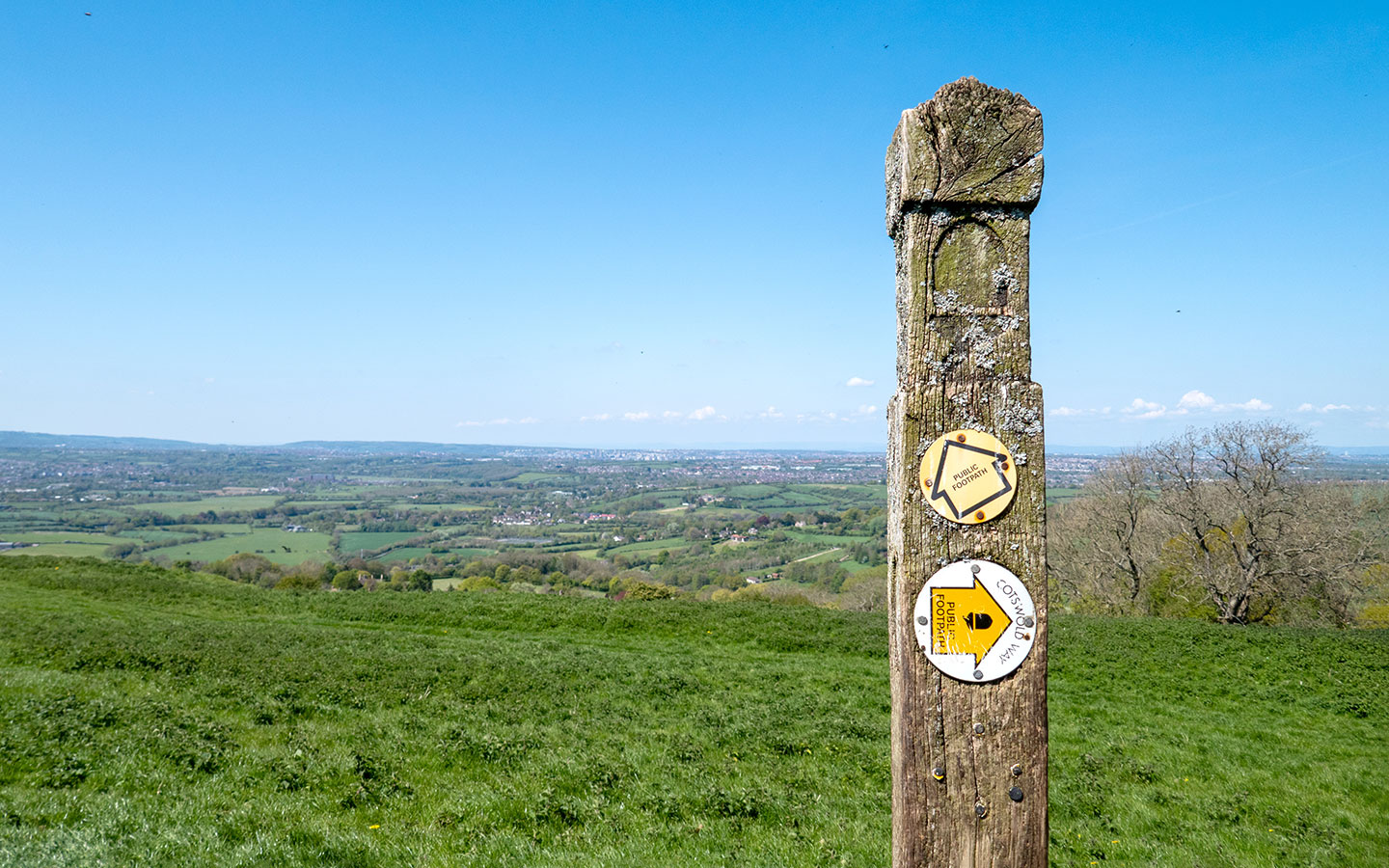
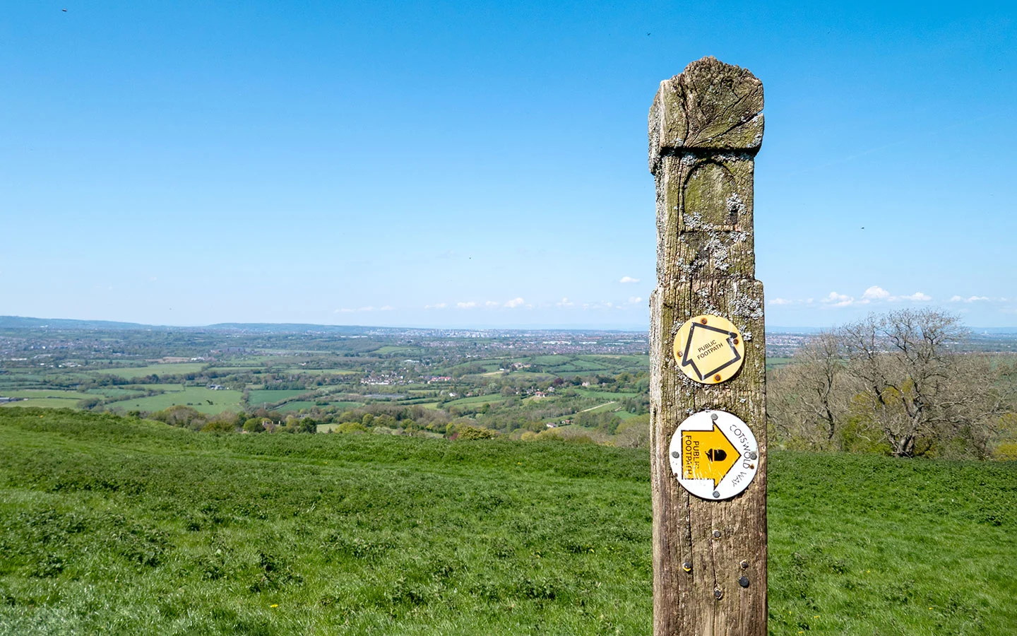
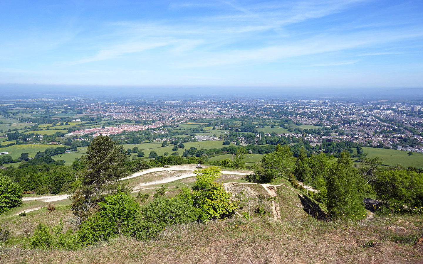
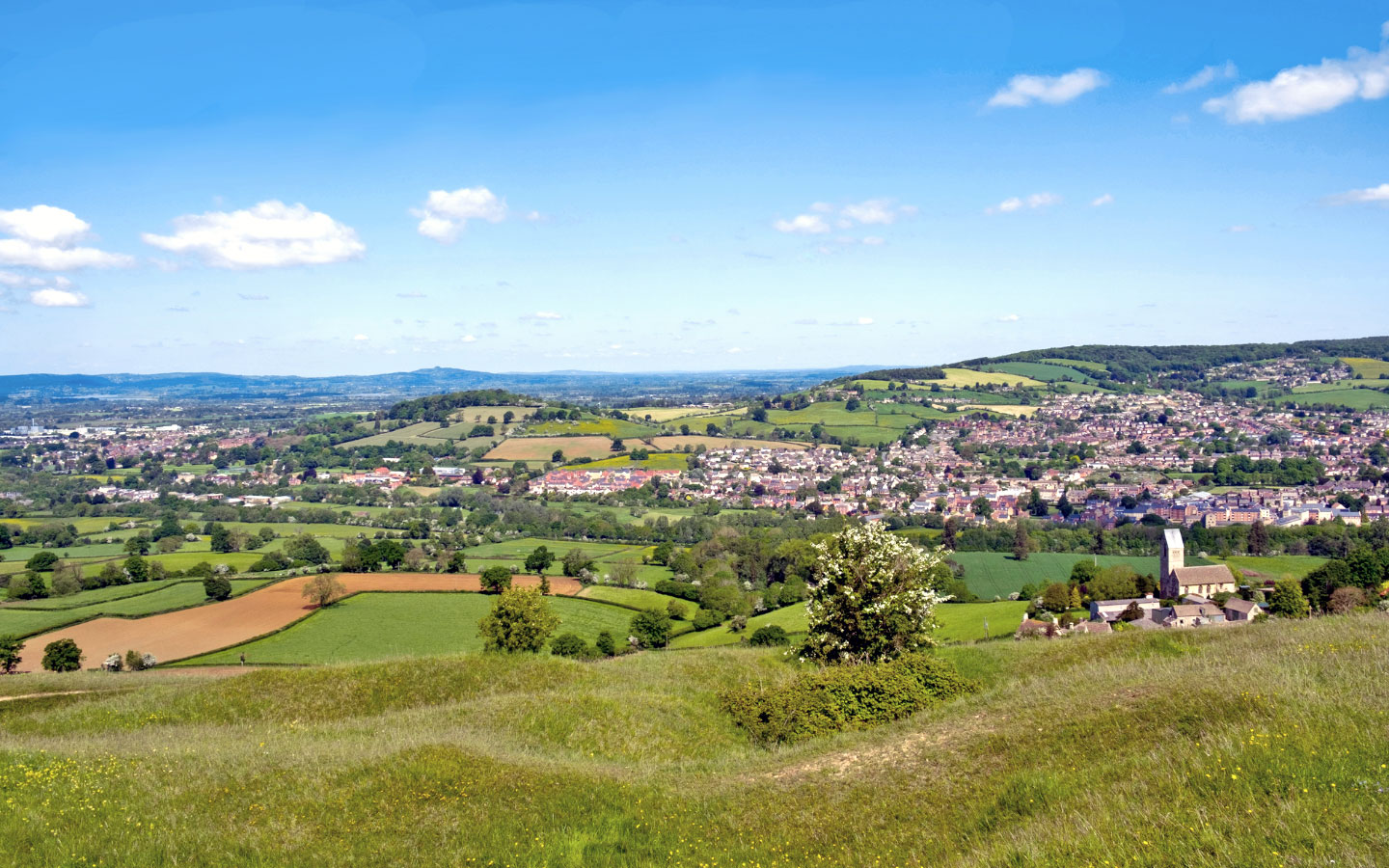
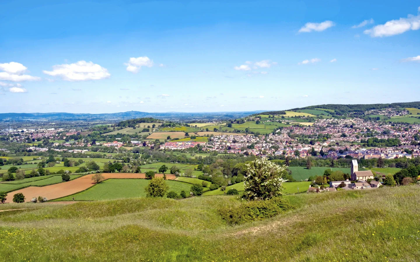
Another route with spectacular views across the Cotswold countryside is the Leckhampton Loop, just south of Cheltenham. The route starts at the Seven Springs pub (currently closed) and follows the Cotswold Way along a flat pathway before it climbs uphill through meadows and limestone grassland, which is part of the Leckhampton Hill and Charlton Kings Common Nature Reserve.
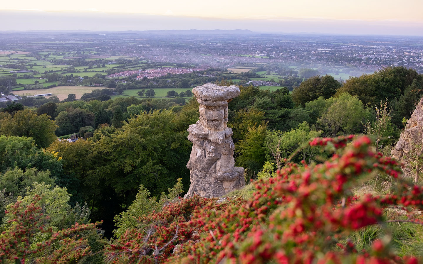
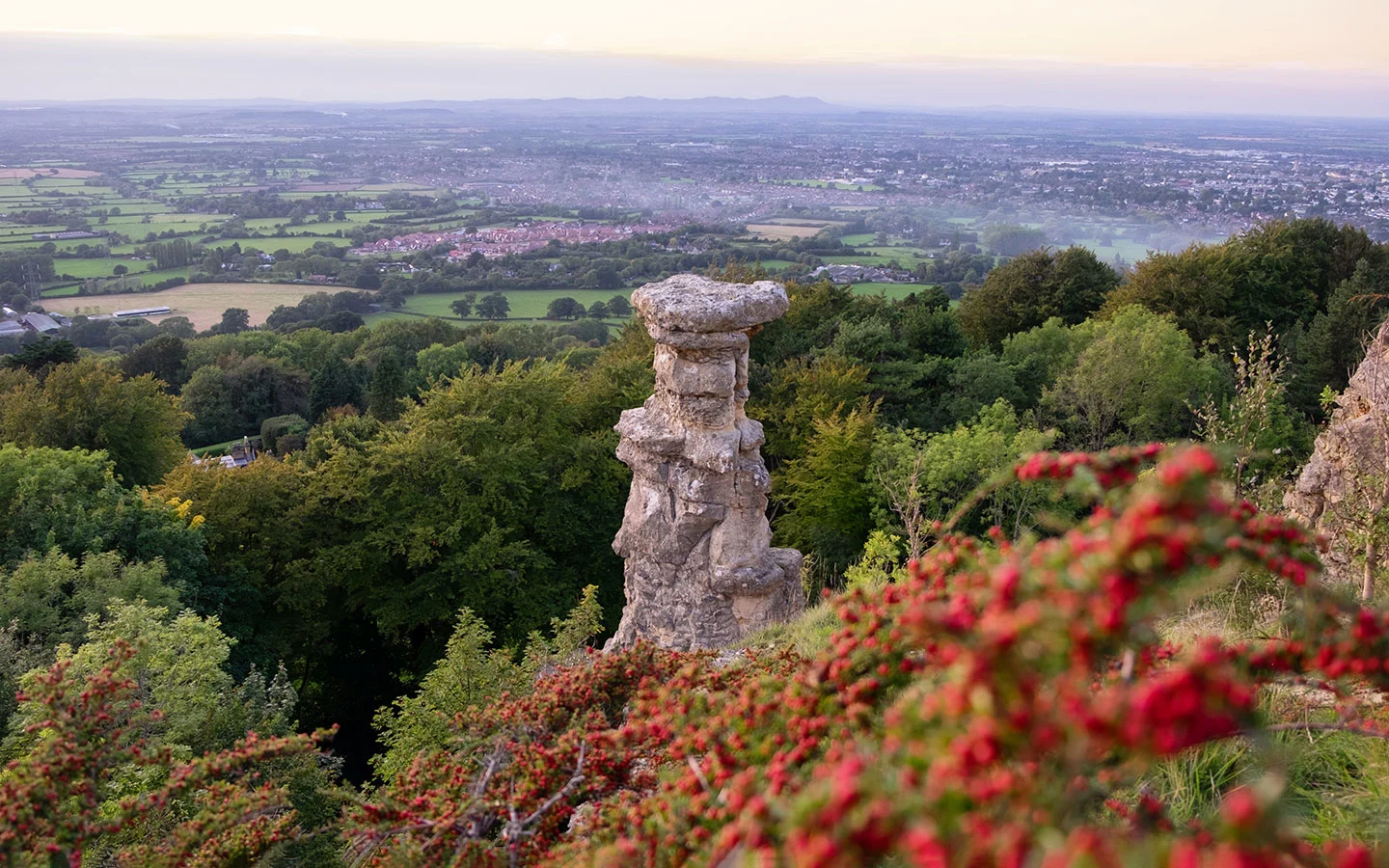
The path runs on through the remains of an old Iron Age hill fort before emerging at the top of Leckhampton Hill, with amazing views of Cheltenham and out as far as Wales. Carry on along the path – though it’s worth making a short diversion to the right to see the rock tower known as the Devil’s Chimney – before turning off and heading downhill through the woods.

Once you reach the remains of an old lime quarry, take the long, straight path downhill to Daisybank Road – this was the route of a railway line in the 1920s. Follow the road to the right as it runs past some spectacular houses. Eventually the road turns into a track and joins back onto the Cotswold Way, where you retrace your footsteps for the final stretch back to the starting point.
- Distance/time: 4.5 miles/2.5 hours.
- Difficulty: Easy, some moderately steep sections.
- Start/finish point: The (now closed) Seven Springs pub (GL53 9NG).
- Parking: Layby next to the Seven Springs pub.
- Public transport: Stagecoach 51 bus (every day) from Cheltenham and Circencester – alight at the Seven Springs stop.
- Map and directions
7. The Selsley Circuit
With its mixture of Cotswold scenery and industrial mill heritage, this Cotswold Way circular walk is a little bit different to the others. And following the trail for almost all of its route makes it one of the easiest to follow. The circuit starts in the village of King’s Stanley to the south of Stonehouse and heads east along the Cotswold Way, climbing up through woodland to Selsley Common.
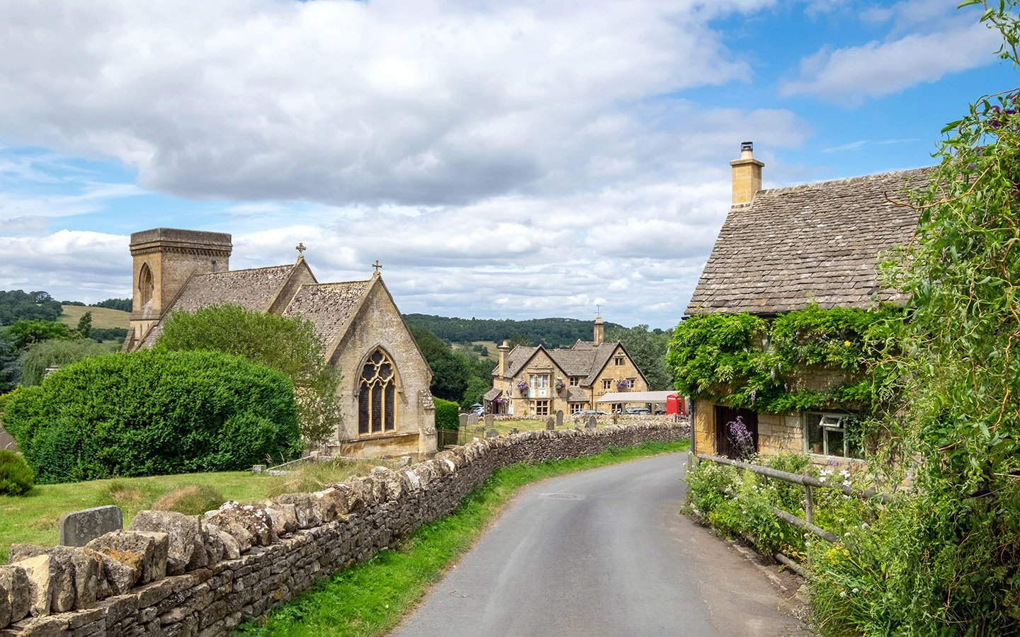
The common is a wide open area of protected limestone grassland with stunning views over the Severn Vale and Wales. You also pass an Iron Age burial mound known as the Toots before starting to head downhill towards the village of Selsey. Don’t miss a stop at Selsey Church, which has beautiful 19th-century stained-glass windows made to an Arts and Crafts design.

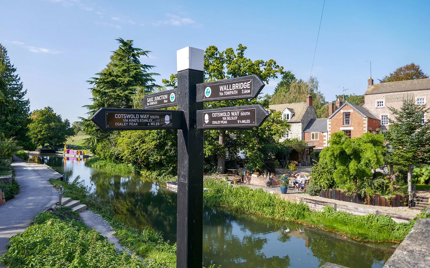
The Cotswold Way continues on past Ebley Mill, a former woollen mill that has been restored and turned into offices, and along the edge of the Stroudwater navigation. This canal was built in 1776 to link Stroud to the River Severn to make it easier to transport goods. Finally the route leaves the canal and passes Stanley Mill on its way back to the start point at The Village Inn.
- Distance/time: 5 miles/3 hours.
- Difficulty: Moderate, some steep sections.
- Start/finish point: The Village Inn in King’s Stanley (GL10 3JD).
- Parking: Car park behind The Village Inn.
- Public transport: Stagecoach 62 bus (every day) to King’s Stanley from Gloucester, Stroud and Stonehouse; Train to Stonehouse then 30-minute walk to the start.
- Map and directions
8. Old Sodbury: The Hill Fort and Church
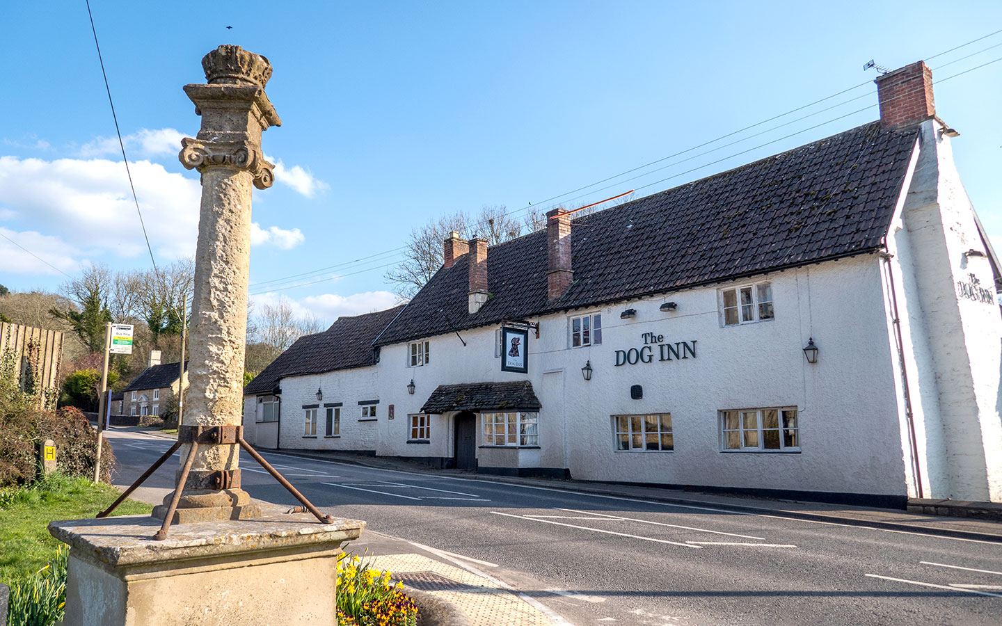
This final walk is a short, easy route, which starts in the village of Old Sodbury, located in the south of the Cotswolds just north of Bath. From the village the route follows the Cotswold Way across farmyards and past the peaceful 11th-century church of St John the Baptist, with a perfectly located bench where you can stop off and look back down to the village below you.
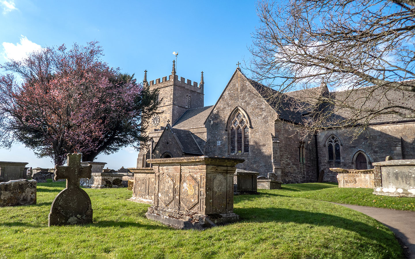

Then carry on through woodlands and past the remains of a hill fort that dates back to the Bronze or Iron Age, before turning off the Cotswold Way and heading back towards Old Sodbury. After you see the church appear to your left, rejoin the Cotswold Way and retrace your steps back to the starting point, ending up outside the Dog Inn, a dog-friendly pub serving food and local ales.
- Distance/time: 2.5 miles/1.5 hours.
- Difficulty: Easy.
- Start/finish point: Opposite the Dog Inn in Old Sodbury (BS37 6LZ).
- Parking: Along Chapel Lane.
- Public transport: Stagecoach 620 bus (Mon–Sat) from Bath, Yate, Tetbury and Stroud.
- Map and directions

* This site contains affiliate links, where I get a small commission from purchases at no extra cost to you.
Save for later


You might also like