Looking for a scenic country walk near Cheltenham? Its location on the edge of the Cotswolds means there are plenty of routes to choose from. But we’ve chosen eight of our favourites within easy reach of Cheltenham, featuring panoramic views, unspoilt landscapes and historic landmarks.
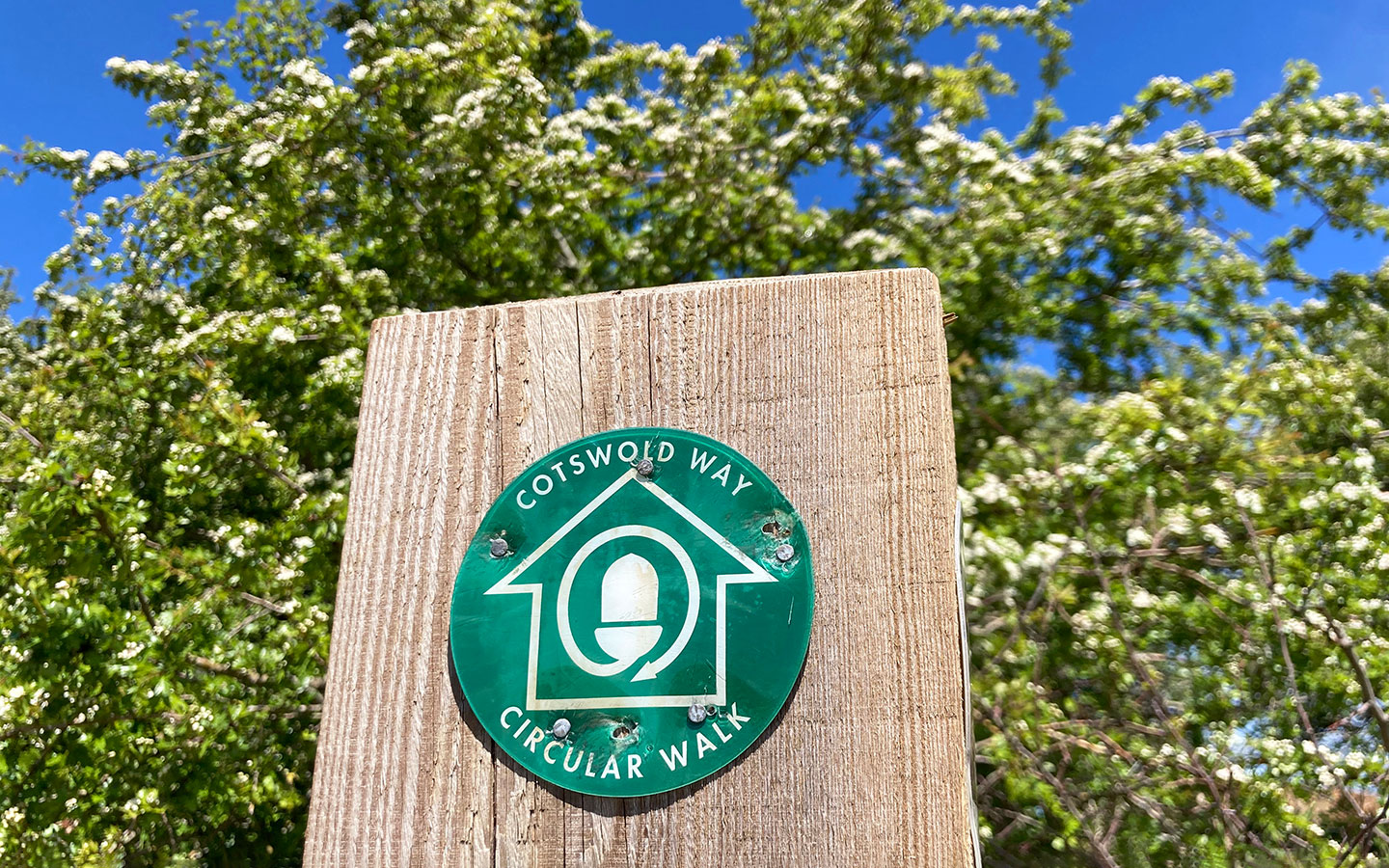
Walks range from 1.7 to 8 miles, all but one of them are circular, and several incorporate stretches of the spectacular 102-mile Cotswold Way walking route between Chipping Campden and Bath. Most of the starting points are also accessible by public transport if you don’t want to drive.
The walks are all dog-friendly, but there may be some sections where dogs need to be kept on a short lead where there’s livestock or ground-nesting birds during nesting season (March–July).

Map of walks near Cheltenham


Leckhampton Hill (3 miles circular)
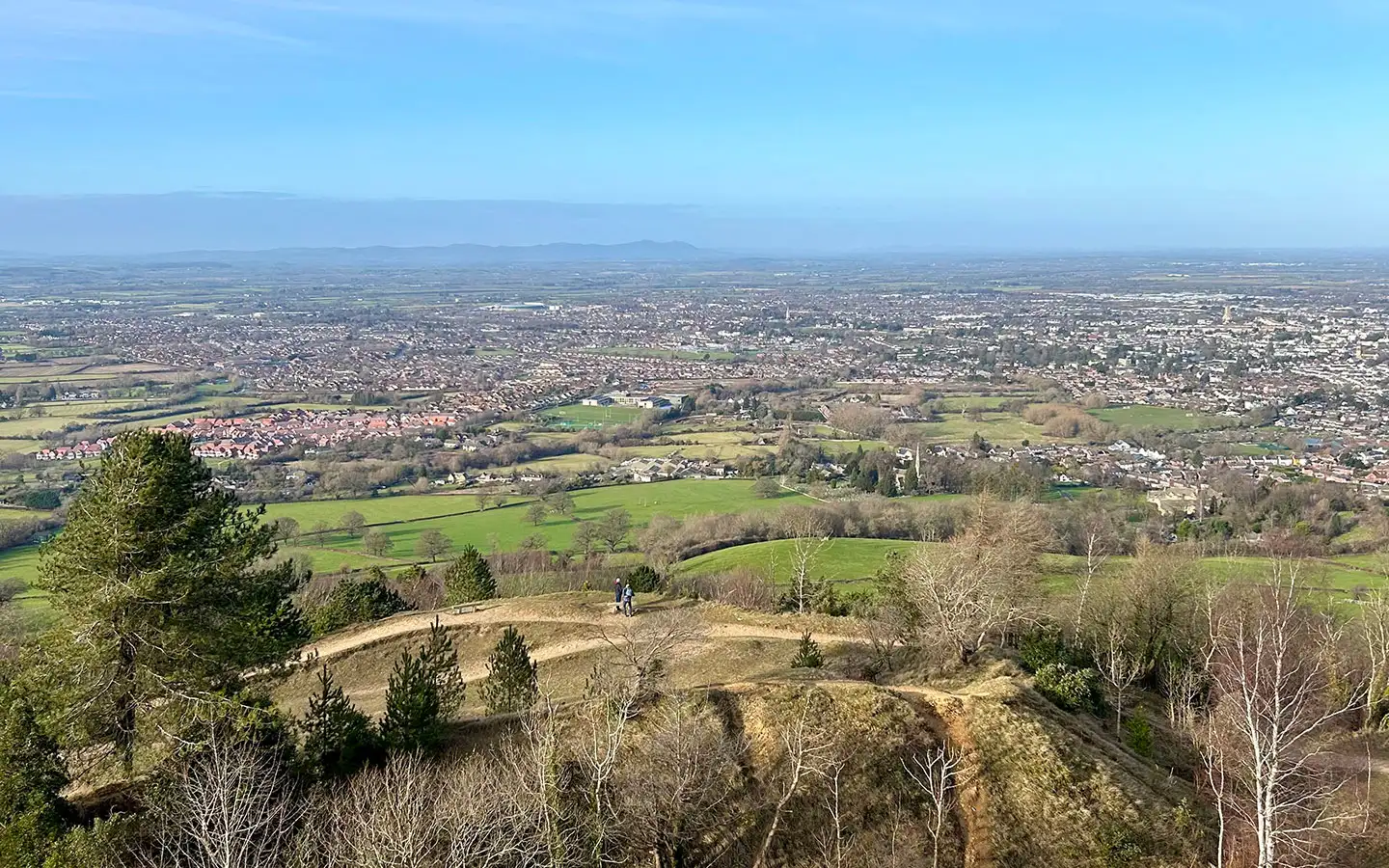
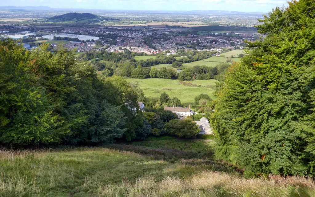
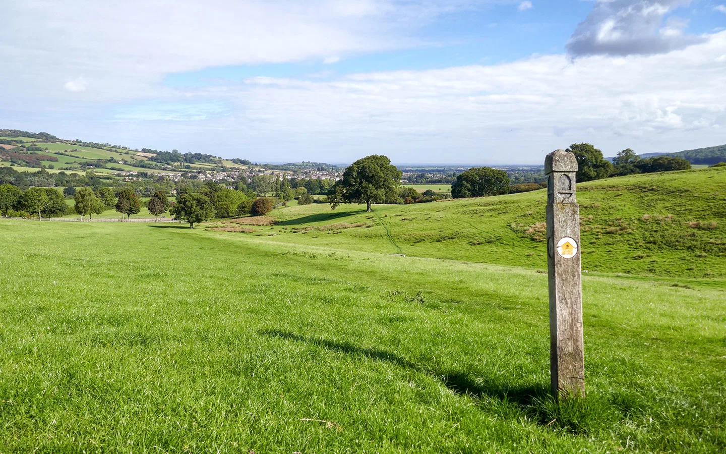
My favourite countryside walk near Cheltenham has to be around Leckhampton Hill. This area of rare limestone grassland is a Site of Special Scientific Interest that’s home to wild orchids, butterflies, insects, birds and small mammals – as well as a herd of Longhorn cattle.
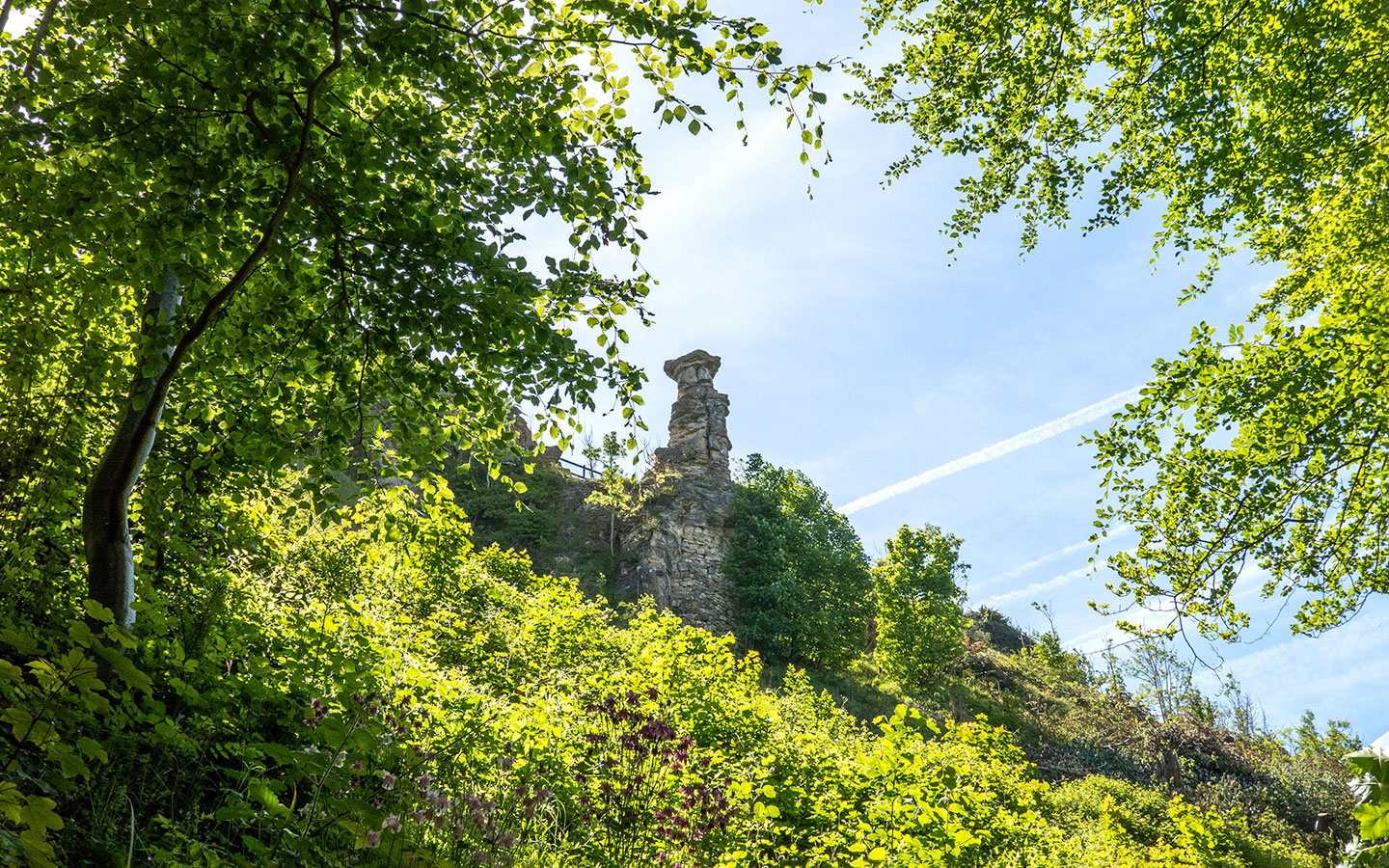
The walk starts on Daisybank Road a few miles south of town and climbs steeply along the route of an old railway line used to transport limestone from quarries on the hill in the 1920s. You can also see the remains of an old lime kiln at the top. The path then runs through woodland, with views up to the Devil’s Chimney, a precarious looking limestone rock formation on the hillside.

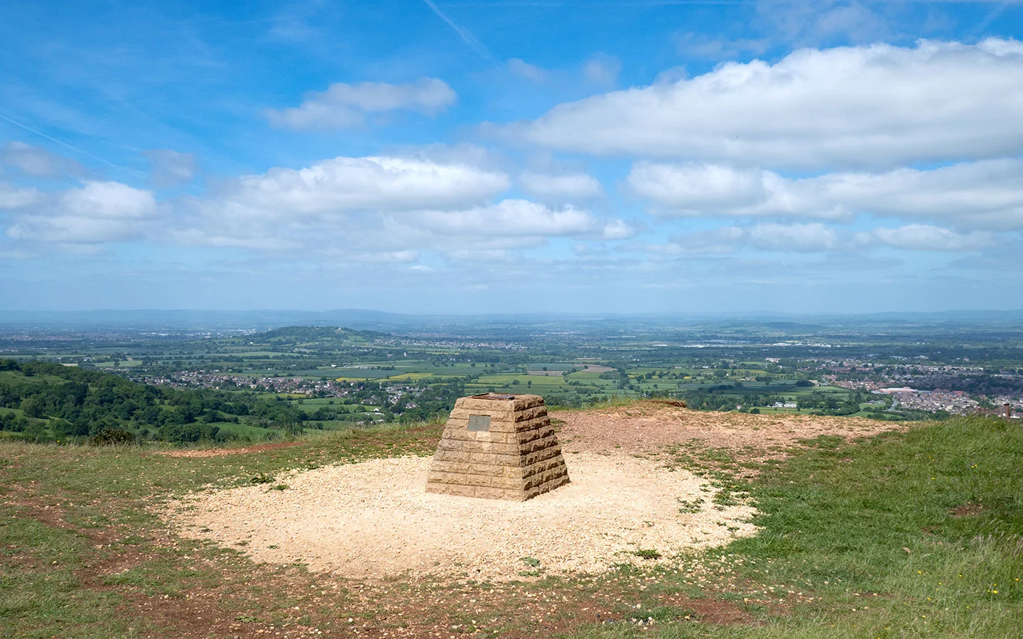
After another climb you join the Cotswold Way, following it to a topograph with views over Cheltenham, the Severn Valley and Malvern Hills. The route carries on along Charlton Kings Common before descending back to Daisybank Road, passing some grand houses on the way.
- Distance: 3 miles/4.8km.
- Time: 1 hour.
- Difficulty: Moderate.
- Start/finish point: Daisybank Road (GL53 9QG), 3 miles from central Cheltenham.
- Access: There are two small car parking areas on Daisybank Road. Or take the Pulhams L bus (every day) from Cheltenham to Leckhampton Hill Foot, a five-minute uphill walk to the start.
- Dogs: Must be kept on a short lead around cattle.
- Map and directions

Crickley Hill (1.7 miles circular)
If you’re looking for a short but scenic walk near Cheltenham, Crickley Hill Country Park is a great option. It was the site of an Iron Age hill fort and a historic battlefield, and over 1300 species of plants and animals are found here, including over half of UK butterfly species.
Today Crickley Hill is jointly managed by the Gloucestershire Wildlife Trust and the National Trust, with plenty of car parking spaces, a café and public toilets. There are a couple of different signposted walking routes – a short family trail (orange) and a longer 1.7-mile route (red).


The walk starts and finishes at the café, and is well marked with wooden posts with red arrows. It begins with panoramic views then heads into the beech and oak woodland of The Scrubbs, which is extra pretty in autumn. After crossing the park’s driveway you go back into the trees, then across a stretch of grassland before a final short but fairly steep climb back up to the start.
- Distance: 1.7 miles/2.7km.
- Time: 45 minutes.
- Difficulty: Easy.
- Start/finish point: Crickley Hill Country Park (GL4 8JY), 5 miles from central Cheltenham.
- Access: There’s a pay and display car park at the top of the hill, but no buses from Cheltenham.
- Dogs: Allowed off-lead in some marked areas and on a short lead in others.
- Map and directions


Cleeve Hill Common (6 miles circular)
At 330 metres, Cleeve Hill Common is the highest point in the Cotswolds, offering stunning views. This conservation area and Site of Special Scientific Interest is another area of limestone grassland where you can spot wildflowers, birds, butterflies and other wildlife as you walk.
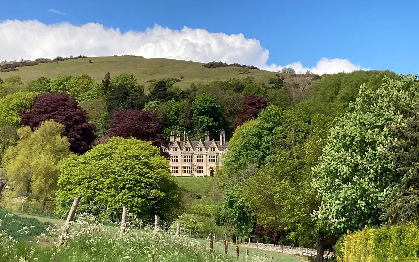
The walk starts at Cleeve Hill Golf Club and follows the Cotswold Way out of the common towards the small hamlet of Postlip, passing 17th-century Postlip Hall. It then winds through quiet woodland, turning off the Cotswold Way towards a group of radio masts, before rejoining the route.
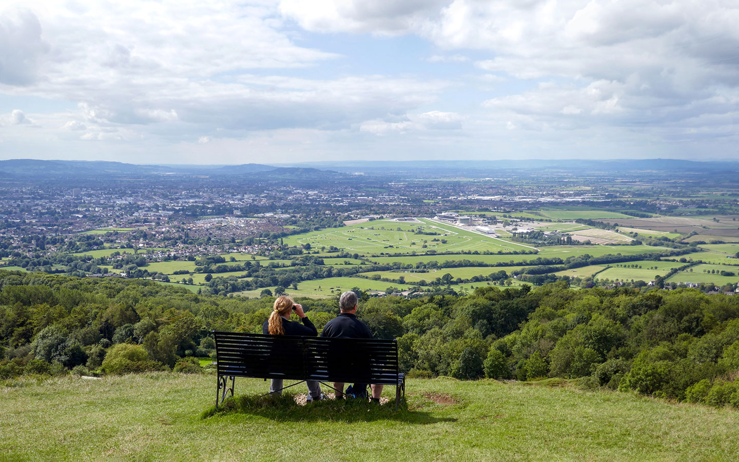

You skirt the edge of the golf course (watch out for stray golf balls) along the escarpment with views down to Cheltenham Racecourse before returning to the starting point. The Golf Club has a café and restaurant, or the nearby Rising Sun pub is a good spot for a drink with a view.
- Distance: 6 miles/9.7km.
- Time: 3.5 hours.
- Difficulty: Moderate, some steep sections.
- Start/finish point: Cleeve Hill Golf Club (GL52 3PW), 5 miles from central Cheltenham.
- Access: Old Quarry pay and display car park next to the Golf Club. Or the Stagecoach W bus (Monday–Saturday) from Cheltenham to the Malvern View care home stop.
- Dogs: Must be kept on a short lead around sheep.
- Map and directions

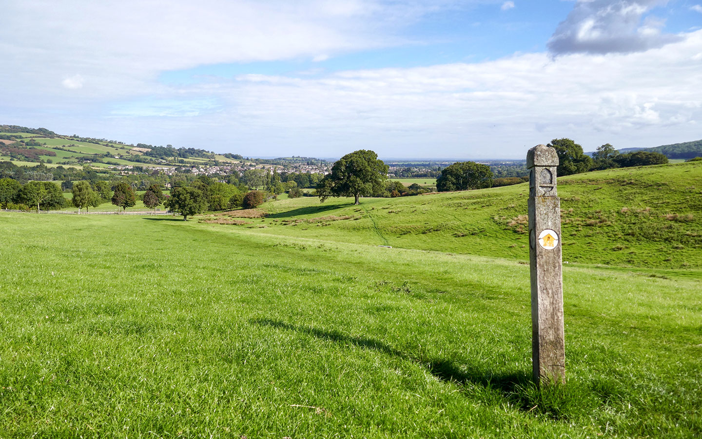
Lineover Woods and Wistley Hill (3.8 miles circular)
This countryside walk near Cheltenham is the perfect weekend walk. It starts and finishes at Dunkertons Park, a farm shop on the edge of Charlton Kings that’s a popular weekend hangout with a selection of food and drink trucks for post-walk refuelling, plus live music and DJ sets.
After crossing the road, you climb steadily uphill on the Cotswold Way along the edge of Lineover Woods. The wood is made up of oak, lime, ash and sycamore trees, as well as the third-largest beech tree in England, dating back 600 years. Keep an eye out for fallow, roe and muntjac deer.


The route flattens out along the top of Ravensgate and Wistley Hills. Then after turning off the Cotswold Way it follows the Cheltenham Circular Footpath before taking a sharp turn to the right. After that path runs downhill though farmland before emerging opposite Dunkertons.
- Distance: 3.8 miles/6.1km.
- Time: 1.5 hours.
- Difficulty: Moderate.
- Start/finish point: Dunkertons Park (GL52 6UT), 3 miles from central Cheltenham.
- Access: Customer car parking at Dunkertons Park. Or the Pulhams 801 bus (every day) from Cheltenham to the Reservoir Inn stop, a few minutes’ walk away.
- Dogs: Must be kept on a short lead around wildlife.
- Map and directions


Cranham, Cooper’s and the Beechwoods (4 miles circular)
This Cotswold Way circular walk takes you from ancient woodland to the top of Cooper’s Hill, the site of one of the Cotswolds’ quirkiest traditions – the cheese rolling. Each May Bank Holiday, daredevil competitors chase a Double Gloucester cheese to the bottom of the hill, trying not to get too injured along the way. But the rest of the year it’s a much more peaceful place!
The walk starts on the edge of the village of Cranham and heads into Buckholt Wood, which is carpeted by bluebells in spring and home to 780 species of fungi. After joining the Cotswold Way, you climb up to the top of Cooper’s Hill for a close-up view of just how steep it is.


The route then runs downhill back into the trees before turning off the Cotswold Way for the final stretch back through Buckholt Wood to Cranham, where The Black Horse pub awaits.
- Distance: 4 miles/6.5km.
- Time: 2.5 hours.
- Difficulty: Easy/moderate, with some steep sections.
- Start/finish point: Cranham (GL4 8HP), 9 miles from central Cheltenham.
- Access: Buckholt Woods car park at the starting point. No buses from Cheltenham.
- Dogs: Must be kept on a short lead around wildlife.
- Map and directions

Cheltenham to Winchcombe (8 miles one way)
This walk from Cheltenham to Winchcombe is one of the Slow Ways routes – part of a plan to map walking routes between all main towns and cities across the UK. It combines part of the Cleeve Hill Common route above and part of the Winchcombe to Belas Knap route below.
The route starts in the centre of Cheltenham and travels north through Pittville and around the edge of the racecourse. After passing Southam, you climb up onto Cleeve Hill. Then after descending towards Postlip, you follow the River Isbourne before picking up the Cotswold Way.


It finishes in the centre of Winchcombe, which has a good choice of cafés and pubs you can visit before heading back to Cheltenham – buses only take 20 minutes but don’t run on Sundays.
- Distance: 8 miles/13km.
- Time: 4.5 hours.
- Difficulty: Moderate.
- Start/finish point: Royal Well Bus Station (GL50 3PD) in central Cheltenham.
- Access: Stagecoach W buses (Monday–Saturday) run from Winchcombe back to Cheltenham.
- Dogs: Must be kept on a short lead around wildlife.
- Map and directions

Winchcombe to Belas Knap (5.1 miles circular)
This route from Winchcombe takes you to one of the Cotswolds’ oldest historic monuments – Neolithic burial mound Belas Knap Long Barrow, which dates from 3000 BC. It’s another of the Cotswold Way circular walks and also gives you great views of Sudeley Castle.
After walking down pretty Vineyard Street, you turn off onto the Cotswold Way route and follow it as it climbs steadily upwards, with Winchcombe stretching out behind you. You then leave the Cotswold Way and walk along quiet country roads before rejoining it near Belas Knap.

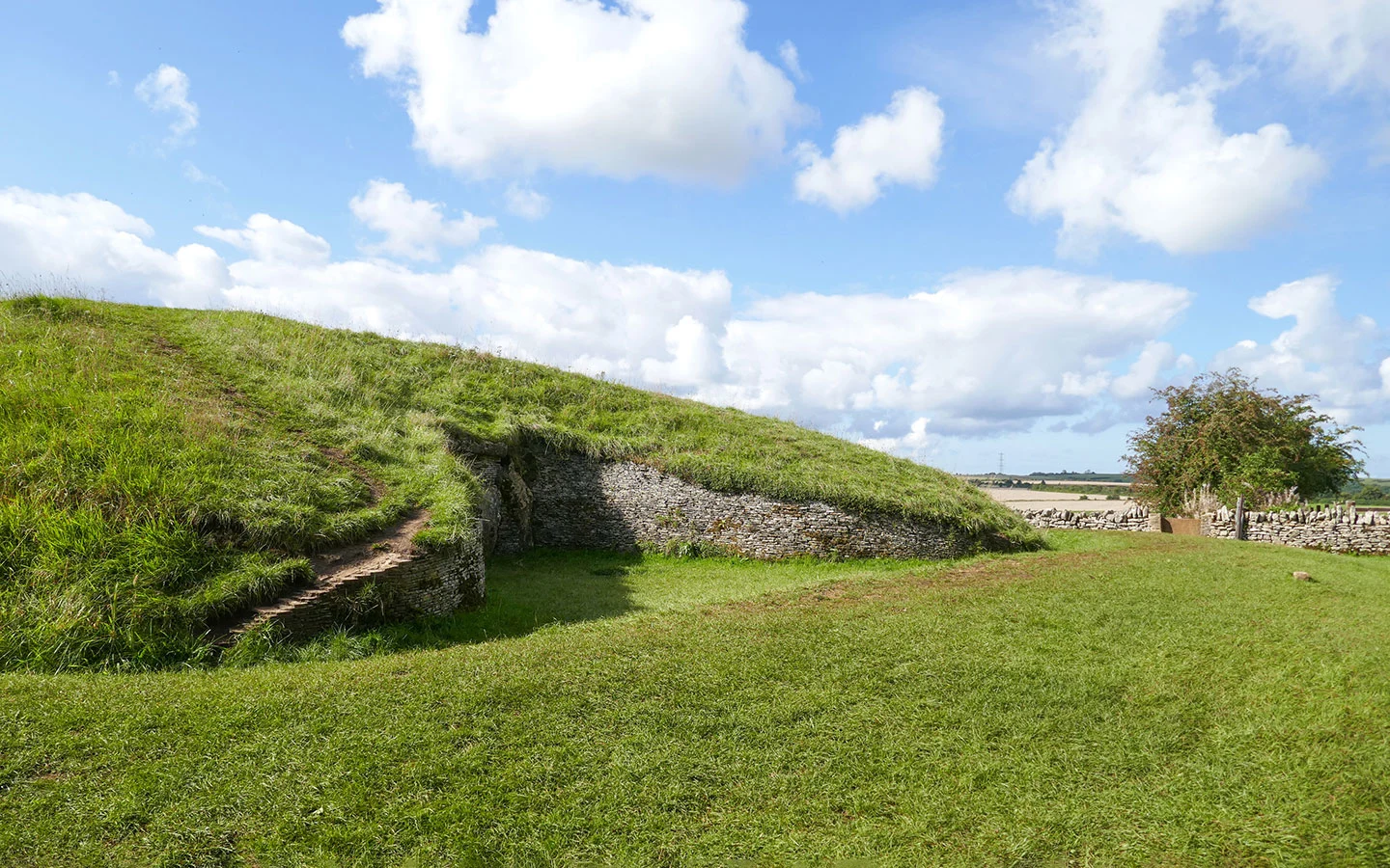
The site was once used for burials, and 31 Bronze Age skeletons were found here when it was excavated in the 19th century. From Belas Knap the walk runs downhill, joining the Winchcombe Way walking route back to town, with views of Sudeley Castle, Winchcombe and beyond.
- Distance: 5.1 miles/8.2km.
- Time: 2–2.5 hours.
- Difficulty: Moderate, some steep sections.
- Start/finish point: Winchcombe war memorial (GL54 5LW), 7 miles from central Cheltenham.
- Access: Paid parking at the Back Lane car park in Winchcombe. Or the Stagecoach W bus (Monday–Saturday) from Cheltenham to the Winchcombe war memorial stop.
- Dogs: Must be kept on a short lead around wildlife.
- Map and directions
Winchcombe and Sudeley Castle (3.7 miles circular)
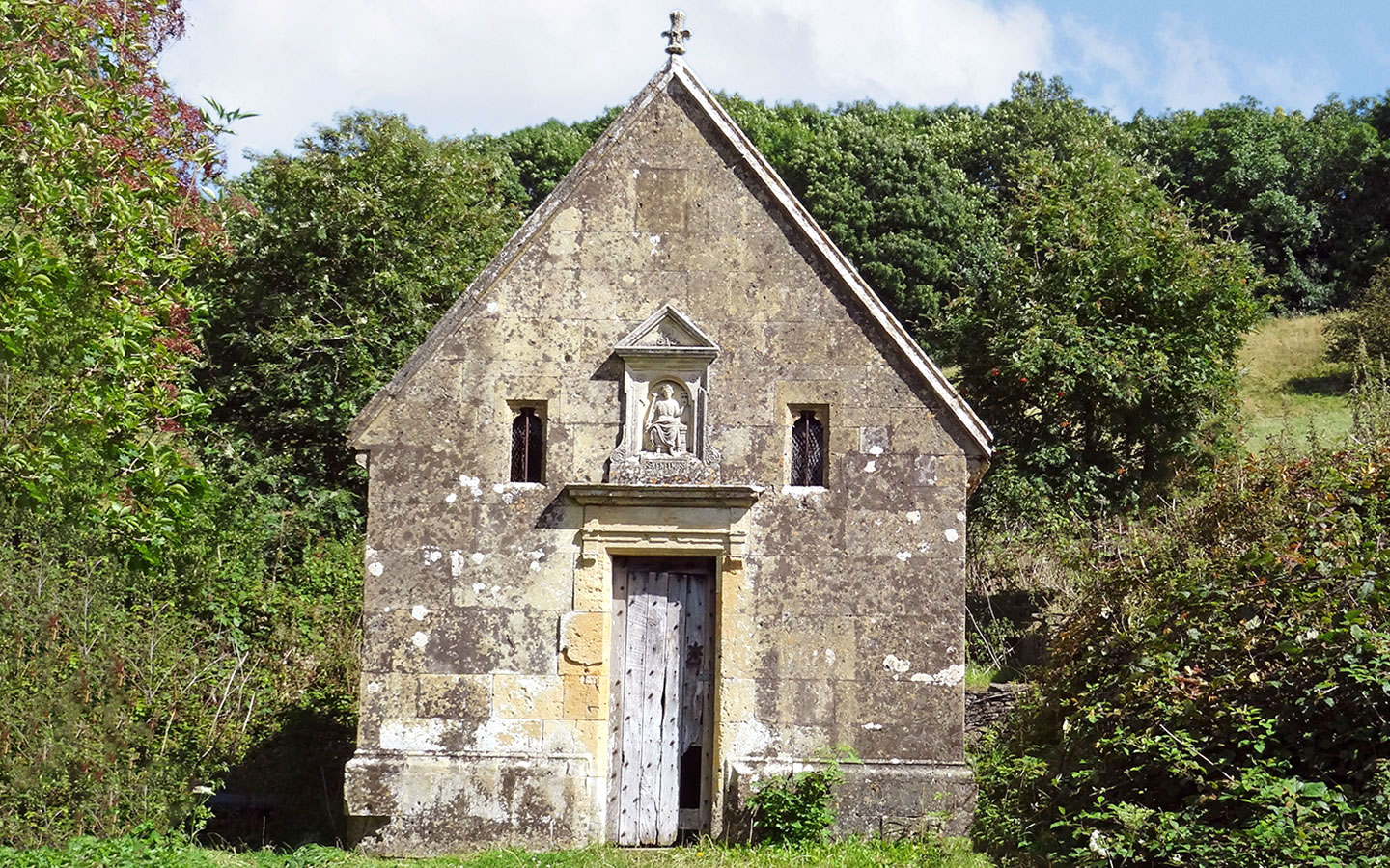
This second walk from Winchcombe is a shorter route, so it’s a good option if you want to visit Sudeley Castle on the same day. This fascinating 15th-century castle and gardens (open March–November) is where Henry VIII’s last wife Katherine Parr lived, died and is buried.
The start of the walk follows Sudeley Castle’s tree-lined driveway, turning off before the entrance. It climbs uphill across fields towards a lesser-known historic landmark – St Kenelm’s Well.


This was an important pilgrimage site in the Middle Ages after legend has it a spring burst from the ground when the body of Mercian king Kenelm stopped here on its way to be buried at Winchcombe Abbey. From the well the route travels across the hills around Winchcombe, following stretches of the Winchcombe Way and Gloucestershire Way on its way back to the town centre.
- Distance: 3.7 miles/5.9km.
- Time: 1 hour 45 minutes.
- Difficulty: Moderate.
- Start/finish point: Winchcombe war memorial (GL54 5LW), 7 miles from central Cheltenham.
- Access: Paid parking at the Back Lane car park in Winchcombe. Or the Stagecoach W bus (Monday–Saturday) from Cheltenham to the Winchcombe war memorial stop.
- Dogs: Must be kept on a short lead around wildlife.
- Map and directions

* This site contains affiliate links, where I get a small commission from purchases at no extra cost to you.
Save for later


You might also like