
Take a walk through Laurie Lee country on this 7.3-mile/11.7km Painswick to Slad walk in the Cotswolds. The route loops through the peaceful countryside that inspired Lee’s 1959 book Cider with Rosie, which tells the story of his childhood in the area at the start of the 20th century.
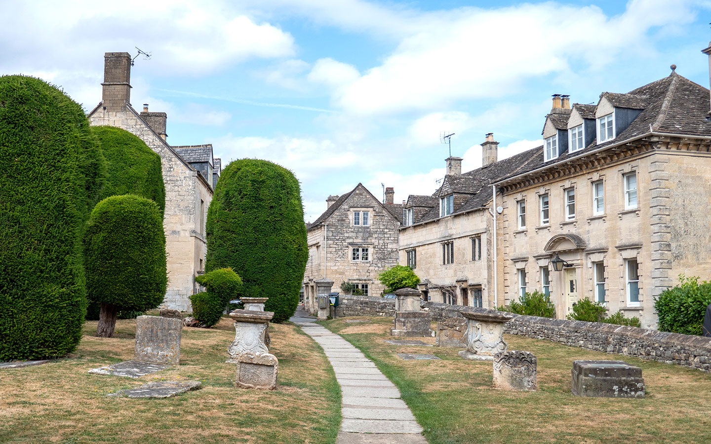
The walk starts in Painswick, a historic wool town known as the ‘Queen of the Cotswolds’ with its church surrounded by 99 sculpted yew trees. It follows Painswick Stream out of the town and heads across fields and through woodland to reach the edge of the village of Slad.

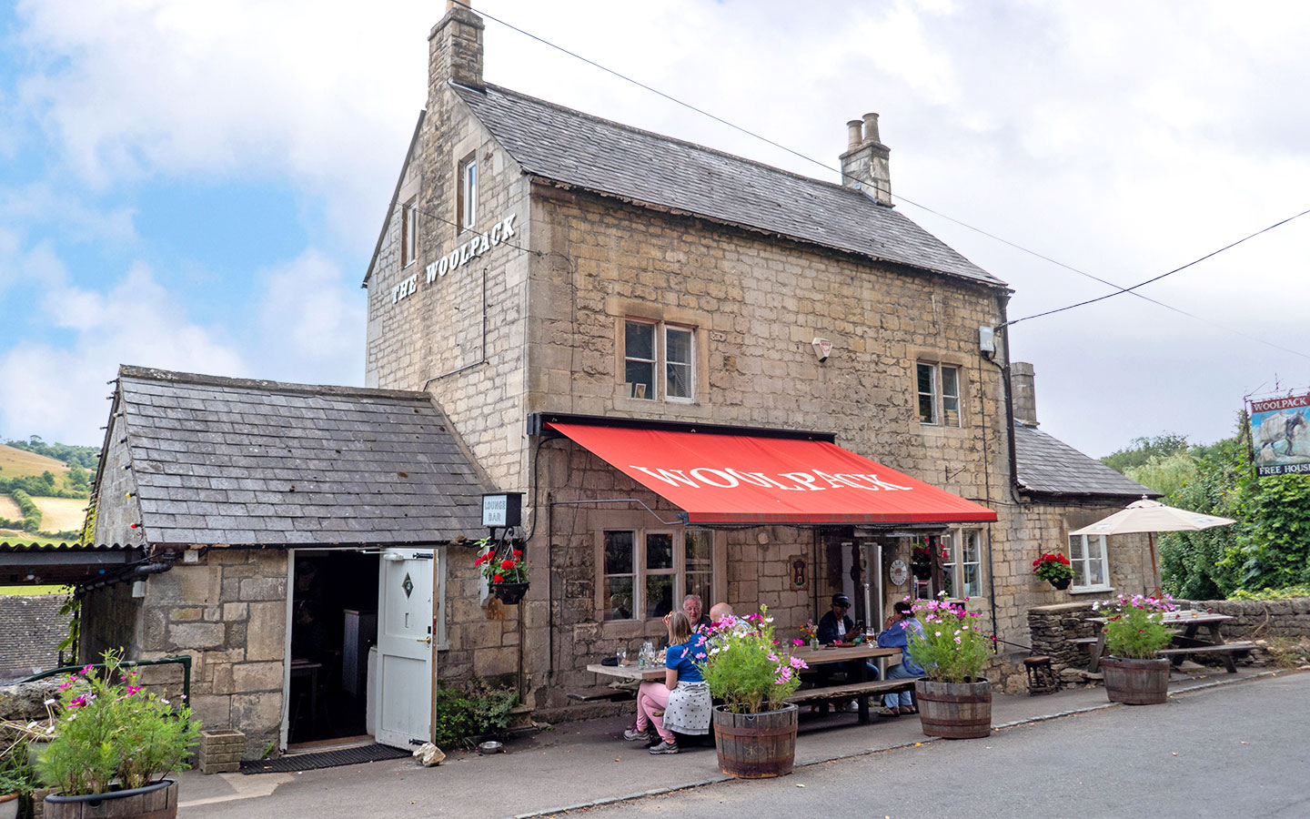
After an optional diversion into Slad to visit the Woolpack Inn, the route heads up the other side of the valley, running along the edge of a nature reserve and through the hamlet of Elcombe before looping back to Slad and on through woodland and meadows on its return to Painswick.
The Painswick to Slad walk is a moderately challenging route with plenty of hills which follows country roads and footpaths, and includes a stretch of the Laurie Lee Wildlife Way.
The route takes around three–four hours to walk, though you can do a diversion though Slad which cuts a couple of kilometres off the total and directly passes the Woolpack Inn, but it does miss out on some of the great views across to the village from the other side of the valley.

Painswick to Slad walk details and map
- Distance: 7.3 miles/11.7km.
- Time: 3–4 hours.
- Elevation: 1476 feet elevation gain.
- Difficulty: Moderate.
- Paths: A mix of small country roads and grass and dirt paths. Some paths run alongside streams so can be muddy if it’s been wet. The route is not all that well-signposted and some footpaths are a bit hidden away so keep an eye on the map and/or directions.
- Accessibility: Several stiles and a stream to cross. Lots of hills, with some steep sections.
- Map: 179 Gloucester, Cheltenham & Stroud*
- Toilets: There are free public toilets in the Stamages Lane car park in Painswick (GL6 6UZ) but no toilets along the route.
- Facilities: There’s a good selection of places to eat and drink in Painswick as well as the Woolpack Inn in Slad, which isn’t directly on the route but is only a short diversion off it.
Disclaimer: While we try to keep information up-to-date and accurate, Explore the Cotswolds cannot accept responsibility for errors or omissions. Walks are undertaken at your own risk, and we are not liable for any personal injury, loss or damage that may occur.
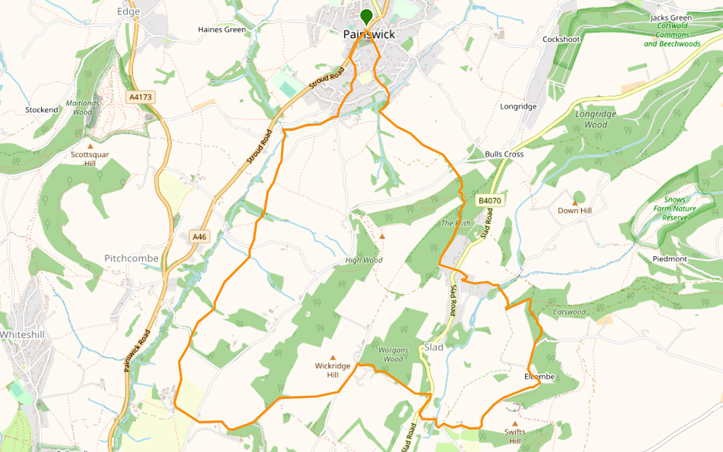

Click on the map above to be taken to Wikiloc, a free app where you can download a map and GPS directions for the Painswick to Slad walk.
Start/finish point
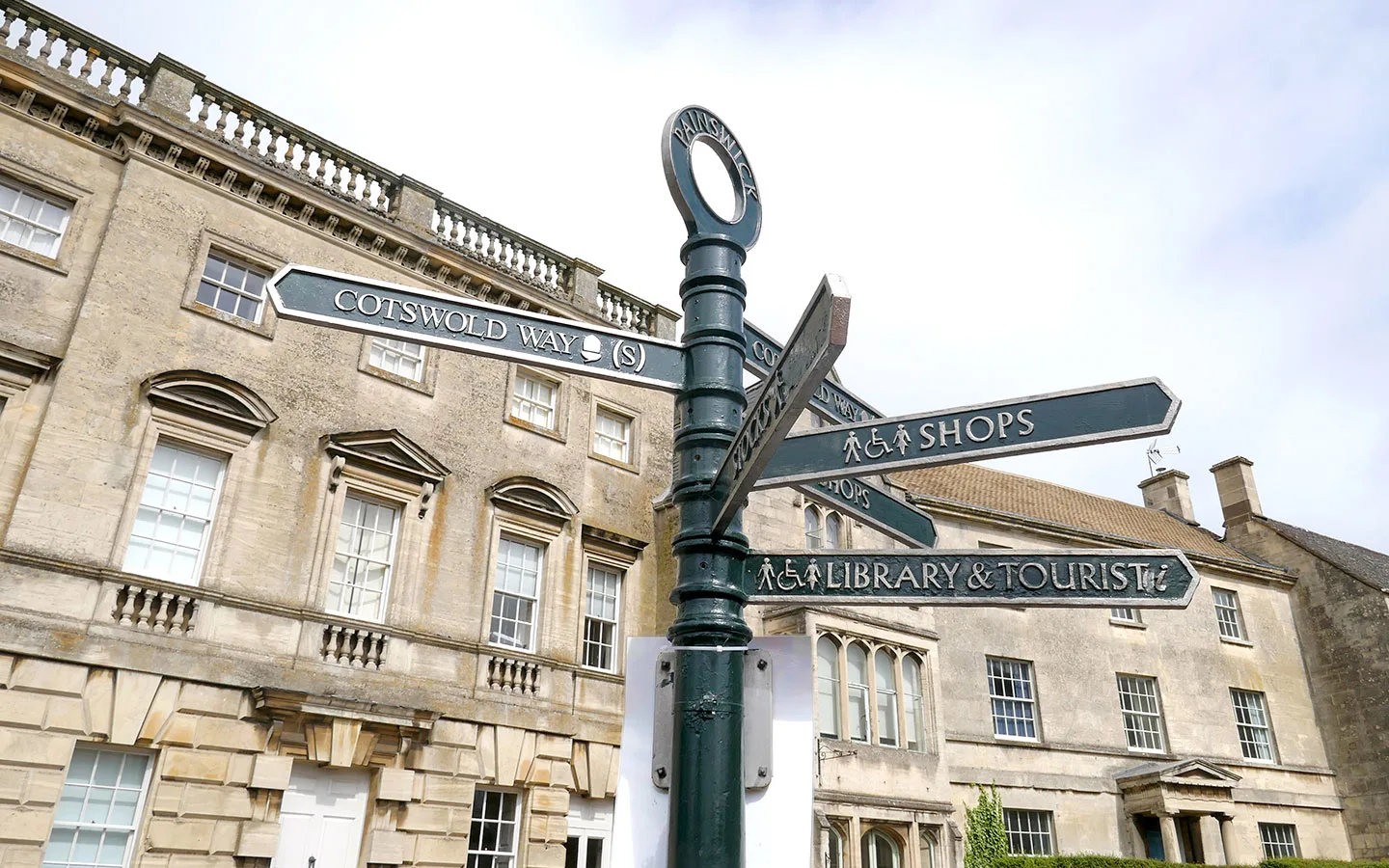
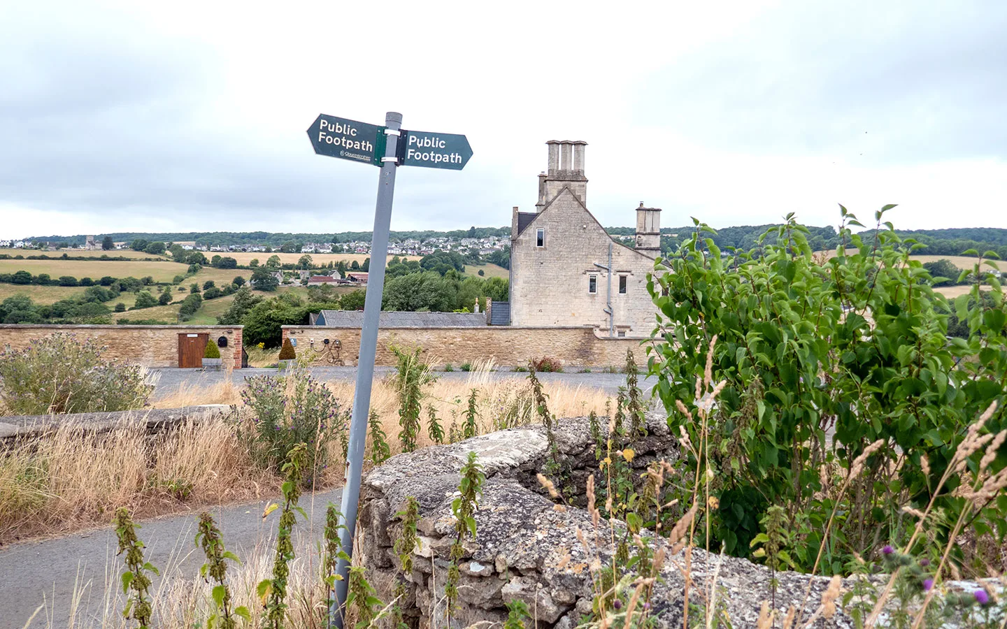
The starting point for the walk is outside St Mary’s Church in Painswick (GL6 6XH), on the corner of New Street and Victoria Street where you’ll see a dark green signpost.
If you’re travelling by car, there is paid parking at the Stamages Lane car park (GL6 6UZ), which is a few minutes further down New Street from the church along the walk route.
If you’re travelling by public transport, the nearest train stations are in Stroud and Cheltenham. Both are connected to Painswick by the Stagecoach number 66 bus, which takes around 10 minutes from Stroud or 40 minutes from Cheltenham, with services running every day.

Painswick to Slad walk route
Stage 1: Painswick to Slad
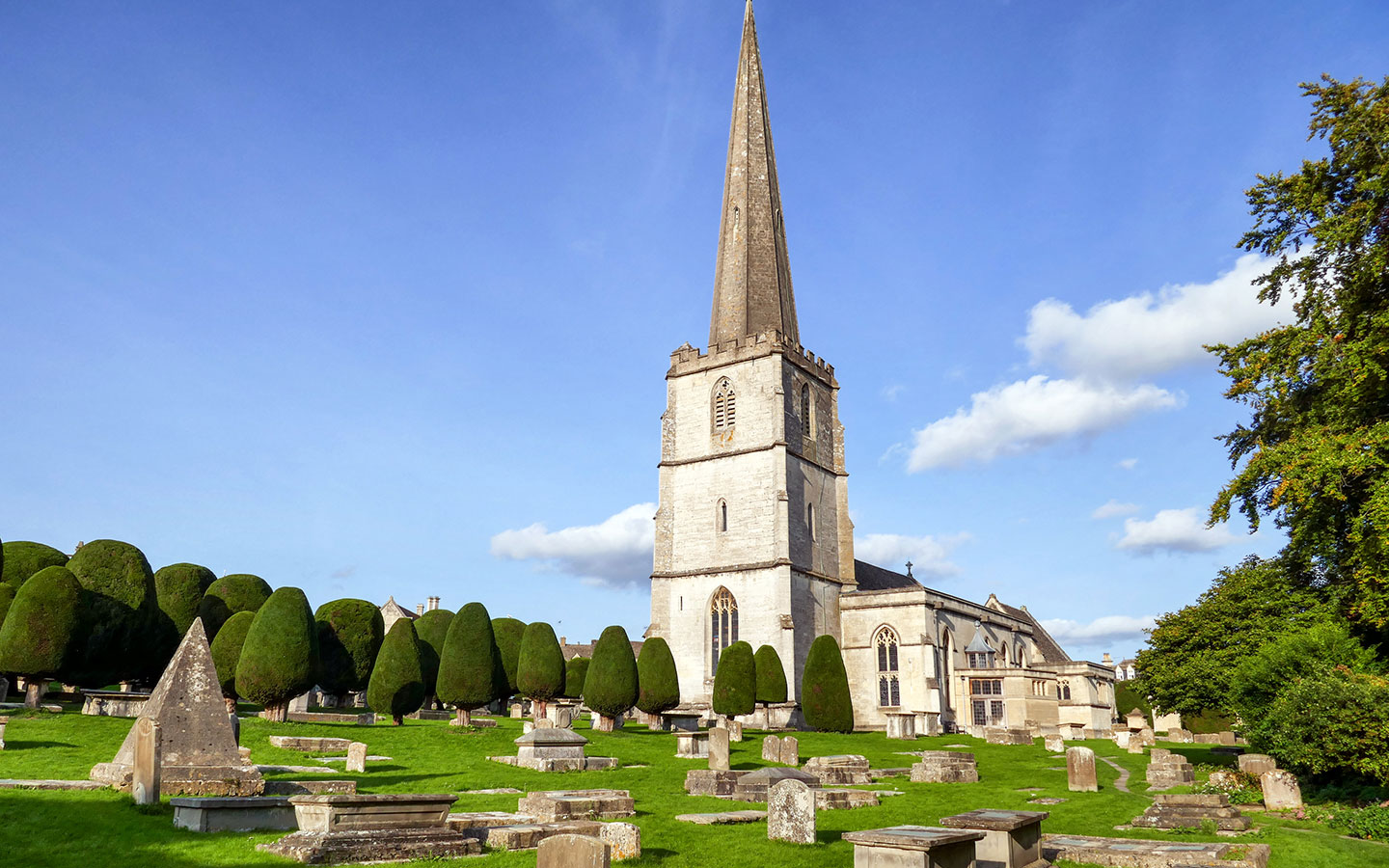
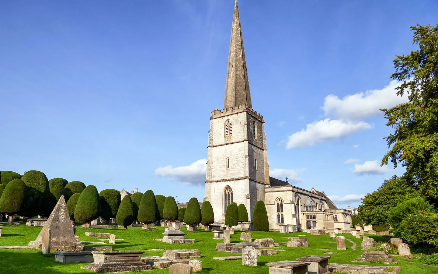
Start your walk outside St Mary’s Church in Painswick. This medieval church is surrounded by two acres of churchyard with 17th- and 18th-century tombs and precisely trimmed yew trees. Legend has it that there are 99 yews, and if a 100th were ever planted then the Devil would destroy it. Though if you try to count them yourself you never seem to get the same number twice!
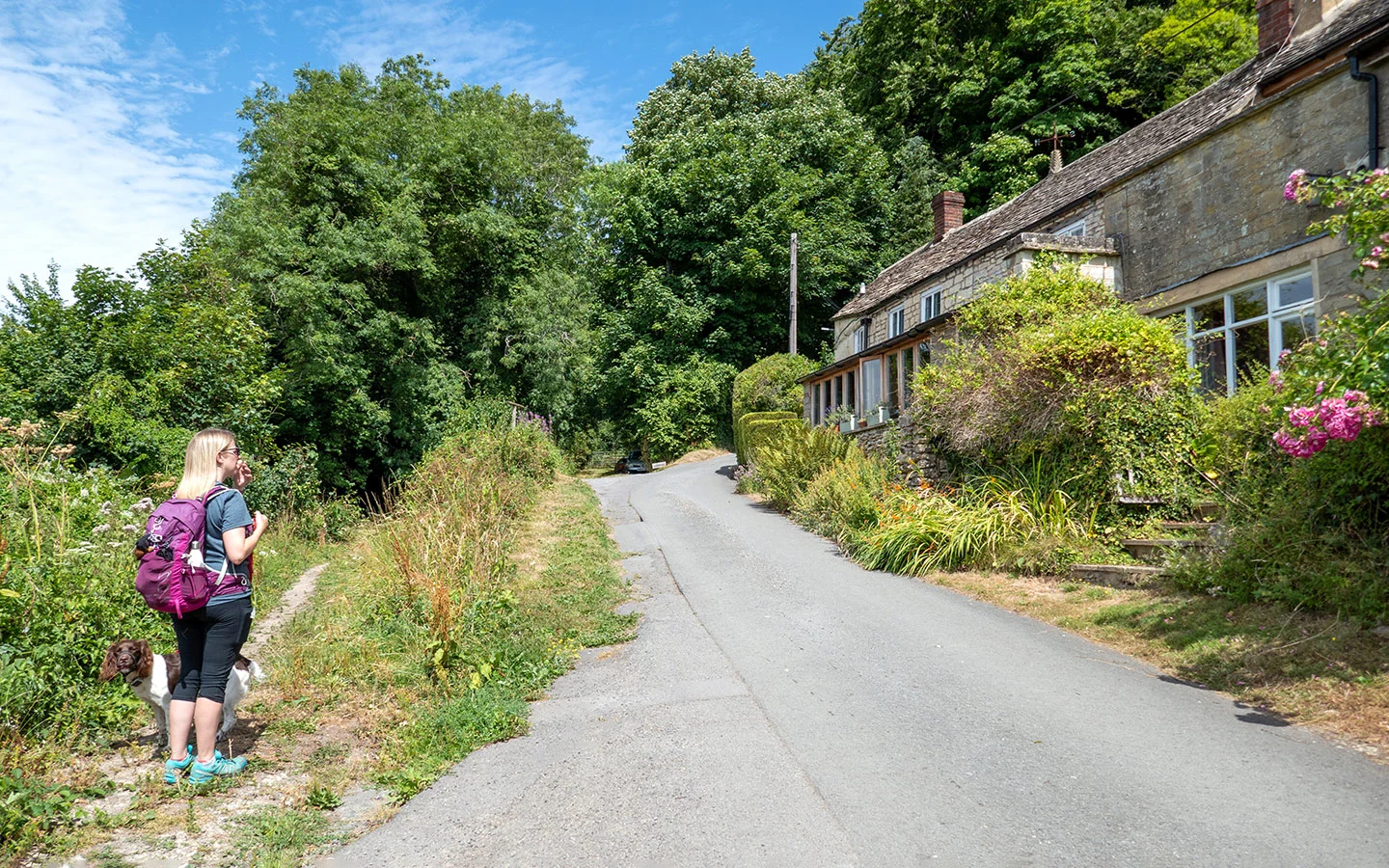
From the church, walk down New Street past the Falcon Inn and the church’s half-timbered lych gate, built in 1901 using timbers from the old belfry. Pass the car park (where you’ll find public toilets) then turn left into Stamages Lane which heads downhill, becoming Stepping Stone Lane.

At the bottom of the hill, just past Stepping Stone Cottage, you’ll see a footpath sign pointing to the right through a narrow gap. Take this path with Painswick Stream to your right, which goes through a kissing gate and across a field to a bridge. Cross the bridge and turn left along an unmade road.
The track heads gradually uphill where it joins a small road. Follow the road to the right, which turns into a gravel track and passes though a gate just after some farm buildings. Walk across the field, which goes steeply downhill at the end and crosses a wooden footbridge.

After the bridge you go over a stile and straight across the field to another stile. Cross over a small road called Pincot Lane, and go straight ahead through the gap between Primrose and Wick Street cottages. Follow the stony path downhill to a gate by a stream and continue straight on through the fields, crossing another stream and passing though several kissing gates.
When the path joins onto a small road, walk along this for around 100 metres then take the path to the right marked with a green public footpath sign. Walk along the edge of the field towards the farm buildings. When you reach Hammonds Farm, turn left and follow the tarmac road.

Go straight on, ignoring the turning to the right by Hammonds Barn. When you get to a crossroads – marked with signs saying ‘Keepers Cottage’ and ‘Hawkwood next left’ – cross over the bigger road and go straight on along a small road which climbs uphill and becomes more of a track.
At the top of the hill, go through metal gate into a field and follow the edge of the field straight ahead until you reach another gate which lead onto the road. Turn left and walk along Folly Lane for 300 metres. Just before you get to a house turn right into the woods, following the public footpath sign.
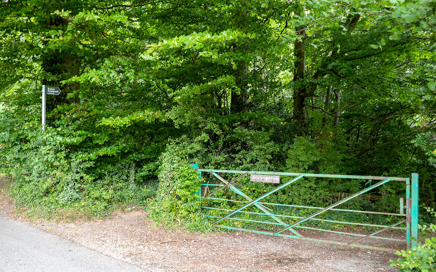

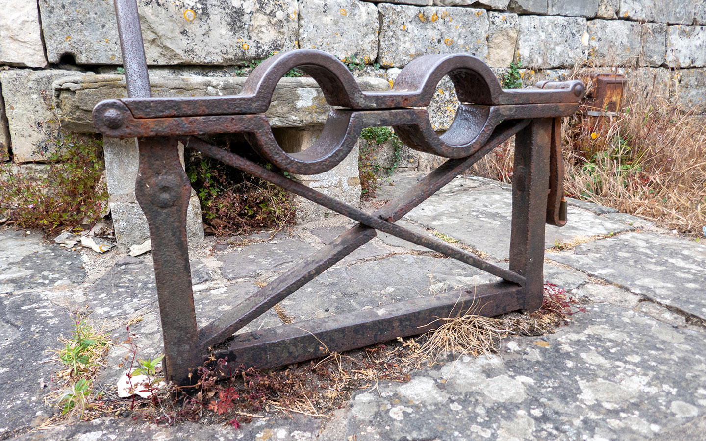
Walk along the edge of the woods (the path can be overgrown) and cross over a stile into a field. Follow the edge of the field downhill through a gate and go along a tree-lined path until you reach some old farm machinery, where there’s a steep path with handrail down to the road.
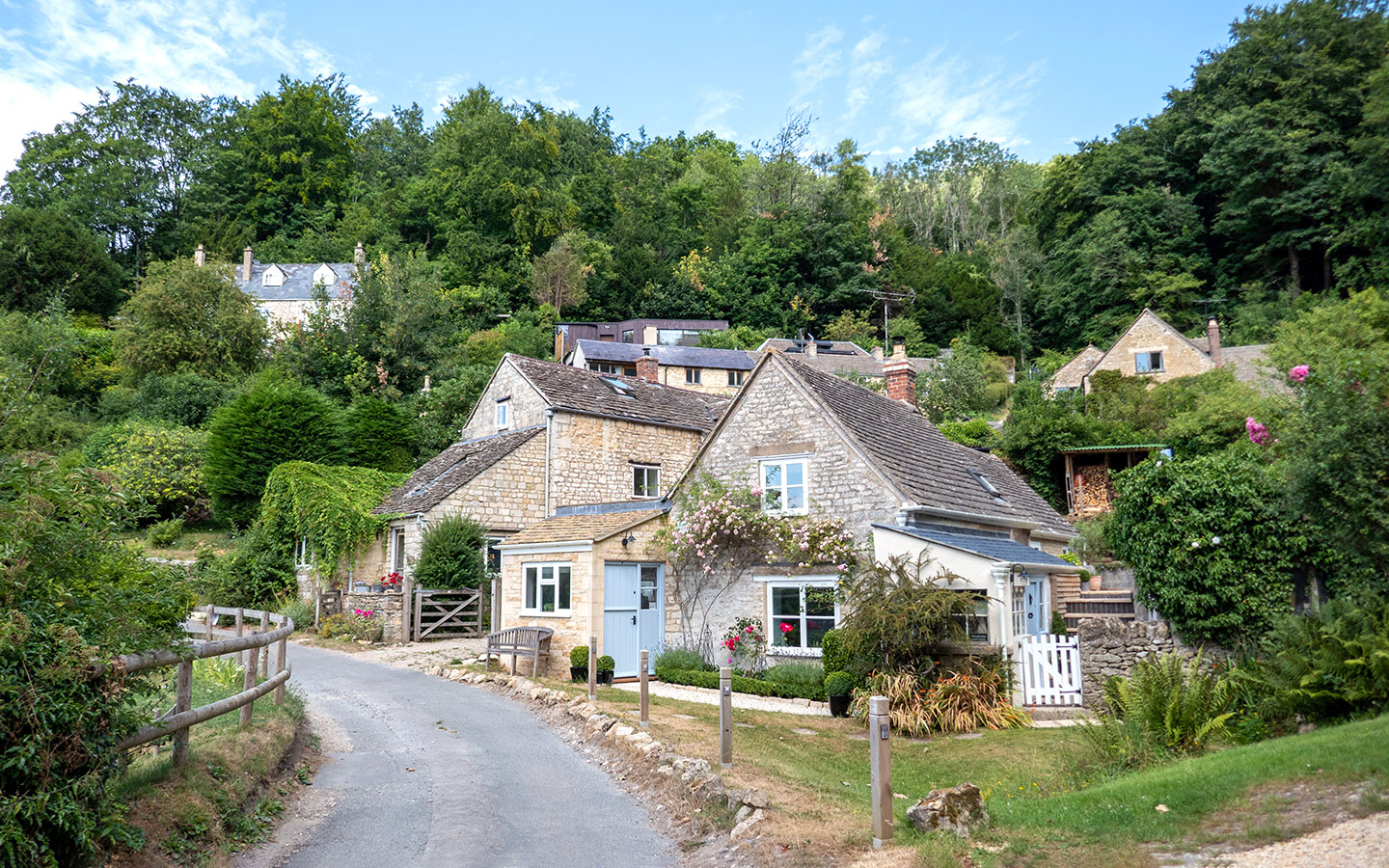
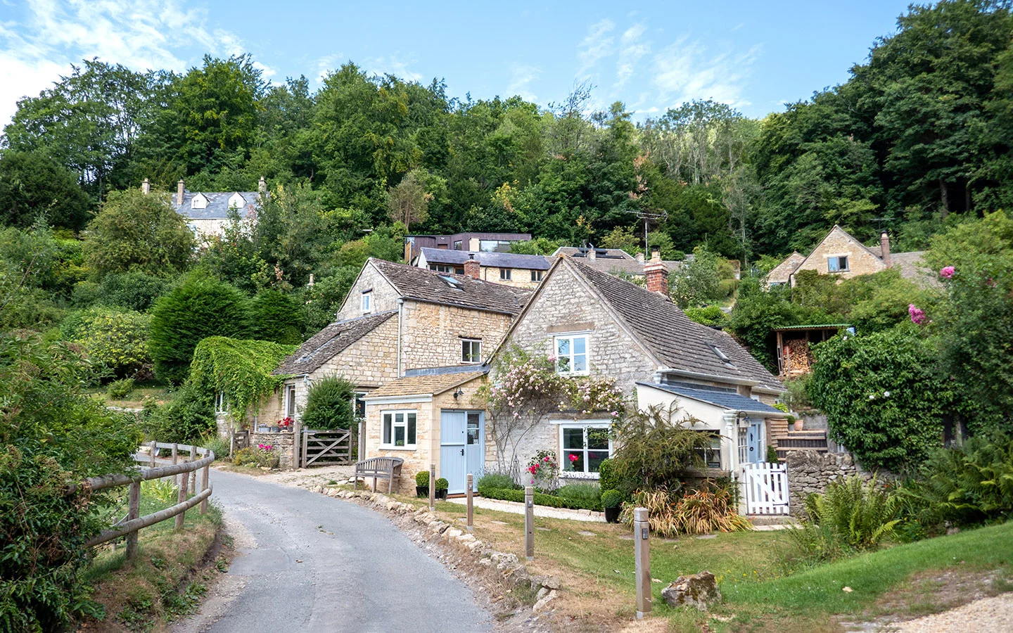
When you join Slad Road, the walking route continues to the right but you can divert to the left if you want to visit Slad village. The Woolpack Inn is around 500 metres up the road, and is a traditional 17th-century pub which serves food and drinks and has a pretty terrace garden. (If you don’t want to visit the pub yet you also get another chance later on in the walk).
Short cut: You can cut a couple of kilometres off the route at this point by walking up Slad Road and through the village, rejoining the route at Slad war memorial (marked below).
Stage 2: Slad Valley
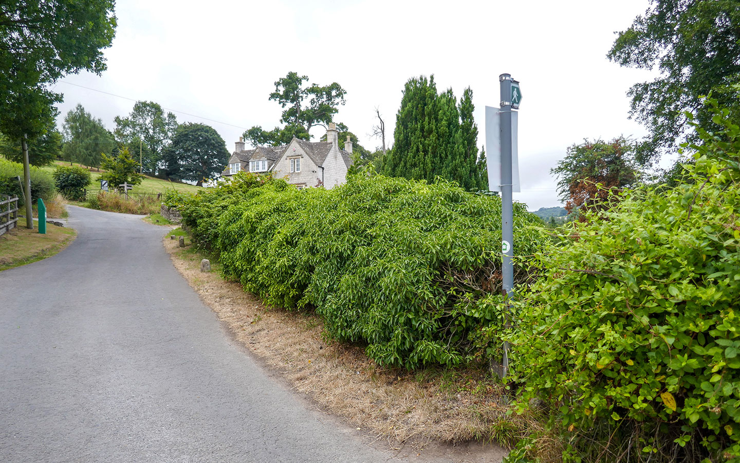
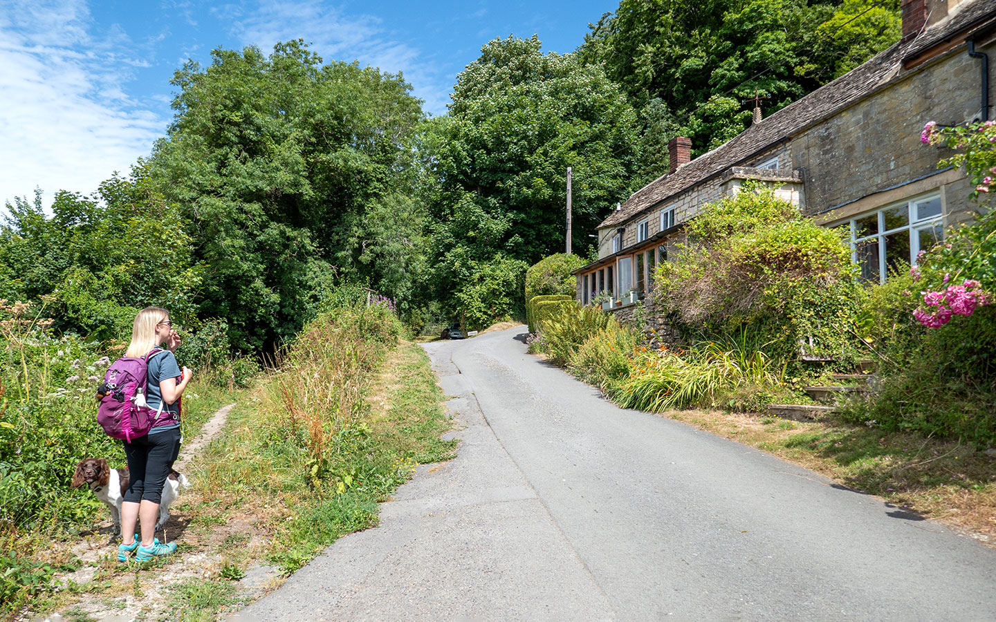
Turn right and follow the road downhill. After around 150 metres, just opposite two large houses on your right, take the public footpath marked to the left, which goes down a narrow track and over a stile. At the bottom of the hill go through a new wooden gate and left onto Slad Lane.
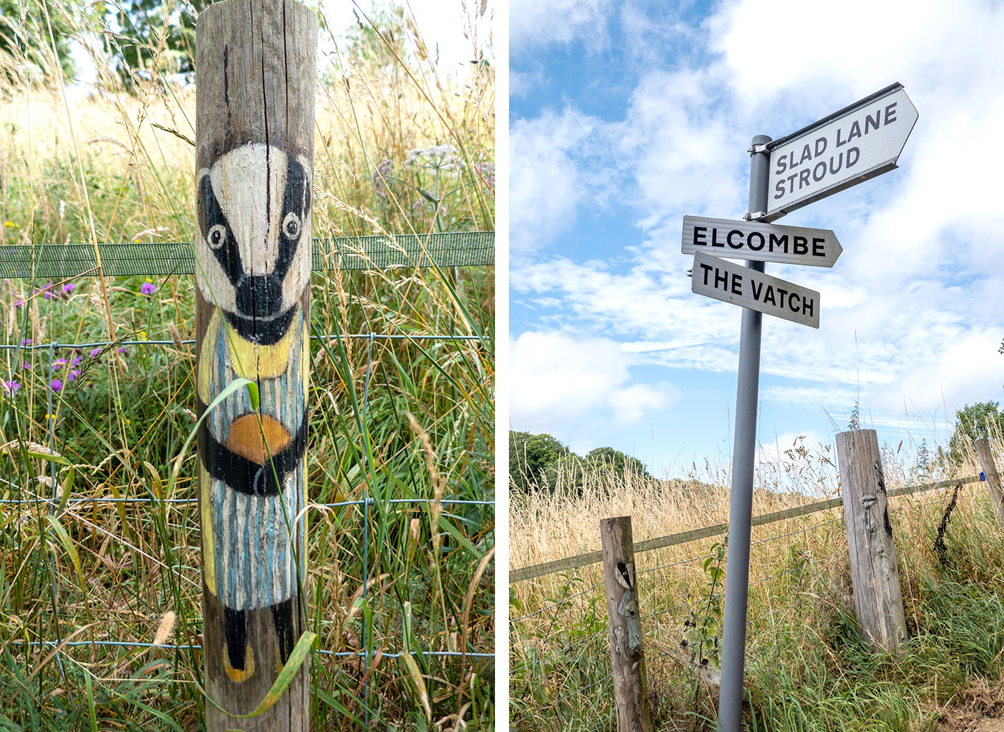
Follow Slad Lane uphill – look out for the wooden posts on the left painted with cartoon badgers. When you reach a signpost saying Slad Lane and Stroud to the right and Elcombe straight on, follow Knapp Lane towards Elcombe (not the private drive to Upper Vatch Mill on the left).

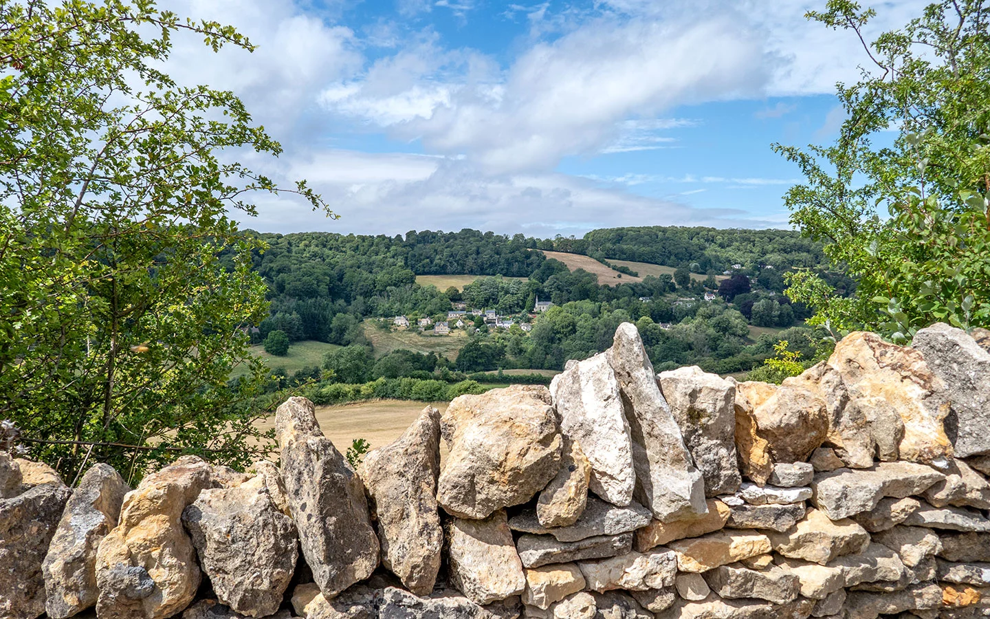
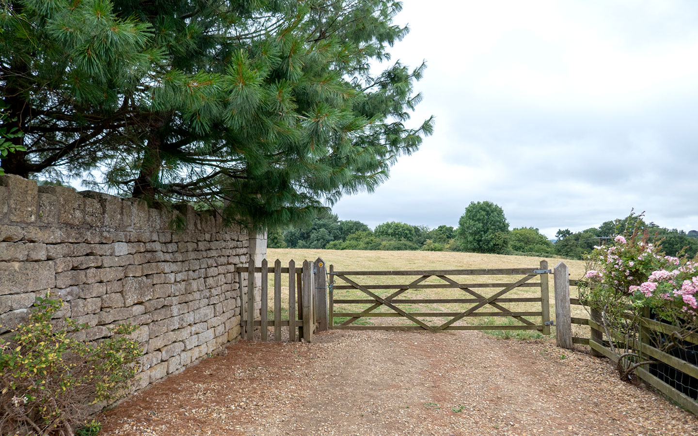
Go through a gate with cattle grid and carry on along the road, which runs along the edge of the Swifts Hill and Laurie Lee Wood Nature Reserve. Swifts Hill is covered in limestone grassland which is home to over 130 species of wildflowers, including some rare orchids. The hill featured in Laurie Lee’s book Cider with Rosie and Laurie Lee Wood was once owned by the Lee family.
Look out over to the left for some great views across the valley to Slad on the other side, with the church and pub clearly visible. Then pass though another gate with a cattle grid and continue along the road as it runs on through the small hillside hamlet of Elcombe.
The road climbs uphill – ignore the signs on the left pointing to Furners Farm and carry straight on up the hill. You’ll pass a couple of cottages on the right. When you reach the second, take the footpath running off to the left rather than carrying on along the road, which takes you into the trees.
Follow the path through the woodland. When it splits, take the left-hand path downhill. The path will then split again into three, where you again follow the left-hand path. After a sharp dog-leg turn to the right, you go down two wide steps and through a gate, heading towards a lake.
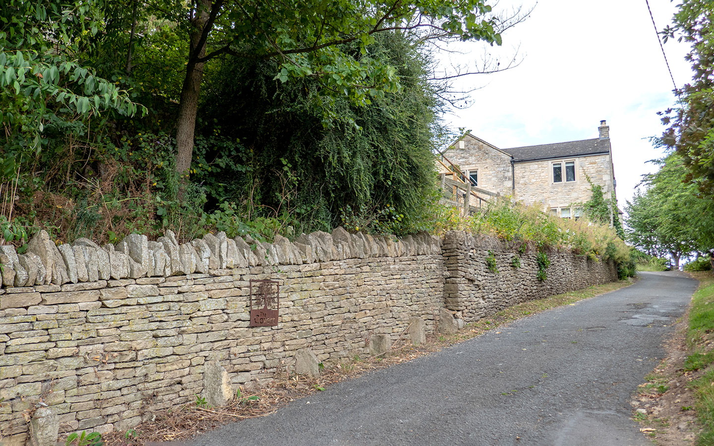
Go across the Slad Brook, pass through a gate and turn left onto the road, following it uphill. When the road curves around to the left after 300 metres, take a sharp right turn in front of a stone wall and a sign for a house named ‘The Covert’ and follow the road as it climbs steeply uphill.
(At this point you can also divert to the left and follow Steanbridge Lane into the village if you want to visit the Woolpack Inn, which is around 500 metres away.)
Carry on uphill until you reach Slad war memorial (the shorter route rejoins the path at this point).

Stage 3: Slad to Painswick
Pass the war memorial and cross over the B4070, carrying straight on uphill. At the top of the hill just after a house called Mayfaire, turn off the road onto a small path to the right marked public bridleway. Follow this through the woods – it splits a couple of times but keep to the left.
When the path merges into another in front of a wooden bench, follow that around to the right. And almost immediately turn left just after a metal gate (with a sign saying ‘Planting land for sale’ on our last visit). Go through the woods, staying right when the path splits then continuing straight on.
The path runs steeply downhill and meets another larger path at the bottom. Cross over this path and continue straight on down a path marked with a blue public bridleway arrow. Continue downhill on this path, which passes through a couple of gates and crosses over a small road.
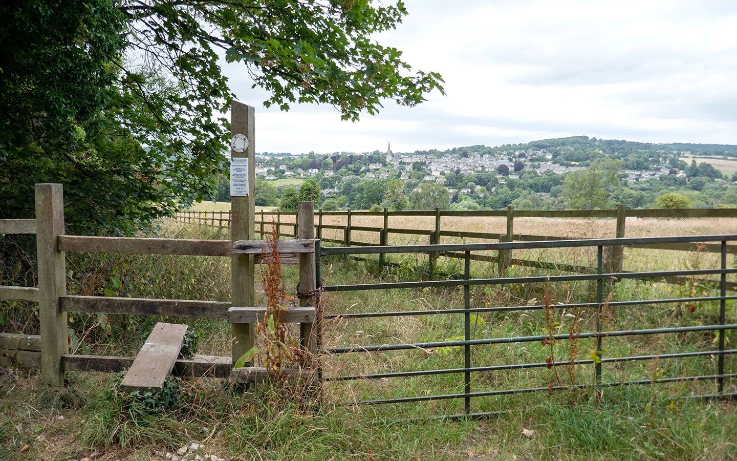
Go over a stile next to a gate and walk along the edge the field with views of Painswick in front of you. You’ll shortly reach another gate which is padlocked – the path isn’t immediately obvious but look around to the left and you’ll see a small metal gate. Go through it (take rucksacks off while you do otherwise you can get stuck!) and follow the narrow overgrown path downhill.

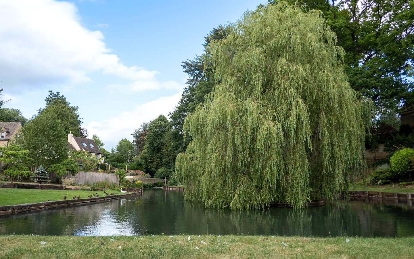
At the bottom of the path it widens out – follow it around to the right and when the path splits after around 50 metres take the small road to the left which runs past houses and a pond with willow tree.
Cross over King’s Mill Lane and take the small footpath straight ahead, which is marked with public footpath sign but can be quite overgrown. This cuts through to Knapp Lane, which you follow uphill where it becomes Kemps Hill (yes yet another hill but this is definitely the last!).

Just in front of Churn Cottage take the footpath with a metal handrail to the left which cuts through to Hale Lane. Follow the lane up towards the church. At the top you can see the stocks from 1840 which were used to punish local townsfolk who got on the wrong side of the law. They’re one of only two sets of ‘spectacle stocks’ in the country, an unusual design which looks like a pair of glasses.
Go through the church gate and across the churchyard and you’ll find yourself back at the starting point. If you fancy a well-earned drink, dog-friendly pub The Oak is only a couple of minutes’ walk away down St Mary’s Street, or the Falcon Inn is opposite the church.

* This site contains affiliate links, where I get a small commission from purchases at no extra cost to you.
Save for later

You might also like


Deborah cooper
Tuesday 24th of March 2026
Hello would love to do this walk would it be possible to send the pdf? Many thanks
Lucy Dodsworth
Friday 27th of March 2026
Hi Deborah, if you add your details in the box at the bottom you can instantly access the PDF.
Julie Mckeown
Friday 29th of August 2025
Please can you send a pdf
Lucy Dodsworth
Friday 29th of August 2025
Hi Julie, if you add your details in the box at the bottom of the post you'll automatically access the PDF. Thanks!
Ashok
Thursday 28th of August 2025
Hi, this looks great. Please could you send me a pdf of the walk? I would be grateful!
Lucy Dodsworth
Friday 29th of August 2025
Hi Ashok, if you add your details in the box at the bottom of the post you'll automatically access the PDF. Thanks!
Anthea Boehmke
Saturday 21st of June 2025
Please could you send me a link to download the walk - thanks
Lucy Dodsworth
Monday 23rd of June 2025
Hi Anthea, if you add your email address in the box at the bottom it will pop up automatically to download – or if you want to send me your email to info@explorethecotswolds I can forward it on to you.
Anne Parmentier
Monday 17th of June 2024
Please can you send me the PDF of this walk Painswick to Slad? Thank you.
Lucy Dodsworth
Tuesday 18th of June 2024
Hi Anne, no problem, I've just sent that across now.