Soak up spectacular views of the Cotswolds from 283 metres up on this 4.4-mile Painswick to Painswick Beacon walk. The beacon was the site of an Iron Age fort dating from the first century BC, and is a Site of Special Scientific Interest due to its rare orchids and other wildflowers.
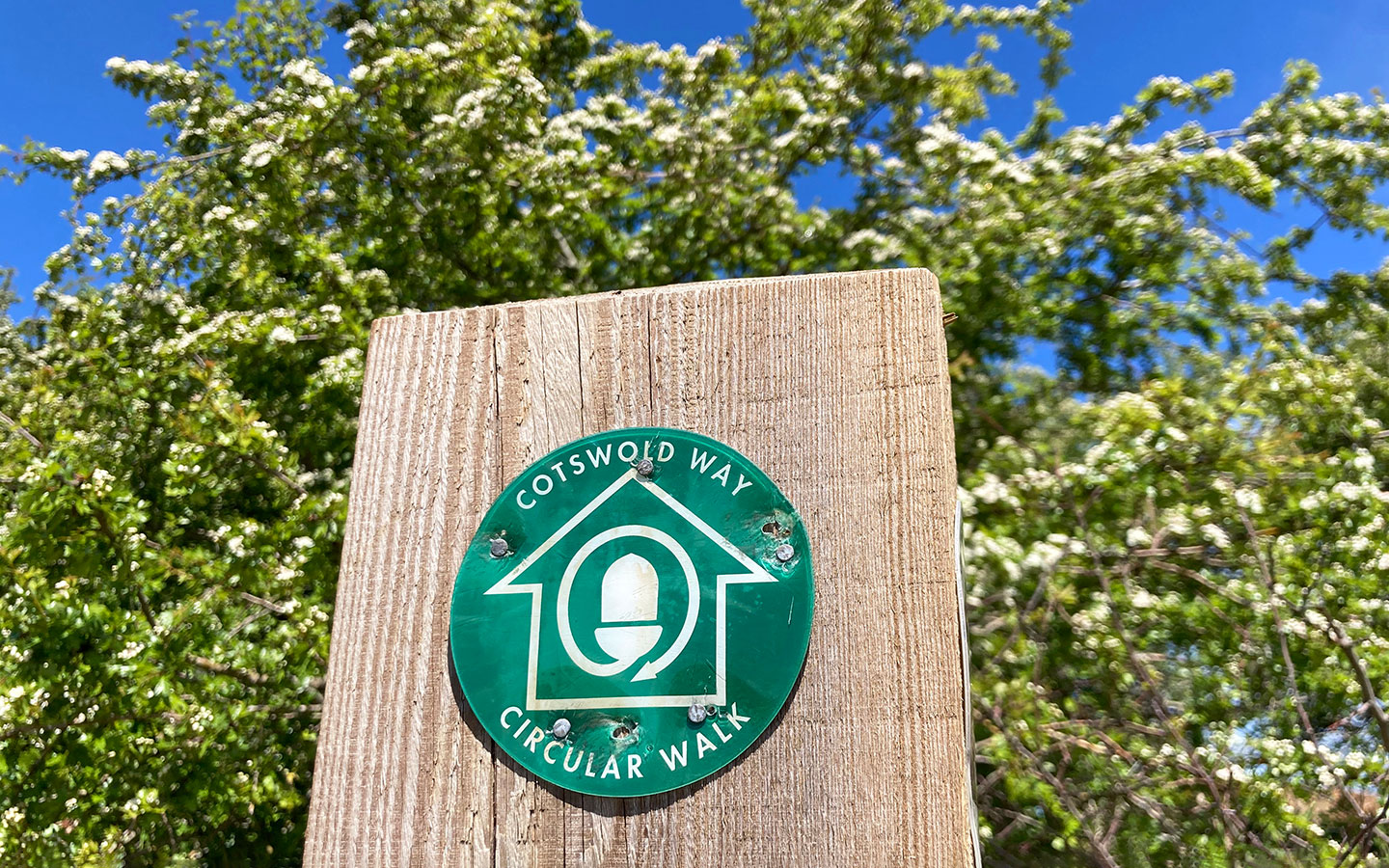
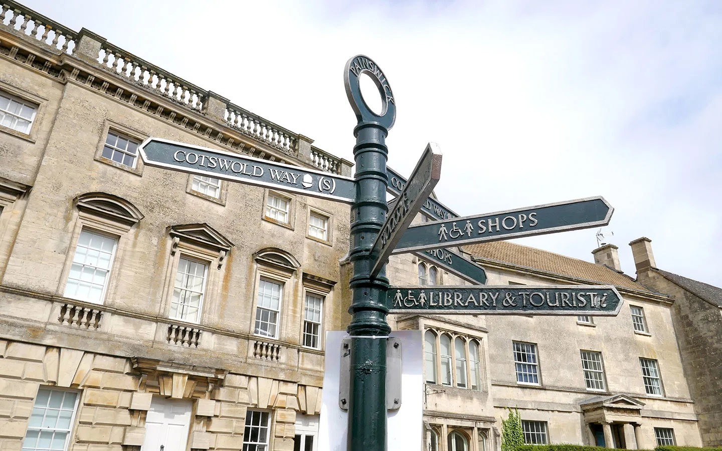
The walk starts outside St Mary’s Church in the pretty village of Painswick and climbs uphill along the route of the famous Cotswold Way – which connects Chipping Campden and Bath over 102 miles. After passing through Painswick Golf Course (keep an eye out for flying golf balls!) it reaches Painswick Beacon, where you can see 360-degree views out over the Cotswold Hills.
From the beacon you head back to Painswick along the Wysis Way, a lesser-known long-distance walking route running for 55 miles from Monmouth to Kemble. The walk follows the Painswick Stream past small hamlets and old mill buildings on its way back into Painswick.
The Painswick to Painswick Beacon walk is moderately difficult, with some steep climbs. The paths are mostly grass and stone, but can be muddy in places in winter. The route takes around 1.5–2 hours to walk, with some good cafés and pubs in Painswick to stop off in afterwards.

Painswick to Painswick Beacon walk details and map
- Distance: 4.4 miles/7.1km.
- Time: 1.5–2 hours.
- Elevation: 666 feet elevation gain.
- Difficulty: Moderate.
- Paths: Mainly grass, dirt and stone paths, including a couple of stretches which can be muddy if it’s been wet, and pavements through Painswick.
- Accessibility: Several stiles and couple of streams to cross. Up and downhill climbs.
- Map: 179 Gloucester, Cheltenham & Stroud*
- Toilets: There are free public toilets in the Stamages Lane car park in Painswick (GL6 6UZ) but no toilets along the route.
- Facilities: There’s a good selection of places to eat and drink in Painswick, including the Painswick Arts Café, Juniper coffee shop, The Oak and The Falcon. The route also passes Painswick Golf Course, whose clubhouse Beacon Bar & Kitchen is open to non-members.
Disclaimer: While we try to keep information up-to-date and accurate, Explore the Cotswolds cannot accept responsibility for errors or omissions. Walks are undertaken at your own risk, and we are not liable for any personal injury, loss or damage that may occur.
Click on the map above to be taken to Wikiloc, a free app where you can download a map and GPS directions for the Painswick to Painswick Beacon walk.
Start/finish point
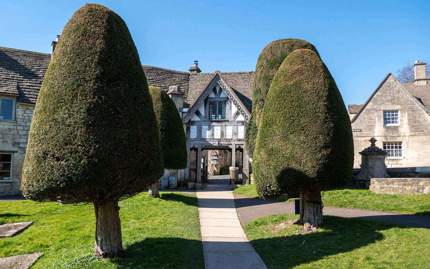
The starting point for the walk is outside St Mary’s Church in Painswick (GL6 6XH), on the corner of New Street and Victoria Street where you’ll see a dark green signpost.
If you’re travelling by car, there is paid parking at the Stamages Lane car park (GL6 6UZ), which is a few minutes further down New Street from the church along the walk route.
If you’re travelling by public transport, the nearest train stations are in Stroud and Cheltenham. Both are connected to Painswick by the Stagecoach number 66 bus, which takes around 10 minutes from Stroud or 40 minutes from Cheltenham, with services running every day.

Painswick to Painswick Beacon walk route
Stage 1: Painswick to Painswick Beacon via the Cotswold Way
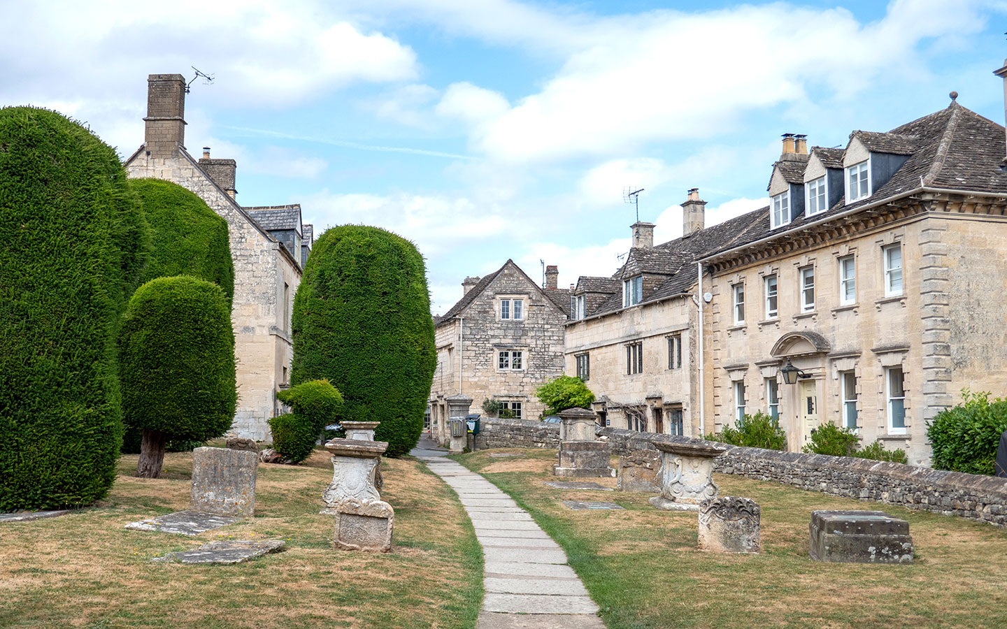
Start your walk outside St Mary’s Church in Painswick. This medieval church is surrounded by two acres of churchyard with 17th- and 18th-century tombs and precisely trimmed yew trees. Legend has it that there are 99 yews, and if a 100th were ever planted then the Devil would destroy it. Though if you try to count them yourself you never seem to get the same number twice!
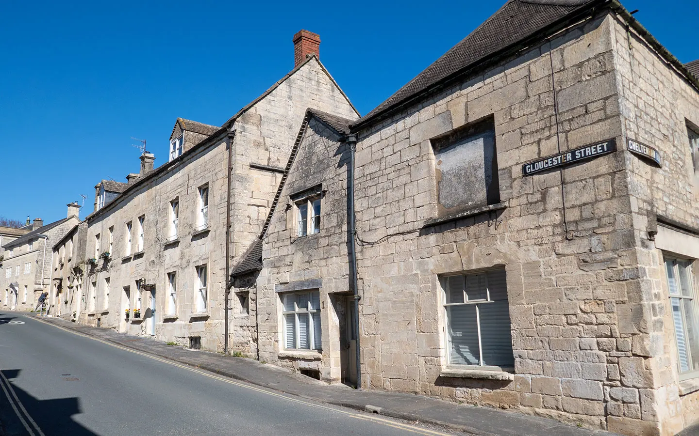
From the church, follow the sign for the ‘Cotswold Way (N)’ which points along New Street. After 150 metres, turn left down Gloucester Street. Follow the road uphill, continuing straight on when you come to a ‘Give Way’ sign and Gloucester Street merges onto Gloucester Road.

Just after passing Gyde Road, turn right down Golf Course Road, marked with a Cotswold Way signpost. The path turns off the road and runs through the ‘Ramblers car park’ before rejoining the road. The Cotswold Way then runs off to the left and the path splits immediately – take the right path (rather than the path uphill on the left) past a sign saying ‘Danger active golf course’.
Follow the Cotswold Way signposts across the golf course, over a small road and then to the left of a stone wall. When the path splits, stay on the right. On your right you’ll see the Painswick Golf Course clubhouse, which has a café that’s open to non-members if you want to stop off.
The path runs through woodland, then emerges next to a quarry. At the end of the quarry driveway you’ll see two signposts. On the left is a wooden sign for the Cotswold Way, and on the right is a metal one for the Wysis Way. Go left, but you’ll need to retrace your steps back here.
Turn off to the right, following the next Cotswold Way signpost. But rather than going straight ahead on the more obvious stony path, take the path on the left which heads uphill along the tree line. Towards the top, climb up the steps cut into the hillside which take you onto a ridge.
These are part of the ramparts built around the Iron Age fort on Painswick Beacon (also known as Kimsbury Hillfort or Castle Godwyn). The fort was occupied from 400–43 BC, and pottery fragments, Roman coins and other archaeological finds have been unearthed here.
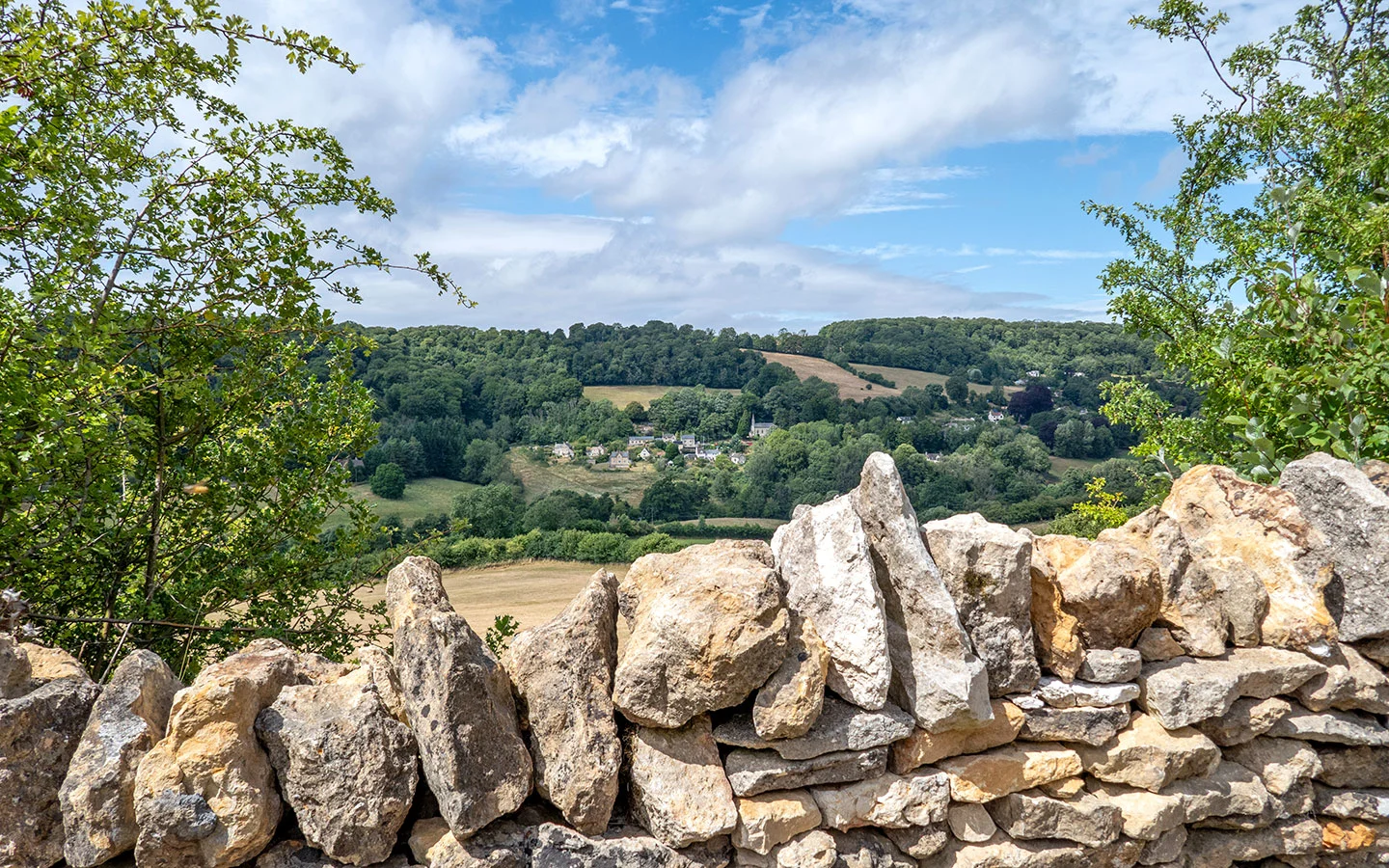
There are panoramic views as far as the Malvern Hills and the Brecon Beacons in Wales on a clear day – with a map on the concrete obelisk to show you what the landmarks are.
Stage 2: Painswick Beacon to Painswick
When you’ve finished soaking up the views, retrace your steps to the junction at the end of the quarry driveway. This time follow the sign saying ‘Public Footpath/Wysis Way’. The path runs downhill where it meets a road – turn left and cross over (beware of traffic).
After 50 metres, take the steps on the right marked with a Wysis Way signpost. Go through the gap in the stone wall ahead and over a stone stile. The path curves to the right then turns sharply to the left across a field. Cross over the stream (which can be muddy in winter) and follow the path as it curves to the right across the next field (which has a boggy patch in the middle).
At the end of the field, go through a gate into woodland. Then almost immediately turn right over a stile (it’s marked with a white arrow but no signpost). Go through another gate, which has a sign saying ‘dogs must be kept on leads’, then follow the path across the field.
Go over the bridge and follow the path to the left, through a gate and across the next field past farm buildings. After crossing over a stile, turn right and follow the stony driveway. At the end of the drive, turn left onto the road then right at the Wysis Way signpost next to Damsell’s Mill.
The path follows the Painswick Stream, and can be muddy in places. When you reach the gate at the end, don’t go left on the Wysis Way. Instead go right across the field, with the Painswick Stream now on your left. At the end of the field go through a gate onto a driveway by a house.
Before the drive turns to the right, go over a stile straight ahead marked with a yellow public footpath sign. Continue straight on, going through a gateway then curving to the right and climbing uphill towards several houses. At the top of the hill, go over a stile onto a small road.
Turn left onto Lower Washwell Lane, which curves around to the right and merges onto Vicarage Street. Go straight on, climbing uphill towards the church spire until you reach a junction.
On the right is the Painswick Centre and the Painswick Arts Café, which is a good place to stop for lunch or for tea and cake. Turn left, passing The Oak pub and Juniper coffee shop on your way into the churchyard. Then go right across the churchyard to reach the starting point.
* This site contains affiliate links, where I get a small commission from purchases at no extra cost to you.
Save for later
You might also like