Explore Oxfordshire’s peaceful Windrush Valley on this 6.2-mile/10km Burford to Swinbrook walk in the Cotswolds. Along the way you can see historic churches with original wall paintings and ornate monuments, the remains of a lost medieval village and stop off at a cosy country pub.
This part of the Cotswolds has links to the Mitford sisters, six sisters who captured the public imagination in the 1930s, including author Nancy Mitford whose book The Pursuit of Love was inspired by her eccentric family. The sisters grew up in Swinbrook and you can see their graves in the churchyard and visit the pub owned by Deborah Mitford until her death in 2014.
The walk starts in Burford, heading down the High Street and over the arched bridge across the River Windrush. It runs through the village of Fulbrook then across farmland on its way into Swinbrook. Then after visiting medieval Widford Church it follows the river back into Burford.
The Burford to Swinbrook walk takes around 2.5–3 hours to complete, plus time for stops. It’s easy to moderate without too many hills, mainly following footpaths and quiet country lanes.

Burford to Swinbrook walk details and map
- Distance: 6.2 miles/10km.
- Time: 2.5–3 hours.
- Elevation: 341 feet elevation gain.
- Difficulty: Easy to moderate.
- Paths: A mix of grass and dirt paths, farm tracks and quiet country roads, with the final stretch along a path on the verge of a fairly busy road.
- Accessibility: Multiple stiles. If there’s been a lot of rain, the River Windrush can flood the path between Widford and Burford so you may need to divert onto the road.
- Map: OL45 The Cotswolds*
- Toilets: There are public toilets in the Guildenford car park near the church in Burford (20p), but none along the walk route.
- Facilities: The Swan Inn in Swinbrook serves food and drinks and is a short diversion off the route, and there are lots of cafés, pubs and restaurants in Burford.
Disclaimer: While we try to keep information up-to-date and accurate, Explore the Cotswolds cannot accept responsibility for errors or omissions. Walks are undertaken at your own risk, and we are not liable for any personal injury, loss or damage that may occur.

Click on the map above to be taken to Wikiloc, a free app where you can download a map and GPS directions for the Burford to Swinbrook walk.
Start/finish point
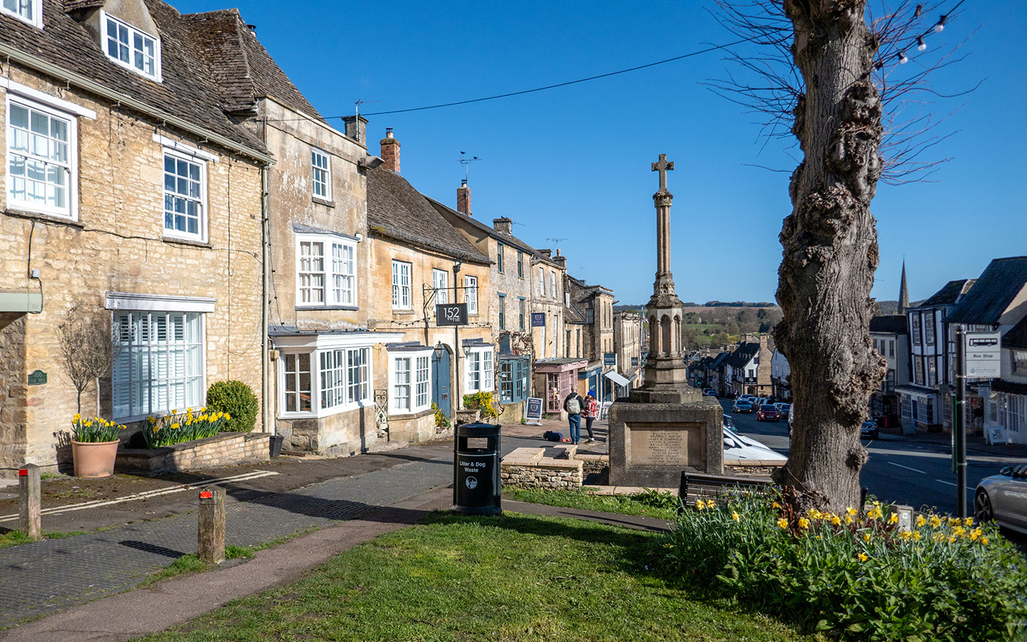
The starting point for the walk is the Burford war memorial on the High Street. If you’re travelling by car, there’s free parking for up to 10 hours at the Guildenford car park (OX18 4SE), but it can get very busy so get there as early as possible. There’s also free on-street parking on the High Street, but this is limited to two hours if you’re on the east side (no limit on the west side).
If you’re travelling by public transport, the Pulhams X52 bus (every day) runs from Oxford (1 hour) and Cheltenham (50 minutes) to Burford. It stops at the Oxford Road Layby, a 10-minute walk from the war memorial. The Stagecoach 233 bus (every day) also connects Burford and Witney.
Burford to Swinbrook walk route
Stage 1: Burford to Swinbrook
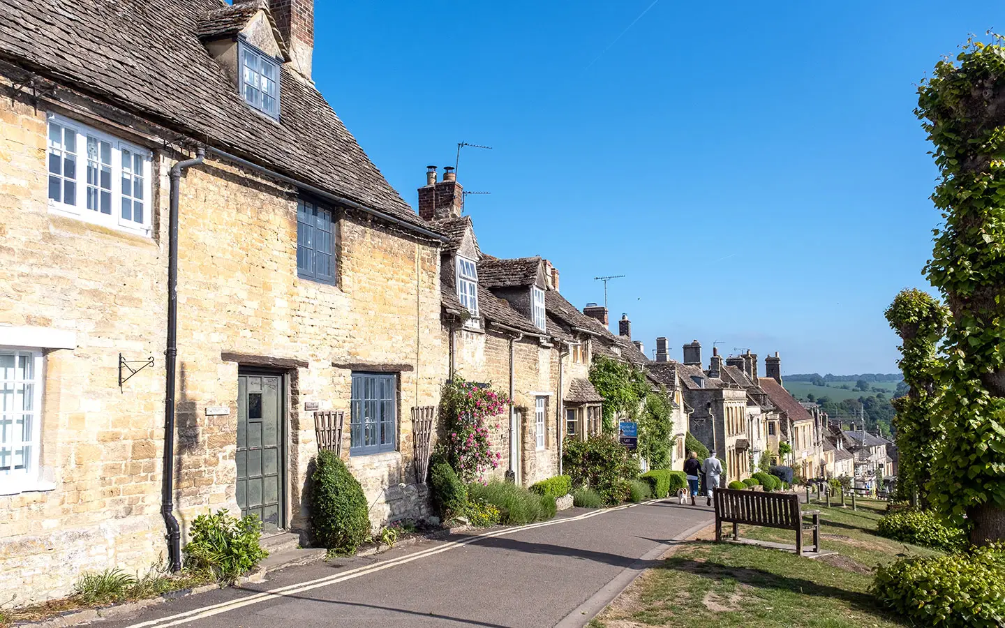
Start your walk next to Burford’s war memorial, and follow the High Street as it runs downhill. Cross over the medieval, four-arched bridge across the River Windrush and carry straight on along the road until you reach a T-junction with signs pointing to Shipton and Banbury.
Cross over the road and walk up the stone steps ahead, marked with a green public footpath sign. At the top of the steps you pass a Second World War pillbox, built to protect the bridge.

Follow the path ahead, crossing over a stone stile from one field to the next. The path runs diagonally across the field then over a (slightly rickety) stile to the right of a stone barn. After crossing another stile you come out onto Westhall Hill road – follow this to the right.
When it joins the larger Burford Road, turn left (there’s no pavement on the left-hand side of the road so you’ll need to cross over). After 150 metres turn left down Garners Lane. Then turn right along Dolphin Lane and left at the end of the road which takes you into the churchyard.

Fulbrook’s Church of St James the Great dates from the 12th century. Outside are some traditional Cotswold bale tombs and a yew tree that’s thought to be over 1000 years old. And inside you can see a Norman font, 17th-century stone memorials and a Green Man carved into the ceiling.
Follow the path around the left-hand side of the church and go over a stone stile next to a bench. The path runs across a field and through a gap into the next field, then crosses a stile where it joins onto a small road. Go right and then turn left at the junction onto Shipton Road.

Cross over almost straight away and follow the public footpath sign along a path through a kissing gate then up some shallow steps. Continue along on this path as it winds its way across crop fields and through a gap in the hedge, until you reach a group of trees at Widley Copse.
Go through a gap in the stone wall ahead and follow the path through the trees until it joins onto a larger stone track. Go right and carry straight on along this track. Once the road curves to the right past Paynes Farm it becomes a more well-made road called Kingswood Lane.

When the lane turns sharply to the left, turn off to the right following a stony path uphill which is marked with a restricted byway sign. Go through the gate at the top and then turn left, following the path along the edge of the stone wall rather than the more obvious path ahead.
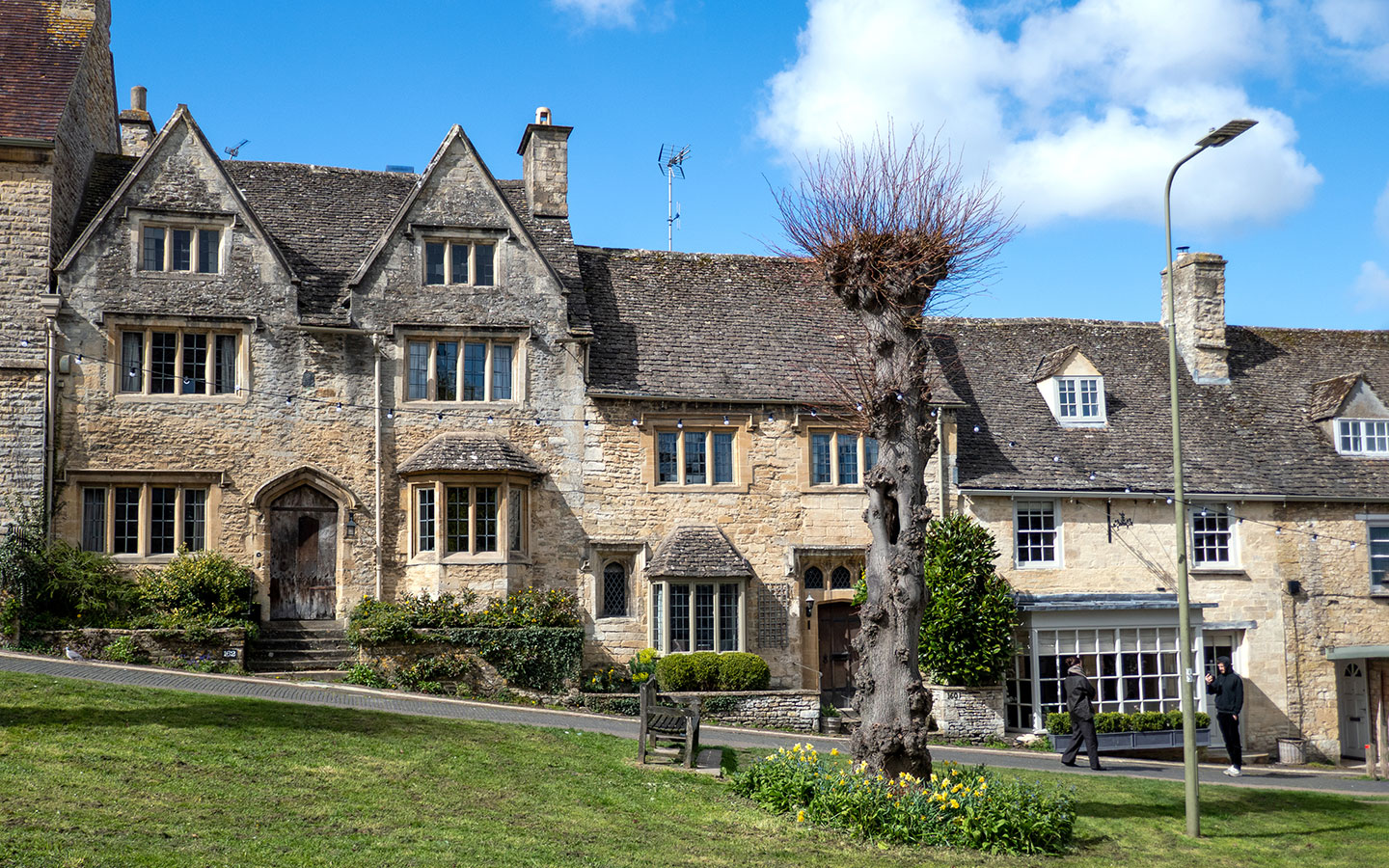
At the end of the field the path goes through a gate, across a small bridge then through another gate onto the road. Turn right and follow the road into Swinbrook. Look out for a house called The Forge on your right which has a poetry board outside and the village stocks to your left.

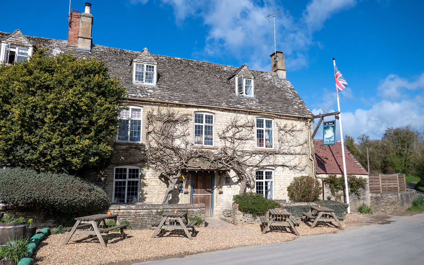
Once you reach the steps to Swinbrook church, you can do a short diversion (400 metres each way) to the Swan Inn. The pub was owned by Deborah Mitford, the Duchess of Devonshire, youngest and last surviving Mitford sister, and has Mitford photos and memorabilia on display.
To reach the pub, carry on along the road past the village green and take the road on the right (it’s narrow with no verge so watch out for cars). After the road curves to the right you’ll see the Swan Inn. Then afterwards retrace your steps to the steps leading up to the churchyard.
Stage 2: Swinbrook to Burford
Walk up the steps into the churchyard and follow the path around to the left of the church. St Mary’s Church has some unusual monuments inside to local landowners the Fettiplace family, with two carved stone memorials showing three of them stacked on top of each other.
There’s also a plaque dedicated to Tom Mitford, brother of the Mitford sisters who died in WWII, on the church wall. And you can see the graves of Nancy, Unity and Diana Mitford in a row in the graveyard behind the church – their parents and sister Pamela are buried here too.

Follow the path through the churchyard then through a gate marked ‘St Oswald’s Widford’. The path runs between two stone walls then through a gate and across fields. You’ll see signs for the Palladian Way, a 125-mile architecture-inspired walking route between Buckingham and Bath.
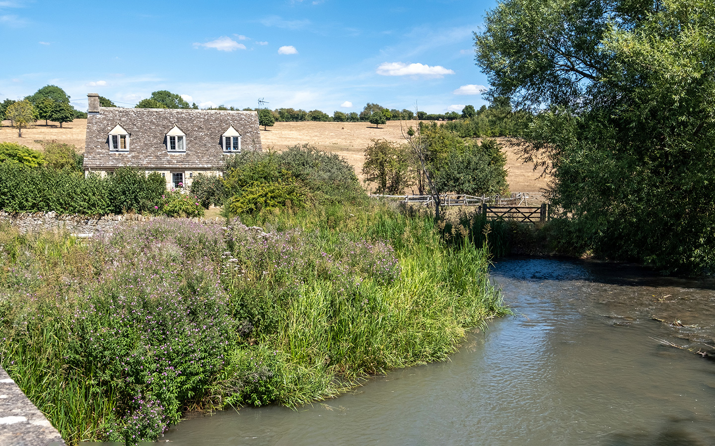
You can see tiny St Olwald’s Church ahead of you. The church was built on the site of a Roman bathhouse in the 11th century. It was originally part of the medieval village of Widford, but the rest of the village has long since disappeared, so it’s now just surrounded by fields.
After the path crosses a cattle grid, you can go right to take a look inside the church. There are fragments of medieval wall paintings as well as wooden box pews from the 18th century.

Back on the track, follow it straight ahead, through a gate and onto the road. Turn left, then walk along the road until you reach a junction where you turn right. Follow the road for about 150 metres then turn off onto the footpath on the right, just before the national speed limits signs.
Note: This stretch of path runs along the River Windrush floodplain so can get flooded (or very muddy) if there’s been lots of rain. If it’s impassible you can carry on along the road instead.

Follow the path along the edge of the River Windrush. After crossing over a small bridge, the path curves left and goes over a stile onto Witney Road. Turn right and follow the road into Burford. This road can be pretty busy with traffic, but there is a pathway along the verge.
Once you get into Burford you pass The Royal Oak and The Angel pubs if you want to stop off for a drink. Otherwise continue on to the end of the road where you come to a junction with the High Street. Turn left and follow the road uphill for 100 metres back to the war memorial.

* This site contains affiliate links, where I get a small commission from purchases at no extra cost to you.
Save for later

You might also like