
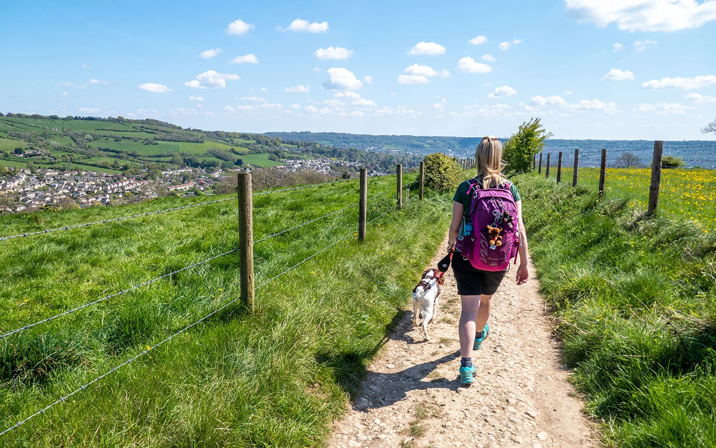
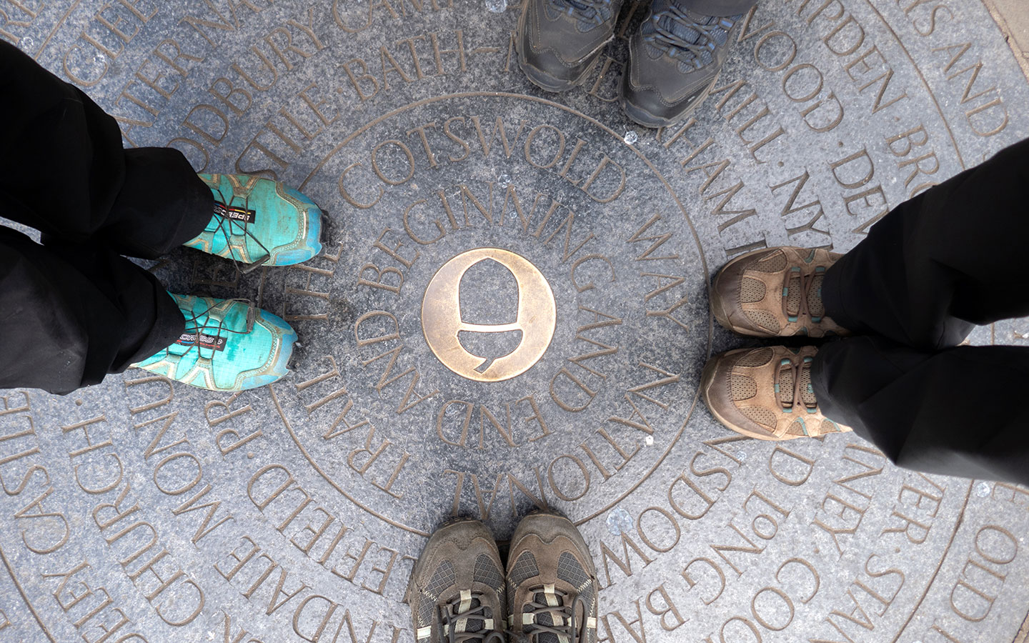
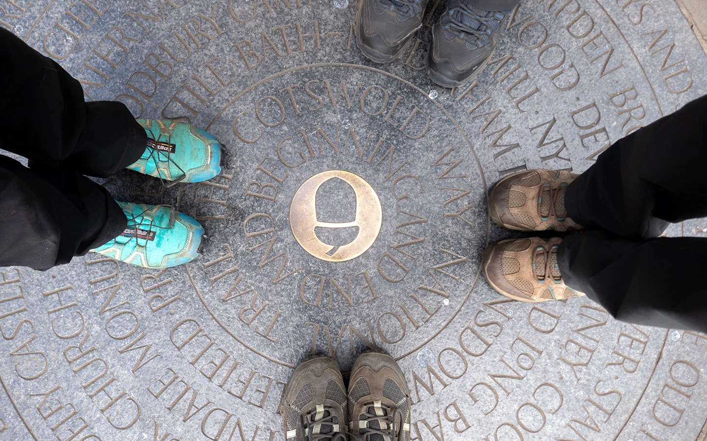
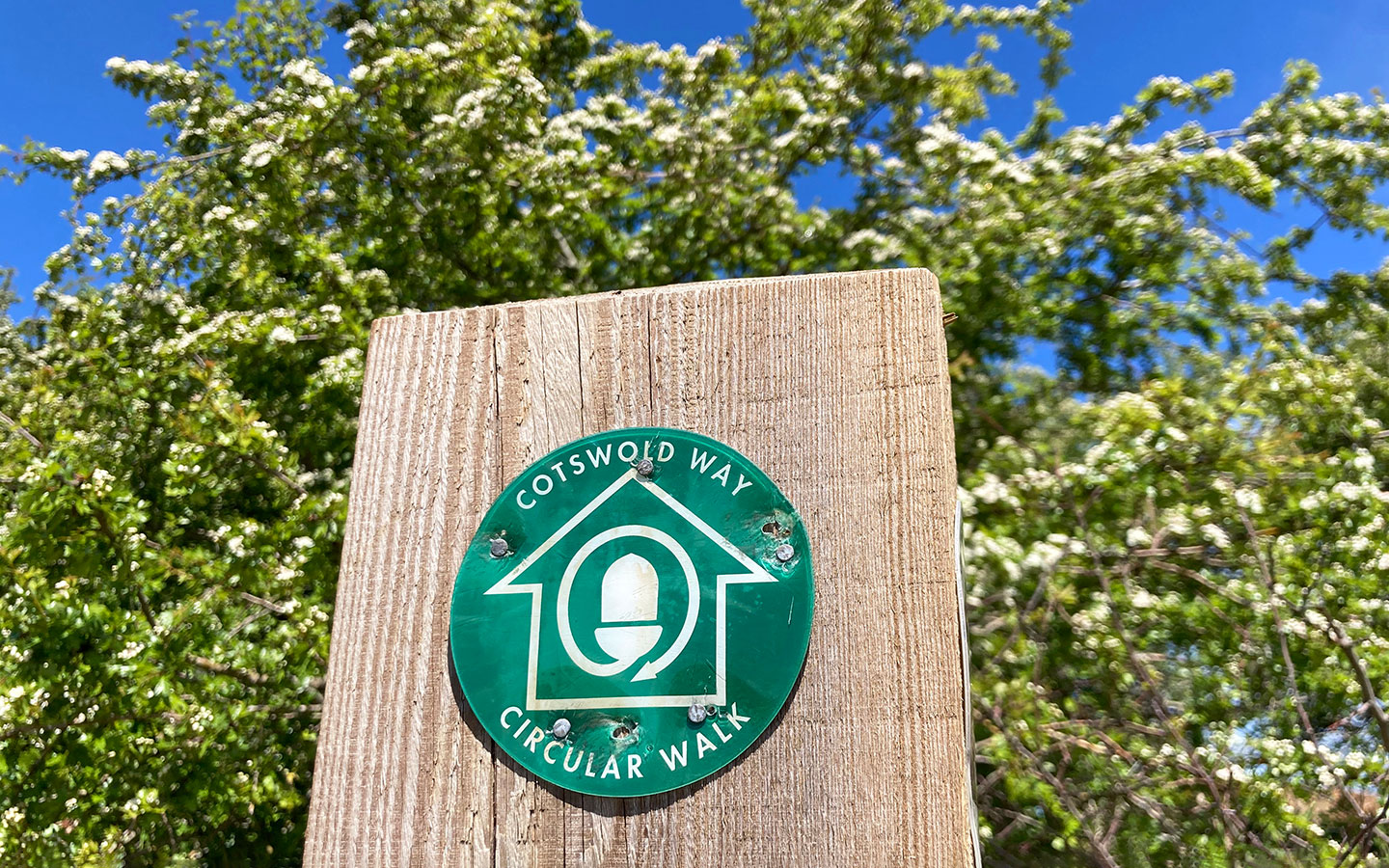
The Cotswold Way is one of the UK’s best long-distance walks, covering 102 miles of beautiful Cotswold countryside, towns and villages between Chipping Campden and Bath. Experienced hikers can complete the route in 7–8 days, but this Cotswold Way itinerary spreads it over 10 days for a fairly relaxed walk to give you time to stop for lunch or visit places along the route.
This itinerary runs from north to south, starting in Chipping Campden and finishing in Bath, but you could also do the route in reverse. You can walk it straight through in one go over 10 days, or break it up into day walks and spread them out over a longer period like we did.
Each day includes an overview of the route and the highlights along the way, as well as providing details of toilets and places to eat. We’ve suggested places to stay if you’re walking straight through, but there are more details in our full guide to accommodation on the Cotswold Way.

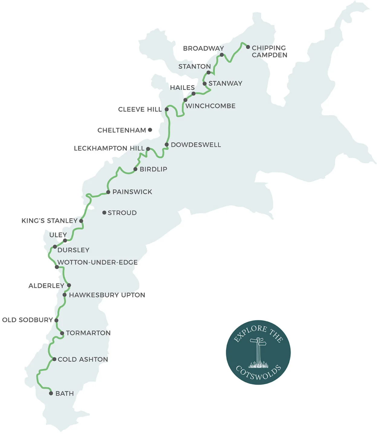
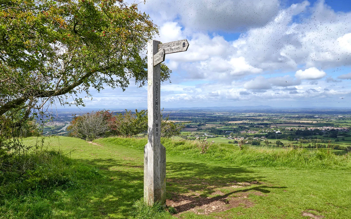
Cotswold Way map
The map below shows the route of the Cotswold Way marked in green, with the main towns and villages along the route (and a couple of larger ones just off it) highlighted.

Notes on planning
Distances: The official distance for the Cotswold Way is 102 miles (164km). But the distances below are based on our daily Strava GPS recordings, which were usually a bit longer than the official guidebook numbers, adding up to around 106 miles (171km) in total.
Timings: The timings given are for walking at a fairly gentle pace. But they don’t include stops for food etc, so make sure to allow an extra 1–2 hours each day to give yourself plenty of time.
Transport: If you’re walking the Cotswold Way as day walks, having two cars (one at the start and one at the end) is the easiest option. Otherwise you can access each day’s start and end point by public transport, or leave your car at the start and get public transport back (options are limited in some areas so you may need to take a taxi or The Robin, the Cotswolds’ bookable minibus).
More tips: There are lots more Cotswold Way tips in our guide, including the best time of year to walk it, map and guidebook recommendations, what to take with you and luggage transport.

Travelling to Chipping Campden
There aren’t any long-stay car parks in Chipping Campden, so it’s best to get to the start point of the walk by public transport. The nearest train stations are in Moreton-in-Marsh and Stratford-upon-Avon, both of which have car parks costing around £5 a day if you want to leave your car.
The Stagecoach no 1/2 bus (Monday–Saturday) runs from Moreton-in-Marsh station and Wood Street in Stratford-upon-Avon to the Noel Arms in Chipping Campden, both taking 40 minutes.
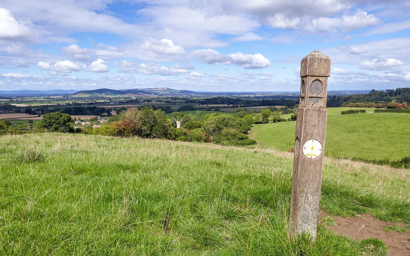
Day 1: Chipping Campden to Stanton (11 miles/18km)
Chipping Campden > Dover’s Hill > Broadway > Stanton (5 hours)
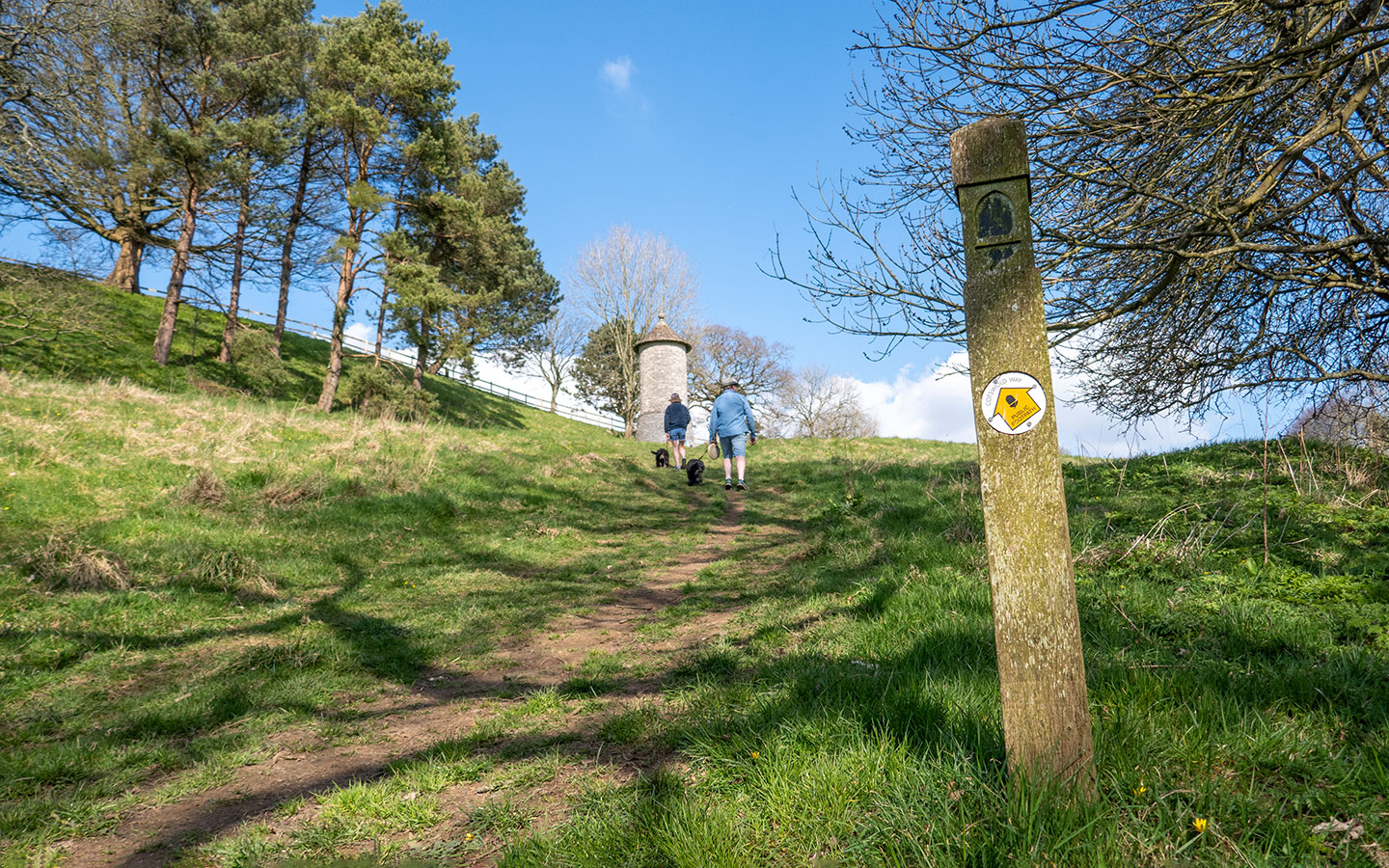
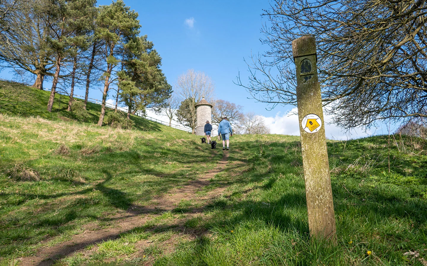
The Cotswold Way starts in the historic wool town of Chipping Campden in the north Cotswolds. A signpost and stone next to the Market Hall mark start of the trail, which runs along the High Street and past St Catharine’s Church before heading out into the countryside and climbing up to Dover’s Hill. From there the path keeps climbing up to Fish Hill and the Broadway Tower.
Look out for deer around the tower before walking downhill to the village of Broadway – there are benches for you to soak up the views. After passing through the village you head back into the countryside, with the tower visible in the distance, climbing up Shenberrow Hill before a final descent to the pretty village of Stanton. You can also add on an optional diversion to Snowshill.

Day 1 highlights
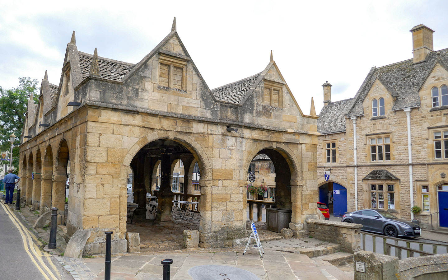
Chipping Campden: Its High Street was once described as ‘the most beautiful village street now left on the island’ with golden-stone buildings housing cafés, pubs and independent shops perfect for a browse. There’s also the wool church of St James and the Court Barn Museum where you can find out about Chipping Campden’s days as a centre for the Arts and Crafts Movement.
Dover’s Hill: The first viewpoint on the route looks out over the Vale of Evesham from 225 metres/738 feet up. The hill was the site of the original English Olympic Games which were started by Robert Dover in 1612, and now hosts the quirky Cotswold Olimpick Games.

Broadway Tower: This hilltop folly was built in 1794 at the second-highest point in the Cotswolds. It’s been used as a printing press and artists’ retreat – and more unexpectedly is also the site of a nuclear bunker. The tower is open to the public so you can look around the interiors and climb up to the top for panoramic views. And there are deer in the parkland around the tower too.
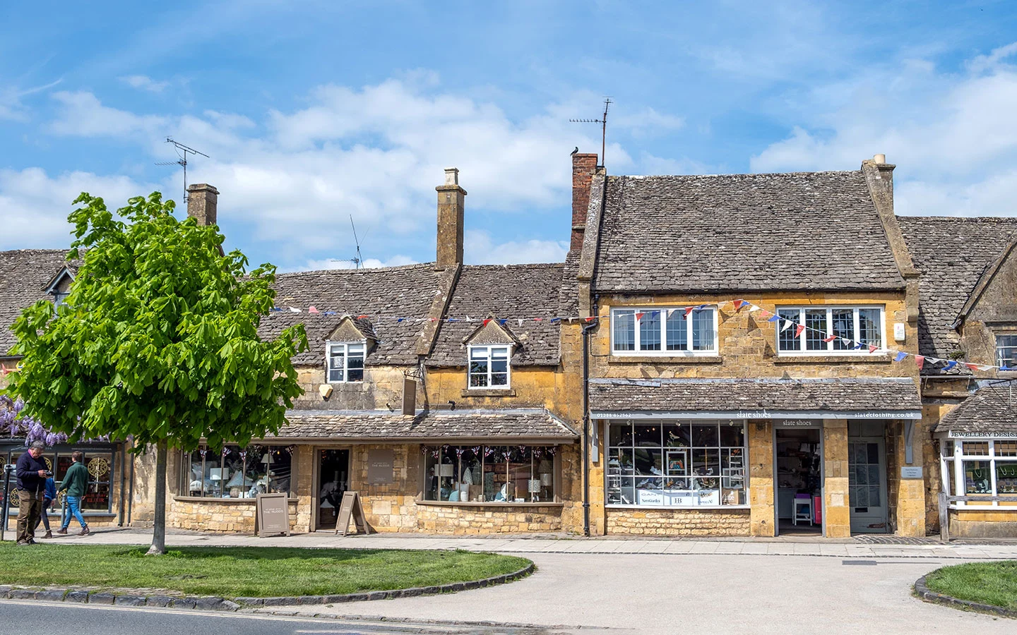
Broadway Village: The village of Broadway is full of boutique shops, restaurants and hotels, including the Lygon Arms where Oliver Cromwell once stayed. There’s also the Broadway Museum and Gordon Russell Design Museum, dedicated to a local Arts and Crafts furniture designer.

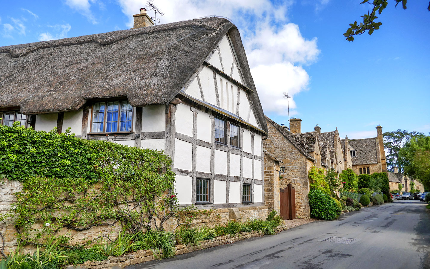
Stanton: Tiny Stanton is a picture-perfect village which was bought and restored by Sir Philip Sidney Stott in the early 20th century. There are village greens, flower-decked cottages, vintage lanterns to light the streets, and the Norman church of St Michael and All Angels.
Day 1 diversion: The village of Snowshill isn’t directly on the Cotswold Way but you can do a diversion (2 miles each way) towards the end of day 1 to add in a visit to the National Trust’s Snowshill Manor and Gardens and spot Bridget Jones’ Diary film locations.

Day 1 facilities
Food and drink: Some sections of the Cotswold Way don’t have many facilities but you’re spoilt for choice on day 1. There’s a good selection of shops and cafés in Chipping Campden and Broadway. If you want to pick up picnic supplies there are small Coop and One Stop supermarkets on the High Street in Chipping Campden or Maylam’s and Toke’s delis sell fresh bread and cheeses.
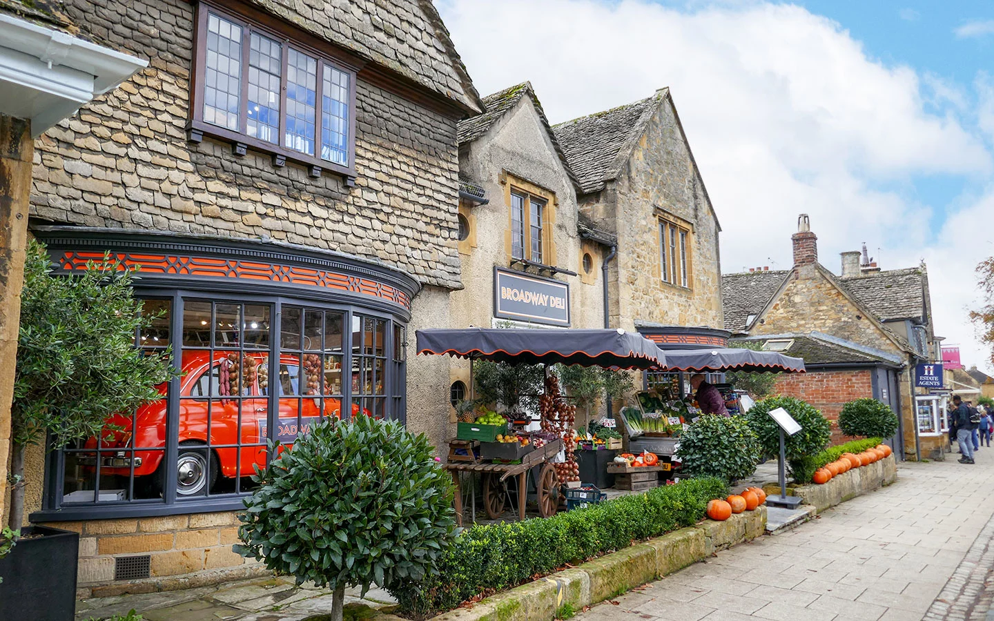
There are two cafés at the Broadway Tower and Broadway village has a Coop and plenty of places to eat out – our favourites include the Broadway Deli and Russell’s Fish and Chips. And the beer garden at the Mount Inn Stanton is a great spot to toast the first day’s walk.
Toilets: There are public toilets in Chipping Campden (at Sheep Street GL55 6DX and on the High Street GL55 6HB), along the route at the Fish Hill Picnic Area (WR12 7LD) and in Broadway (at the Activity Park, 71 High Street WR12 7DP and in Church Close Car Park WR12 7AH).
Accommodation: Shenberrow Hill B&B is the only place to stay in Stanton, so if that’s fully booked you may need to stay in Broadway instead, making day one 7 miles and day two 12 miles.

Day 2: Stanton to Winchcombe (8 miles/13km)
Stanton > Stanway > Wood Stanway > Hailes > Winchcombe (4 hours)
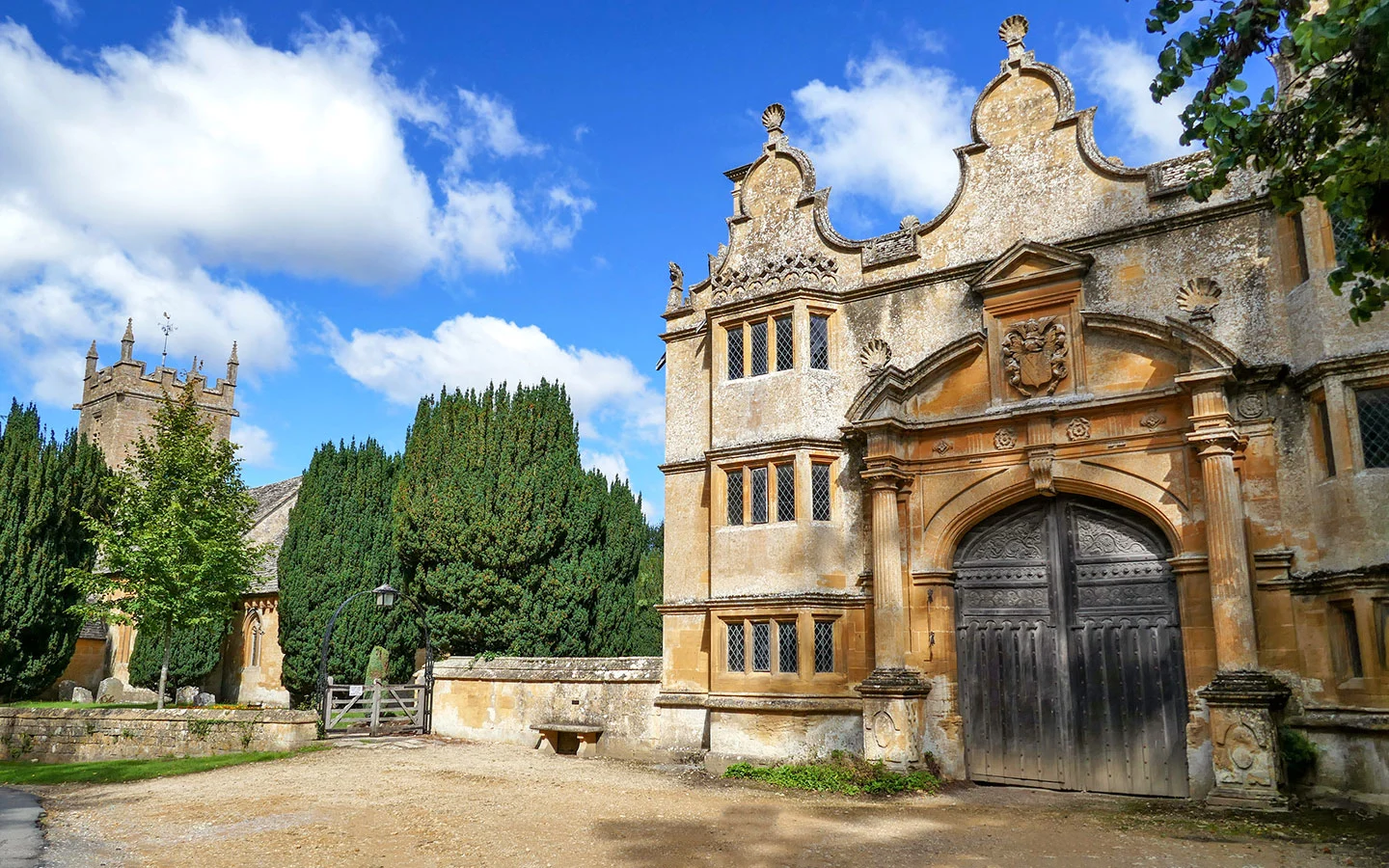
The walk starts in Stanton village and turns off onto farmland, walking over fields undulating with medieval ploughing ridges then into parkland, passing the spot where the Cotswold Way was inaugurated in 2007. You walk through the small village of Stanway, passing its church and the 17th-century gatehouse of Stanway House, then onto neighbouring Wood Stanway.
After that the route starts to climb, running past the remains of Iron Age Beckbury Camp then descending to Hailes with its medieval abbey before arriving into Winchcombe (where you could add on a visit to Sudeley Castle as day 2 is the shortest on this Cotswold Way itinerary).

Day 2 highlights
Stanway: Jacobean manor Stanway House boasts the highest gravity fountain in the world, with a single jet shooting 300 feet into the air surrounded by water gardens. It’s only open to the public from 2pm–5pm on Tuesdays and Thursdays in June, July and August unfortunately, so unless you time it well you’ll only see the gatehouse, but you can call in to the village church.
Steam trains: The Gloucestershire–Warwickshire Steam Railway runs almost parallel to today’s walk so you might hear the whistle of a passing train and see it chugging away in the distance.

Hailes Abbey: Hailes Abbey was founded in 1246 and became one of the most renowned shrines in medieval England as pilgrims came to see the Holy Blood of Hailes – allegedly a vial of Christ’s blood (though probably more likely to be duck’s blood!). The abbey is now a ruin but you can explore what’s left of it and find out about the monks who lived there in the museum.
Winchcombe: The town of Winchcombe has some interesting art galleries, interiors and antique shops to peruse, plus plenty of traditional pubs and a small local history museum.
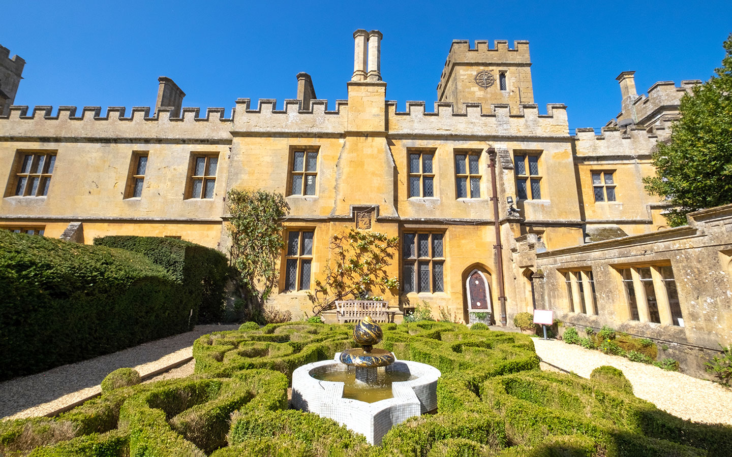
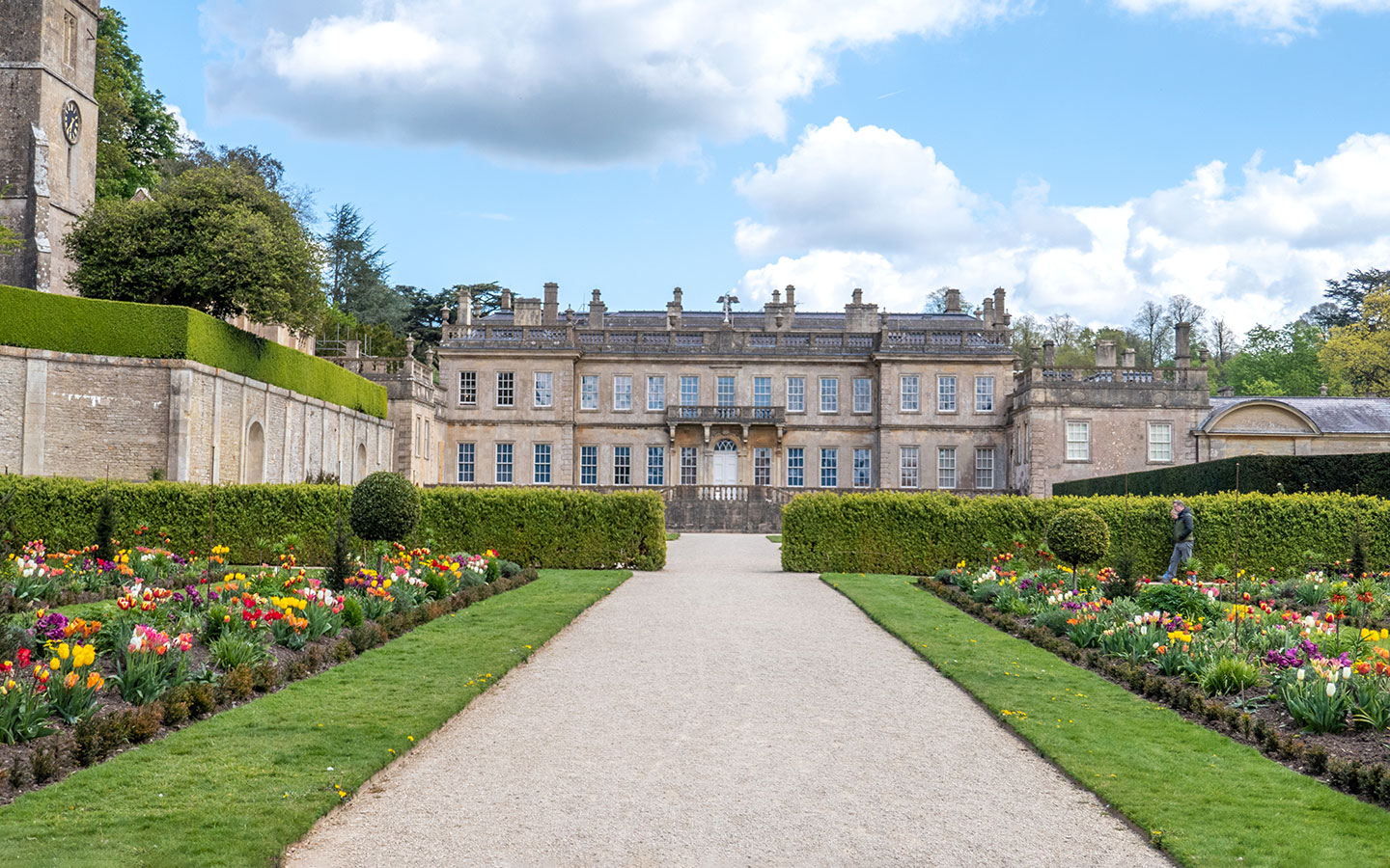
Sudeley Castle: 15th-century Sudeley Castle in Winchcombe hosted kings and queens and was the home of Henry VIII’s last wife Katherine Parr, who died there and is buried in St Mary’s Chapel in the grounds. The castle is open to visitors and you can explore some of the interior rooms, see an exhibition of royal artifacts and wander around its 10 carefully manicured gardens.
Day 2 facilities
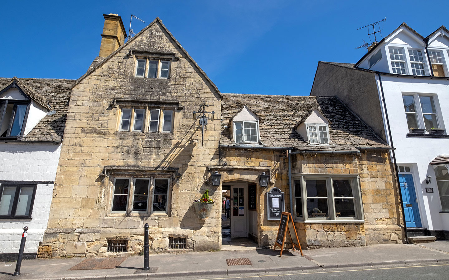
Food and drink: There are no shops along the route, but the Orchard Kitchen café and farm shop at Hayles Fruit Farm serves all-day breakfasts, toasties and frittatas. Winchcombe has plenty of places to eat and drink including the Lion Inn and Plaisterers Arms pubs. There’s also 5 North Street restaurant for something more upscale, or The Old Bakery Coffee & Wine Bar.
Toilets: The only toilets along the route are for customers at Hayles Fruit Farm and Hailes Abbey. Then Winchcombe has public toilets in the Back Lane car park (GL54 5PW), costing 20p.
Accommodation: Winchcombe has good pub accommodation at The Lion Inn* and White Hart Inn* (this includes some ‘ramblers’ rooms with shared bathrooms if you’re on a budget).
Day 3: Winchcombe to Dowdeswell (11.8 miles/18km)
Winchcombe > Belas Knap > Cleeve Hill > Dowdeswell (6 hours)
The third day involves a bit more climbing, taking you to the highest point in the Cotswolds at Cleeve Hill. After leaving Winchcombe you head uphill towards the Neolithic burial chamber at Belas Knap. The path runs along a flat section on top of the hill before going downhill into the Breakheart Plantation woods, through a farmyard and past 17th-century Postlip Hall.
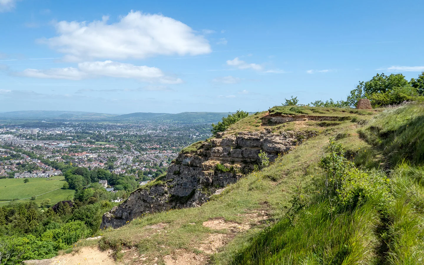
Once you reach Cleeve Common it’s a fairly steady climb to the trig point at the top of Cleeve Hill with panoramic views over Cheltenham (though watch out for flying balls from the golf course). After walking along the escarpment you pass through tranquil Prestbury Hill Nature Reserve before heading downhill along the edge of Dowdeswell Woods to finish by the reservoir.
Day 3 highlights
Winchcombe views: As you climb up the hill outside Winchcombe don’t forget to look behind you for some great views, first of the town and then of Sudeley Castle.
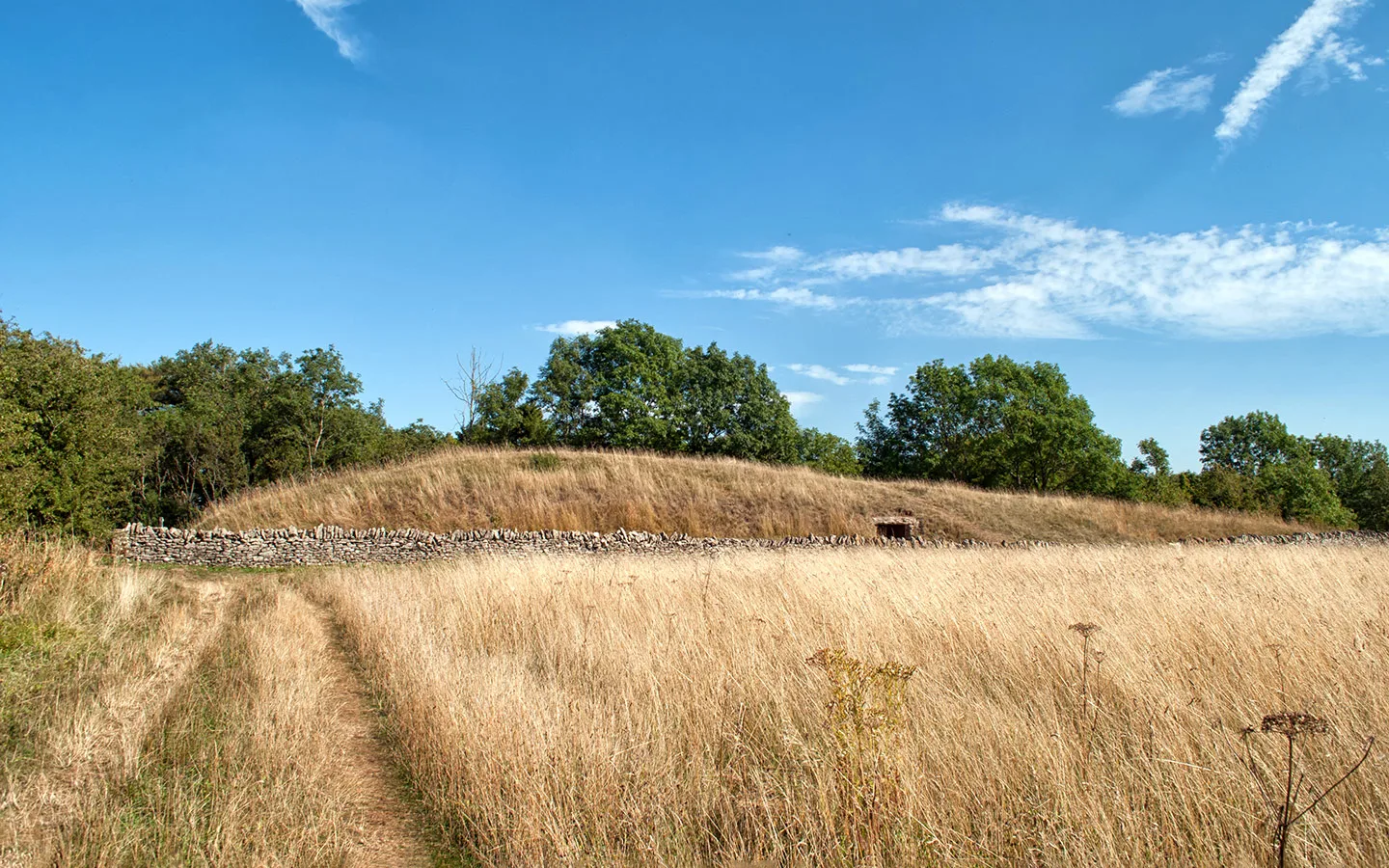
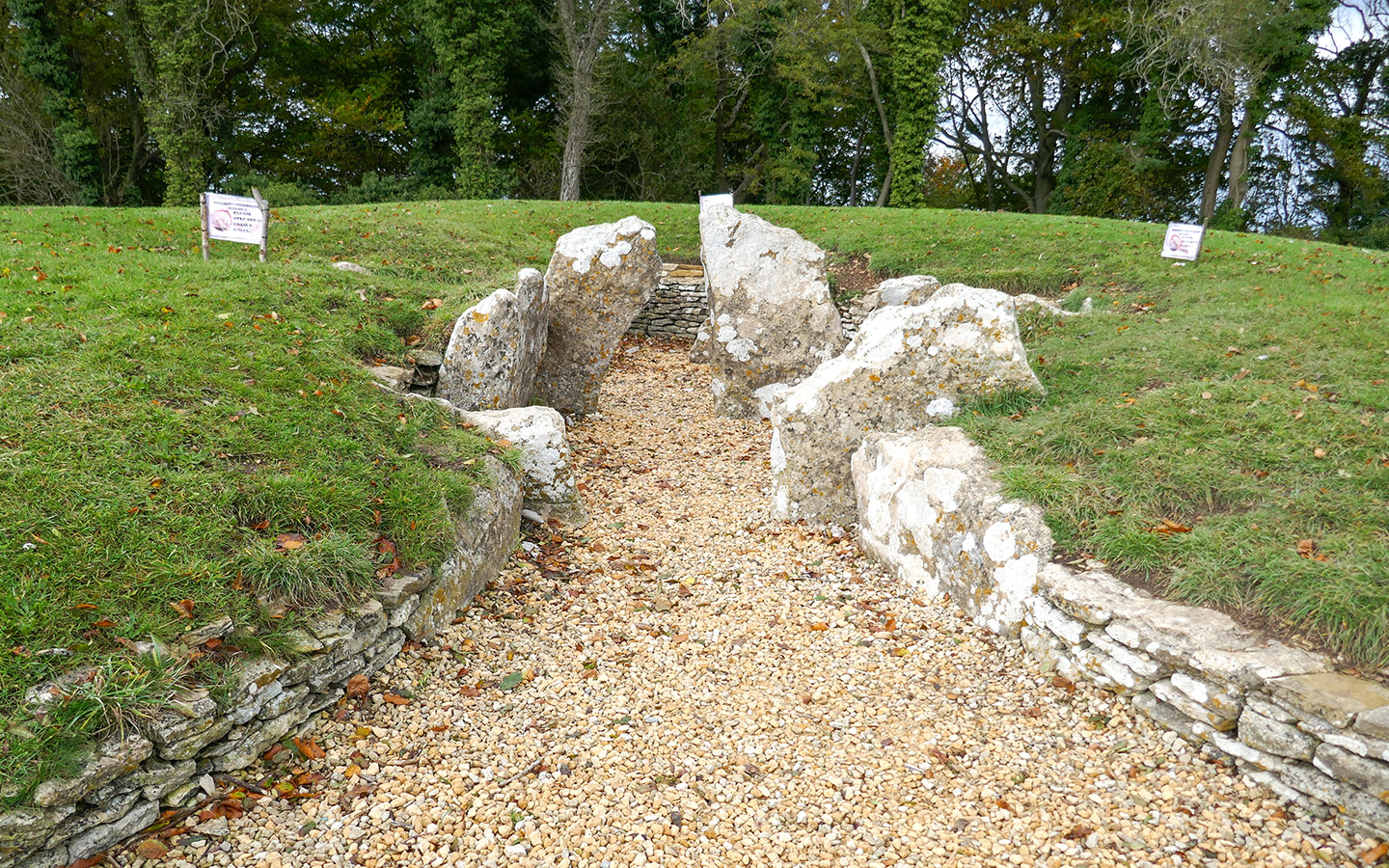
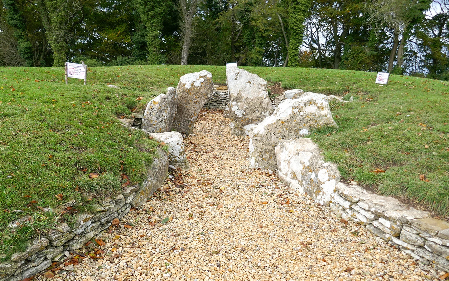
Belas Knap: This unassuming grass-covered mound on a hillside above Winchcombe is actually a Neolithic long barrow – a tomb for communal burials which dates back 5000 years. Over 30 Bronze Age skeletons were found inside when it was excavated in the 19th century and you can see a false entrance at the front built to deter grave robbers and the real entrance at the side.

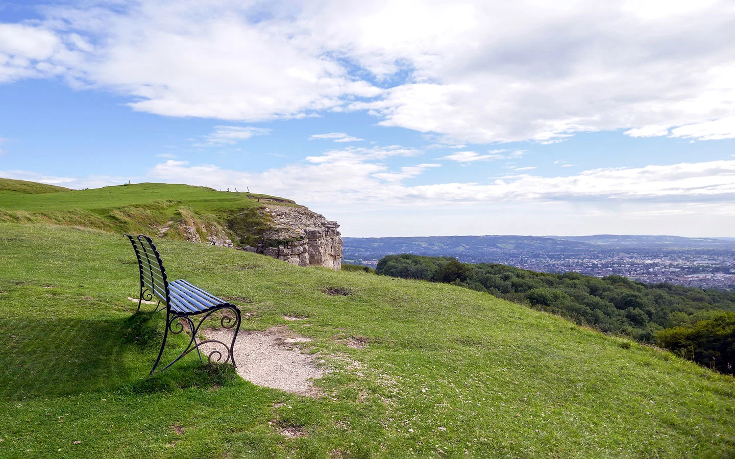
Cleeve Hill: Cleeve Hill is a Site of Special Scientific Interest and area of protected limestone grassland home to rare wildflowers, birds and mammals. It’s the highest point in the Cotswolds at 325 metres/1066 feet with views for miles – look down and you’ll see Cheltenham Racecourse below you. There’s also a golf club and resident sheep who keep the grass neatly trimmed.
Prestbury Hill Nature Reserve: This peaceful nature reserve next to Cleeve Common is an important habitat for over 30 species of butterflies – and in spring and summer you’ll also see lots of wildflowers like cowslips and orchids which are their food source.

Day 3 facilities
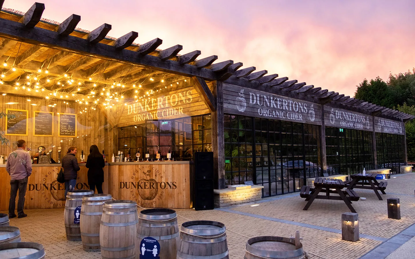
Food and drink: There are Coop and Nisa Local grocery stores in Winchcombe as well as the Williams of Winchcombe deli for picnic supplies, and plenty of cafés. The Cotswold Way Cafe and Flynn’s on the Hill at Cleeve Hill Golf Course serve lunches, snacks and ice creams. And Dunkertons Park is a short walk from the end point of the walk, with a farm shop and street food stalls.
Toilets: There are public toilets in Winchcombe’s Back Lane car park (GL54 5PW), costing 20p, and customer toilets at Dunkertons in Dowdeswell (GL52 6UT), but none along the route.
Accommodation: The Charlton Boutique Hotel* is the closest hotel to the trail, 0.6 miles from the finish point. Or there are lots more options in Cheltenham but you’d want to take a bus or taxi into town. The Pulhams 801 bus (daily) stops by the La Petite Bar & Grill on the A40.

Day 4: Dowdeswell to Birdlip (10.4 miles/16.7km)
Dowdeswell > Wistley Hill > Leckhampton Hill > Crickley Hill > Birdlip (5 hours)
Day four of this Cotswold Way itinerary is a day of four hills – Wistley, Leckhampton, Crickley and Birdlip. Though after an initial climb it’s not too strenuous a walk, with plenty of fantastic views along the way. After crossing the road from the reservoir the route runs uphill through Lineover Wood and then climbs up onto Wistley Hill where you get the first of the views.
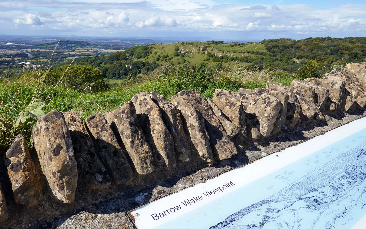
You cross over the Cirencester Road at Seven Springs then zig-zag along the hilltops. First there’s Charlton Kings Common and Leckhampton Hill with views across Cheltenham. Then after a stretch of woodland you reach Crickley Hill Country Park. The route crosses a busy road by the Air Balloon roundabout before turning off to Barrow Wake viewpoint on the way to Birdlip.
[Note there may be diversions of the path around the Air Balloon due to roadworks.]

Day 4 highlights
Lineover Woods: This ancient woodland is made up of beech, oak, lime, ash and sycamore trees, and includes a 600-year-old beech tree said to be the third largest in Britain. Look out for the carpet of wildflowers on the forest floor in spring, with bluebells, orchids and lily of the valley.
Leckhampton Hill: Leckhampton Hill and neighbouring Charlton Kings Common are another stretch of the limestone grassland this part of the Cotswolds is known for. You can also see site of an Iron Age hill fort and remnants of the hill’s days as a limestone quarry. And you can do a short diversion off the path to the Devil’s Chimney, a rock stack jutting out of the hillside.
Crickley Hill Country Park: This country park is a popular spot for walkers from Cheltenham, with views stretching as far as the Black Mountains in Wales. There’s a small visitors centre and a café, which does delicious ice cream if you’re there on a sunny day.

Day 4 facilities
Food and drink: There’s a bakery and deli at Dunkertons in Dowdeswell. Star Bistro just before Crickley Hill serves breakfast, lunch and tea (Mondays to Fridays). Crickley Hill Country Park café sells snacks and ice creams. And the Royal George pub in Birdlip village does traditional pub food.
Toilets: There are customer toilets at Dunkertons Park near the start of the route (GL52 6UT) and free public toilets at Crickley Hill Country Park (GL4 8JY).
Accommodation: The Royal George* is the only accommodation in Birdlip village, a Greene King pub dating from the 18th century with 34 simple, good-value room bedrooms.

Day 5: Birdlip to Painswick (8.6 miles/13.9km)
Birdlip > Coopers’ Hill > Painswick Beacon > Painswick (4.5 hours)
Much of day five’s walk takes you through shady woodland after skirting the village of Birdlip. On your right are occasional views towards the Malvern Hills. You can also see the remains of Great Witcombe Roman Villa – it’s a short diversion off the track if you want to take a closer look.
The route climbs up Cooper’s Hill – where the famous cheese-rolling takes place – and then crosses a nature reserve before going back into woodland. You pass through Painswick golf course on your way up to the hilltop Painswick Beacon, before walking downhill to Painswick village.
Day 5 highlights
Coopers Hill: On the Spring Bank Holiday each year, daredevil participants from all around the world chase a round of Double Gloucester cheese down this steep hill, risking injury to be crowned champion and take the cheese home. Despite the risks this quirky event has become a local tradition, but if you visit any other time of the year the hill is a much more peaceful spot.
Buckholt Wood: Part of the Beechwoods National Nature Reserve, Buckholt Wood is an area of beechwood forest that’s a habitat for birds and insects, and you might even see a deer.

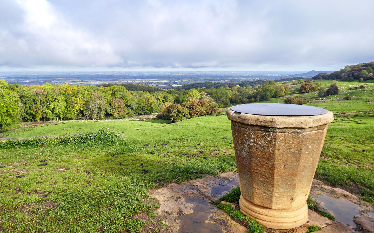
Painswick Beacon: This viewpoint lies on the site of an impressive Iron Age hill fort, with the highest point at 280 metres/920 feet marked with an obelisk and 360º views.
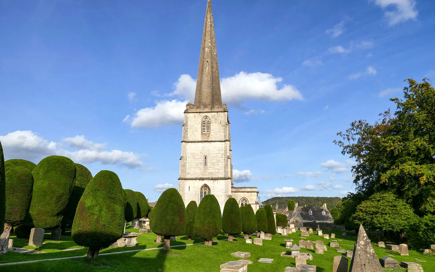
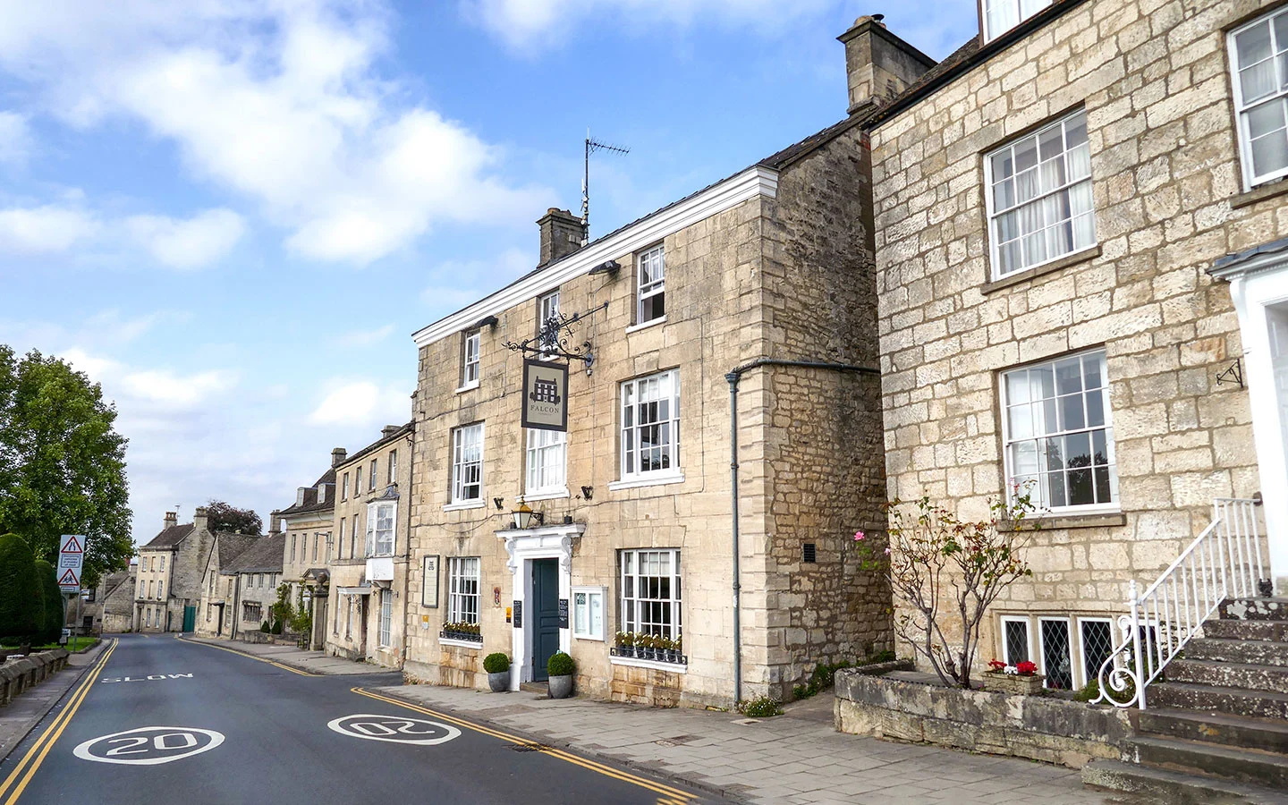
Painswick: The historic wool town of Painswick is one of the most charming towns on the Cotswold Way itinerary. As well as shops, cafés and restaurants, there’s St Mary’s Church with its medieval tombs and neatly trimmed yew trees. And Painswick Rococo Gardens on the edge of the village are England’s only complete Rococo garden, built in the 1740s with follies, archways and a maze.

Day 5 facilities
Food and drink: There isn’t much at the start of the route other than the Royal George in Birdlip. The Royal William pub in Cranham halfway along the route is now closed, so the next place for food is Painswick. There’s a café at Painswick Rococo Gardens and plenty of places to eat in Painswick itself, including the Falcon Inn, The Oak pub, St Michael’s Bistro and the Arts Café.
Toilets: Free public toilets in Painswick’s Stamages Lane car park (GL6 6UZ), but none before then.
Accommodation: Painswick has lots of places to stay, including high-end hotel The Painswick, the stylish Falcon Inn* opposite the church and homely, country style St Anne’s B&B.*

Day 6: Painswick to King’s Stanley (9.5 miles/15.5km)
Painswick > Haresfield Beacon > Stonehouse > King’s Stanley (5 hours)
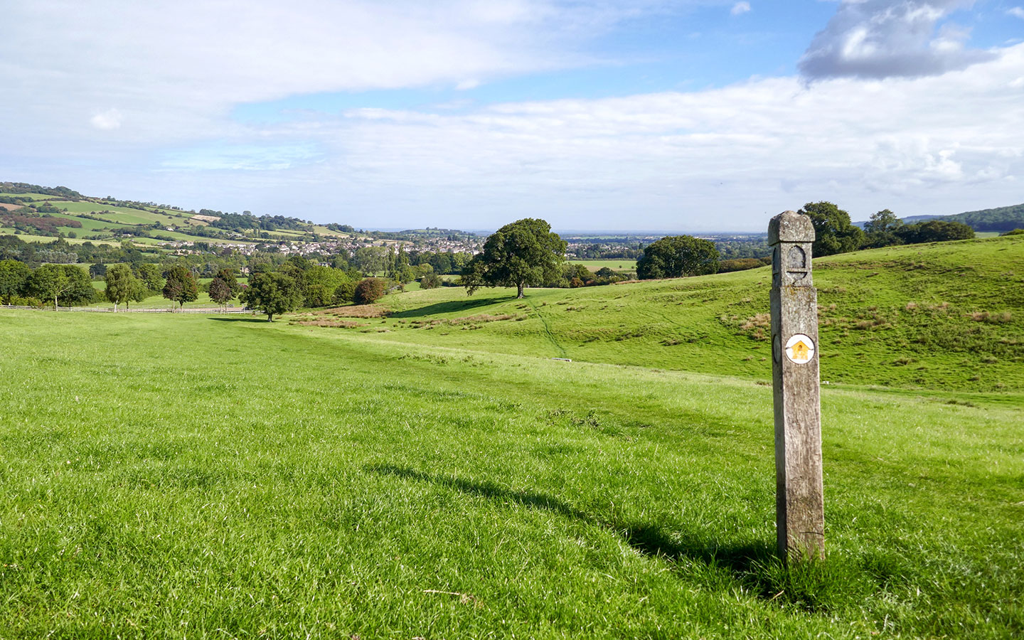
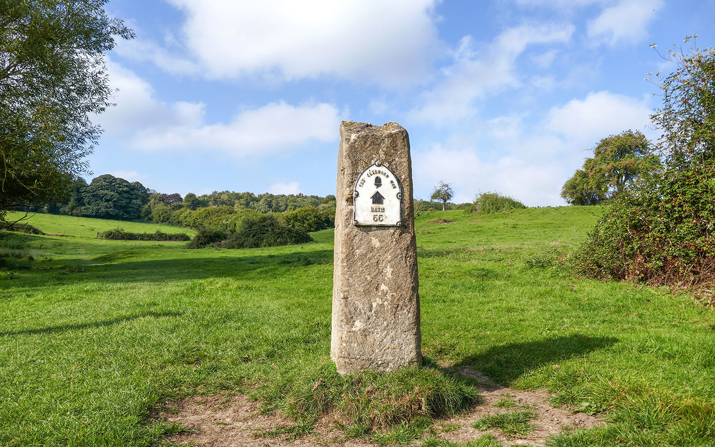
Day six passes the halfway point of this Cotswold Way itinerary, leaving Painswick and heading across fields past a marker stone showing 55 miles to Bath. The path climbs up, twisting and turning along the escarpment to Haresfield Beacon viewpoint before running through Standish Wood.
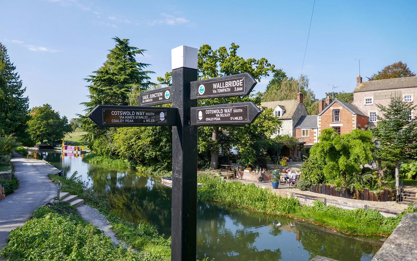
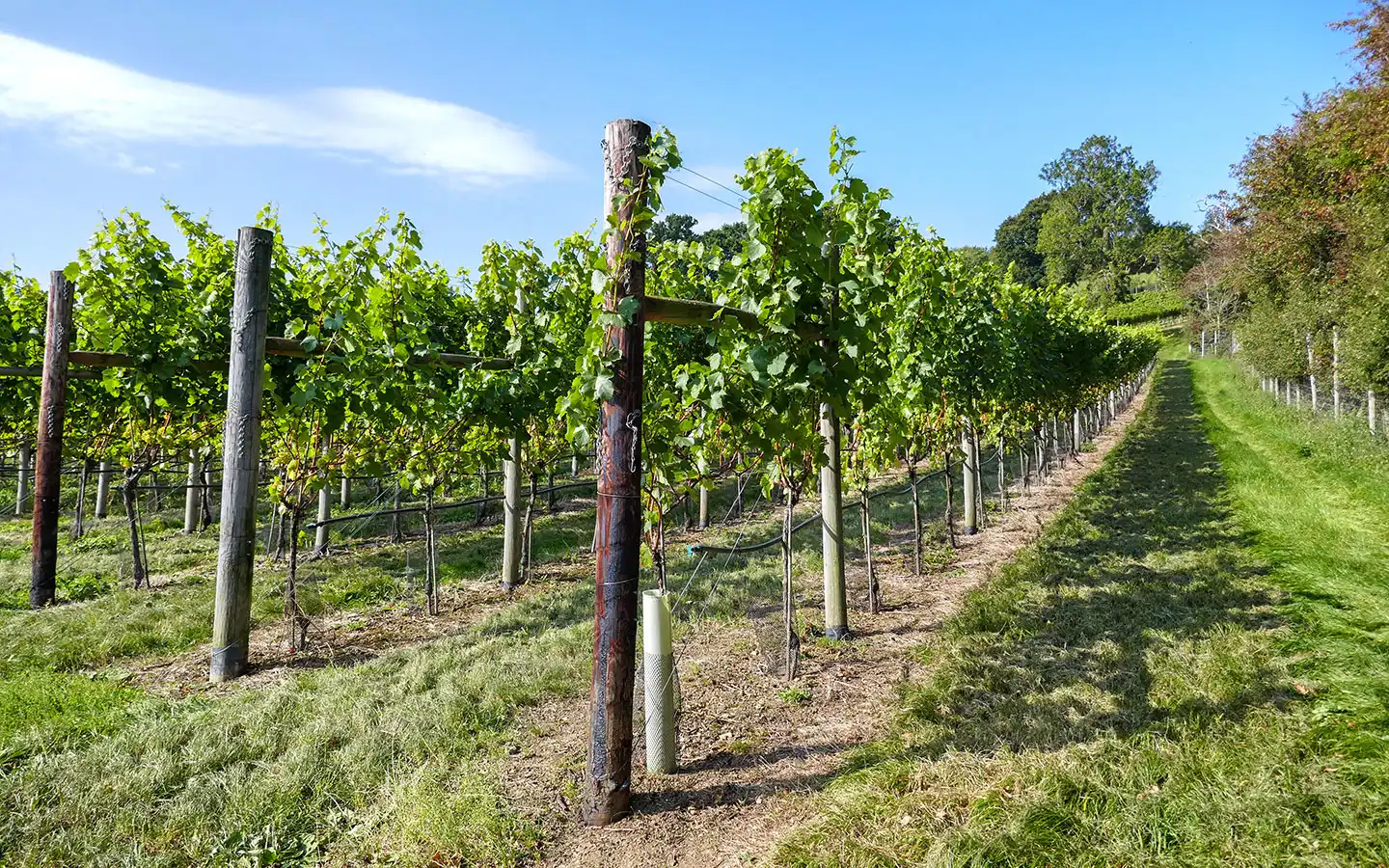
The Cotswold Way descends through fields, woodland and more unexpectedly past some of Woodchester Valley Vineyard’s vines. It cuts across the edge of Stonehouse, going over the railway line and Stroudwater Navigation canal then continuing on into King’s Stanley.

Day 6 highlights
Haresfield Beacon: This beacon is another sweeping viewpoint, surrounded by the beech trees of Standish Woods. With views for miles it’s no surprise it was the site of a Romano-British hillfort.
Stroudwater Navigation: The canal was built in 1776 to transport goods between Stroud and the River Severn. Now it’s used as a walking and boating route, with the old textile mill buildings forming a contrast with the countryside and woodland along most of the Cotswold Way.

Day 6 facilities
Food and drink: Painswick has a Premier Express grocery store or you can pick up picnic supplies at the Arts Café or Juniper coffee shop. Just before Stonehouse there are a couple of pubs a short diversion off the route – the Vine Tree Inn in Randwick and Carpenters Arms in Westrip. And King’s Stanley has a Coop supermarket and a takeaway (the Kings Head pub is currently closed).
Toilets: Free public toilets in Painswick’s Stamages Lane car park (GL6 6UZ), but none after that.
Accommodation: King’s Stanley has a couple of B&Bs – Orchardene has two bedrooms and The Grey Cottage a mile off the route between King’s Stanley and Leonard Stanley has three.

Day 7: Kings Stanley to Wotton-under-Edge (15 miles/24km)
King’s Stanley > Coaley Peak > Dursley > North Nibley > Wotton-under-Edge (7 hours)
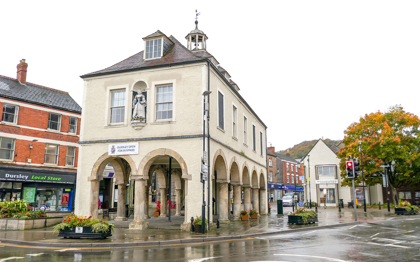
Day seven is the longest on this Cotswold Way itinerary, first climbing to Coaley Peak where you can see Neolithic burial site Nympsfield Long Barrow. The route passes another long barrow at Uley, known as Hetty Peglar’s Tump. Then there are more great views from Cam Long Down before the route heads downhill into the town of Dursley, which was once a centre for the wool trade.
From Dursley the Cotswold Way climbs Stinchcombe Hill where it runs in a loop around the edge of the golf course (a short cut can chop 4.5km off). You then head south to North Nibley, climbing up to the Tynedale Monument before walking through woodland to Wotton-under-Edge.
Day 7 highlights
Nympsfield Long Barrow: Neolithic pottery and 13 skeletons were uncovered in this burial chamber which was built around 2800 BC. Unlike Belas Knap, the mound covering the barrow has been removed so you can see the shape of the chambers inside.
Stinchcombe Hill: This 200-acre reserve is both a Site of Special Scientific Interest and Area of Outstanding Natural Beauty. It has more of the Cotswolds’ Jurassic limestone grassland so look out for roe and muntjac deer, woodpeckers, buzzards, kestrels and butterflies.
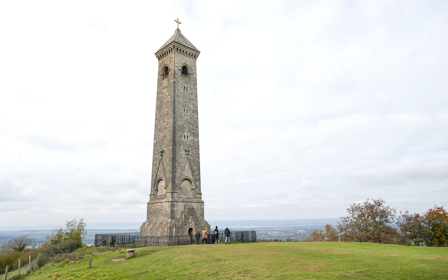
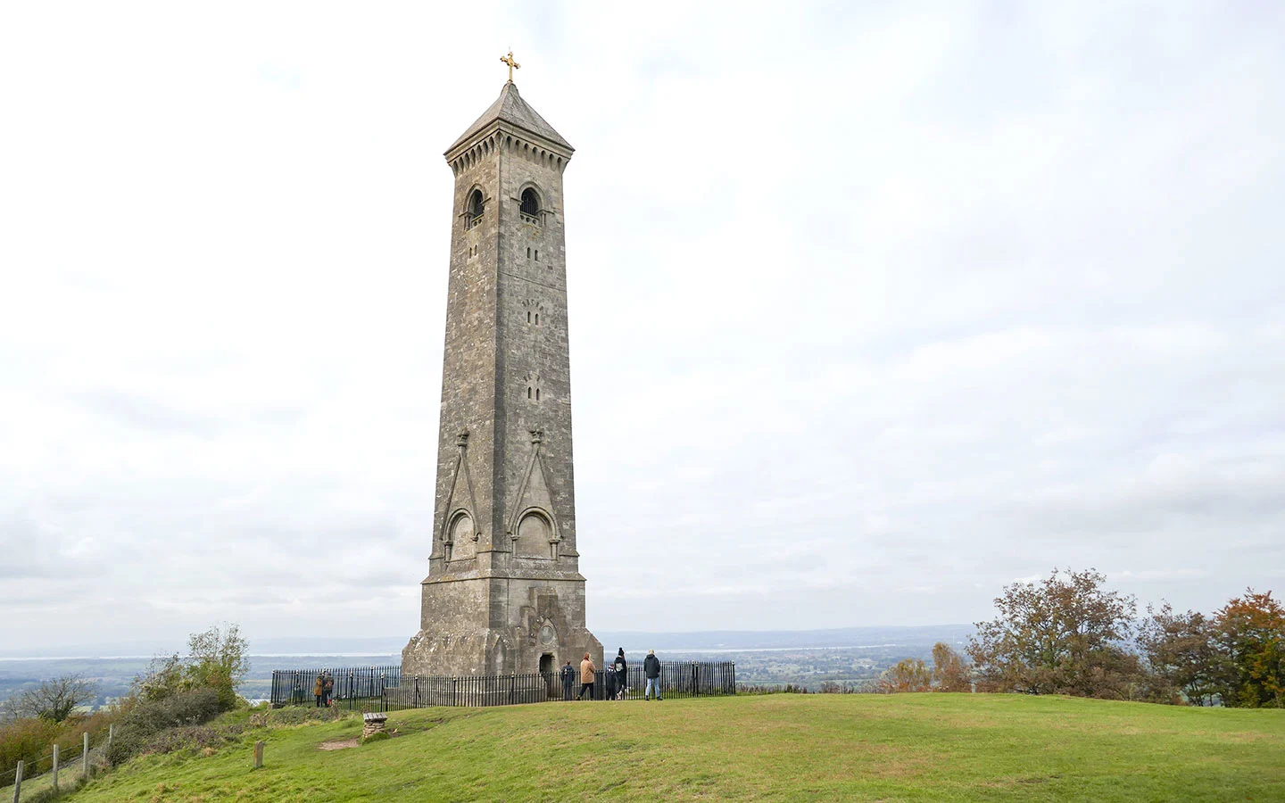
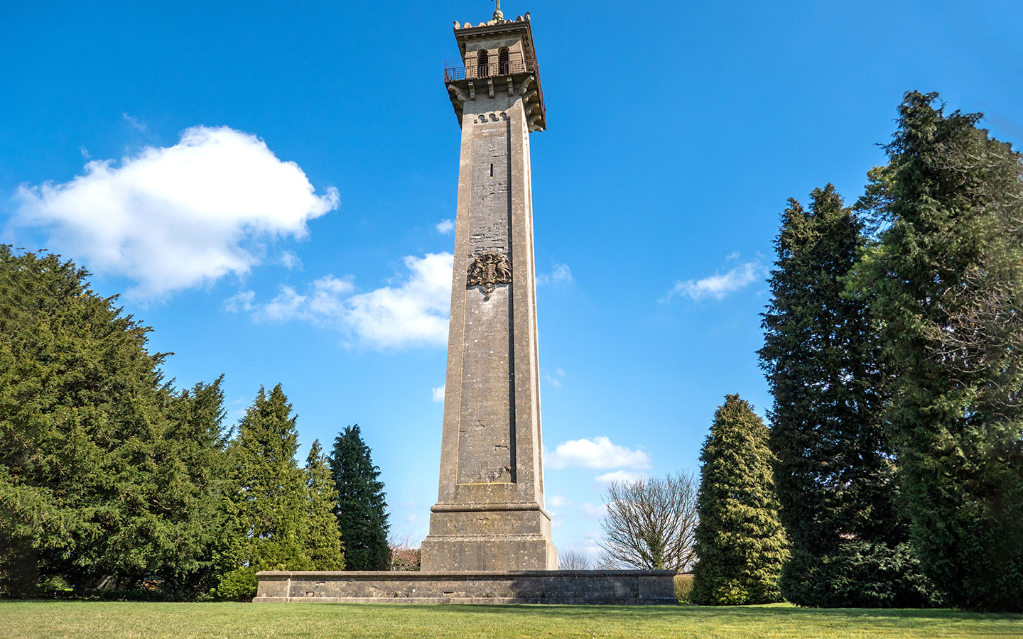
Tyndale Monument: This 111-foot-tall hilltop monument was built in honour of William Tyndale, who was born nearby and translated the first New Testament into English. It can be seen from as far away as Bristol and you can climb the 120 steps to the top if you want to get even higher.
Wotton-under-Edge: A historic market town with a high street lined with interesting independent shops. There’s also the 13th-century church of St Mary the Virgin, the Perry and Dawes Almshouses and a Heritage Centre where you can find out about the town’s history.
Day 7 facilities
Food and drink: There’s a Coop supermarket in King’s Stanley. Dursley has several supermarkets, cafés and the Old Spot pub serving food. There’s also a village shop and the Black Horse Inn in North Nibley, and a selection of cafés, pubs and restaurants in Wotton-under-Edge.
Toilets: There are public toilets at the May Lane car park in Dursley (GL11 4JQ) and on the Rope Walk in Wotton-under-Edge (GL12 7AA).
Accommodation: 17th-century coaching inn The Swan Hotel* in Wotton-under-Edge is right on the trail with 15 bedrooms. Or The Cabin is a stylish, light and bright self-catering property.

Day 8: Wotton-under-Edge to Old Sodbury (12.4 miles/20km)
Wotton-under-Edge > Wortley > Alderley > Lower Kilcott > Hawkesbury Upton > Horton > Little Sodbury > Old Sodbury (6 hours)
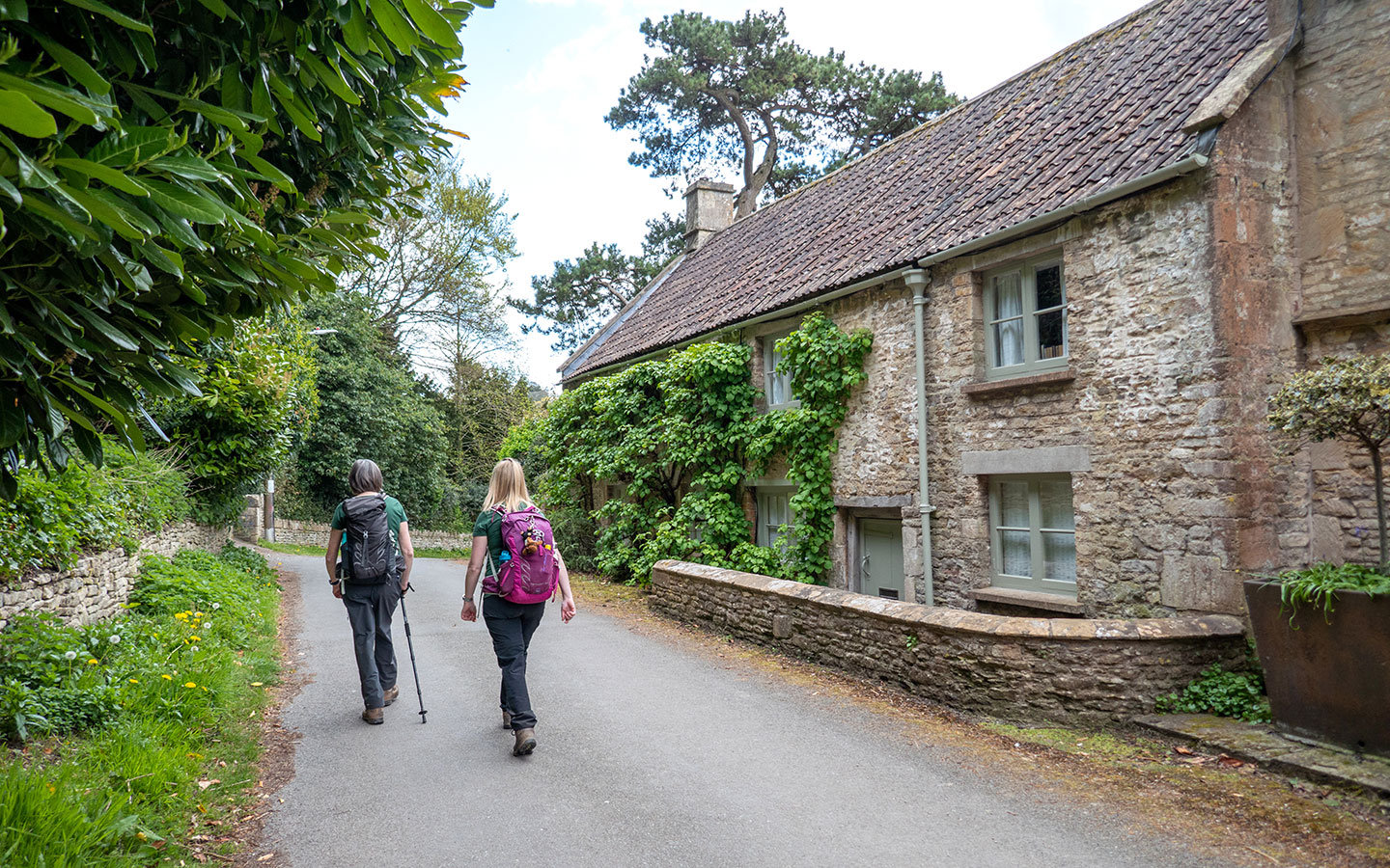
Day eight’s route takes you south of Wotton-under-Edge, passing the entrance to National Trust Tudor hunting lodge Newark Park, and then running through the villages of Wortley and Alderley. The Cotswold Way joins up with the Monarch’s Way for a while, then you turn off into woodland at Lower Kilcott and walk across fields towards the towering Somerset Monument.
The route then skirts the edge of Hawkesbury Upton, passing an old drover’s pool and following the drovers’ road towards Horton – where you get a glimpse Horton Court and its 12th-century church through the trees. You then pass through Little Sodbury, crossing the remains of Sodbury Camp Iron Age hill fort, before reaching Old Sodbury and finishing next to the church.

Day 8 highlights
Alderley: The pretty village of Alderley has Cotswold stone cottages, an Elizabethan manor house and St Kenelm’s Church, which was rebuilt in 1802 with an original 15th-century tower.
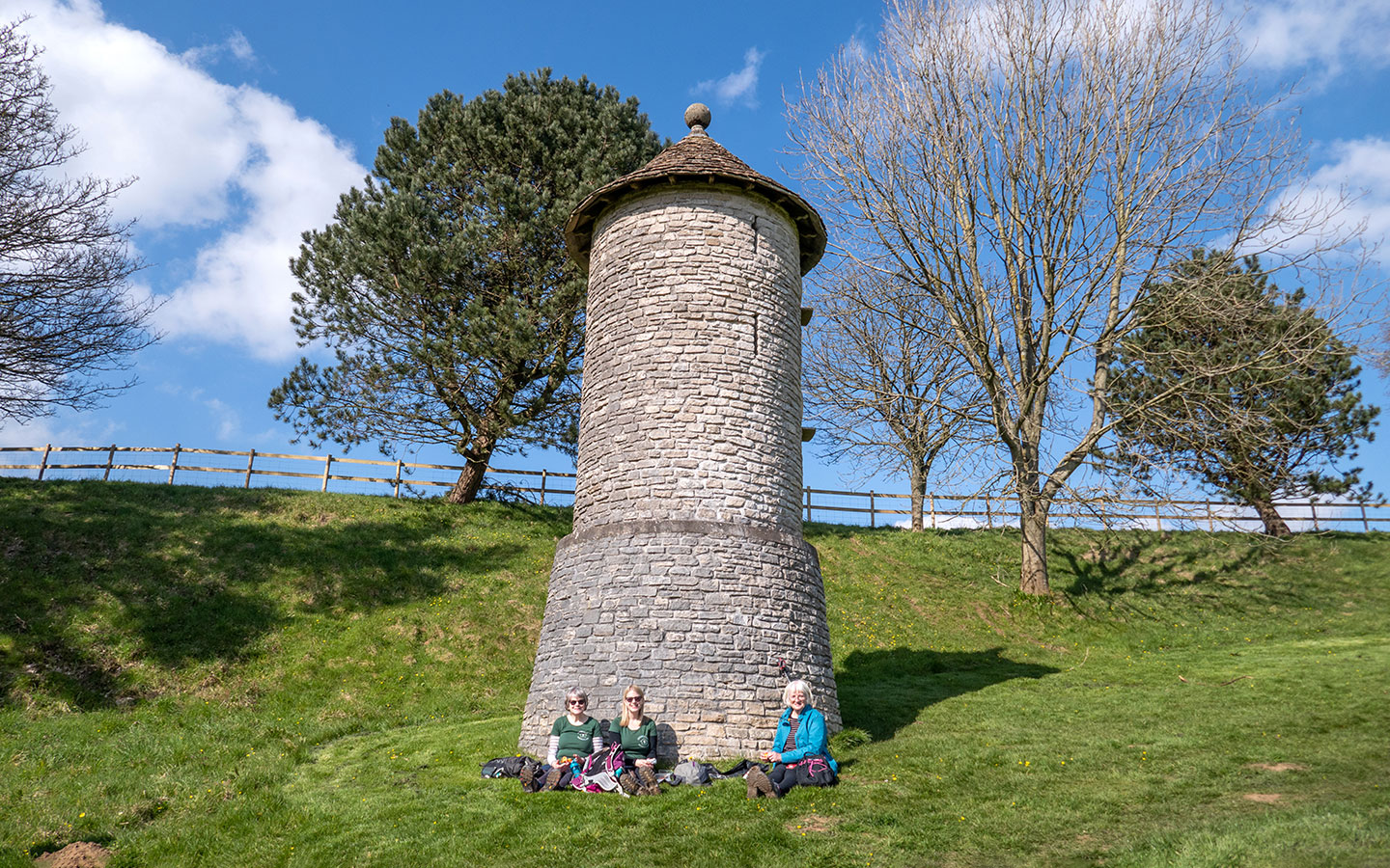
Somerset Monument: This 100-foot-tall stone tower was built in 1846 to commemorates Lord Robert Somerset, son of the Duke of Beaufort (owner of nearby Badminton House) and a soldier and local politician. There’s a viewing platform at the top but unfortunately it’s not open to the public, but it’s a good stop for a break with a bench on the roadside by the monument.

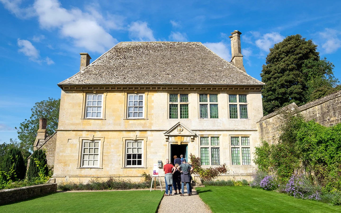
Horton Court: This National Trust property is just off the Cotswold Way but you might be able to see it as you walk. It was built in the 16th century and has been used as a filming location for Wolf Hall and Poldark, but is now available to rent, sleeping 10 people in five bedrooms.
Owlery: Look out for a quirky little tower just before you reach the village of Horton. It’s not a folly or a dovecote but actually a rather grand house for owls, built as a safe place for them to nest.

Day 8 facilities
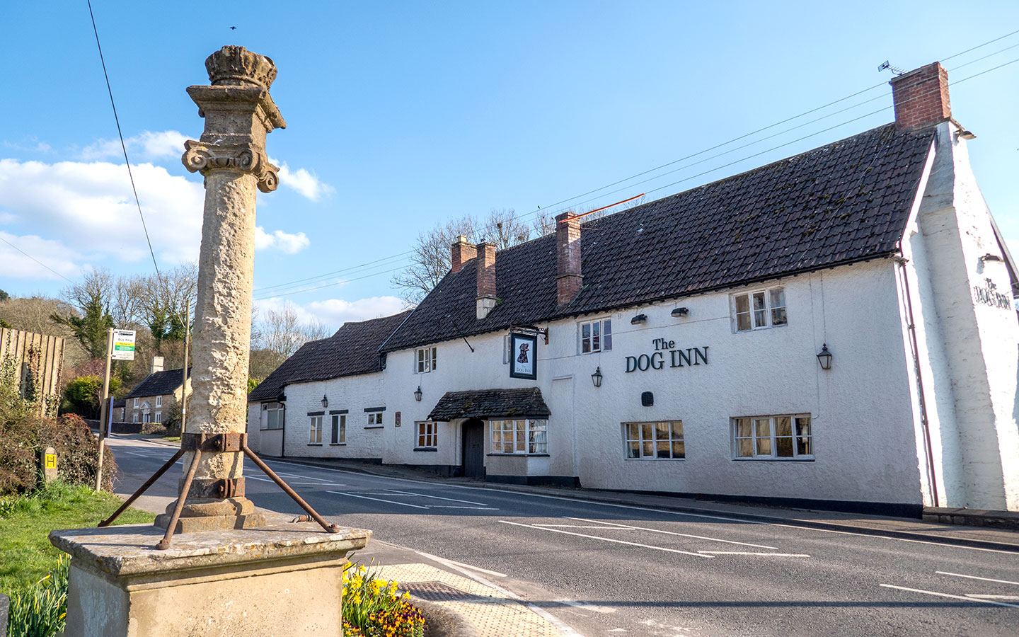
Food and drink: There are Coop and Tesco supermarkets, Relish deli, a bakery and cafés in Wotton-under-Edge. You can take a short diversion off the trail into Hawkesbury Upton which has two pubs – The Fox Inn and Beaufort Arms – and the Hawkesbury Stores village shop selling bread, cakes and groceries. Then the Dog Inn pub in Old Sodbury is just downhill from the church.
Toilets: There are public toilets in Wotton-under-Edge (GL12 7AA) at the start, but none along the route other than customer toilets in the pubs.
Accommodation: The Dog Inn* in Old Sodbury is a 500-year-old village pub with four en-suite bedrooms. Or Sodbury House is a farmhouse bed and breakfast just off the route.

Day 9: Old Sodbury to Cold Ashton (9 miles/14.5km)
Old Sodbury > Tormarton > Dyrham > Pennsylvania > Cold Ashton (4.5 hours)
The penultimate day’s walk starts at the Church of St John the Baptist in Old Sodbury and heads down through the village. You pass through the parkland-style grounds of Dodington Park estate then through the village of Tormarton, whose pretty duckpond is a good spot to stop at.
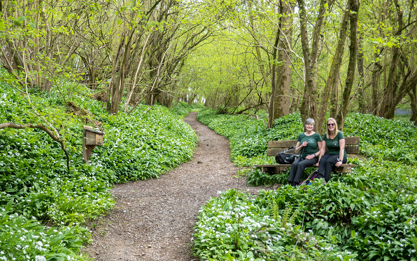
There are a few busy roads on this stretch – with a bridge over the M4 motorway and a couple of roads to cross. The Cotswold Way then runs across fields until it reaches the village of Dyrham, skirting the edge of the National Trust Dyrham Park house and gardens. You then walk through shady ancient woodland and the village of Pennsylvania before ending in Cold Ashton.

Day 9 highlights
Dodington Park: The route runs through some of the 300 acres of well-manicured grounds that belong to Dodington Park, an 18th-century country house now owned by billionaire inventor James Dyson. The Grade I-listed manor is hidden away – with lots of stern notices telling you to stay on the path – but there are rolling hills, grazing sheep and a pretty stone bridge over a stream.
Tormarton: In this small village you’ll find the 12th-century St Mary Magdalene church, a pub and the village pond – a memorial to Lady Altrincham who lived at Tormarton Court.

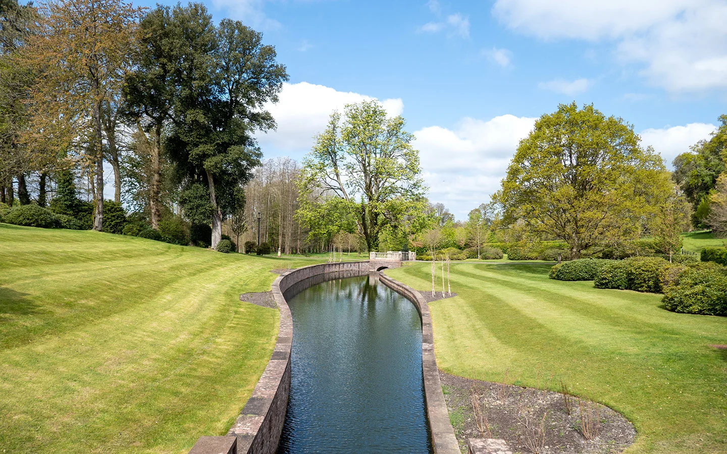
Dyrham Park: The entrance to this National Trust property is just off the route but it’s worth a stop. It was built in the 17th-century for diplomat William Blathwayt and contains artwork and collectibles from his travels and is surrounded by formal gardens and acres of parkland.
Dyrham Wood: This ancient woodland is a peaceful oasis, carpeted with bluebells and wild garlic when we visited. Look out for the wood’s resident deer – and the wooden post box containing a notebook and pen where Cotswold Way walkers can record their visit for posterity.

Day 9 facilities
Food and drink: There are service stations selling basic snacks and drinks in Old Sodbury and Pennsylvania. It’s a short diversion off the route to the Compass Inn in Tormarton or The Crown pub in Tolldown. There’s also a customer café at Dyrham Park but nothing in Cold Ashton.
Toilets: There are no toilets along the route other for customers at the pubs and Dyrham Park.
Accommodation: Cold Ashton has a couple of places to stay – Hill Farm on the Cotswold Way has two rooms and Toghill House Farm* has five B&B guest bedrooms a mile off the route.
Day 10: Cold Ashton to Bath (10.4 miles/16.7km)
Cold Ashton > Lansdown Hill > Weston > Bath (5.5 hours)
The final day of this Cotswold Way itinerary takes you from Cold Ashton to the historic city of Bath. It runs through rolling hills before gradually climbing up Lansdown Hill, where there are memorials to the English Civil War Battle of Lansdown. You carry on along the hilltop past a golf course and Bath Racecourse, with views of Bristol, Bath and the Avon Valley from Prospect Stile.
Then the path starts to descend, running past Kelston Round Hill on the way into the Bath suburb of Weston. There are a few final climbs to tackle before reaching the centre of Bath, passing landmarks like the Royal Crescent and Roman Baths on your way to the finish at Bath Abbey.

Day 10 highlights
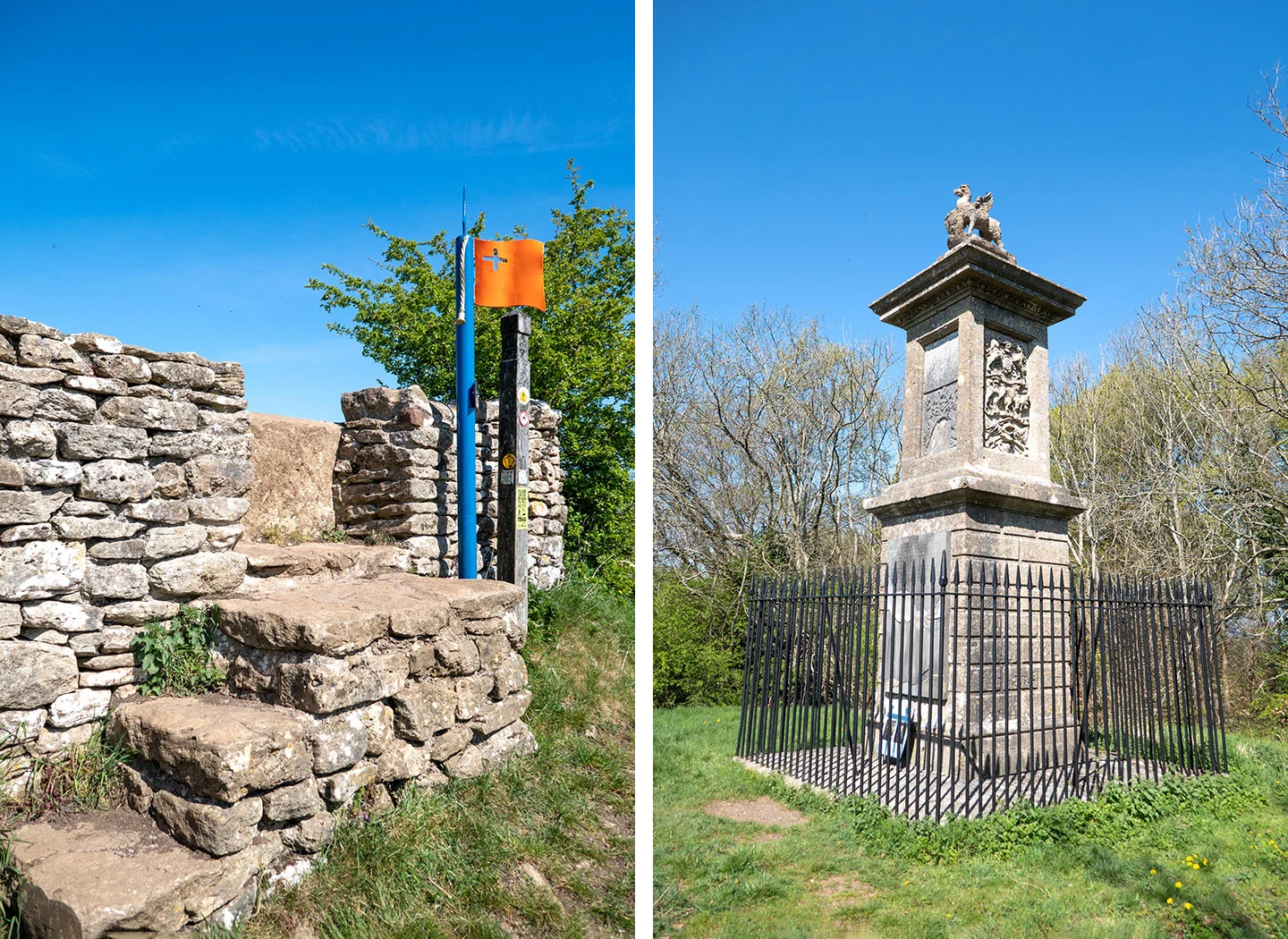
Battle sites: The Battle of Lansdown took place on Lansdown Hill on 5 July 1643 when the Royalists took on the Parliamentarians in a bloody fight during the English Civil War. The battlefield is marked with flag-post markers and information boards at key points, and the route passes Sir Bevil Grenville’s Monument, dedicated to a Royalist commander killed in the battle.
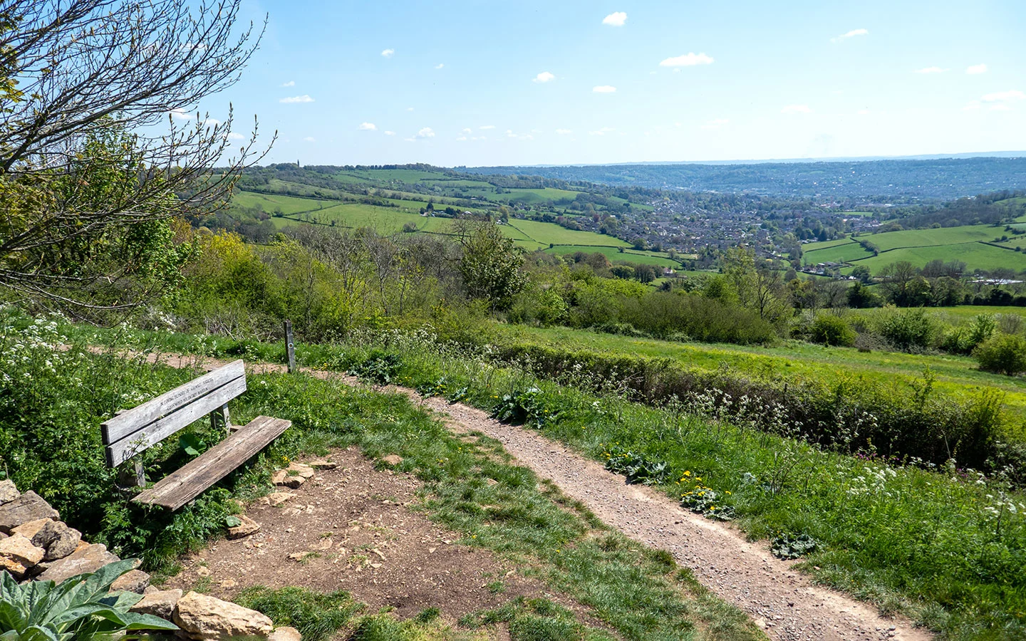
Prospect Stile: This kissing gate is a good place for a stop, with a bench where you can soak up the panoramic views over Bristol and Bath and out as far as the Black Mountains.

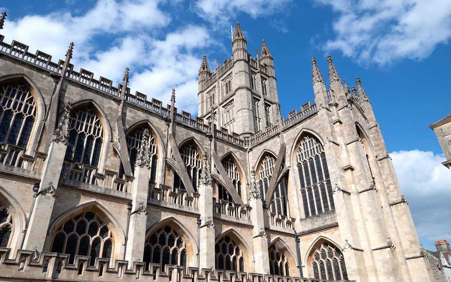
Arriving into Bath: With its golden Georgian buildings, Bath is one of England’s most spectacular cities. And the Cotswold Way runs right past some of its highlights – from the curving buildings of the Royal Crescent and The Circus to the Pump Room and Roman Baths.
Bath Abbey: The finish point for the Cotswold Way is the west front of Bath Abbey, with a stone marker on the ground and carved stone angels climbing Jacob’s Ladder to heaven as a backdrop. The abbey dates back to 1499 and it’s worth heading inside to see its fan-vaulted ceilings and stained-glass windows – you can also climb to the top of the tower if you have the energy left!

Day 10 facilities
Food and drink: There are no facilities in Cold Ashton and nothing on the route until Weston, where you’ll find a Tesco Express supermarket, Parsons Bakery and Café 25 on the High Street. And there’s a huge selection of places to eat, drink and celebrate once you reach Bath.
Toilets: There are public toilets in Bath in Victoria Park (BA1 2LZ), Charlotte Street Car Park (BA1 2NE) and Monmouth Street (BA1 2AN), all of which charge 20p, but none along the rest of route.
Accommodation: There’s a huge selection of places to stay in Bath. Our favourite is the stylish Hotel Indigo Bath* or splash out at The Royal Crescent Hotel.* A more affordable option is a room in Bath University’s student residences, available during the Easter and summer holidays.

Travelling on from Bath
Bath is well connected by public transport, with direct trains to London (1 hour 20 minutes) and Bristol Temple Meads (12 minutes) for connections to destinations around the UK. There are also local buses to to Bristol and National Express coaches to London and other UK destinations.
If you’re travelling back to the start point, you can take a train to Moreton-in-Marsh (1 hour 45 minutes, change at Reading) or Stratford-upon-Avon (3 hours with 2/3 changes en route). Then the Stagecoach no 1/2 bus (Monday–Saturday) connects on to Chipping Campden.
* This site contains affiliate links, where I get a small commission from purchases at no extra cost to you.
Save for later

You might also like


Barbara
Wednesday 1st of October 2025
We found your blog so helpful while walking the Cotswolds last month! Although we had a company set up our accommodations and move our luggage, they didn’t really provide much in the way of information about the trail. We checked your blog post daily for sights and details.
Some things that surprised us were how food places were often closed Mondays and late afternoons on Sundays. Luckily Uber is now available, but sometimes a long wait. Also, your information about where to find food helped us realize we would need to pack sandwiches most days. I think that’s a good suggestion as it was a lifesaver for us.
Evelyn
Friday 29th of September 2023
Hi. I am so happy to have found your article. Doing this is in my bucket list. I want to do it on my own, or joining smaller groups. Yes, I know there are tour companies that offer this trip, but they are outrageously expensive!! If I do it on my own (I am a young-senior female), it is safe? I am doing my research now, so I can plan well. I was thinking about where to stay every day, maybe B & Bs, or small hotels, or something else that is comfortable and clean. Any way, thank you for your article.
Lucy Dodsworth
Friday 29th of September 2023
Hi Evelyn, I've not walked the route solo but we found it to be safe, with a decent number of other walkers around. And if you're looking for places to stay I have a big guide to accommodation along the route: https://explorethecotswolds.com/cotswold-way-accommodation/
Pat Griffin
Saturday 15th of July 2023
I am interested in two of us walking the Cotswold Way next May or June from South to North. Does Explore the Cotswolds offer assistance for those traveling in that direction? Please advise. Pat
Lucy Dodsworth
Saturday 15th of July 2023
Hi Pat, we can only give advice but if you are looking with help to plan/book the trip then I'd recommend getting in touch with Compass Holidays https://www.compass-holidays.com
Cassandre
Sunday 22nd of January 2023
Hi. I'm thinking of doing this walk over the summer and I'm wondering about the accommodations you did. Thanks!
Runip
Sunday 14th of May 2023
@Lucy Dodsworth, Excellent article, very informative. I am interested on details of accommodation as well.
Lucy Dodsworth
Monday 23rd of January 2023
Hi Cassandre, I actually have a post in progress with details of accommodation along the Cotswold Way so do check back in a couple of weeks!